Aoinaig Mhòr
Coastal Feature, Headland, Point in Ross-shire
Scotland
Aoinaig Mhòr
Aoinaig Mhòr is a prominent coastal feature located in Ross-shire, Scotland. It is a headland that juts out into the waters of the North Atlantic Ocean, forming a distinct point along the coastline. The name "Aoinaig Mhòr" is derived from Gaelic, with "Aoinaig" meaning headland or promontory, and "Mhòr" meaning large or great.
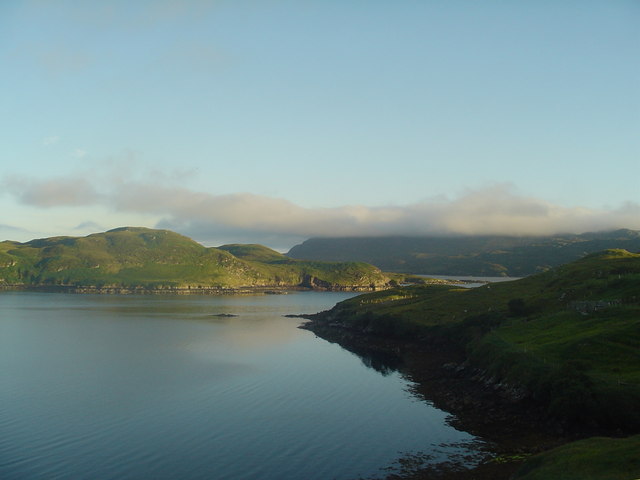
This headland is known for its dramatic and rugged landscape, characterized by steep cliffs that plunge into the sea below. The cliffs are composed of various types of rock, including sandstone and shale, which have been shaped by the relentless force of the waves over time. The sheer height of the cliffs provides stunning panoramic views of the surrounding coastline and the vast expanse of the ocean.
Aoinaig Mhòr is also home to a diverse array of wildlife, making it a popular spot for nature enthusiasts. Seabirds such as gannets, guillemots, and puffins can be spotted nesting on the cliffs, while seals can often be seen basking on the rocky shores. The surrounding waters are teeming with marine life, including dolphins, porpoises, and even occasional sightings of whales.
The headland is easily accessible via a coastal path, which allows visitors to explore its rugged beauty up close. The path winds its way along the cliff edge, offering breathtaking views and opportunities for photography. It is important to exercise caution when visiting Aoinaig Mhòr, as the cliffs can be dangerous and unpredictable, and it is advisable to stay on designated paths and follow any safety guidelines provided.
In summary, Aoinaig Mhòr is a stunning and picturesque headland in Ross-shire, Scotland. Its towering cliffs, diverse wildlife, and panoramic vistas make it a captivating destination for nature lovers and those seeking a glimpse of Scotland's rugged coastal beauty.
If you have any feedback on the listing, please let us know in the comments section below.
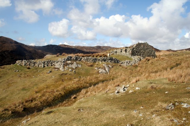
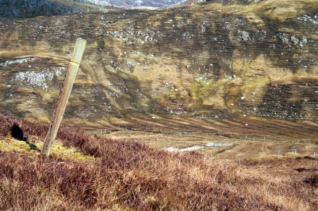
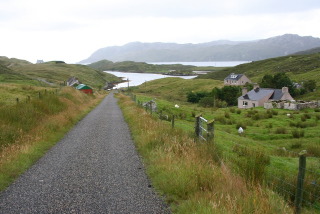
Aoinaig Mhòr Images
Images are sourced within 2km of 58.010471/-6.4763054 or Grid Reference NB3511. Thanks to Geograph Open Source API. All images are credited.
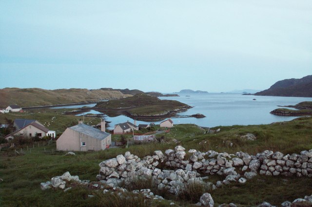
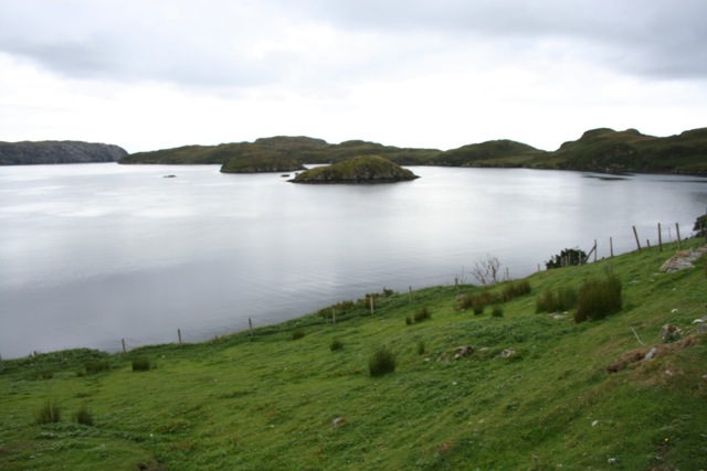
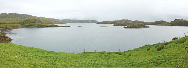
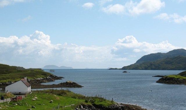
![Coastal view, Orasaigh One would assume that the name 'Orasaigh' refers to the small island [centre left], as well as the community. The island is accessible at low tide, like several Oronsay and Orasay islands around the west coast.](https://s1.geograph.org.uk/geophotos/01/47/41/1474105_b387cda5.jpg)
Aoinaig Mhòr is located at Grid Ref: NB3511 (Lat: 58.010471, Lng: -6.4763054)
Unitary Authority: Na h-Eileanan an Iar
Police Authority: Highlands and Islands
What 3 Words
///trickling.tops.innovator. Near Leurbost, Na h-Eileanan Siar
Nearby Locations
Related Wikis

Orinsay
Orinsay (Scottish Gaelic: Orasaigh) is a crofting village on the Isle of Lewis in the district of Pairc, in the Outer Hebrides, Scotland. The settlement...

Stiomrabhaig
Stiomrabhaig is an abandoned crofter's village on the Isle of Lewis in the Outer Hebrides. == History == The United Kingdom Census 1851 shows that the...

Eilean Liubhaird
Eilean Liubhaird or Eilean Iubhard is an island in the Outer Hebrides, to the east of Lewis. == Geography and geology == The rock is "gneiss bedrock with...

Gravir
Gravir (Scottish Gaelic: Grabhair), is a village on the shore of Loch Odhairn (a sea loch) in the Park district of the Isle of Lewis. Gravir is within...

Park, Lewis
Park (Scottish Gaelic: A' Phàirc), also known as South Lochs, is a huge area of land connected to the rest of Lewis only by a narrow neck between Loch...

Calbost
Calbost (Scottish Gaelic: Calabost) is a village on the Isle of Lewis in the Outer Hebrides, Scotland. Calbost is within the parish of Lochs, and within...

Cabharstadh
Cabharstadh or Caversta (Scottish Gaelic: Cabharstaigh) is a village on the Isle of Lewis in the Outer Hebrides, Scotland. Caversta is situated in the...
Loch Erisort
Loch Erisort (Scottish Gaelic: Èireasort) is an 8-mile-long narrow sea inlet on the east coast of the Isle of Lewis in the Outer Hebrides off the west...
Nearby Amenities
Located within 500m of 58.010471,-6.4763054Have you been to Aoinaig Mhòr?
Leave your review of Aoinaig Mhòr below (or comments, questions and feedback).