Loch a' Ghromuinn

Lake, Pool, Pond, Freshwater Marsh in Ross-shire

Scotland

Loch a' Ghromuinn

Caolas a Tuath A panoramic view down the length of the channel.
Caolas a Tuath Credit: Rob Burke

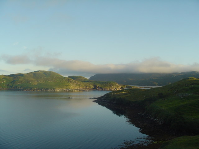
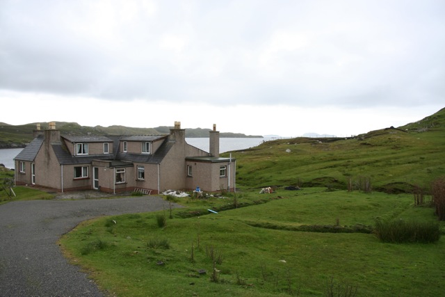
Loch a' Ghromuinn, located in Ross-shire, Scotland, is a picturesque freshwater loch nestled amidst the stunning Highland landscape. Covering an area of approximately 1.5 hectares, it is considered a relatively small loch, but it holds great natural and ecological significance.

Surrounded by lush vegetation and rolling hills, Loch a' Ghromuinn is a haven for various species of flora and fauna. The loch itself is home to an array of freshwater fish, including brown trout, which attracts anglers from far and wide. Its crystal-clear waters provide a serene and tranquil environment, making it a popular spot for fishing enthusiasts and nature lovers alike.

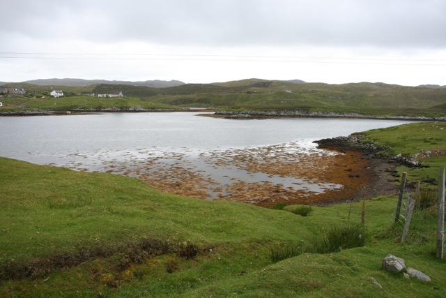
The shoreline of Loch a' Ghromuinn is fringed with reeds, rushes, and other water-loving plants, creating a vibrant and diverse freshwater marsh ecosystem. This marshland provides a vital habitat for numerous bird species, such as moorhens, coots, and various waterfowl, including ducks and geese. Birdwatchers flock to the area to observe and appreciate the rich avian biodiversity.

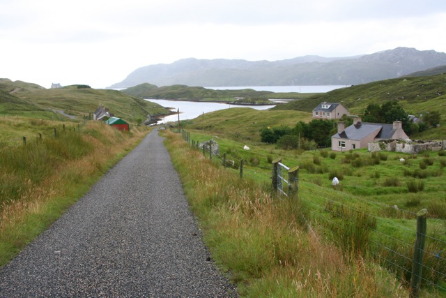
Visitors to Loch a' Ghromuinn can enjoy a range of recreational activities, including boating, kayaking, and wildlife spotting. The tranquil atmosphere and scenic beauty of the loch make it an ideal location for picnics and leisurely walks along its shores.

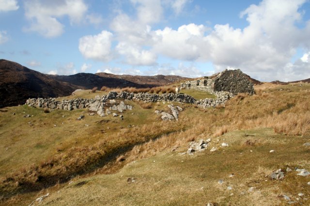
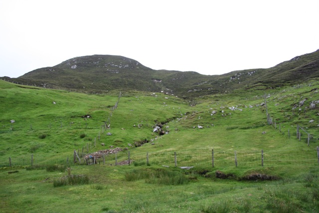
Overall, Loch a' Ghromuinn is a hidden gem within the Scottish Highlands, offering a peaceful retreat for those seeking a connection with nature. Its diverse ecosystem, abundant wildlife, and breathtaking scenery make it a must-visit destination for anyone exploring the natural wonders of Ross-shire.

If you have any feedback on the listing, please let us know in the comments section below.

Loch a' Ghromuinn Images

Images are sourced within 2km of 58.013703/-6.4746931 or Grid Reference NB3511. Thanks to Geograph Open Source API. All images are credited.
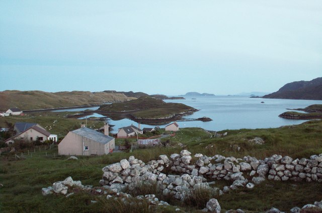
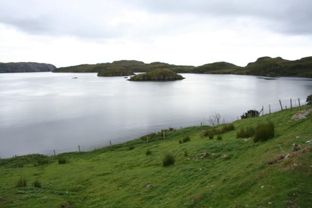
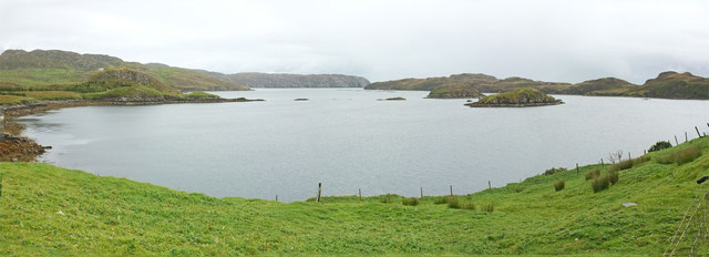
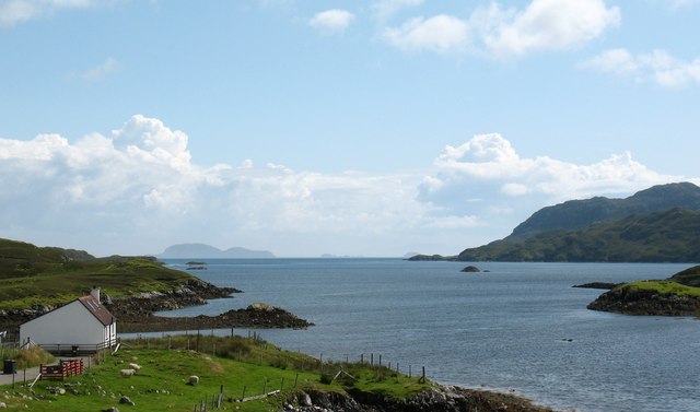
Caolas a Tuath A panoramic view down the length of the channel.
Caolas a Tuath
A panoramic view down the length of the channel.
The abandoned township of Stiomrabhaigh
Islands on Loch Shaghachain
The township of Stiomrabhaigh looking North West
B8060 nearing Leumrabhagh
Lemreway Island - Eilean Iubhaird A stunning view from the road end at Aird a' Chaolais looking across the sea loch to Eilean Iubhaird
Lemreway Island - Eilean Iubhaird
A stunning view from the road end at Aird a' Chaolais looking across the sea loch to Eilean Iubhaird
Orasaigh with view of Shiant Islands
Orasaigh from top of footpath steps
Loch near Giearol
Loch near Giearol
Ruined blackhouse at Stiomrabhaig The census of 1851 shows that the village consisted of 16 dwellings and supported a population of 81. By 1858 there were none. Clearances had been well underway in the area during the first half of the 19th century; many of them brutal and uncaring. The residents of Stiomrabhaigh were better placed of than most, having leases directly with the land owner. But when these expired, they accepted an offer of crofts in Leumrabhagh. Lewis was relatively prosperous right up until World War I, which put an end to the herring trade with Russia and Eastern Europe and in spite of the clearances, the increasing population put pressure on land. There were numerous requests to resettle Stiomrabhaigh, all of which were resisted by the landowners and it was not until 1921 when Lord Leverhulme abandoned his ambitious plan for Lewis that crofters returned to the township. Even the resettlement was marked with tragedy as two young men were drowned while transporting household goods from Calbost. These settlers were never officially recognized as crofters by the government;  they received no help and no road was built to the township. Given the difficulties of living without facilities, over the next twenty years, a number of the families drifted back to Leumrabhagh. At the start of World War II only two families remained and by the end of the 1940’s, Stiomrabhaigh was once again deserted. Today there is much of the township to be seen; its ruined buildings, lazybeds and field walls standing in splendid isolation between the moor and the sea.
Ruined blackhouse at Stiomrabhaig
The census of 1851 shows that the village consisted of 16 dwellings and supported a population of 81. By 1858 there were none. Clearances had been well underway in the area during the first half of the 19th century; many of them brutal and uncaring. The residents of Stiomrabhaigh were better placed of than most, having leases directly with the land owner. But when these expired, they accepted an offer of crofts in Leumrabhagh. Lewis was relatively prosperous right up until World War I, which put an end to the herring trade with Russia and Eastern Europe and in spite of the clearances, the increasing population put pressure on land. There were numerous requests to resettle Stiomrabhaigh, all of which were resisted by the landowners and it was not until 1921 when Lord Leverhulme abandoned his ambitious plan for Lewis that crofters returned to the township. Even the resettlement was marked with tragedy as two young men were drowned while transporting household goods from Calbost. These settlers were never officially recognized as crofters by the government; they received no help and no road was built to the township. Given the difficulties of living without facilities, over the next twenty years, a number of the families drifted back to Leumrabhagh. At the start of World War II only two families remained and by the end of the 1940’s, Stiomrabhaigh was once again deserted. Today there is much of the township to be seen; its ruined buildings, lazybeds and field walls standing in splendid isolation between the moor and the sea.
Glen Orinsay A marker post on the footpath to the deserted village of Stiomrabhaigh in front of the greens and browns of Glen Orinsay.
Glen Orinsay
A marker post on the footpath to the deserted village of Stiomrabhaigh in front of the greens and browns of Glen Orinsay.
Caolas a Tuath bay Leumrabhagh looking out to Eilean Liubhaird (Edward's Isle), past the islands of Sgeir Ghlas (Green Isle) and Sgeir Fraoich (Heather Isle) in Caolas a'Tuath (North Strait).
Caolas a Tuath bay
Leumrabhagh looking out to Eilean Liubhaird (Edward's Isle), past the islands of Sgeir Ghlas (Green Isle) and Sgeir Fraoich (Heather Isle) in Caolas a'Tuath (North Strait).
The road to Orasaigh Looking towards Orinsay Island
The road to Orasaigh
Looking towards Orinsay Island
House at Orasaigh Looking towards Shiant Islands
House at Orasaigh
Looking towards Shiant Islands
Orasaigh
Orasaigh
Orasaigh hills
Orasaigh hills
Coastal view, Orasaigh One would assume that the name 'Orasaigh' refers to the small island [centre left], as well as the community. The island is accessible at low tide, like several Oronsay and Orasay islands around the west coast.
Coastal view, Orasaigh
One would assume that the name 'Orasaigh' refers to the small island [centre left], as well as the community. The island is accessible at low tide, like several Oronsay and Orasay islands around the west coast.
Orasaigh View southwards from Orasaigh with the Shiant Islands in the distance.
Orasaigh
View southwards from Orasaigh with the Shiant Islands in the distance.
Show me another place!

Loch a' Ghromuinn is located at Grid Ref: NB3511 (Lat: 58.013703, Lng: -6.4746931)

Unitary Authority: Na h-Eileanan an Iar

Police Authority: Highlands and Islands

What 3 Words

///polar.shop.earth. Near Leurbost, Na h-Eileanan Siar

Related Wikis

Orinsay

Orinsay (Scottish Gaelic: Orasaigh) is a crofting village on the Isle of Lewis in the district of Pairc, in the Outer Hebrides, Scotland. The settlement...

Stiomrabhaig

Stiomrabhaig is an abandoned crofter's village on the Isle of Lewis in the Outer Hebrides. == History == The United Kingdom Census 1851 shows that the...

Eilean Liubhaird

Eilean Liubhaird or Eilean Iubhard is an island in the Outer Hebrides, to the east of Lewis. == Geography and geology == The rock is "gneiss bedrock with...

Gravir

Gravir (Scottish Gaelic: Grabhair), is a village on the shore of Loch Odhairn (a sea loch) in the Park district of the Isle of Lewis. Gravir is within...

Nearby Amenities

Located within 500m of 58.013703,-6.4746931
Turning Circle
Lat/Long: 58.0151585/-6.4672205
Passing Place
Lat/Long: 58.0153453/-6.4682934
Power: pole
Lat/Long: 58.0151959/-6.4671361
Power: pole
Lat/Long: 58.0154963/-6.4674927
Power: pole
Lat/Long: 58.0161813/-6.4682819
Power: pole
Lat/Long: 58.0165644/-6.4687314
Power: pole
Lat/Long: 58.016895/-6.4691126
Passing Place
Lat/Long: 58.0159395/-6.4683604
The data included in this document is from www.openstreetmap.org. The data is made available under ODbL.

Have you been to Loch a' Ghromuinn?

Leave your review of Loch a' Ghromuinn below (or comments, questions and feedback).