Carn na Bèiste

Coastal Feature, Headland, Point in Ross-shire

Scotland

Carn na Bèiste

Looking towards Loch Mor Stiomrabhaigh
Looking towards Loch Mor Stiomrabhaigh Credit: Mike Dunn

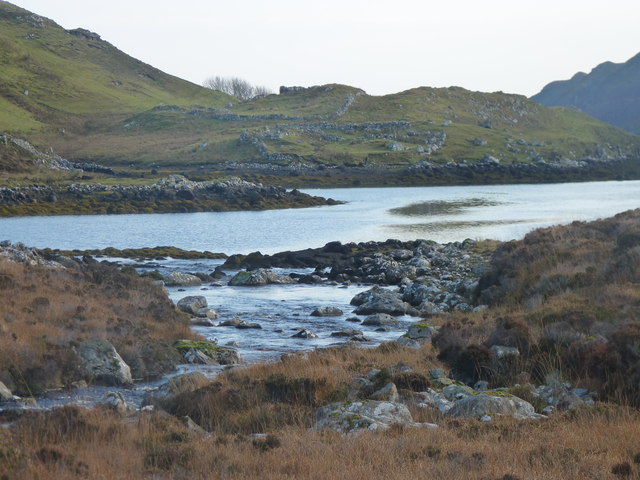
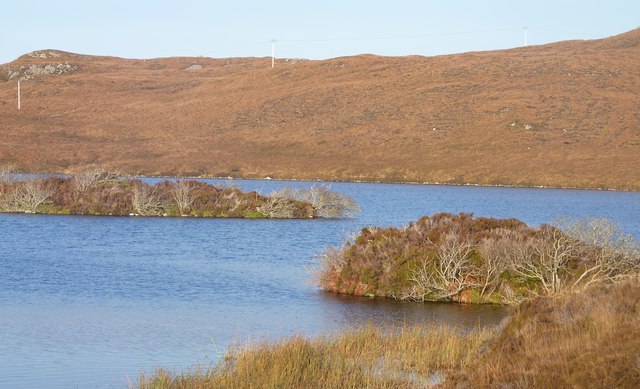
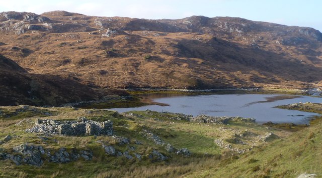
Carn na Bèiste is a prominent coastal feature located in Ross-shire, Scotland. Situated on the western coast of the Scottish Highlands, this headland or point offers stunning panoramic views of the surrounding landscape and the vast waters of the North Atlantic Ocean.

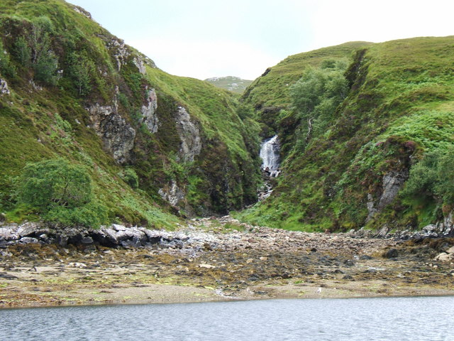
Rising to an elevation of approximately 246 meters (807 feet), Carn na Bèiste is characterized by its rugged and rocky terrain, making it a popular spot for outdoor enthusiasts and hikers. The headland is formed by ancient volcanic rocks, which have been shaped by the forces of erosion over millions of years. This geological history is evident in the dramatic cliffs and craggy outcrops that define the area.

The headland is also known for its diverse wildlife, with various seabirds nesting along the cliffs, including guillemots, razorbills, and even the occasional puffin. The surrounding ocean is home to a variety of marine life, and visitors may be lucky enough to spot seals or dolphins swimming in the waters below.

Access to Carn na Bèiste is relatively easy, with a well-maintained footpath leading to the summit. The climb offers breathtaking views of the coastline, nearby islands, and the distant mountain ranges of the Scottish Highlands. It is advisable to check the weather conditions before embarking on the hike, as the exposed nature of the headland can make it challenging in inclement weather.

Carn na Bèiste is a truly remarkable coastal feature that showcases the natural beauty and geological diversity of the Scottish Highlands. Its combination of stunning landscapes, rich wildlife, and captivating history makes it a must-visit destination for nature enthusiasts and adventurers alike.

If you have any feedback on the listing, please let us know in the comments section below.

Carn na Bèiste Images

Images are sourced within 2km of 58.010088/-6.4815612 or Grid Reference NB3511. Thanks to Geograph Open Source API. All images are credited.
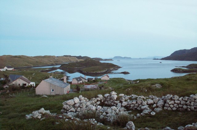
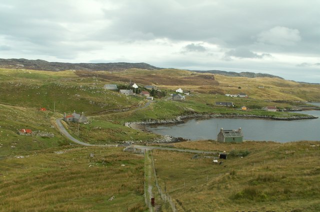
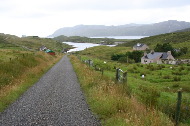
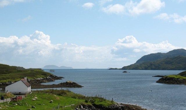
Looking towards Loch Mor Stiomrabhaigh
The abandoned township of Stiomrabhaigh
Islands on Loch Shaghachain
The township of Stiomrabhaigh looking North West
Orasaigh with view of Shiant Islands
Orasaigh from top of footpath steps
Loch near Giearol
Loch near Giearol
Ruined blackhouse at Stiomrabhaig The census of 1851 shows that the village consisted of 16 dwellings and supported a population of 81. By 1858 there were none. Clearances had been well underway in the area during the first half of the 19th century; many of them brutal and uncaring. The residents of Stiomrabhaigh were better placed of than most, having leases directly with the land owner. But when these expired, they accepted an offer of crofts in Leumrabhagh. Lewis was relatively prosperous right up until World War I, which put an end to the herring trade with Russia and Eastern Europe and in spite of the clearances, the increasing population put pressure on land. There were numerous requests to resettle Stiomrabhaigh, all of which were resisted by the landowners and it was not until 1921 when Lord Leverhulme abandoned his ambitious plan for Lewis that crofters returned to the township. Even the resettlement was marked with tragedy as two young men were drowned while transporting household goods from Calbost. These settlers were never officially recognized as crofters by the government;  they received no help and no road was built to the township. Given the difficulties of living without facilities, over the next twenty years, a number of the families drifted back to Leumrabhagh. At the start of World War II only two families remained and by the end of the 1940’s, Stiomrabhaigh was once again deserted. Today there is much of the township to be seen; its ruined buildings, lazybeds and field walls standing in splendid isolation between the moor and the sea.
Ruined blackhouse at Stiomrabhaig
The census of 1851 shows that the village consisted of 16 dwellings and supported a population of 81. By 1858 there were none. Clearances had been well underway in the area during the first half of the 19th century; many of them brutal and uncaring. The residents of Stiomrabhaigh were better placed of than most, having leases directly with the land owner. But when these expired, they accepted an offer of crofts in Leumrabhagh. Lewis was relatively prosperous right up until World War I, which put an end to the herring trade with Russia and Eastern Europe and in spite of the clearances, the increasing population put pressure on land. There were numerous requests to resettle Stiomrabhaigh, all of which were resisted by the landowners and it was not until 1921 when Lord Leverhulme abandoned his ambitious plan for Lewis that crofters returned to the township. Even the resettlement was marked with tragedy as two young men were drowned while transporting household goods from Calbost. These settlers were never officially recognized as crofters by the government; they received no help and no road was built to the township. Given the difficulties of living without facilities, over the next twenty years, a number of the families drifted back to Leumrabhagh. At the start of World War II only two families remained and by the end of the 1940’s, Stiomrabhaigh was once again deserted. Today there is much of the township to be seen; its ruined buildings, lazybeds and field walls standing in splendid isolation between the moor and the sea.
Glen Orinsay A marker post on the footpath to the deserted village of Stiomrabhaigh in front of the greens and browns of Glen Orinsay.
Glen Orinsay
A marker post on the footpath to the deserted village of Stiomrabhaigh in front of the greens and browns of Glen Orinsay.
The road to Orasaigh Looking towards Orinsay Island
The road to Orasaigh
Looking towards Orinsay Island
House at Orasaigh Looking towards Shiant Islands
House at Orasaigh
Looking towards Shiant Islands
Orasaigh
Orasaigh
Orasaigh hills
Orasaigh hills
Allt Gil Mhic Phaic burn Showing the mouth of the Allt Gil Mhic Phaic burn flowing into Tob na Gile Moire on Loch Shell (Loch Sealg)
Allt Gil Mhic Phaic burn
Showing the mouth of the Allt Gil Mhic Phaic burn flowing into Tob na Gile Moire on Loch Shell (Loch Sealg)
Coastal view, Orasaigh One would assume that the name 'Orasaigh' refers to the small island [centre left], as well as the community. The island is accessible at low tide, like several Oronsay and Orasay islands around the west coast.
Coastal view, Orasaigh
One would assume that the name 'Orasaigh' refers to the small island [centre left], as well as the community. The island is accessible at low tide, like several Oronsay and Orasay islands around the west coast.
Orasaigh View southwards from Orasaigh with the Shiant Islands in the distance.
Orasaigh
View southwards from Orasaigh with the Shiant Islands in the distance.
Ruined cottage, Orasaigh Wind and weather appear to have been the major factors in the slow decay of this cottage. The 'Rayburn' style stove is still in situ.
Ruined cottage, Orasaigh
Wind and weather appear to have been the major factors in the slow decay of this cottage. The 'Rayburn' style stove is still in situ.
Seaweed on the shore Looking along a seaweed covered shore from a small jetty on this inlet of Loch Sealg.
Seaweed on the shore
Looking along a seaweed covered shore from a small jetty on this inlet of Loch Sealg.
Show me another place!

Carn na Bèiste is located at Grid Ref: NB3511 (Lat: 58.010088, Lng: -6.4815612)

Unitary Authority: Na h-Eileanan an Iar

Police Authority: Highlands and Islands

What 3 Words

///lance.arise.bidder. Near Leurbost, Na h-Eileanan Siar

Related Wikis

Stiomrabhaig

Stiomrabhaig is an abandoned crofter's village on the Isle of Lewis in the Outer Hebrides. == History == The United Kingdom Census 1851 shows that the...

Orinsay

Orinsay (Scottish Gaelic: Orasaigh) is a crofting village on the Isle of Lewis in the district of Pairc, in the Outer Hebrides, Scotland. The settlement...

Eilean Liubhaird

Eilean Liubhaird or Eilean Iubhard is an island in the Outer Hebrides, to the east of Lewis. == Geography and geology == The rock is "gneiss bedrock with...

Gravir

Gravir (Scottish Gaelic: Grabhair), is a village on the shore of Loch Odhairn (a sea loch) in the Park district of the Isle of Lewis. Gravir is within...

Nearby Amenities

Located within 500m of 58.010088,-6.4815612
Tòb Stiomrabhaigh
Natural: bay
Lat/Long: 58.0112923/-6.4884921
The data included in this document is from www.openstreetmap.org. The data is made available under ODbL.

Have you been to Carn na Bèiste?

Leave your review of Carn na Bèiste below (or comments, questions and feedback).