Loch a' Chàrnain

Settlement in Inverness-shire

Scotland

Loch a' Chàrnain
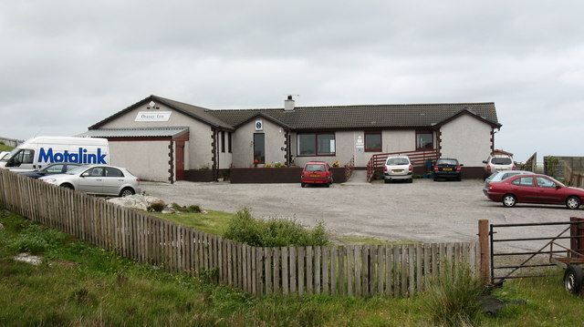
The Orosay Inn Great wee hotel with simple rooms and great food - especially seafood (I speak only as a satisfied customer!).
The Orosay Inn Credit: Gordon Brown

The requested URL returned error: 429 Too Many Requests

If you have any feedback on the listing, please let us know in the comments section below.

Loch a' Chàrnain Images

Images are sourced within 2km of 57.37339/-7.3134565 or Grid Reference NF8043. Thanks to Geograph Open Source API. All images are credited.

The Orosay Inn Great wee hotel with simple rooms and great food - especially seafood (I speak only as a satisfied customer!).
The Orosay Inn
Great wee hotel with simple rooms and great food - especially seafood (I speak only as a satisfied customer!).
Wayside shrine On the Loch Carnan road
Wayside shrine
On the Loch Carnan road
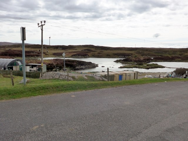
Fish farm base at Loch Carnan
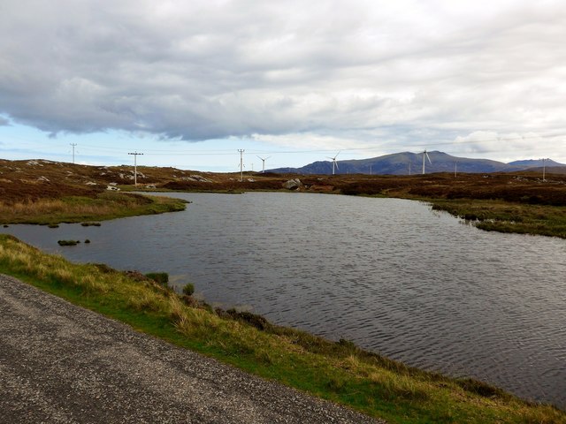
Loch Carnan Community Wind Farm Now capable of generating its full 6.9MW.  This wind farm is built on (presumably) crofting land and revenues will go to the local community - revenues estimated at around £20 million over the next 20 years.
Loch Carnan Community Wind Farm
Now capable of generating its full 6.9MW. This wind farm is built on (presumably) crofting land and revenues will go to the local community - revenues estimated at around £20 million over the next 20 years.
Lochcarnan Community Windfarm Now capable of generating its full 6.9MW. This wind farm is built on (presumably) crofting land and revenues will go to the local community - revenues estimated at around £20 million over the next 20 years
Lochcarnan Community Windfarm
Now capable of generating its full 6.9MW. This wind farm is built on (presumably) crofting land and revenues will go to the local community - revenues estimated at around £20 million over the next 20 years
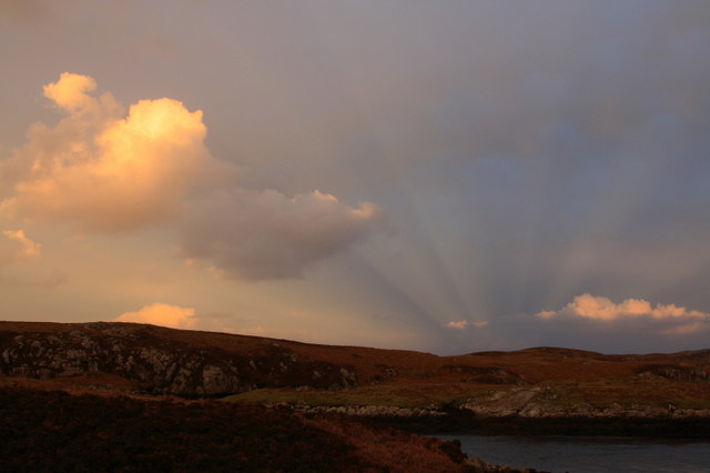
Sunset Shadows Rays and shadows cast by the setting sun over Lochcarnan. The sun is behind the photographer.
Sunset Shadows
Rays and shadows cast by the setting sun over Lochcarnan. The sun is behind the photographer.
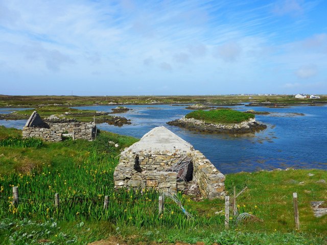
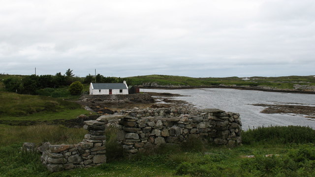
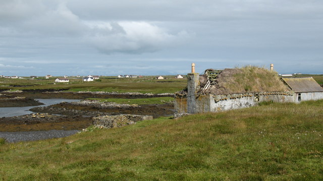
Ruins at Grosavagh It can be difficult to tell in the Outer Hebrides, but this is salt water (you can see the tide marks).
Ruins at Grosavagh
It can be difficult to tell in the Outer Hebrides, but this is salt water (you can see the tide marks).
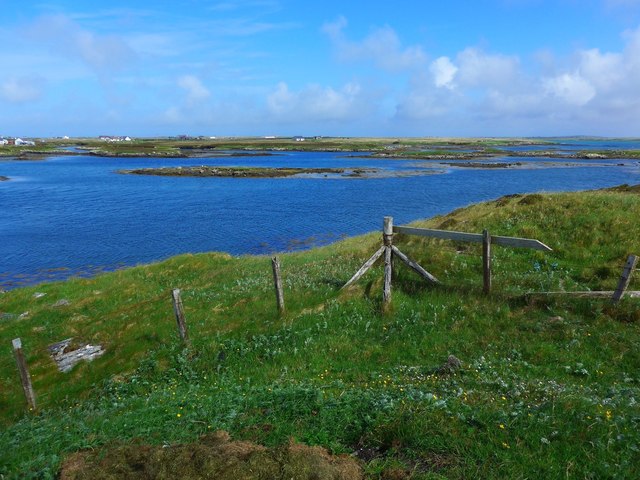
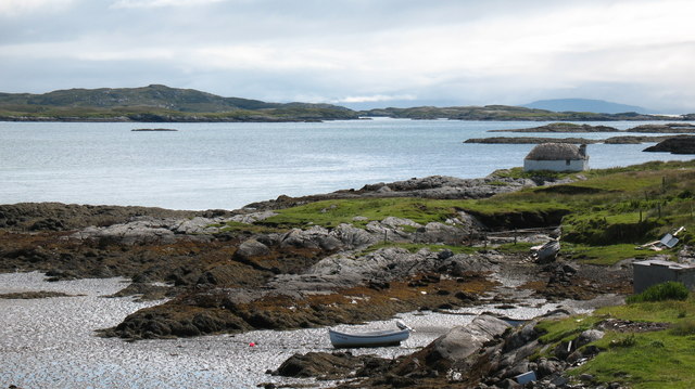
Coast at Grosavagh Looking over to houses at Griomasaigh.
Coast at Grosavagh
Looking over to houses at Griomasaigh.
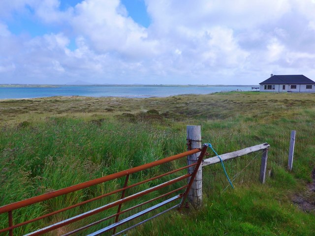
New house at Grosavagh Beyond is the stretch of sea separating South Uist (here) from the next island up the chain, Benbecula.
New house at Grosavagh
Beyond is the stretch of sea separating South Uist (here) from the next island up the chain, Benbecula.
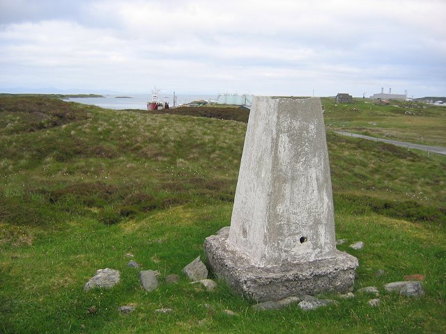
Lochcarnan Beyond the trigpoint the background includes a fish processing plant and the Uist's diesel fired power station. The square relevant part is the single track road running through acid soiled grazing on the rugged east coast of South Uist.
Lochcarnan
Beyond the trigpoint the background includes a fish processing plant and the Uist's diesel fired power station. The square relevant part is the single track road running through acid soiled grazing on the rugged east coast of South Uist.
Stone quarry near Loch a Charnain The quarry shown is now flooded and disused, but the working quarry is just around the corner and operated by R J McLeod.
Stone quarry near Loch a Charnain
The quarry shown is now flooded and disused, but the working quarry is just around the corner and operated by R J McLeod.
Road junction and shrine, South Uist. South Uist is a stronghold of the Catholic faith and roadside shrines are plentiful. This one is at Loch a Charnain on the road to Sandavaig.
Road junction and shrine, South Uist.
South Uist is a stronghold of the Catholic faith and roadside shrines are plentiful. This one is at Loch a Charnain on the road to Sandavaig.
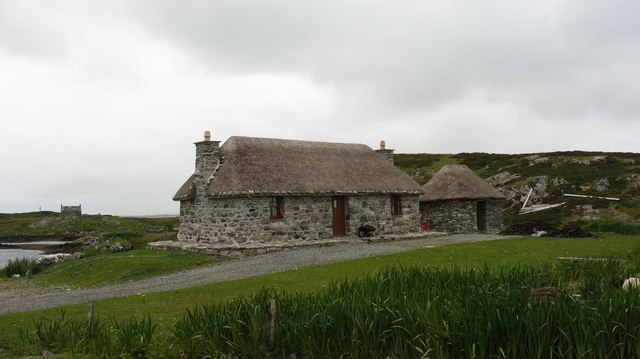
Cottage by the shore A nicely restored traditional cottage by the shore, overlooking a narrow inlet on the NE coast of South Uist.
Cottage by the shore
A nicely restored traditional cottage by the shore, overlooking a narrow inlet on the NE coast of South Uist.
Restored cottage at Rubha Ghaisinis A nicely restored traditional cottage at the road end.
Restored cottage at Rubha Ghaisinis
A nicely restored traditional cottage at the road end.
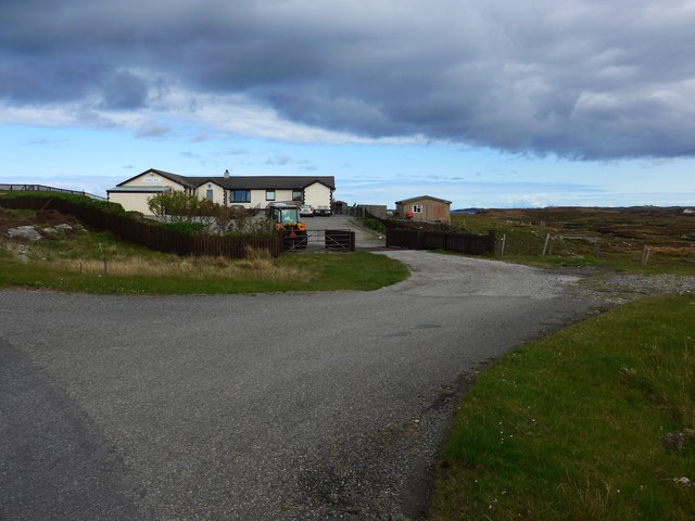
Oasis in the desert. The Orasay Inn is by a dead end road on the north east side of South Uist and offers food, drink and accommodation.
Oasis in the desert.
The Orasay Inn is by a dead end road on the north east side of South Uist and offers food, drink and accommodation.
Cottage on the shore. Restored traditional cottage on the shores of the channel between South Uist and Benbecula.
Cottage on the shore.
Restored traditional cottage on the shores of the channel between South Uist and Benbecula.
Ruined croft at Aird Mhor. A slowly decaying traditional cottage by the shore.
Ruined croft at Aird Mhor.
A slowly decaying traditional cottage by the shore.
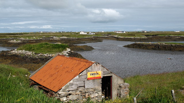
South Uist tyre depot? Small shed by the shore with an antique sign.
South Uist tyre depot?
Small shed by the shore with an antique sign.
Show me another place!

Loch a' Chàrnain is located at Grid Ref: NF8043 (Lat: 57.37339, Lng: -7.3134565)

Unitary Authority: Na h-Eileanan an Iar

Police Authority: Highlands and Islands

Also known as: Lochcarnan

What 3 Words

///chicken.inspector.clapper. Near Balivanich, Na h-Eileanan Siar

Related Wikis

Carnan (townland)

Carnan is a townland in County Tyrone, Northern Ireland. It is situated in the historic barony of Dungannon Upper and the civil parish of Arboe and covers...

Loch Bee

Loch Bì, sometimes anglicised as Loch Bee, is the largest loch on the island of South Uist in the Outer Hebrides of Scotland. It lies at the northern end...

Iochdar

Iochdar (Scottish Gaelic: An t-Ìochdair), also spelled Eochar, is a hamlet and community on the west coast of the island of South Uist, in the Outer Hebrides...

Eilean na Cille

Eilean na Cille, south east of Benbecula is an island of the Outer Hebrides connected to Grimsay (South) by a causeway which carries the B891. The road...

Nearby Amenities

Located within 500m of 57.37339,-7.3134565
Passing Place
Lat/Long: 57.3719641/-7.31095
Passing Place
Lat/Long: 57.374136/-7.3160556
Passing Place
Lat/Long: 57.3747303/-7.3180058
Bus Stop
Loch Carnan
Naptan AtcoCode: 6010731728
Naptan Bearing: S
Naptan CommonName: Loch Carnan
Naptan Indicator: Power Station
Naptan Landmark: Power Station
Naptan NaptanCode: 94723459
Naptan Street: Power Station
Naptan Verified: no
Source: naptan_import
Lat/Long: 57.3754419/-7.3100893
Barrier: cattle_grid
Lat/Long: 57.373896/-7.3124078
Denomination: catholic
Historic: wayside_shrine
Religion: christian
Lat/Long: 57.3732283/-7.3134693
Loch a' Chàrnain
Name En: Lochcarnan
Name Gd: Loch a' Chàrnain
Place: village
Lat/Long: 57.3760423/-7.3075486
Power: pole
Lat/Long: 57.3722211/-7.3153952
Power: pole
Lat/Long: 57.3725754/-7.3164158
Power: pole
Lat/Long: 57.3728871/-7.3173344
Power: pole
Lat/Long: 57.373198/-7.318241
Power: pole
Lat/Long: 57.3735537/-7.3192938
Power: pole
Lat/Long: 57.3739189/-7.320313
Power: pole
Lat/Long: 57.3742515/-7.3213363
Power: pole
Lat/Long: 57.3759904/-7.3066914
Power: pole
Lat/Long: 57.3756528/-7.307708
Power: pole
Lat/Long: 57.3752399/-7.3089418
Power: pole
Lat/Long: 57.3750837/-7.3101327
Power: pole
Lat/Long: 57.3748834/-7.3115516
Power: pole
Lat/Long: 57.3746448/-7.3120075
Power: pole
Lat/Long: 57.3745067/-7.3142123
Power: pole
Lat/Long: 57.3748162/-7.3150814
Power: pole
Lat/Long: 57.3751806/-7.3161891
Power: pole
Lat/Long: 57.3755841/-7.3174122
Generator Method: photovoltaic
Generator Output Electricity: small_installation
Generator Source: solar
Generator Type: solar_photovoltaic_panel
Power: generator
Lat/Long: 57.374608/-7.3118252
Power: pole
Lat/Long: 57.3726846/-7.3122972
Power: pole
Lat/Long: 57.3724641/-7.3135847
Power: pole
Lat/Long: 57.3754084/-7.320073
Power: pole
Lat/Long: 57.374741/-7.3186138
Power: pole
Lat/Long: 57.3742421/-7.3177502
Power: pole
Lat/Long: 57.3735834/-7.3166022
Power: pole
Lat/Long: 57.3730592/-7.3156969
Power: pole
Lat/Long: 57.3723701/-7.3144765
Power: pole
Lat/Long: 57.371882/-7.3132011
Power: pole
Lat/Long: 57.3717995/-7.3121256
Power: pole
Lat/Long: 57.3718964/-7.3144323
Power: pole
Lat/Long: 57.3717222/-7.3133647
Power: pole
Lat/Long: 57.3714835/-7.3118386
Power: pole
Lat/Long: 57.3713151/-7.3107684
Power: pole
Lat/Long: 57.3710873/-7.3094353
Power: pole
Lat/Long: 57.370704/-7.3069476
Power: pole
Lat/Long: 57.3715783/-7.3135552
Power: pole
Lat/Long: 57.3714351/-7.3126486
Power: pole
Lat/Long: 57.371289/-7.3116642
Power: pole
Lat/Long: 57.3709709/-7.309615
Power: pole
Lat/Long: 57.3707756/-7.3083973
Power: pole
Lat/Long: 57.370665/-7.3076074
Power: pole
Lat/Long: 57.37172/-7.3111466
Power: pole
Lat/Long: 57.3714958/-7.3097089
Power: pole
Lat/Long: 57.37125/-7.3082551
Power: pole
Lat/Long: 57.3710099/-7.3068363
Passing Place
Lat/Long: 57.3757633/-7.3202837
Barrier: cattle_grid
Lat/Long: 57.3751394/-7.3108212
Passing Place
Lat/Long: 57.3738233/-7.3149325
Passing Place
Lat/Long: 57.3749869/-7.3185473
Power: pole
Lat/Long: 57.3762499/-7.3174928
Power: pole
Lat/Long: 57.3768876/-7.3175786
Power: pole
Lat/Long: 57.3741481/-7.3146952
Passing Place
Lat/Long: 57.3761521/-7.3074821
Passing Place
Lat/Long: 57.3755301/-7.3096743
The data included in this document is from www.openstreetmap.org. The data is made available under ODbL.

Have you been to Loch a' Chàrnain?

Leave your review of Loch a' Chàrnain below (or comments, questions and feedback).