Uiginish Bonnet

Coastal Feature, Headland, Point in Inverness-shire

Scotland

Uiginish Bonnet

War Memorial and Duirinish Stone at Dunvegan
War Memorial and Duirinish Stone at Dunvegan Credit: Sandy Gerrard

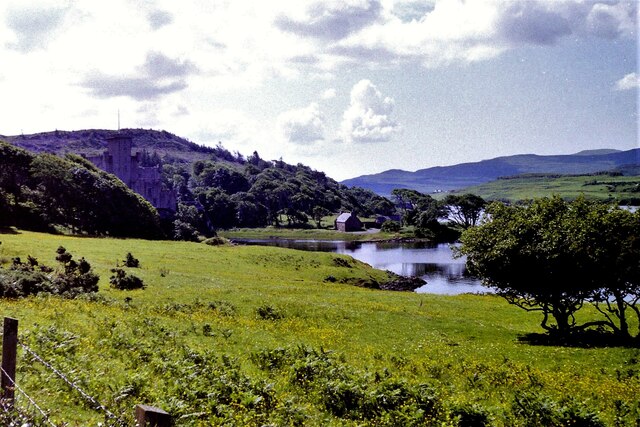
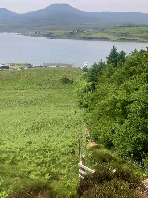
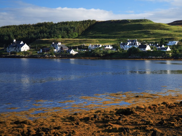
Uiginish Bonnet is a prominent coastal feature located in Inverness-shire, Scotland. Situated on the west coast of the country, it is specifically found on the Isle of Skye, near the village of Dunvegan. This impressive headland is known for its distinctive shape, resembling a bonnet, which has earned it its unique name.

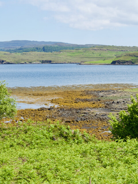
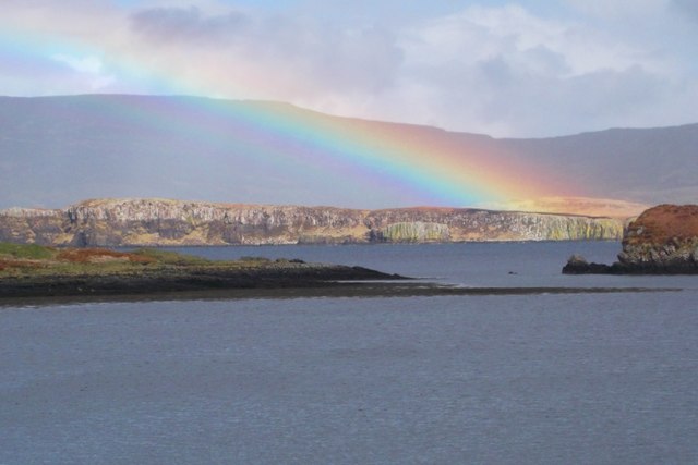
Rising majestically from the surrounding landscape, Uiginish Bonnet offers breathtaking views of the surrounding area. The headland is characterized by steep cliffs that drop dramatically into the sea, creating a picturesque and rugged coastline. The cliffs are composed of ancient volcanic rock, which adds to the area's geological significance.

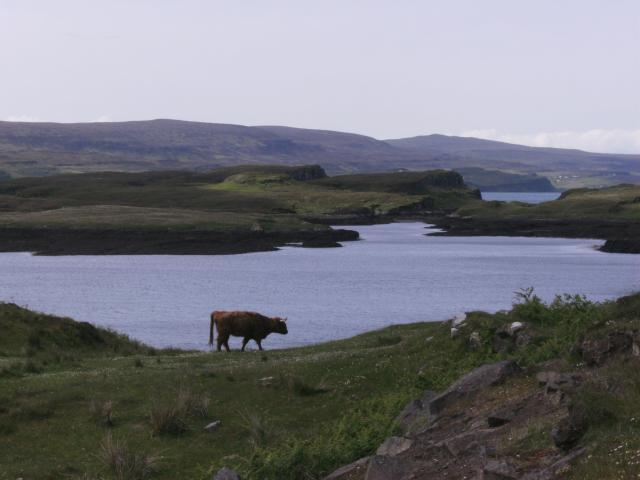
The headland is home to a diverse range of wildlife, including various seabirds such as puffins, gannets, and fulmars. It is not uncommon to spot seals basking on the rocks or swimming in the nearby waters. The coastal waters around Uiginish Bonnet are also known for their rich marine life, making it a popular spot for fishing enthusiasts.

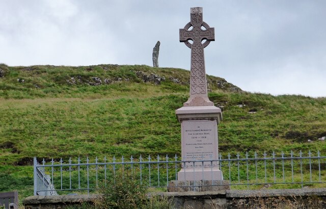
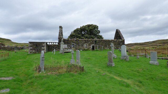
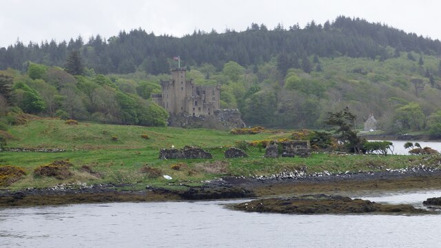
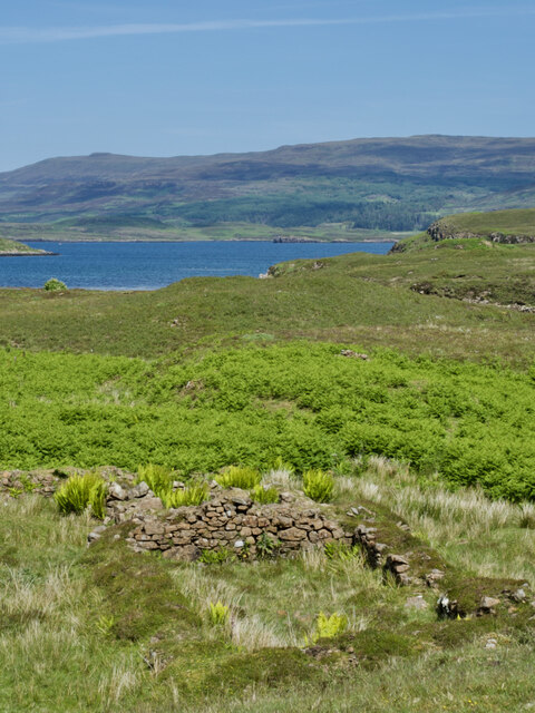
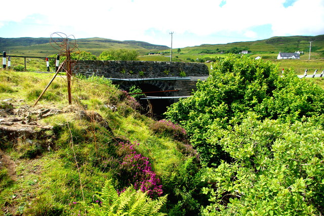
In addition to its natural beauty, Uiginish Bonnet holds historical significance. The area is dotted with remnants of ancient settlements and structures, including the ruins of a medieval castle. These remnants serve as a testament to the area's rich history and provide visitors with a glimpse into the past.

Overall, Uiginish Bonnet is a captivating coastal feature that offers a blend of natural beauty, wildlife, and historical significance. Whether one is interested in exploring the rugged cliffs, observing the diverse wildlife, or delving into the area's rich history, this headland is a must-visit destination for those traveling to Inverness-shire.

If you have any feedback on the listing, please let us know in the comments section below.

Uiginish Bonnet Images

Images are sourced within 2km of 57.445526/-6.6050287 or Grid Reference NG2348. Thanks to Geograph Open Source API. All images are credited.
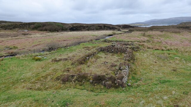
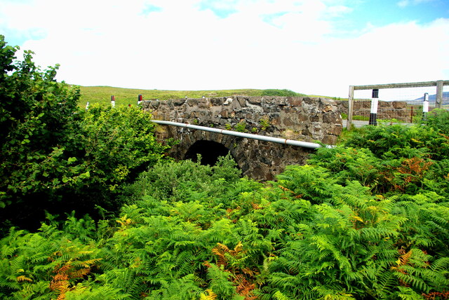
War Memorial and Duirinish Stone at Dunvegan
St Mary's Church; Dunvegan Late 17th century with some later additions. Abandoned in the mid 19th century <span class="nowrap"><a title="https://canmore.org.uk/site/10798/skye-dunvegan-st-marys-church-dunvegan-st-marys-old-church-kilmuir" rel="nofollow ugc noopener" href="https://canmore.org.uk/site/10798/skye-dunvegan-st-marys-church-dunvegan-st-marys-old-church-kilmuir">Link</a><img style="margin-left:2px;" alt="External link" title="External link - shift click to open in new window" src="https://s1.geograph.org.uk/img/external.png" width="10" height="10"/></span>
St Mary's Church; Dunvegan
Late 17th century with some later additions. Abandoned in the mid 19th century LinkExternal link
Looking along the coast towards Dunvegan Castle, Skye, 1988
Ruined Blackhouse Settlement
Dunvegan Castle/Caisteal Dhùn Bheagain <span class="nowrap"><a title="https://canmore.org.uk/site/10835/skye-dunvegan-castle" rel="nofollow ugc noopener" href="https://canmore.org.uk/site/10835/skye-dunvegan-castle">Link</a><img style="margin-left:2px;" alt="External link" title="External link - shift click to open in new window" src="https://s1.geograph.org.uk/img/external.png" width="10" height="10"/></span>
Dunvegan Castle/Caisteal Dhùn Bheagain
Loch from Dunvegan Castle The castle provides opportunities for trips to see seals.
Loch from Dunvegan Castle
The castle provides opportunities for trips to see seals.
Dusk's embrace—Captivating Loch Dunvegan in the twilight glow
A sunny day view of a ruined shieling amidst a sea of bracken
Tràigh Bheag, the 'little beach' that hides its sands
Dun Totaig — a mass of tumbled stone and an invasion of bracken For historical information, see ‘Skye, Dun Totaig | Canmore’. 2023. Canmore.org.uk <<span class="nowrap"><a title="https://canmore.org.uk/site/10834/skye-dun-totaig" rel="nofollow ugc noopener" href="https://canmore.org.uk/site/10834/skye-dun-totaig">Link</a><img style="margin-left:2px;" alt="External link" title="External link - shift click to open in new window" src="https://s1.geograph.org.uk/img/external.png" width="10" height="10"/></span> > [accessed 14 July 2023]

‌
Dun Totaig — a mass of tumbled stone and an invasion of bracken
For historical information, see ‘Skye, Dun Totaig | Canmore’. 2023. Canmore.org.uk <LinkExternal link > [accessed 14 July 2023] ‌
Looking down on Dunvegan from Druim na Creige
A850 at Dunvegan
A850 at Dunvegan
Drochaid Peigi Siosalaiche (1) Peggy Chisholm&amp;#039;s Bridge carries the B884 Glendale road over the Brunigill Burn near its outflow into Loch Erghallan, just south of the township of Skinidin (Sgianaidin).  In the early 20th century Peggy lived in a house near the bridge, of which no traces remain. The parapets have frequently had to be rebuilt following impacts by vehicles on the narrow road.

The Ordnance Survey Name Books of 1876-8 record Brunigill as the name &amp;quot;applied to a house one Storey high thatched and in ordinary repair Situated about ½ mile to the South-east of Skinidin Property of McLeod of Mcleod&amp;quot;; this may have been Peggy&amp;#039;s home. Alexander Forbes in his 1923 work on the place names of Skye  derives the name from the Norse &amp;quot;Brunnr&amp;quot; indicating a ravine.

This image shows the downstream side of the bridge. For the view from upstream see &lt;a href=&quot;https://www.geograph.org.uk/photo/7560297&quot;&gt;NG2247 : Drochaid Peigi Siosalaiche (2)&lt;/a&gt;.
Drochaid Peigi Siosalaiche (1)
Peggy Chisholm's Bridge carries the B884 Glendale road over the Brunigill Burn near its outflow into Loch Erghallan, just south of the township of Skinidin (Sgianaidin). In the early 20th century Peggy lived in a house near the bridge, of which no traces remain. The parapets have frequently had to be rebuilt following impacts by vehicles on the narrow road. The Ordnance Survey Name Books of 1876-8 record Brunigill as the name "applied to a house one Storey high thatched and in ordinary repair Situated about ½ mile to the South-east of Skinidin Property of McLeod of Mcleod"; this may have been Peggy's home. Alexander Forbes in his 1923 work on the place names of Skye derives the name from the Norse "Brunnr" indicating a ravine. This image shows the downstream side of the bridge. For the view from upstream see NG2247 : Drochaid Peigi Siosalaiche (2).
Drochaid Peigi Siosalaiche (2) Peggy Chisholm&amp;#039;s Bridge carries the B884 Glendale road over the Brunigill Burn near its outflow into Loch Erghallan, just south of the township of Skinidin (Sgianaidin). In the early 20th century Peggy lived in a house near the bridge, of which no traces remain. The parapets have frequently had to be rebuilt following impacts by vehicles on the narrow road.

The Ordnance Survey Name Books of 1876-8 record Brunigill as the name &amp;quot;applied to a house one Storey high thatched and in ordinary repair Situated about ½ mile to the South-east of Skinidin Property of McLeod of Mcleod&amp;quot;; this may have been Peggy&amp;#039;s home. Alexander Forbes in his 1923 work on the place names of Skye derives the name from the Norse &amp;quot;Brunnr&amp;quot; indicating a ravine.

This image shows the view from upstream. For downstream side of the bridge see &lt;a href=&quot;https://www.geograph.org.uk/photo/7560294&quot;&gt;NG2247 : Drochaid Peigi Siosalaiche (1)&lt;/a&gt;.
Drochaid Peigi Siosalaiche (2)
Peggy Chisholm's Bridge carries the B884 Glendale road over the Brunigill Burn near its outflow into Loch Erghallan, just south of the township of Skinidin (Sgianaidin). In the early 20th century Peggy lived in a house near the bridge, of which no traces remain. The parapets have frequently had to be rebuilt following impacts by vehicles on the narrow road. The Ordnance Survey Name Books of 1876-8 record Brunigill as the name "applied to a house one Storey high thatched and in ordinary repair Situated about ½ mile to the South-east of Skinidin Property of McLeod of Mcleod"; this may have been Peggy's home. Alexander Forbes in his 1923 work on the place names of Skye derives the name from the Norse "Brunnr" indicating a ravine. This image shows the view from upstream. For downstream side of the bridge see NG2247 : Drochaid Peigi Siosalaiche (1).
Highland Cattle at Loch Dunvegan Taken from the Claigan road North of Dunvegan Castle. View over blooming meadows to Fiadhairt peninsula with the open Loch beyond. Across Loch Dunvegan lie the hamlets Uig, Borreraig and Galtrigill with Ben Skriaig and Biod an Athair rising behind them.
Highland Cattle at Loch Dunvegan
Taken from the Claigan road North of Dunvegan Castle. View over blooming meadows to Fiadhairt peninsula with the open Loch beyond. Across Loch Dunvegan lie the hamlets Uig, Borreraig and Galtrigill with Ben Skriaig and Biod an Athair rising behind them.
Reeds in Loch Suardal Looking south at the part of the loch below the dam, and what is presumably the lower dam, marked on the map at the normal tide line, can be seen at the narrow point.
Reeds in Loch Suardal
Looking south at the part of the loch below the dam, and what is presumably the lower dam, marked on the map at the normal tide line, can be seen at the narrow point.
Reeds by Loch Suardal A large patch abounding with warblers and other bird song, on the lower side of the dam. Macleod&amp;#039;s Table North/Healabhal Mhòr is the peak in cloud in the distance.
Reeds by Loch Suardal
A large patch abounding with warblers and other bird song, on the lower side of the dam. Macleod's Table North/Healabhal Mhòr is the peak in cloud in the distance.
Rainbow over Fiadhairt A low afternoon rainbow is seen over Fiadhairt across Loch Dunvegan from Colbost.  The islands in the foreground are the Eilean Glas and Eilean Dubh Beag.
Rainbow over Fiadhairt
A low afternoon rainbow is seen over Fiadhairt across Loch Dunvegan from Colbost. The islands in the foreground are the Eilean Glas and Eilean Dubh Beag.
Show me another place!

Uiginish Bonnet is located at Grid Ref: NG2348 (Lat: 57.445526, Lng: -6.6050287)

Unitary Authority: Highland

Police Authority: Highlands and Islands

What 3 Words

///light.navy.evaporate. Near Dunvegan, Highland

Related Wikis

Dunvegan Castle

Dunvegan Castle (Caisteal Dhùn Bheagain) is located 1 mile (1.6 km) to the north of Dunvegan on the Isle of Skye, off the west coast of Scotland. It is...

Eilean Mòr, Loch Dunvegan

Eilean Mòr is an uninhabited island in Loch Dunvegan in north west Skye, Scotland. At low water the island is connected to Eilean Dubh. == Footnotes ==
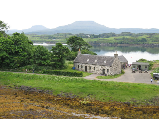
Dunvegan

Dunvegan (Scottish Gaelic: Dùn Bheagain) is a village on the Isle of Skye in Scotland. It is famous for Dunvegan Castle, seat of the chiefs of Clan MacLeod...

Dun Fiadhairt

Dun Fiadhairt is an Iron Age broch located on the north coast of the island of Skye, in Scotland (grid reference NG23115042). == Location == Dun Fiadhairt...

Nearby Amenities

Located within 500m of 57.445526,-6.6050287
Source: PGS
Lat/Long: 57.4485643/-6.6010478
Source: PGS
Lat/Long: 57.4483969/-6.6017291
Source: PGS
Lat/Long: 57.4482843/-6.6023138
Source: PGS
Lat/Long: 57.448648/-6.6031722
Source: PGS
Lat/Long: 57.4489655/-6.6037837
Source: PGS
Lat/Long: 57.4491012/-6.6040144
Source: PGS
Lat/Long: 57.4493869/-6.604819
Source: PGS
Lat/Long: 57.4497217/-6.6047547
Source: PGS
Lat/Long: 57.4498805/-6.6049531
Source: PGS
Lat/Long: 57.4498025/-6.6053555
Source: PGS
Lat/Long: 57.4487127/-6.6002366
Source: PGS
Lat/Long: 57.4485095/-6.6008279
Uiginish Point
Seamark Light 1 Character: Fl
Seamark Light 1 Colour: green
Seamark Light 1 Height: 14
Seamark Light 1 Period: 3
Seamark Light 1 Range: 5
Seamark Light 1 Sector End: 128
Seamark Light 1 Sector Start: 40
Seamark Light 1 Sequence: 1+(2)
Seamark Light 2 Character: Fl
Seamark Light 2 Colour: white
Seamark Light 2 Height: 14
Seamark Light 2 Period: 3
Seamark Light 2 Range: 7
Seamark Light 2 Sector End: 306
Seamark Light 2 Sector Start: 128
Seamark Light 2 Sequence: 1+(2)
Seamark Light Reference: A 4058
Seamark Type: light_minor
Source: US NGA Pub. 114. 2011-05-26.
Lat/Long: 57.44705/-6.6098833
Uiginish Point
Description: A green flashing light with a period of 3 seconds and a range of 7 miles.
Man Made: lighthouse
Lat/Long: 57.4471766/-6.6100288
Description: Side buoy (shape: conical) green having a green flashing light with a period of 5 seconds.
Man Made: lighthouse
Lat/Long: 57.4464949/-6.5975257
The data included in this document is from www.openstreetmap.org. The data is made available under ODbL.

Have you been to Uiginish Bonnet?

Leave your review of Uiginish Bonnet below (or comments, questions and feedback).