Rubha Ille Mhòire

Coastal Feature, Headland, Point in Ross-shire

Scotland

Rubha Ille Mhòire

Port Griogaspuil Always marked on OS maps right back to the very first in 1858, but very little to see other than the ruins of old quays and the low walls of three buildings. Rumoured to be the site of a mill, but not much of a stream to turn a mill wheel
Port Griogaspuil Credit: Richard Barrett

Rubha Ille Mhòire is a prominent headland located in Ross-shire, Scotland. Situated on the west coast, this coastal feature is known for its stunning natural beauty and rugged landscape. The name Rubha Ille Mhòire translates to "Big Isle Point" in English, reflecting the presence of a small island just off the coast.

The headland is characterized by towering cliffs that offer breathtaking views of the surrounding area. These cliffs are composed of diverse rock formations, including sandstone and limestone, which have been shaped over centuries by the relentless force of the Atlantic Ocean. The constant crashing of waves against the rocks has created dramatic sea stacks and caves that attract both nature enthusiasts and photographers.

The headland is also home to a diverse range of flora and fauna. The coastal grasslands are adorned with an array of wildflowers, including sea pink, thrift, and harebells, creating a vibrant and colorful landscape. The surrounding waters are teeming with marine life, including seals, dolphins, and various species of seabirds such as puffins and gannets. Birdwatchers flock to Rubha Ille Mhòire to catch a glimpse of these magnificent creatures.

Rubha Ille Mhòire is not only a haven for wildlife but also a popular destination for outdoor activities. Hiking trails crisscross the headland, providing opportunities for visitors to explore its rugged terrain and enjoy panoramic views of the coastline. The area is also frequented by rock climbers, as the cliffs offer challenging and exhilarating routes for experienced climbers.

Overall, Rubha Ille Mhòire is a captivating coastal feature that showcases the raw beauty of Scotland's west coast. Its stunning cliffs, diverse wildlife, and outdoor recreational opportunities make it a must-visit destination for nature lovers and adventurers alike.

If you have any feedback on the listing, please let us know in the comments section below.

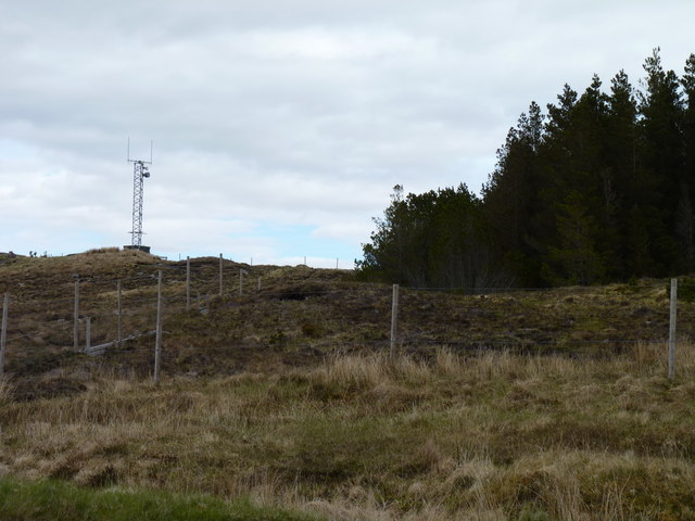
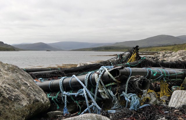
Rubha Ille Mhòire Images

Images are sourced within 2km of 58.040422/-6.6816803 or Grid Reference NB2315. Thanks to Geograph Open Source API. All images are credited.

Port Griogaspuil Always marked on OS maps right back to the very first in 1858, but very little to see other than the ruins of old quays and the low walls of three buildings. Rumoured to be the site of a mill, but not much of a stream to turn a mill wheel
Port Griogaspuil
Always marked on OS maps right back to the very first in 1858, but very little to see other than the ruins of old quays and the low walls of three buildings. Rumoured to be the site of a mill, but not much of a stream to turn a mill wheel
Mast on a hill Telecoms mast close to woodland above Loch an Rathaid.
Mast on a hill
Telecoms mast close to woodland above Loch an Rathaid.
Old bridge on the A859
Ãird an Troim Looking over Loch an Rathaid.
Ãird an Troim
Looking over Loch an Rathaid.
Debris on the shore of Loch Seaforth/Loch Shiphoirt, Isle of Lewis I assume the debris has drifted from a fish farm.
Debris on the shore of Loch Seaforth/Loch Shiphoirt, Isle of Lewis
I assume the debris has drifted from a fish farm.
View across moorland from Corra Chnoc, Isle of Lewis Looking towards Cearnabhal, the top of which is in the cloud.
View across moorland from Corra Chnoc, Isle of Lewis
Looking towards Cearnabhal, the top of which is in the cloud.
Loch a' Chorra Chnoic, Isle of Lewis According to the OS Name Book of 1848-1852, Loch a' Chorra Chnoic means Steep Hill Loch.
Loch a' Chorra Chnoic, Isle of Lewis
According to the OS Name Book of 1848-1852, Loch a' Chorra Chnoic means Steep Hill Loch.
Ruined farmstead by Loch Seaforth/Loch Shiphoirt, Isle of Lewis The farmstead is marked as a ruin on the 1st Edition OS map surveyed during 1850-53.
Ruined farmstead by Loch Seaforth/Loch Shiphoirt, Isle of Lewis
The farmstead is marked as a ruin on the 1st Edition OS map surveyed during 1850-53.
Salt marsh by Loch Seaforth/Loch Shiphoirt, Isle of Lewis The Aline Community Woodland can be seen on the right and in the centre of the horizon is the unnamed hill on Eilean Shìophoirt.
Salt marsh by Loch Seaforth/Loch Shiphoirt, Isle of Lewis
The Aline Community Woodland can be seen on the right and in the centre of the horizon is the unnamed hill on Eilean Shìophoirt.
Dorus Beag, Loch Seaforth/Loch Shiphoirt, Isle of Lewis Dorus Beag is the channel between the shore and a rock called Sgeir Liath which was under water at the time the photo was taken.  Dorus Beag means Little Door.
Dorus Beag, Loch Seaforth/Loch Shiphoirt, Isle of Lewis
Dorus Beag is the channel between the shore and a rock called Sgeir Liath which was under water at the time the photo was taken. Dorus Beag means Little Door.
Shieling mound, Rubha Àirigh an t-Sruth, Loch Seaforth/Loch Shiphoirt, Isle of Lewis According to the OS Name Book of 1848-1852, Rubha Àirigh an t-Sruth means The Streams Shieling's point.
Shieling mound, Rubha Àirigh an t-Sruth, Loch Seaforth/Loch Shiphoirt, Isle of Lewis
According to the OS Name Book of 1848-1852, Rubha Àirigh an t-Sruth means The Streams Shieling's point.
Building remains by Loch Seaforth/Loch Shiphoirt, Isle of Lewis The 1st Edition OS map, surveyed in 1850-53, shows two buildings, already unroofed at that time.
Building remains by Loch Seaforth/Loch Shiphoirt, Isle of Lewis
The 1st Edition OS map, surveyed in 1850-53, shows two buildings, already unroofed at that time.
Loch Seaforth/Loch Shiphoirt, Isle of Lewis Looking towards Mullach Breac Mhalasgair.
Loch Seaforth/Loch Shiphoirt, Isle of Lewis
Looking towards Mullach Breac Mhalasgair.
Tob Sgeir nan Radan, Loch Seaforth/Loch Shiphoirt, Isle of Lewis The OS Name Book of 1848-52 describes Tob Sgeir nan Radan as a small bay or harbour. The name means Rat's Rock Bay.
Tob Sgeir nan Radan, Loch Seaforth/Loch Shiphoirt, Isle of Lewis
The OS Name Book of 1848-52 describes Tob Sgeir nan Radan as a small bay or harbour. The name means Rat's Rock Bay.
Stone circle (and nosy sheep) by Loch Seaforth/Loch Shiphoirt, Isle of Lewis The stone circle is one of two about 20 metres apart and is described at <span class="nowrap"><a title="https://canmore.org.uk/site/282987/lewis-rubha-leathann" rel="nofollow ugc noopener" href="https://canmore.org.uk/site/282987/lewis-rubha-leathann">Link</a><img style="margin-left:2px;" alt="External link" title="External link - shift click to open in new window" src="https://s1.geograph.org.uk/img/external.png" width="10" height="10"/></span>.
Stone circle (and nosy sheep) by Loch Seaforth/Loch Shiphoirt, Isle of Lewis
The stone circle is one of two about 20 metres apart and is described at LinkExternal link.
Ruined farmhouse, Tota nan Scalag by Loch Seaforth/Loch Shìophoirt, Isle of Lewis The farmhouse was already in ruins at the time of the compilation of the OS Name Book in 1848-52.
Ruined farmhouse, Tota nan Scalag by Loch Seaforth/Loch Shìophoirt, Isle of Lewis
The farmhouse was already in ruins at the time of the compilation of the OS Name Book in 1848-52.
Aline Community Woodland Formerly a Forestry Commission Scotland plantation, this woodland was acquired by the Erisort Trust in 2006. The photograph shows operations to remove Lodgepole Pines that were killed by Pine Beauty Moth.
Aline Community Woodland
Formerly a Forestry Commission Scotland plantation, this woodland was acquired by the Erisort Trust in 2006. The photograph shows operations to remove Lodgepole Pines that were killed by Pine Beauty Moth.
Stornoway to Tarbert Road The hill to the right is Beinn a' Mhuil.An Cliseam (Clisham) is to the left.
Stornoway to Tarbert Road
The hill to the right is Beinn a' Mhuil.An Cliseam (Clisham) is to the left.
Show me another place!

Rubha Ille Mhòire is located at Grid Ref: NB2315 (Lat: 58.040422, Lng: -6.6816803)

Unitary Authority: Na h-Eileanan an Iar

Police Authority: Highlands and Islands

What 3 Words

///mend.blaring.lilac. Near Leurbost, Na h-Eileanan Siar

Related Wikis

Airidh a' Bhruaich

Airidh a' Bhruaich (Arivruaich - anglicised) is a scattered crofting township in the South Lochs district of the Isle of Lewis in the Outer Hebrides of...

Seaforth Island

Seaforth Island (Scottish Gaelic: Eilean Shìphoirt/Shìophoirt or Mulag) is an uninhabited island in the Outer Hebrides of Scotland. Unlike many other...

Ardvourlie Castle

Ardvourlie Castle is a 19th-century country house on Harris, one of the Western Isles off the north-west coast of Scotland. The house was built beside...

Eilean Mòr, Loch Langavat

Eilean Mòr is an island in Loch Langavat on the Isle of Lewis in the Outer Hebrides of Scotland. == Footnotes ==

Have you been to Rubha Ille Mhòire?

Leave your review of Rubha Ille Mhòire below (or comments, questions and feedback).