Ob Dubh

Bay in Inverness-shire

Scotland

Ob Dubh

Blackhouse Museum, Colbost The croft museum in the township of Colbost, on the west shore of Loch Dunvegan, was established in 1969 by local man Peter MacAskill as the first of several heritage projects in the area. Its centrepiece was a restored island blackhouse (Taigh Dubh), constructed of rough unmortared stone and replicating typical living conditions in 19th-century rural Skye. There were two doors, one for the crofter's family who occupied two thirds of the building and the other for the animals housed in the byre which took up the remaining space. There were no windows or chimneys; daylight entered through the doorways and smoke from the central peat fire, continuously burning in its hearth on the floor of the living room, escaped though a raised opening in the thatched roof. The interior was thus dark and smoky and the floor was of beaten earth. Kettles and cooking pots were hung on a slabhraidh (chain) suspended from the rafters over the fire, and crockery and utensils was kept in a dresser and presses (cupboards) against the walls. A replica of an illicit whisky still could be seen to the rear of the museum.

The adjoining Three Chimneys restaurant was also opened by Peter, initially to provide refreshments for visitors to the museum, and takes its name from the Kent hamlet near Sevenoaks where Peter had formerly lived.

Sadly the museum was not able to reopen following its closure just before the Covid pandemic of 2020, and by 2023 it stood derelict with the neglected roof thatch disintegrating.
Blackhouse Museum, Colbost Credit: Sandy Gerrard

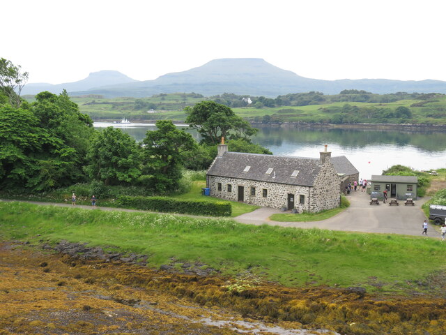
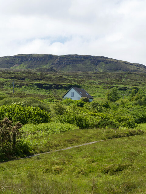
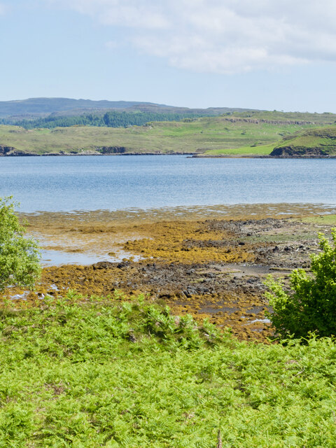
Ob Dubh is a picturesque bay located in the county of Inverness-shire, Scotland. Situated on the western coast of Scotland, it is known for its stunning natural beauty and tranquil atmosphere. The bay is nestled between rolling hills and offers breathtaking views of the surrounding landscape.

The bay itself is characterized by its crescent shape, with a wide sandy beach that stretches for approximately 1.5 kilometers. The sand is soft and golden, making it an ideal spot for sunbathing, picnicking, and leisurely walks along the shore. The crystal-clear waters of the bay are perfect for swimming, kayaking, and other water sports.

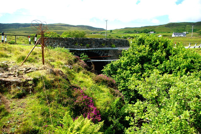
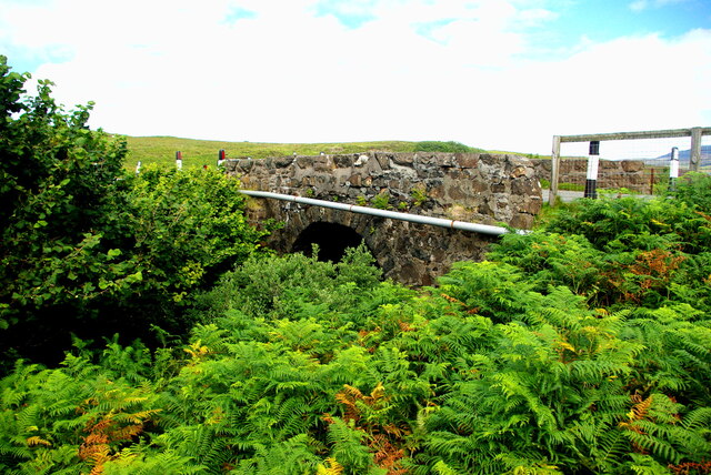
Surrounded by lush greenery and rocky cliffs, Ob Dubh provides a haven for wildlife enthusiasts. The bay is home to a diverse range of bird species, including gulls, cormorants, and oystercatchers. Seals and dolphins can often be spotted swimming in the bay, delighting visitors with their playful antics.

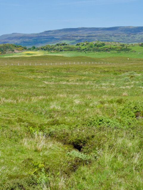
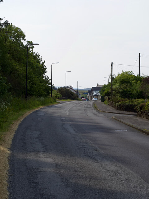
Hiking trails and coastal paths surround the bay, offering opportunities for exploration and adventure. The nearby hills provide panoramic views of the bay and the surrounding countryside, making it a popular destination for hillwalkers and nature lovers.

Ob Dubh is a peaceful and serene destination, perfect for those seeking a break from the hustle and bustle of everyday life. Whether it's enjoying the beach, observing wildlife, or simply taking in the beauty of the Scottish coastline, Ob Dubh offers a truly unforgettable experience for visitors.

If you have any feedback on the listing, please let us know in the comments section below.

Ob Dubh Images

Images are sourced within 2km of 57.440225/-6.6144366 or Grid Reference NG2348. Thanks to Geograph Open Source API. All images are credited.
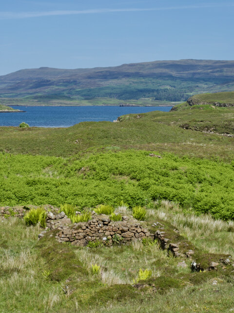
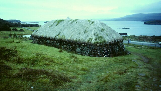
Blackhouse Museum, Colbost The croft museum in the township of Colbost, on the west shore of Loch Dunvegan, was established in 1969 by local man Peter MacAskill as the first of several heritage projects in the area. Its centrepiece was a restored island blackhouse (Taigh Dubh), constructed of rough unmortared stone and replicating typical living conditions in 19th-century rural Skye. There were two doors, one for the crofter's family who occupied two thirds of the building and the other for the animals housed in the byre which took up the remaining space. There were no windows or chimneys; daylight entered through the doorways and smoke from the central peat fire, continuously burning in its hearth on the floor of the living room, escaped though a raised opening in the thatched roof. The interior was thus dark and smoky and the floor was of beaten earth. Kettles and cooking pots were hung on a slabhraidh (chain) suspended from the rafters over the fire, and crockery and utensils was kept in a dresser and presses (cupboards) against the walls. A replica of an illicit whisky still could be seen to the rear of the museum.

The adjoining Three Chimneys restaurant was also opened by Peter, initially to provide refreshments for visitors to the museum, and takes its name from the Kent hamlet near Sevenoaks where Peter had formerly lived.

Sadly the museum was not able to reopen following its closure just before the Covid pandemic of 2020, and by 2023 it stood derelict with the neglected roof thatch disintegrating.
Blackhouse Museum, Colbost
The croft museum in the township of Colbost, on the west shore of Loch Dunvegan, was established in 1969 by local man Peter MacAskill as the first of several heritage projects in the area. Its centrepiece was a restored island blackhouse (Taigh Dubh), constructed of rough unmortared stone and replicating typical living conditions in 19th-century rural Skye. There were two doors, one for the crofter's family who occupied two thirds of the building and the other for the animals housed in the byre which took up the remaining space. There were no windows or chimneys; daylight entered through the doorways and smoke from the central peat fire, continuously burning in its hearth on the floor of the living room, escaped though a raised opening in the thatched roof. The interior was thus dark and smoky and the floor was of beaten earth. Kettles and cooking pots were hung on a slabhraidh (chain) suspended from the rafters over the fire, and crockery and utensils was kept in a dresser and presses (cupboards) against the walls. A replica of an illicit whisky still could be seen to the rear of the museum. The adjoining Three Chimneys restaurant was also opened by Peter, initially to provide refreshments for visitors to the museum, and takes its name from the Kent hamlet near Sevenoaks where Peter had formerly lived. Sadly the museum was not able to reopen following its closure just before the Covid pandemic of 2020, and by 2023 it stood derelict with the neglected roof thatch disintegrating.
Loch Dunvegan A view across the sea loch from Colbost on a June evening. Dunvegan Castle in <a href="https://www.geograph.org.uk/gridref/NG2449">NG2449</a> is prominent on the eastern shore.
Loch Dunvegan
A view across the sea loch from Colbost on a June evening. Dunvegan Castle in NG2449 is prominent on the eastern shore.
Looking along the coast towards Dunvegan Castle, Skye, 1988
Ruined Blackhouse Settlement
Disused quarry close to the B884
Dunvegan Castle/Caisteal Dhùn Bheagain <span class="nowrap"><a title="https://canmore.org.uk/site/10835/skye-dunvegan-castle" rel="nofollow ugc noopener" href="https://canmore.org.uk/site/10835/skye-dunvegan-castle">Link</a><img style="margin-left:2px;" alt="External link" title="External link - shift click to open in new window" src="https://s1.geograph.org.uk/img/external.png" width="10" height="10"/></span>
Dunvegan Castle/Caisteal Dhùn Bheagain
Loch from Dunvegan Castle The castle provides opportunities for trips to see seals.
Loch from Dunvegan Castle
The castle provides opportunities for trips to see seals.
Folk Museum in decline Three years on from the closure enforced by Covid, the restored black house at the centre of the Colbost Croft Museum is showing sad signs of severe neglect.  The central section of the thatched roof has given way, leaving only the retaining wire netting, while rank weeds have invaded the remaining parts of the thatch. An upturned wheelbarrow is quietly rusting away in the foreground.
Folk Museum in decline
Three years on from the closure enforced by Covid, the restored black house at the centre of the Colbost Croft Museum is showing sad signs of severe neglect. The central section of the thatched roof has given way, leaving only the retaining wire netting, while rank weeds have invaded the remaining parts of the thatch. An upturned wheelbarrow is quietly rusting away in the foreground.
Decline of the Colbost Folk Museum Three years on from the closure enforced by Covid, the restored black house is showing sad signs of severe neglect.  The central section of the thatched roof has given way, leaving only the retaining wire netting, while rank weeds have invaded the remaining parts of the thatch. Agricultural machinery and an old wheel lie among the long grass.
Decline of the Colbost Folk Museum
Three years on from the closure enforced by Covid, the restored black house is showing sad signs of severe neglect. The central section of the thatched roof has given way, leaving only the retaining wire netting, while rank weeds have invaded the remaining parts of the thatch. Agricultural machinery and an old wheel lie among the long grass.
An astonishing hillside, Cnoc a' Bhonnaich Beag, and its incredibly ordinary house
A sunny day view of a ruined shieling amidst a sea of bracken
Tràigh Bheag, the 'little beach' that hides its sands
A choice of features: a bog, a stream, a fence, or the basalt ridge of Cnoc a' Chrochadair
Dun Totaig — a mass of tumbled stone and an invasion of bracken For historical information, see ‘Skye, Dun Totaig | Canmore’. 2023. Canmore.org.uk <<span class="nowrap"><a title="https://canmore.org.uk/site/10834/skye-dun-totaig" rel="nofollow ugc noopener" href="https://canmore.org.uk/site/10834/skye-dun-totaig">Link</a><img style="margin-left:2px;" alt="External link" title="External link - shift click to open in new window" src="https://s1.geograph.org.uk/img/external.png" width="10" height="10"/></span> > [accessed 14 July 2023]

‌
Dun Totaig — a mass of tumbled stone and an invasion of bracken
For historical information, see ‘Skye, Dun Totaig | Canmore’. 2023. Canmore.org.uk <LinkExternal link > [accessed 14 July 2023] ‌
A850 at Dunvegan
A850 at Dunvegan
Drochaid Peigi Siosalaiche (1) Peggy Chisholm&amp;#039;s Bridge carries the B884 Glendale road over the Brunigill Burn near its outflow into Loch Erghallan, just south of the township of Skinidin (Sgianaidin).  In the early 20th century Peggy lived in a house near the bridge, of which no traces remain. The parapets have frequently had to be rebuilt following impacts by vehicles on the narrow road.

The Ordnance Survey Name Books of 1876-8 record Brunigill as the name &amp;quot;applied to a house one Storey high thatched and in ordinary repair Situated about ½ mile to the South-east of Skinidin Property of McLeod of Mcleod&amp;quot;; this may have been Peggy&amp;#039;s home. Alexander Forbes in his 1923 work on the place names of Skye  derives the name from the Norse &amp;quot;Brunnr&amp;quot; indicating a ravine.

This image shows the downstream side of the bridge. For the view from upstream see &lt;a href=&quot;https://www.geograph.org.uk/photo/7560297&quot;&gt;NG2247 : Drochaid Peigi Siosalaiche (2)&lt;/a&gt;.
Drochaid Peigi Siosalaiche (1)
Peggy Chisholm's Bridge carries the B884 Glendale road over the Brunigill Burn near its outflow into Loch Erghallan, just south of the township of Skinidin (Sgianaidin). In the early 20th century Peggy lived in a house near the bridge, of which no traces remain. The parapets have frequently had to be rebuilt following impacts by vehicles on the narrow road. The Ordnance Survey Name Books of 1876-8 record Brunigill as the name "applied to a house one Storey high thatched and in ordinary repair Situated about ½ mile to the South-east of Skinidin Property of McLeod of Mcleod"; this may have been Peggy's home. Alexander Forbes in his 1923 work on the place names of Skye derives the name from the Norse "Brunnr" indicating a ravine. This image shows the downstream side of the bridge. For the view from upstream see NG2247 : Drochaid Peigi Siosalaiche (2).
Drochaid Peigi Siosalaiche (2) Peggy Chisholm&amp;#039;s Bridge carries the B884 Glendale road over the Brunigill Burn near its outflow into Loch Erghallan, just south of the township of Skinidin (Sgianaidin). In the early 20th century Peggy lived in a house near the bridge, of which no traces remain. The parapets have frequently had to be rebuilt following impacts by vehicles on the narrow road.

The Ordnance Survey Name Books of 1876-8 record Brunigill as the name &amp;quot;applied to a house one Storey high thatched and in ordinary repair Situated about ½ mile to the South-east of Skinidin Property of McLeod of Mcleod&amp;quot;; this may have been Peggy&amp;#039;s home. Alexander Forbes in his 1923 work on the place names of Skye derives the name from the Norse &amp;quot;Brunnr&amp;quot; indicating a ravine.

This image shows the view from upstream. For downstream side of the bridge see &lt;a href=&quot;https://www.geograph.org.uk/photo/7560294&quot;&gt;NG2247 : Drochaid Peigi Siosalaiche (1)&lt;/a&gt;.
Drochaid Peigi Siosalaiche (2)
Peggy Chisholm's Bridge carries the B884 Glendale road over the Brunigill Burn near its outflow into Loch Erghallan, just south of the township of Skinidin (Sgianaidin). In the early 20th century Peggy lived in a house near the bridge, of which no traces remain. The parapets have frequently had to be rebuilt following impacts by vehicles on the narrow road. The Ordnance Survey Name Books of 1876-8 record Brunigill as the name "applied to a house one Storey high thatched and in ordinary repair Situated about ½ mile to the South-east of Skinidin Property of McLeod of Mcleod"; this may have been Peggy's home. Alexander Forbes in his 1923 work on the place names of Skye derives the name from the Norse "Brunnr" indicating a ravine. This image shows the view from upstream. For downstream side of the bridge see NG2247 : Drochaid Peigi Siosalaiche (1).
Sea Cloud II Viewed from Colbost, the windjammer Sea Cloud II lies at anchor off the Fiadhairt peninsula in Loch Dunvegan.  She is a 3-masted barque of 3,849 tons built in Castropol in northern Spain in 2000 and registered in Valetta, Malta.  For more details see the following:

Marine Traffic &lt;span class=&quot;nowrap&quot;&gt;&lt;a title=&quot;http://www.marinetraffic.com/en/ais/details/ships/248953000&quot; rel=&quot;nofollow ugc noopener&quot; href=&quot;http://www.marinetraffic.com/en/ais/details/ships/248953000&quot;&gt;Link&lt;/a&gt;&lt;img style=&quot;margin-left:2px;&quot; alt=&quot;External link&quot; title=&quot;External link - shift click to open in new window&quot; src=&quot;https://s1.geograph.org.uk/img/external.png&quot; width=&quot;10&quot; height=&quot;10&quot;/&gt;&lt;/span&gt;
Wikipedia &lt;span class=&quot;nowrap&quot;&gt;&lt;a title=&quot;http://en.wikipedia.org/wiki/Sea_Cloud_II&quot; rel=&quot;nofollow ugc noopener&quot; href=&quot;http://en.wikipedia.org/wiki/Sea_Cloud_II&quot;&gt;Link&lt;/a&gt;&lt;img style=&quot;margin-left:2px;&quot; alt=&quot;External link&quot; title=&quot;External link - shift click to open in new window&quot; src=&quot;https://s1.geograph.org.uk/img/external.png&quot; width=&quot;10&quot; height=&quot;10&quot;/&gt;&lt;/span&gt;
and the ship&amp;#039;s own site &lt;span class=&quot;nowrap&quot;&gt;&lt;a title=&quot;http://www.seacloud.com/en/the-yachts/sea-cloud-2/&quot; rel=&quot;nofollow ugc noopener&quot; href=&quot;http://www.seacloud.com/en/the-yachts/sea-cloud-2/&quot;&gt;Link&lt;/a&gt;&lt;img style=&quot;margin-left:2px;&quot; alt=&quot;External link&quot; title=&quot;External link - shift click to open in new window&quot; src=&quot;https://s1.geograph.org.uk/img/external.png&quot; width=&quot;10&quot; height=&quot;10&quot;/&gt;&lt;/span&gt;
Sea Cloud II
Viewed from Colbost, the windjammer Sea Cloud II lies at anchor off the Fiadhairt peninsula in Loch Dunvegan. She is a 3-masted barque of 3,849 tons built in Castropol in northern Spain in 2000 and registered in Valetta, Malta. For more details see the following: Marine Traffic LinkExternal link Wikipedia LinkExternal link and the ship's own site LinkExternal link
Show me another place!

Ob Dubh is located at Grid Ref: NG2348 (Lat: 57.440225, Lng: -6.6144366)

Unitary Authority: Highland

Police Authority: Highlands and Islands

What 3 Words

///judges.form.alpha. Near Dunvegan, Highland

Related Wikis

Eilean Mòr, Loch Dunvegan

Eilean Mòr is an uninhabited island in Loch Dunvegan in north west Skye, Scotland. At low water the island is connected to Eilean Dubh. == Footnotes ==

The Three Chimneys

The Three Chimneys is a restaurant in Colbost, Isle of Skye, Scotland. While in operation beforehand, the restaurant came to prominence after being taken...
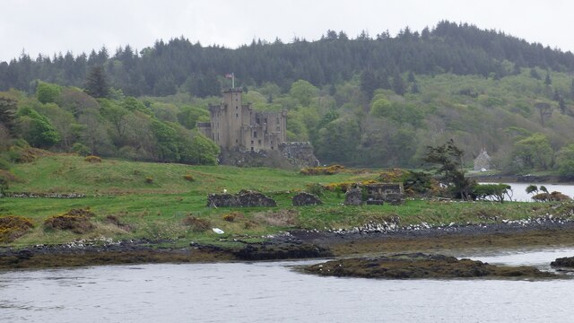
Dunvegan Castle

Dunvegan Castle (Caisteal Dhùn Bheagain) is located 1 mile (1.6 km) to the north of Dunvegan on the Isle of Skye, off the west coast of Scotland. It is...

Colbost

Colbost (Scottish Gaelic: Cealabost) is a scattered hamlet on the B884 road, in the Glendale estate, overlooking Loch Dunvegan on the Scottish island of...

Nearby Amenities

Located within 500m of 57.440225,-6.6144366
Source: PGS
Lat/Long: 57.4400348/-6.621894
Source: PGS
Lat/Long: 57.440702/-6.6225522
Source: PGS
Lat/Long: 57.4433476/-6.6199285
Source: PGS
Lat/Long: 57.44278/-6.6193968
Source: PGS
Lat/Long: 57.4420808/-6.6194655
Source: PGS
Lat/Long: 57.4417018/-6.6201264
Source: PGS
Lat/Long: 57.4411582/-6.6196865
Source: PGS
Lat/Long: 57.4406047/-6.6192853
Source: PGS
Lat/Long: 57.4402219/-6.6199478
Loch Erghallan
Natural: bay
Lat/Long: 57.4384233/-6.6220293
Ob Dubh
Natural: bay
Lat/Long: 57.4398207/-6.6132497
The data included in this document is from www.openstreetmap.org. The data is made available under ODbL.

Have you been to Ob Dubh?

Leave your review of Ob Dubh below (or comments, questions and feedback).