Triadaburie

Coastal Feature, Headland, Point in Ross-shire

Scotland

Triadaburie

Great Bernera bridges The new bridge under construction and the old white bridge.
Great Bernera bridges Credit: Catherine Morgan

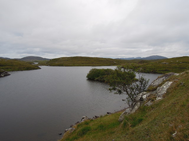
Triadaburie is a prominent coastal feature located in Ross-shire, Scotland. It is a headland that juts out into the North Sea, forming a distinctive point along the rugged coastline.

This headland is characterized by its steep cliffs, which provide stunning panoramic views of the surrounding area. The cliffs themselves are composed of various rock formations, including sandstone and limestone, which have been shaped by years of erosion from the crashing waves. These cliffs also serve as a nesting site for several seabird species, including puffins and guillemots, making it a popular spot for birdwatching enthusiasts.

Triadaburie is known for its dramatic coastal scenery, with its rugged cliffs contrasting against the deep blue sea. The area is also home to a diverse range of flora and fauna, with wildflowers and grasses dotting the landscape. It is not uncommon to spot seals or dolphins swimming in the waters below, adding to the area's natural beauty.

Access to Triadaburie is relatively easy, with a well-maintained footpath leading visitors to the headland. The path offers breathtaking views along the way, allowing visitors to appreciate the coastal landscape before reaching the point itself. There are also several benches strategically placed along the path, providing ample opportunities to rest and take in the scenery.

Overall, Triadaburie is a picturesque headland that showcases the stunning coastal beauty of Ross-shire. It offers a unique blend of rugged cliffs, diverse wildlife, and panoramic views, making it a must-visit destination for nature lovers and outdoor enthusiasts alike.

If you have any feedback on the listing, please let us know in the comments section below.

Triadaburie Images

Images are sourced within 2km of 58.205712/-6.8476623 or Grid Reference NB1534. Thanks to Geograph Open Source API. All images are credited.

Great Bernera bridges The new bridge under construction and the old white bridge.
Great Bernera bridges
The new bridge under construction and the old white bridge.
"The Bridge Across the Atlantic" Bernera Bridge is one of several bridges which claim to span the Atlantic Ocean. This one connects the Lewis mainland with the island of Great Bernera / Bearnaraigh. Note the standing stones on the far side of the bridge.
<span class="nowrap"><a title="http://www.uigandbernera.com/" rel="nofollow ugc noopener" href="http://www.uigandbernera.com/">Link</a><img style="margin-left:2px;" alt="External link" title="External link - shift click to open in new window" src="https://s1.geograph.org.uk/img/external.png" width="10" height="10"/></span>
"The Bridge Across the Atlantic"
Bernera Bridge is one of several bridges which claim to span the Atlantic Ocean. This one connects the Lewis mainland with the island of Great Bernera / Bearnaraigh. Note the standing stones on the far side of the bridge. LinkExternal link
Bernera Bridge Opened in 1953 and connecting Lewis with Great Bernera / Bearnaraigh.
<span class="nowrap"><a title="http://www.uigandbernera.com/" rel="nofollow ugc noopener" href="http://www.uigandbernera.com/">Link</a><img style="margin-left:2px;" alt="External link" title="External link - shift click to open in new window" src="https://s1.geograph.org.uk/img/external.png" width="10" height="10"/></span>
Bernera Bridge
Opened in 1953 and connecting Lewis with Great Bernera / Bearnaraigh. LinkExternal link
Sea Kayakers by Port a Chruidh Kayakers who have come from Miavaig / Miabhaig and are heading eastwards, having just passed below Bernera Bridge. The mainland of Lewis is on the far side of the 1953 bridge.
<span class="nowrap"><a title="http://www.uigandbernera.com/" rel="nofollow ugc noopener" href="http://www.uigandbernera.com/">Link</a><img style="margin-left:2px;" alt="External link" title="External link - shift click to open in new window" src="https://s1.geograph.org.uk/img/external.png" width="10" height="10"/></span>
Sea Kayakers by Port a Chruidh
Kayakers who have come from Miavaig / Miabhaig and are heading eastwards, having just passed below Bernera Bridge. The mainland of Lewis is on the far side of the 1953 bridge. LinkExternal link
Lewisian Gneiss Pink, folded Lewisian gneiss at the north end of Bernera Bridge. These are amongst the oldest rocks in the world.
<span class="nowrap"><a title="http://www.uigandbernera.com/" rel="nofollow ugc noopener" href="http://www.uigandbernera.com/">Link</a><img style="margin-left:2px;" alt="External link" title="External link - shift click to open in new window" src="https://s1.geograph.org.uk/img/external.png" width="10" height="10"/></span>
Lewisian Gneiss
Pink, folded Lewisian gneiss at the north end of Bernera Bridge. These are amongst the oldest rocks in the world. LinkExternal link
Stone Circle by Bernera Bridge Ancient stone circle on a mound above the north end of the bridge. the stones are part of the famous Callanish complex of standing stones.
Stone Circle by Bernera Bridge
Ancient stone circle on a mound above the north end of the bridge. the stones are part of the famous Callanish complex of standing stones.
Cleitir Stone Circle Calanais VIII - four standing stones above Bernera Bridge and the sound separating the island from Lewis.
Cleitir Stone Circle
Calanais VIII - four standing stones above Bernera Bridge and the sound separating the island from Lewis.
Bernera Bridge
Bernera Bridge
Standing stones by Bernera Bridge
Loch Ional A very peaceful place
Loch Ional
A very peaceful place
Great Bernera: postbox № HS2 82 and a ruined croft house This postbox stands at the southern end of the island, a few hundred yards from the Bernera Bridge. Behind it, we see a ruined croft house, so common in the Scottish islands.
Great Bernera: postbox № HS2 82 and a ruined croft house
This postbox stands at the southern end of the island, a few hundred yards from the Bernera Bridge. Behind it, we see a ruined croft house, so common in the Scottish islands.
Great Bernera Road Bridge Great Bernera lies in Loch Roag on the north-west coast of Lewis and is linked to it by a road bridge. Built in 1953, the bridge was the first pre-stressed concrete bridge in Europe. The main settlement on the island is Breaclete (Gaelic: Breacleit).
I was here bagging the island of Great Bernera with George Morl and its high point a TuMP called Middle Shalaval, at 87 metres and a P87 hill.
Great Bernera Road Bridge
Great Bernera lies in Loch Roag on the north-west coast of Lewis and is linked to it by a road bridge. Built in 1953, the bridge was the first pre-stressed concrete bridge in Europe. The main settlement on the island is Breaclete (Gaelic: Breacleit). I was here bagging the island of Great Bernera with George Morl and its high point a TuMP called Middle Shalaval, at 87 metres and a P87 hill.
Callanish X
Callanish X
Great Bernera Road Bridge The road south hugged the shore in 1975. Now it blasts straight ahead.
Great Bernera Road Bridge
The road south hugged the shore in 1975. Now it blasts straight ahead.
Standing Stones look over Sruth Iarsiadar  The name in this case means the current at Iarsiadar. It's a narrow tidal channel between Great Bernera and the rest of Lewis.
Standing Stones look over Sruth Iarsiadar
The name in this case means the current at Iarsiadar. It's a narrow tidal channel between Great Bernera and the rest of Lewis.
Tursachan standing stone and Bernera Road Bridge The stone is one of a group of three standing with a fourth being prostrate.
Tursachan standing stone and Bernera Road Bridge
The stone is one of a group of three standing with a fourth being prostrate.
A view over Loch Barraglom From Iarsiadar.
A view over Loch Barraglom
From Iarsiadar.
The Bernera Bridge The bridge was opened in 1953 and widened in 1998. Prior to that, Bernera was connected to the main island by ferry but during construction of the bridge, divers found the remains of a causeway, of unknown age.
The Bernera Bridge
The bridge was opened in 1953 and widened in 1998. Prior to that, Bernera was connected to the main island by ferry but during construction of the bridge, divers found the remains of a causeway, of unknown age.
Show me another place!

Triadaburie is located at Grid Ref: NB1534 (Lat: 58.205712, Lng: -6.8476623)

Unitary Authority: Na h-Eileanan an Iar

Police Authority: Highlands and Islands

What 3 Words

///strikers.twins.atoms. Near Carloway, Na h-Eileanan Siar

Related Wikis

Callanish VIII

The Callanish VIII stone setting is one of many megalithic structures around the better-known (and larger) Calanais I on the west coast of the Isle of...

Dun Bharabhat, Great Bernera

Dun Bharabhat (or Dun Baravat) is an Iron Age galleried dun or "semi-broch" situated on the island of Great Bernera near Lewis in Scotland (grid reference...

Fuaigh Mòr

Fuaigh Mòr (sometimes anglicised as Vuia Mor) is an island in the Outer Hebrides of Scotland. It is off the west coast of Lewis near Great Bernera in...

Great Bernera

Great Bernera (; Scottish Gaelic: Beàrnaraigh Mòr), often known just as Bernera (Scottish Gaelic: Beàrnaraigh), is an island and community in the Outer...

Nearby Amenities

Located within 500m of 58.205712,-6.8476623
Passing Place
Lat/Long: 58.2082388/-6.8493519
Passing Place
Lat/Long: 58.2081384/-6.8479396
Passing Place
Lat/Long: 58.2070554/-6.846795
Post Box
Operator: Royal Mail
Lat/Long: 58.2091425/-6.8507291
Tacleit
Name En: Hacklete
Name Gd: Tacleit
Place: village
Lat/Long: 58.2091129/-6.849857
Power: pole
Lat/Long: 58.2099518/-6.8496727
Power: pole
Lat/Long: 58.2096736/-6.8488511
Power: pole
Lat/Long: 58.209393/-6.8479957
Power: pole
Lat/Long: 58.2090482/-6.847226
Power: pole
Lat/Long: 58.2086403/-6.8463142
Power: pole
Lat/Long: 58.2083573/-6.8457048
Power: pole
Lat/Long: 58.2081575/-6.8453075
Power: pole
Lat/Long: 58.2076629/-6.8443912
Power: pole
Lat/Long: 58.2070362/-6.8432649
Power: pole
Lat/Long: 58.2064309/-6.8421657
Power: pole
Lat/Long: 58.2061907/-6.8416962
Power: pole
Lat/Long: 58.2059767/-6.841317
Power: pole
Lat/Long: 58.2083133/-6.8465828
Power: pole
Lat/Long: 58.208261/-6.8473705
Power: pole
Lat/Long: 58.2082146/-6.8481921
Power: pole
Lat/Long: 58.2081599/-6.8490836
Power: pole
Lat/Long: 58.2094631/-6.8451969
Power: pole
Lat/Long: 58.209154/-6.8453233
Power: pole
Lat/Long: 58.2088722/-6.8454249
Power: pole
Lat/Long: 58.208934/-6.851212
Power: pole
Lat/Long: 58.2091373/-6.8521826
Barrier: cattle_grid
Lat/Long: 58.2087322/-6.8522923
Generator Method: photovoltaic
Generator Output Electricity: small_installation
Generator Source: solar
Generator Type: solar_photovoltaic_panel
Power: generator
Lat/Long: 58.2079443/-6.8492882
Loch Rog
Natural: bay
Wikidata: Q3777175
Wikipedia: en:Loch Ròg
Lat/Long: 58.2024367/-6.8457086
The data included in this document is from www.openstreetmap.org. The data is made available under ODbL.

Have you been to Triadaburie?

Leave your review of Triadaburie below (or comments, questions and feedback).