Creag Ille Chaluim Ghlais

Coastal Feature, Headland, Point in Ross-shire

Scotland

Creag Ille Chaluim Ghlais

Great Bernera bridges The new bridge under construction and the old white bridge.
Great Bernera bridges Credit: Catherine Morgan

Creag Ille Chaluim Ghlais is a prominent coastal feature located in Ross-shire, Scotland. It is a headland that juts out into the North Sea, forming a picturesque point along the rugged coastline.

The name "Creag Ille Chaluim Ghlais" is derived from the Gaelic language and translates to "the rock of young Malcolm of the green." This name is believed to reference a historical figure or event associated with the area.

The headland is characterized by its steep cliffs, which rise dramatically from the sea below. These cliffs are composed of various rock formations, including sandstone and shale, which have been shaped and eroded by the relentless coastal elements over centuries.

Creag Ille Chaluim Ghlais offers breathtaking views of the surrounding landscape, with sweeping vistas of the North Sea and the distant hills of Ross-shire. The headland is also home to an abundance of wildlife, including seabirds, such as gannets and puffins, which nest in the cliffs.

The area surrounding Creag Ille Chaluim Ghlais is rich in natural beauty and provides opportunities for outdoor activities such as hiking, birdwatching, and photography. Visitors can explore the rugged coastline, walk along the cliff-top paths, or simply enjoy the tranquility and stunning scenery.

Overall, Creag Ille Chaluim Ghlais is a magnificent coastal feature that showcases the raw beauty of the Scottish coastline and provides a unique and memorable experience for those who visit.

If you have any feedback on the listing, please let us know in the comments section below.

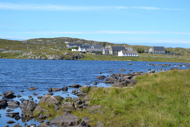
Creag Ille Chaluim Ghlais Images

Images are sourced within 2km of 58.209458/-6.8388168 or Grid Reference NB1534. Thanks to Geograph Open Source API. All images are credited.

Great Bernera bridges The new bridge under construction and the old white bridge.
Great Bernera bridges
The new bridge under construction and the old white bridge.
Moorland and loch on Great Bernera The loch is unnamed on the map, but the Allt Loch an Fheoir flows into it, so this must be Loch an Fheoir.

The houses in the distance are on the road south of Bhalasaigh.
Moorland and loch on Great Bernera
The loch is unnamed on the map, but the Allt Loch an Fheoir flows into it, so this must be Loch an Fheoir. The houses in the distance are on the road south of Bhalasaigh.
"The Bridge Across the Atlantic" Bernera Bridge is one of several bridges which claim to span the Atlantic Ocean. This one connects the Lewis mainland with the island of Great Bernera / Bearnaraigh. Note the standing stones on the far side of the bridge.
<span class="nowrap"><a title="http://www.uigandbernera.com/" rel="nofollow ugc noopener" href="http://www.uigandbernera.com/">Link</a><img style="margin-left:2px;" alt="External link" title="External link - shift click to open in new window" src="https://s1.geograph.org.uk/img/external.png" width="10" height="10"/></span>
"The Bridge Across the Atlantic"
Bernera Bridge is one of several bridges which claim to span the Atlantic Ocean. This one connects the Lewis mainland with the island of Great Bernera / Bearnaraigh. Note the standing stones on the far side of the bridge. LinkExternal link
Breacleit, Bernera Summer flowers, church and school in the village centre.
<span class="nowrap"><a title="http://www.uigandbernera.com/" rel="nofollow ugc noopener" href="http://www.uigandbernera.com/">Link</a><img style="margin-left:2px;" alt="External link" title="External link - shift click to open in new window" src="https://s1.geograph.org.uk/img/external.png" width="10" height="10"/></span>
Breacleit, Bernera
Summer flowers, church and school in the village centre. LinkExternal link
Loch Ionail Freshwater loch on the island of Great Bernera / Bearnaraigh.
<span class="nowrap"><a title="http://www.uigandbernera.com/" rel="nofollow ugc noopener" href="http://www.uigandbernera.com/">Link</a><img style="margin-left:2px;" alt="External link" title="External link - shift click to open in new window" src="https://s1.geograph.org.uk/img/external.png" width="10" height="10"/></span>
Loch Ionail
Freshwater loch on the island of Great Bernera / Bearnaraigh. LinkExternal link
Tob Bhalasaigh Tidal lagoon with a mix of rare seaweeds on Great Bernera / Bearnaraigh.
<span class="nowrap"><a title="http://www.uigandbernera.com/" rel="nofollow ugc noopener" href="http://www.uigandbernera.com/">Link</a><img style="margin-left:2px;" alt="External link" title="External link - shift click to open in new window" src="https://s1.geograph.org.uk/img/external.png" width="10" height="10"/></span>
Tob Bhalasaigh
Tidal lagoon with a mix of rare seaweeds on Great Bernera / Bearnaraigh. LinkExternal link
Valasay Bridge Carrying the single track road across an outlet of the tidal lagoon, Tob Bhalasaigh on Great Bernera / Bearnaraigh.
<span class="nowrap"><a title="http://www.uigandbernera.com/" rel="nofollow ugc noopener" href="http://www.uigandbernera.com/">Link</a><img style="margin-left:2px;" alt="External link" title="External link - shift click to open in new window" src="https://s1.geograph.org.uk/img/external.png" width="10" height="10"/></span>
Valasay Bridge
Carrying the single track road across an outlet of the tidal lagoon, Tob Bhalasaigh on Great Bernera / Bearnaraigh. LinkExternal link
Shoreline at Tob Bhalasaigh Rocks and heather at the edge of the tidal lagoon in Valasay.
<span class="nowrap"><a title="http://www.uigandbernera.com/" rel="nofollow ugc noopener" href="http://www.uigandbernera.com/">Link</a><img style="margin-left:2px;" alt="External link" title="External link - shift click to open in new window" src="https://s1.geograph.org.uk/img/external.png" width="10" height="10"/></span>
Shoreline at Tob Bhalasaigh
Rocks and heather at the edge of the tidal lagoon in Valasay. LinkExternal link
Bernera Bridge Opened in 1953 and connecting Lewis with Great Bernera / Bearnaraigh.
<span class="nowrap"><a title="http://www.uigandbernera.com/" rel="nofollow ugc noopener" href="http://www.uigandbernera.com/">Link</a><img style="margin-left:2px;" alt="External link" title="External link - shift click to open in new window" src="https://s1.geograph.org.uk/img/external.png" width="10" height="10"/></span>
Bernera Bridge
Opened in 1953 and connecting Lewis with Great Bernera / Bearnaraigh. LinkExternal link
Sea Kayakers by Port a Chruidh Kayakers who have come from Miavaig / Miabhaig and are heading eastwards, having just passed below Bernera Bridge. The mainland of Lewis is on the far side of the 1953 bridge.
<span class="nowrap"><a title="http://www.uigandbernera.com/" rel="nofollow ugc noopener" href="http://www.uigandbernera.com/">Link</a><img style="margin-left:2px;" alt="External link" title="External link - shift click to open in new window" src="https://s1.geograph.org.uk/img/external.png" width="10" height="10"/></span>
Sea Kayakers by Port a Chruidh
Kayakers who have come from Miavaig / Miabhaig and are heading eastwards, having just passed below Bernera Bridge. The mainland of Lewis is on the far side of the 1953 bridge. LinkExternal link
Lewisian Gneiss Pink, folded Lewisian gneiss at the north end of Bernera Bridge. These are amongst the oldest rocks in the world.
<span class="nowrap"><a title="http://www.uigandbernera.com/" rel="nofollow ugc noopener" href="http://www.uigandbernera.com/">Link</a><img style="margin-left:2px;" alt="External link" title="External link - shift click to open in new window" src="https://s1.geograph.org.uk/img/external.png" width="10" height="10"/></span>
Lewisian Gneiss
Pink, folded Lewisian gneiss at the north end of Bernera Bridge. These are amongst the oldest rocks in the world. LinkExternal link
Stone Circle by Bernera Bridge Ancient stone circle on a mound above the north end of the bridge. the stones are part of the famous Callanish complex of standing stones.
Stone Circle by Bernera Bridge
Ancient stone circle on a mound above the north end of the bridge. the stones are part of the famous Callanish complex of standing stones.
Cleitir Stone Circle Calanais VIII - four standing stones above Bernera Bridge and the sound separating the island from Lewis.
Cleitir Stone Circle
Calanais VIII - four standing stones above Bernera Bridge and the sound separating the island from Lewis.
The road to Tacleit For anyone who enjoys driving, this is rather a wonderful sight - a well-maintained twisty lane through open countryside with wonderful views.
The lane leads to the settlement of Tacleit from the village of Breacleit on Great Bernera.
The road to Tacleit
For anyone who enjoys driving, this is rather a wonderful sight - a well-maintained twisty lane through open countryside with wonderful views. The lane leads to the settlement of Tacleit from the village of Breacleit on Great Bernera.
View to the mountains of Harris The massive bulk of the mountains of North Harris command the view southwest from Breacleit on Great Bernera.
View to the mountains of Harris
The massive bulk of the mountains of North Harris command the view southwest from Breacleit on Great Bernera.
View across Loch Geal towards Breacleit
Bernera Bridge
Bernera Bridge
Standing stones by Bernera Bridge
Show me another place!

Creag Ille Chaluim Ghlais is located at Grid Ref: NB1534 (Lat: 58.209458, Lng: -6.8388168)

Unitary Authority: Na h-Eileanan an Iar

Police Authority: Highlands and Islands

What 3 Words

///spoiled.repelled.limits. Near Carloway, Na h-Eileanan Siar

Related Wikis

Callanish VIII

The Callanish VIII stone setting is one of many megalithic structures around the better-known (and larger) Calanais I on the west coast of the Isle of...

Dun Bharabhat, Great Bernera

Dun Bharabhat (or Dun Baravat) is an Iron Age galleried dun or "semi-broch" situated on the island of Great Bernera near Lewis in Scotland (grid reference...

Breaclete

Breacleit (or Roulanish; Scottish Gaelic: Breacleit; Old Norse: Breiðiklettr) is the central village on Great Bernera in the Outer Hebrides, Scotland....

Great Bernera

Great Bernera (; Scottish Gaelic: Beàrnaraigh Mòr), often known just as Bernera (Scottish Gaelic: Beàrnaraigh), is an island and community in the Outer...

Nearby Amenities

Located within 500m of 58.209458,-6.8388168
Power: pole
Lat/Long: 58.2110969/-6.8311222
Power: pole
Lat/Long: 58.2100684/-6.8307593
Power: pole
Lat/Long: 58.2091779/-6.8304579
Power: pole
Lat/Long: 58.2090482/-6.847226
Power: pole
Lat/Long: 58.2086403/-6.8463142
Power: pole
Lat/Long: 58.2083573/-6.8457048
Power: pole
Lat/Long: 58.2081575/-6.8453075
Power: pole
Lat/Long: 58.2076629/-6.8443912
Power: pole
Lat/Long: 58.2070362/-6.8432649
Power: pole
Lat/Long: 58.2064309/-6.8421657
Power: pole
Lat/Long: 58.2061907/-6.8416962
Power: pole
Lat/Long: 58.2059767/-6.841317
Power: pole
Lat/Long: 58.2083133/-6.8465828
Power: pole
Lat/Long: 58.2094631/-6.8451969
Power: pole
Lat/Long: 58.209154/-6.8453233
Power: pole
Lat/Long: 58.2088722/-6.8454249
The data included in this document is from www.openstreetmap.org. The data is made available under ODbL.

Have you been to Creag Ille Chaluim Ghlais?

Leave your review of Creag Ille Chaluim Ghlais below (or comments, questions and feedback).