Hacklete

Settlement in Ross-shire

Scotland

Hacklete

Great Bernera bridges The new bridge under construction and the old white bridge.
Great Bernera bridges Credit: Catherine Morgan

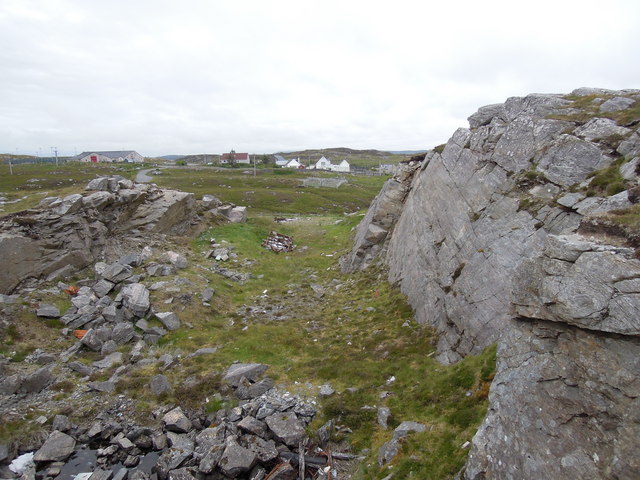
Hacklete is a small settlement located in the county of Ross-shire, Scotland. Situated on the Isle of Lewis, it lies on the western coast of the island, overlooking the picturesque Loch Grimshader. The area is known for its stunning natural beauty and serene surroundings.

With a population of around 150 residents, Hacklete is a close-knit community. The settlement primarily consists of a scattering of traditional croft houses, which are characteristic of the region. These houses are surrounded by lush green fields and rolling hills, giving Hacklete a rural and tranquil atmosphere.

The economy of Hacklete is primarily based on agriculture and fishing. Many of the local residents are involved in crofting, a traditional small-scale farming practice. The fertile land and mild climate of the area make it ideal for growing crops and rearing livestock. Fishing is also a significant industry, with the nearby loch providing a rich source of seafood.

In terms of amenities, Hacklete has limited facilities. There is a small primary school that serves the local children, and a community hall that hosts various events and gatherings. However, for shopping and other services, residents usually travel to nearby towns such as Stornoway.

Hacklete offers a range of outdoor activities for both residents and visitors. The stunning landscape provides ample opportunities for hiking, cycling, and wildlife spotting. The nearby Loch Grimshader is also popular for fishing and boating.

In summary, Hacklete, Ross-shire, is a small and picturesque settlement on the Isle of Lewis, known for its rural charm, agricultural practices, and breathtaking natural beauty.

If you have any feedback on the listing, please let us know in the comments section below.

Hacklete Images

Images are sourced within 2km of 58.209231/-6.8506825 or Grid Reference NB1534. Thanks to Geograph Open Source API. All images are credited.

Great Bernera bridges The new bridge under construction and the old white bridge.
Great Bernera bridges
The new bridge under construction and the old white bridge.
Moorland and loch on Great Bernera The loch is unnamed on the map, but the Allt Loch an Fheoir flows into it, so this must be Loch an Fheoir.

The houses in the distance are on the road south of Bhalasaigh.
Moorland and loch on Great Bernera
The loch is unnamed on the map, but the Allt Loch an Fheoir flows into it, so this must be Loch an Fheoir. The houses in the distance are on the road south of Bhalasaigh.
Bridge at Bhalasaigh Looking back to the road end on the main island of Great Bernera.
Bridge at Bhalasaigh
Looking back to the road end on the main island of Great Bernera.
"The Bridge Across the Atlantic" Bernera Bridge is one of several bridges which claim to span the Atlantic Ocean. This one connects the Lewis mainland with the island of Great Bernera / Bearnaraigh. Note the standing stones on the far side of the bridge.
<span class="nowrap"><a title="http://www.uigandbernera.com/" rel="nofollow ugc noopener" href="http://www.uigandbernera.com/">Link</a><img style="margin-left:2px;" alt="External link" title="External link - shift click to open in new window" src="https://s1.geograph.org.uk/img/external.png" width="10" height="10"/></span>
"The Bridge Across the Atlantic"
Bernera Bridge is one of several bridges which claim to span the Atlantic Ocean. This one connects the Lewis mainland with the island of Great Bernera / Bearnaraigh. Note the standing stones on the far side of the bridge. LinkExternal link
Loch Ionail Freshwater loch on the island of Great Bernera / Bearnaraigh.
<span class="nowrap"><a title="http://www.uigandbernera.com/" rel="nofollow ugc noopener" href="http://www.uigandbernera.com/">Link</a><img style="margin-left:2px;" alt="External link" title="External link - shift click to open in new window" src="https://s1.geograph.org.uk/img/external.png" width="10" height="10"/></span>
Loch Ionail
Freshwater loch on the island of Great Bernera / Bearnaraigh. LinkExternal link
Tob Bhalasaigh Tidal lagoon with a mix of rare seaweeds on Great Bernera / Bearnaraigh.
<span class="nowrap"><a title="http://www.uigandbernera.com/" rel="nofollow ugc noopener" href="http://www.uigandbernera.com/">Link</a><img style="margin-left:2px;" alt="External link" title="External link - shift click to open in new window" src="https://s1.geograph.org.uk/img/external.png" width="10" height="10"/></span>
Tob Bhalasaigh
Tidal lagoon with a mix of rare seaweeds on Great Bernera / Bearnaraigh. LinkExternal link
Valasay Bridge Carrying the single track road across an outlet of the tidal lagoon, Tob Bhalasaigh on Great Bernera / Bearnaraigh.
<span class="nowrap"><a title="http://www.uigandbernera.com/" rel="nofollow ugc noopener" href="http://www.uigandbernera.com/">Link</a><img style="margin-left:2px;" alt="External link" title="External link - shift click to open in new window" src="https://s1.geograph.org.uk/img/external.png" width="10" height="10"/></span>
Valasay Bridge
Carrying the single track road across an outlet of the tidal lagoon, Tob Bhalasaigh on Great Bernera / Bearnaraigh. LinkExternal link
Shoreline at Tob Bhalasaigh Rocks and heather at the edge of the tidal lagoon in Valasay.
<span class="nowrap"><a title="http://www.uigandbernera.com/" rel="nofollow ugc noopener" href="http://www.uigandbernera.com/">Link</a><img style="margin-left:2px;" alt="External link" title="External link - shift click to open in new window" src="https://s1.geograph.org.uk/img/external.png" width="10" height="10"/></span>
Shoreline at Tob Bhalasaigh
Rocks and heather at the edge of the tidal lagoon in Valasay. LinkExternal link
Valasay Footbridge The bridge across the tidal Tob Bhalasaigh was built in 1898.
<span class="nowrap"><a title="http://www.uigandbernera.com/" rel="nofollow ugc noopener" href="http://www.uigandbernera.com/">Link</a><img style="margin-left:2px;" alt="External link" title="External link - shift click to open in new window" src="https://s1.geograph.org.uk/img/external.png" width="10" height="10"/></span>
Valasay Footbridge
The bridge across the tidal Tob Bhalasaigh was built in 1898. LinkExternal link
Tidal Lagoon, Valasay Tob Bhalasaigh, on the island of Great Bernera / Bearnaraigh.
<span class="nowrap"><a title="http://www.uigandbernera.com/" rel="nofollow ugc noopener" href="http://www.uigandbernera.com/">Link</a><img style="margin-left:2px;" alt="External link" title="External link - shift click to open in new window" src="https://s1.geograph.org.uk/img/external.png" width="10" height="10"/></span>
Tidal Lagoon, Valasay
Tob Bhalasaigh, on the island of Great Bernera / Bearnaraigh. LinkExternal link
Bernera Bridge Opened in 1953 and connecting Lewis with Great Bernera / Bearnaraigh.
<span class="nowrap"><a title="http://www.uigandbernera.com/" rel="nofollow ugc noopener" href="http://www.uigandbernera.com/">Link</a><img style="margin-left:2px;" alt="External link" title="External link - shift click to open in new window" src="https://s1.geograph.org.uk/img/external.png" width="10" height="10"/></span>
Bernera Bridge
Opened in 1953 and connecting Lewis with Great Bernera / Bearnaraigh. LinkExternal link
Sea Kayakers by Port a Chruidh Kayakers who have come from Miavaig / Miabhaig and are heading eastwards, having just passed below Bernera Bridge. The mainland of Lewis is on the far side of the 1953 bridge.
<span class="nowrap"><a title="http://www.uigandbernera.com/" rel="nofollow ugc noopener" href="http://www.uigandbernera.com/">Link</a><img style="margin-left:2px;" alt="External link" title="External link - shift click to open in new window" src="https://s1.geograph.org.uk/img/external.png" width="10" height="10"/></span>
Sea Kayakers by Port a Chruidh
Kayakers who have come from Miavaig / Miabhaig and are heading eastwards, having just passed below Bernera Bridge. The mainland of Lewis is on the far side of the 1953 bridge. LinkExternal link
Lewisian Gneiss Pink, folded Lewisian gneiss at the north end of Bernera Bridge. These are amongst the oldest rocks in the world.
<span class="nowrap"><a title="http://www.uigandbernera.com/" rel="nofollow ugc noopener" href="http://www.uigandbernera.com/">Link</a><img style="margin-left:2px;" alt="External link" title="External link - shift click to open in new window" src="https://s1.geograph.org.uk/img/external.png" width="10" height="10"/></span>
Lewisian Gneiss
Pink, folded Lewisian gneiss at the north end of Bernera Bridge. These are amongst the oldest rocks in the world. LinkExternal link
Stone Circle by Bernera Bridge Ancient stone circle on a mound above the north end of the bridge. the stones are part of the famous Callanish complex of standing stones.
Stone Circle by Bernera Bridge
Ancient stone circle on a mound above the north end of the bridge. the stones are part of the famous Callanish complex of standing stones.
Cleitir Stone Circle Calanais VIII - four standing stones above Bernera Bridge and the sound separating the island from Lewis.
Cleitir Stone Circle
Calanais VIII - four standing stones above Bernera Bridge and the sound separating the island from Lewis.
Bernera Bridge
Bernera Bridge
Standing stones by Bernera Bridge
Quarry at Buaile Chruidh An old quarry where hard Lewisian gneiss was extracted to construct not only many houses in the village but also public buildings seen in the background such as Bernera School, The Church of Scotland and the Free Kirk.
Quarry at Buaile Chruidh
An old quarry where hard Lewisian gneiss was extracted to construct not only many houses in the village but also public buildings seen in the background such as Bernera School, The Church of Scotland and the Free Kirk.
Show me another place!

Hacklete is located at Grid Ref: NB1534 (Lat: 58.209231, Lng: -6.8506825)

Unitary Authority: Na h-Eileanan an Iar

Police Authority: Highlands and Islands

Also known as: Tacleit

What 3 Words

///crumples.baseballs.used. Near Carloway, Na h-Eileanan Siar

Related Wikis

Dun Bharabhat, Great Bernera

Dun Bharabhat (or Dun Baravat) is an Iron Age galleried dun or "semi-broch" situated on the island of Great Bernera near Lewis in Scotland (grid reference...

Callanish VIII

The Callanish VIII stone setting is one of many megalithic structures around the better-known (and larger) Calanais I on the west coast of the Isle of...

Fuaigh Mòr

Fuaigh Mòr (sometimes anglicised as Vuia Mor) is an island in the Outer Hebrides of Scotland. It is off the west coast of Lewis near Great Bernera in...

Great Bernera

Great Bernera (; Scottish Gaelic: Beàrnaraigh Mòr), often known just as Bernera (Scottish Gaelic: Beàrnaraigh), is an island and community in the Outer...

Nearby Amenities

Located within 500m of 58.209231,-6.8506825
Passing Place
Lat/Long: 58.2126891/-6.8542186
Passing Place
Lat/Long: 58.2116279/-6.8528974
Passing Place
Lat/Long: 58.2115383/-6.8527507
Passing Place
Lat/Long: 58.2112751/-6.8521559
Passing Place
Lat/Long: 58.2101437/-6.8511085
Passing Place
Lat/Long: 58.2082388/-6.8493519
Passing Place
Lat/Long: 58.2081384/-6.8479396
Passing Place
Lat/Long: 58.2070554/-6.846795
Post Box
Operator: Royal Mail
Lat/Long: 58.2091425/-6.8507291
Tacleit
Name En: Hacklete
Name Gd: Tacleit
Place: village
Lat/Long: 58.2091129/-6.849857
Power: pole
Lat/Long: 58.2124951/-6.8545085
Power: pole
Lat/Long: 58.2118876/-6.8541981
Power: pole
Lat/Long: 58.2113153/-6.8538874
Power: pole
Lat/Long: 58.2106803/-6.8542539
Power: pole
Lat/Long: 58.2101136/-6.8546541
Power: pole
Lat/Long: 58.2097093/-6.8548888
Power: pole
Lat/Long: 58.2111349/-6.8532389
Power: pole
Lat/Long: 58.2109601/-6.8527243
Power: pole
Lat/Long: 58.2105547/-6.8515167
Power: pole
Lat/Long: 58.2102539/-6.8505913
Power: pole
Lat/Long: 58.2099518/-6.8496727
Power: pole
Lat/Long: 58.2096736/-6.8488511
Power: pole
Lat/Long: 58.209393/-6.8479957
Power: pole
Lat/Long: 58.2090482/-6.847226
Power: pole
Lat/Long: 58.2086403/-6.8463142
Power: pole
Lat/Long: 58.2083573/-6.8457048
Power: pole
Lat/Long: 58.2081575/-6.8453075
Power: pole
Lat/Long: 58.2076629/-6.8443912
Power: pole
Lat/Long: 58.2070362/-6.8432649
Power: pole
Lat/Long: 58.2083133/-6.8465828
Power: pole
Lat/Long: 58.208261/-6.8473705
Power: pole
Lat/Long: 58.2082146/-6.8481921
Power: pole
Lat/Long: 58.2081599/-6.8490836
Power: pole
Lat/Long: 58.2094631/-6.8451969
Power: pole
Lat/Long: 58.209154/-6.8453233
Power: pole
Lat/Long: 58.2088722/-6.8454249
Power: pole
Lat/Long: 58.2113501/-6.8523473
Power: pole
Lat/Long: 58.2110957/-6.8527649
Power: pole
Lat/Long: 58.2107996/-6.853284
Power: pole
Lat/Long: 58.208934/-6.851212
Power: pole
Lat/Long: 58.2091373/-6.8521826
Power: pole
Lat/Long: 58.2093205/-6.8530718
Power: pole
Lat/Long: 58.2095369/-6.8540469
Power: pole
Lat/Long: 58.2098875/-6.8559028
Power: pole
Lat/Long: 58.2101457/-6.8570669
Power: pole
Lat/Long: 58.2097925/-6.857832
Power: pole
Lat/Long: 58.2094596/-6.8585813
Power: pole
Lat/Long: 58.2110875/-6.857197
Power: pole
Lat/Long: 58.2106427/-6.8571391
Generator Method: wind_turbine
Generator Source: wind
Generator Type: horizontal_axis
Power: generator
Lat/Long: 58.2120003/-6.8559736
Barrier: cattle_grid
Lat/Long: 58.2087322/-6.8522923
Generator Method: photovoltaic
Generator Output Electricity: small_installation
Generator Source: solar
Generator Type: solar_photovoltaic_panel
Power: generator
Lat/Long: 58.2079443/-6.8492882
The data included in this document is from www.openstreetmap.org. The data is made available under ODbL.

Have you been to Hacklete?

Leave your review of Hacklete below (or comments, questions and feedback).