Druim na h-Uamha

Coastal Feature, Headland, Point in Ross-shire

Scotland

Druim na h-Uamha

A slipway in Loch Miabhaig
A slipway in Loch Miabhaig Credit: Alan Reid

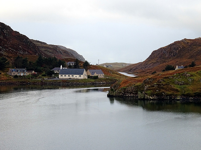
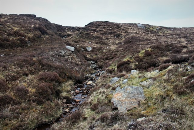
Druim na h-Uamha is a coastal feature located in Ross-shire, Scotland. It is a prominent headland that stretches out into the sea, forming a distinct point along the coastline. The name "Druim na h-Uamha" translates to "ridge of the cave" in Gaelic.

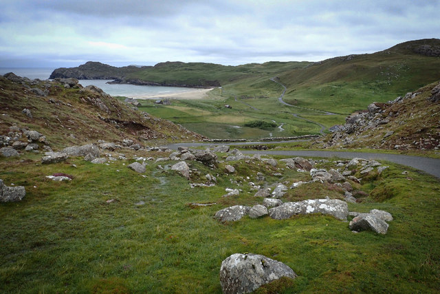
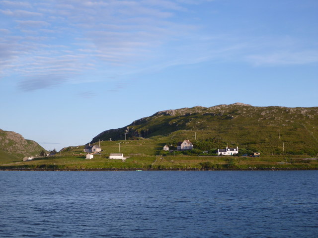
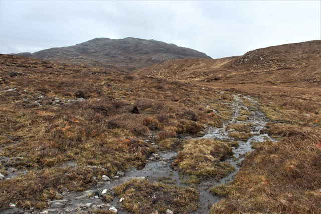
The headland is characterized by its rugged and rocky terrain, with cliffs rising steeply from the water below. These cliffs provide stunning panoramic views of the surrounding coastline and the open sea, making it a popular spot for tourists and nature enthusiasts.

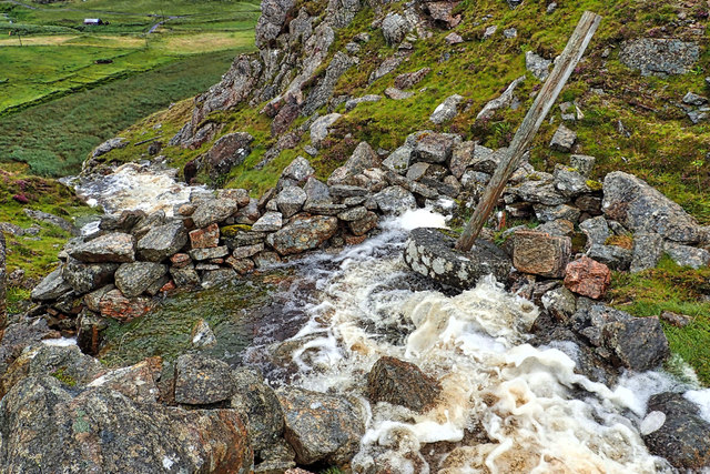
One notable feature of Druim na h-Uamha is the presence of sea caves. These caves are formed by the constant erosion of the waves crashing against the rocks over the years. They add an element of intrigue and mystique to the headland, attracting explorers and adventure-seekers.

The area around Druim na h-Uamha is rich in biodiversity, with various seabirds nesting on the cliffs and marine life thriving in the surrounding waters. It is not uncommon to spot species such as puffins, guillemots, and seals in the vicinity.

Access to Druim na h-Uamha is relatively easy, with a walking trail leading visitors to the headland. The trail offers scenic views and allows visitors to immerse themselves in the natural beauty of the area. However, caution is advised while exploring the cliffs and caves, as they can be hazardous, especially during rough weather conditions.

Overall, Druim na h-Uamha is a captivating coastal feature that showcases the raw beauty of Scotland's coastline. It offers a unique blend of stunning landscapes, wildlife, and geological formations, making it a must-visit destination for nature lovers and adventure enthusiasts alike.

If you have any feedback on the listing, please let us know in the comments section below.

Druim na h-Uamha Images

Images are sourced within 2km of 58.200109/-6.9641849 or Grid Reference NB0834. Thanks to Geograph Open Source API. All images are credited.

A slipway in Loch Miabhaig
Lochan at Cragavig An old boundary wall snakes across the moorland
Lochan at Cragavig
An old boundary wall snakes across the moorland
Cerishader: postbox № HS2 158 A small postbox on the B8011, with its back to Loch Ròg. It is emptied at 9 o'clock each morning, except Sunday.
Cerishader: postbox № HS2 158
A small postbox on the B8011, with its back to Loch Ròg. It is emptied at 9 o'clock each morning, except Sunday.
Carishader postbox The sea inlet is part of Loch Ròg.
Carishader postbox
The sea inlet is part of Loch Ròg.
The settlement at Miavaig/Miabhaig Viewed across Loch Miabhaig.
The settlement at Miavaig/Miabhaig
Viewed across Loch Miabhaig.
Photo opportunity, Cairisiadar, Isle of Lewis An adjacent sign invites you to "Join the band".

One of the band members has swapped her guitar for bagpipes and gained a kilt since Colin visited in 2011: <a href="https://www.geograph.org.uk/photo/2646155">NB0933 : Join the Band</a>.
Photo opportunity, Cairisiadar, Isle of Lewis
An adjacent sign invites you to "Join the band". One of the band members has swapped her guitar for bagpipes and gained a kilt since Colin visited in 2011: NB0933 : Join the Band.
Bus shelter, Miabhaig, Isle of Lewis Looking along the course of the B8011, a footpath and the Abhainn a' Ghlinne along Gleann Bhaltois.

The Lewis bus shelter is designed to provide protection whichever way the wind is blowing.  This example has gained a piece of artwork by Janie Nicoll (<span class="nowrap"><a title="http://www.janienicoll.co.uk/artworks-2016.html" rel="nofollow ugc noopener" href="http://www.janienicoll.co.uk/artworks-2016.html">Link</a><img style="margin-left:2px;" alt="External link" title="External link - shift click to open in new window" src="https://s1.geograph.org.uk/img/external.png" width="10" height="10"/></span> ) since it was visited by Peter in 2014: <a href="https://www.geograph.org.uk/photo/4017964">NB0834 : Lewis style bus shelter (ii)</a>.
Bus shelter, Miabhaig, Isle of Lewis
Looking along the course of the B8011, a footpath and the Abhainn a' Ghlinne along Gleann Bhaltois. The Lewis bus shelter is designed to provide protection whichever way the wind is blowing. This example has gained a piece of artwork by Janie Nicoll (LinkExternal link ) since it was visited by Peter in 2014: NB0834 : Lewis style bus shelter (ii).
Re-entrant between Druim an Rathaid and Bide Ruadh
Remains of a mill, Allt Tota Pallair A small dry stone wall built across the burn, with an old millstone.
Remains of a mill, Allt Tota Pallair
A small dry stone wall built across the burn, with an old millstone.
Remains of a mill, Allt Tota Pallair A small dry stone wall built across the burn, with an old millstone.
Remains of a mill, Allt Tota Pallair
A small dry stone wall built across the burn, with an old millstone.
Loch Sgailleir
Loch Sgailleir
MV Cuma taking sea kayaks on board at Miabhaig MV Cuma takes tourists on week-long trips around the Outer Hebrides and out to St. Kilda. Some of those tourists, like us, are sea kayakers wanting to visit places they couldn't get to by paddling all the way (the crossing to St. Kilda is a bit epic for most people), and skipper Murdo can also arrange for a local paddler who knows all the best places to visit. If the weather is unsuitable (it was too rough to anchor safely off St. Kilda during our week) there are a vast number of more or less sheltered places to go. With a "mother ship" to provide safe rest and excellent food, the weather is no hindrance to a fantastic week !
MV Cuma taking sea kayaks on board at Miabhaig
MV Cuma takes tourists on week-long trips around the Outer Hebrides and out to St. Kilda. Some of those tourists, like us, are sea kayakers wanting to visit places they couldn't get to by paddling all the way (the crossing to St. Kilda is a bit epic for most people), and skipper Murdo can also arrange for a local paddler who knows all the best places to visit. If the weather is unsuitable (it was too rough to anchor safely off St. Kilda during our week) there are a vast number of more or less sheltered places to go. With a "mother ship" to provide safe rest and excellent food, the weather is no hindrance to a fantastic week !
Cairisiadar from Loch Rog The northwest end of this small community strung out along the B8011 catches the evening light as we return by boat to Miabhaig.
Cairisiadar from Loch Rog
The northwest end of this small community strung out along the B8011 catches the evening light as we return by boat to Miabhaig.
Abhainn Uasaig A short river at Carishader.
Abhainn Uasaig
A short river at Carishader.
A burn draining Geàrraidh Mhòr
Track to Loch an Druim Riabhaich
Geàrraidh Theurabridh A cluster of moor shielings.
Geàrraidh Theurabridh
A cluster of moor shielings.
Show me another place!

Druim na h-Uamha is located at Grid Ref: NB0834 (Lat: 58.200109, Lng: -6.9641849)

Unitary Authority: Na h-Eileanan an Iar

Police Authority: Highlands and Islands

What 3 Words

///bikes.displays.overgrown. Near Carloway, Na h-Eileanan Siar

Related Wikis

Cliff, Lewis

Cliff (Scottish Gaelic: Cliobh) is a small settlement on the Isle of Lewis, in the Outer Hebrides, Scotland. Cliff is within the parish of Uig. The settlement...

Loch na Berie

Loch Na Berie is a broch in the Outer Hebrides of Scotland, located approximately 400 yards from the shore, and is thought to have been located on an island...

Flodaigh, Lewis

Flodaigh is a small island in Loch Roag on the west coast of Lewis in the Outer Hebrides of Scotland. It is about 33 hectares (82 acres) in extent and...

Kneep

Kneep (Scottish Gaelic: Cnìp) is a village on the Isle of Lewis, in the Outer Hebrides, Scotland. Kneep is within the parish of Uig. Various archaeological...

Related Videos

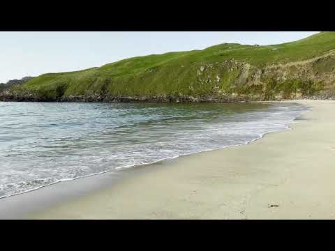
Cliff Beach Isle of Lewis 4K Video

Beautiful remote beach in Lewis and Harris Scotland, Sept. 2023. Wait til the end for photo of beach from above taken at golden ...

Kneep, Isle of Lewis

Kneep (Scottish Gaelic: Cnìp) is a village on the Isle of Lewis, in the Outer Hebrides, Scotland. Kneep is within the parish of Uig.

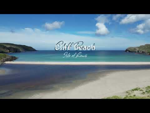
Cliff Beach - Isle of Lewis - Outer Hebrides - Scotland | 4K | DJI Mini 3 Pro

Cliff Beach is located on the western side of Isle of Lewis (Outer Hebrides in Scotland). It is beautiful stretch of light cream sand ...

Nearby Amenities

Located within 500m of 58.200109,-6.9641849
Passing Place
Lat/Long: 58.2033644/-6.9658394
Bus Stop
Miavaig (Lewis)
Naptan AtcoCode: 6010731756
Naptan Bearing: W
Naptan CommonName: Miavaig (Lewis)
Naptan Indicator: B8011 Junction
Naptan Landmark: B8011 Junction
Naptan NaptanCode: 94723873
Naptan Street: B8011 Junction
Naptan Verified: no
Source: naptan_import
Lat/Long: 58.20326/-6.9629188
Bus Stop
Miavaig Turn
Naptan AtcoCode: 6010731868
Naptan Bearing: NW
Naptan CommonName: Miavaig Turn
Naptan Indicator: Miavaig Turn
Naptan Landmark: Miavaig Turn
Naptan NaptanCode: 94723945
Naptan Street: Miavaig Turn
Naptan Verified: no
Source: naptan_import
Lat/Long: 58.2032589/-6.9627141
Miabhaig
Name En: Miavaig
Name Gd: Miabhaig
Place: village
Lat/Long: 58.2029652/-6.9596178
Passing Place
Lat/Long: 58.2013676/-6.9572234
Power: pole
Lat/Long: 58.2010722/-6.956996
Power: pole
Lat/Long: 58.2011631/-6.9582835
Power: pole
Lat/Long: 58.2012137/-6.9590604
Power: pole
Lat/Long: 58.2013231/-6.9603582
Power: pole
Lat/Long: 58.2016505/-6.9607994
Power: pole
Lat/Long: 58.2021642/-6.9614727
Power: pole
Lat/Long: 58.2029096/-6.9624099
Power: pole
Lat/Long: 58.2031059/-6.9626604
Power: pole
Lat/Long: 58.2039517/-6.9629706
Power: pole
Lat/Long: 58.2044893/-6.9629631
Barrier: cattle_grid
Lat/Long: 58.2014886/-6.9560943
Power: pole
Lat/Long: 58.2011515/-6.9561351
Power: pole
Lat/Long: 58.2011093/-6.9569539
Power: pole
Lat/Long: 58.2012624/-6.9576926
Power: pole
Lat/Long: 58.2014127/-6.9583933
Power: pole
Lat/Long: 58.2016481/-6.9586921
Passing Place
Lat/Long: 58.2033734/-6.9676989
The data included in this document is from www.openstreetmap.org. The data is made available under ODbL.

Have you been to Druim na h-Uamha?

Leave your review of Druim na h-Uamha below (or comments, questions and feedback).