Eilean Dubh nan Uan

Coastal Feature, Headland, Point in Inverness-shire

Scotland

Eilean Dubh nan Uan

Beehive in Dun Caragarry Looking over Dun Caragarry to the mouth of Loch Euphort. The small structure at centre is a beehive chamber built within the ruin of the dun. The chamber was photographed by Erskine Beveridge, and his photo can be found facing page 163 of his book ‘North Uist’. More information on the dun, including Beveridge’s photo, can be found on the CANMORE website (CANMORE ID 10429).
Beehive in Dun Caragarry Credit: Marc Calhoun

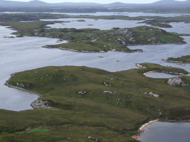
Eilean Dubh nan Uan is a prominent coastal feature located in the region of Inverness-shire, Scotland. It is a headland that extends into the North Atlantic Ocean, forming a distinctive point along the rugged coastline. The name of this headland translates to "black isle of the lambs" in English, reflecting its historical association with sheep farming.

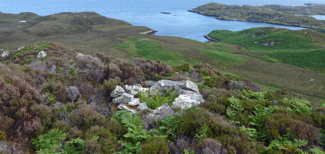
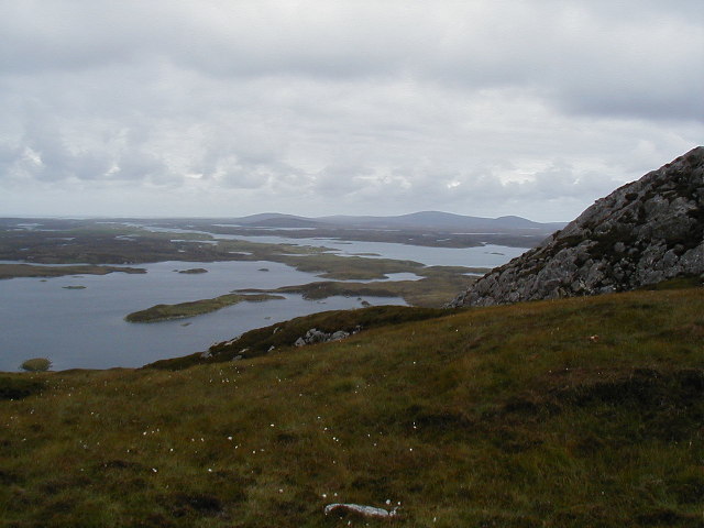
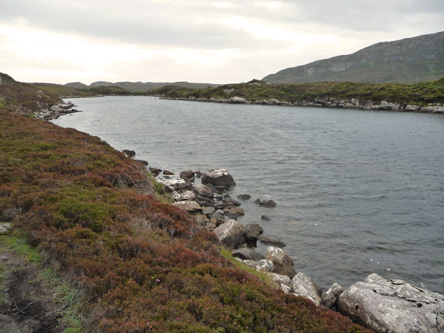
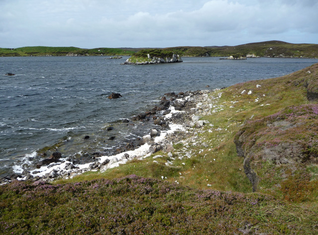
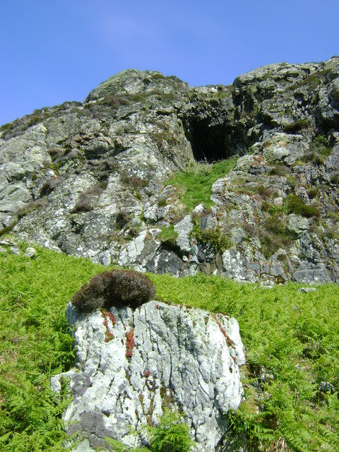
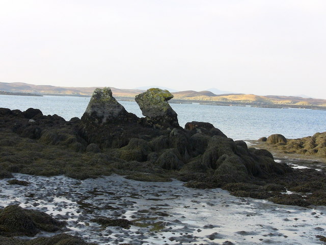
Situated on the western coast of Inverness-shire, Eilean Dubh nan Uan offers stunning panoramic views of the surrounding landscape. The headland is characterized by steep cliffs, rocky outcrops, and a diverse range of flora and fauna. The area is also known for its rich maritime heritage, with evidence of ancient settlements and structures, such as the remains of a lighthouse that once guided ships along the treacherous coastline.

Visitors to Eilean Dubh nan Uan can explore the headland on foot, following well-maintained trails that wind through the rugged terrain. The coastal paths provide opportunities for birdwatching, as the headland is home to a variety of seabirds, including puffins, guillemots, and razorbills. Additionally, the headland offers a vantage point for spotting marine mammals, such as seals and dolphins, that frequent the nearby waters.

Eilean Dubh nan Uan also holds cultural significance, with several folklore and legends associated with the area. These tales often revolve around the harsh beauty of the headland and its connection to the surrounding coastal communities.

Overall, Eilean Dubh nan Uan is a captivating coastal feature that showcases the natural beauty and cultural heritage of Inverness-shire. Its dramatic cliffs, diverse wildlife, and panoramic views make it a must-visit destination for nature enthusiasts and those interested in the region's history.

If you have any feedback on the listing, please let us know in the comments section below.

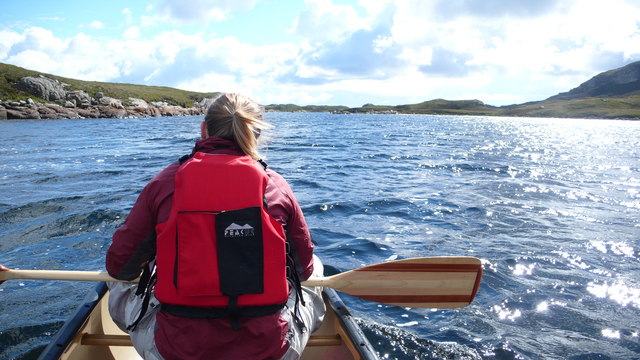
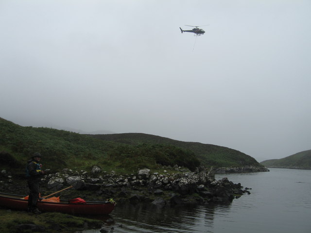
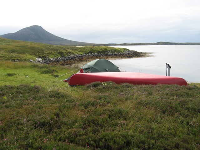
Eilean Dubh nan Uan Images

Images are sourced within 2km of 57.551446/-7.1671679 or Grid Reference NF9163. Thanks to Geograph Open Source API. All images are credited.
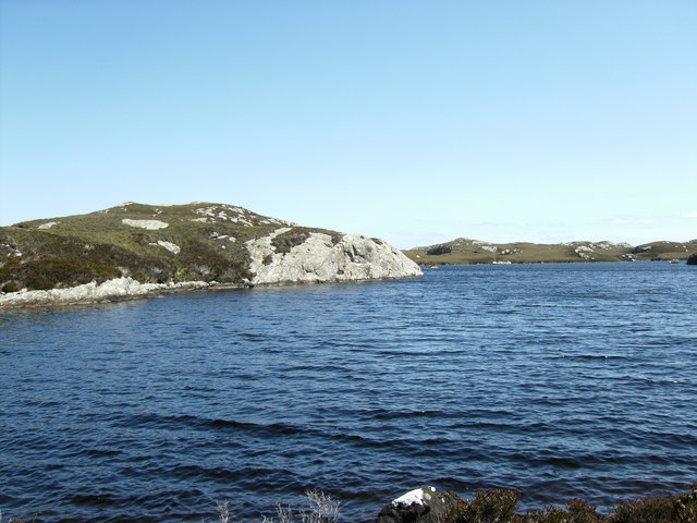
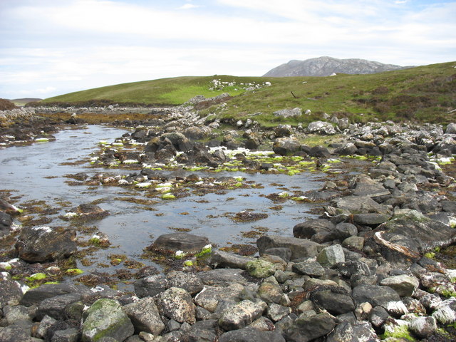
Beehive in Dun Caragarry Looking over Dun Caragarry to the mouth of Loch Euphort. The small structure at centre is a beehive chamber built within the ruin of the dun. The chamber was photographed by Erskine Beveridge, and his photo can be found facing page 163 of his book ‘North Uist’. More information on the dun, including Beveridge’s photo, can be found on the CANMORE website (CANMORE ID 10429).
Beehive in Dun Caragarry
Looking over Dun Caragarry to the mouth of Loch Euphort. The small structure at centre is a beehive chamber built within the ruin of the dun. The chamber was photographed by Erskine Beveridge, and his photo can be found facing page 163 of his book ‘North Uist’. More information on the dun, including Beveridge’s photo, can be found on the CANMORE website (CANMORE ID 10429).
Sculpture at the end of the road One of the sculptures at the end of the road. Literally at the very end of the road along Loch Euphort.
Sculpture at the end of the road
One of the sculptures at the end of the road. Literally at the very end of the road along Loch Euphort.
View NW from the slopes of Burabhal Loch Obasaraigh is to the left.
View NW from the slopes of Burabhal
Loch Obasaraigh is to the left.
Loch a Ghlinne-dorca from slopes of Burabhal
Anchorage in Loch Eyport
East end of Loch Obasaraigh, looking to Burabhal The bay at the E end of Loch Obasaraigh with the top of Burabhal clearly visible.  A quick an easy way into the hill of Eaval with the use of the canoe.  The spit of land in the background is clearly visible on the map.
East end of Loch Obasaraigh, looking to Burabhal
The bay at the E end of Loch Obasaraigh with the top of Burabhal clearly visible. A quick an easy way into the hill of Eaval with the use of the canoe. The spit of land in the background is clearly visible on the map.
South side of the island Eilean Leathann Canoeing into Eaval we passed South of the island Eilean Leathann, which you see off the persons left shoulder.  The ridge of Eaval in the distance
South side of the island Eilean Leathann
Canoeing into Eaval we passed South of the island Eilean Leathann, which you see off the persons left shoulder. The ridge of Eaval in the distance
Acairseid LI We had canoed into here from Clachan on Loch Euphort hoping to find a quiet camping spot on Loch Thundair.  However on walking over from Acairseid Li to Thundair we caught sight of a large fish farm at the South end of the loch.  This helicopter was servicing the fish farm
Acairseid LI
We had canoed into here from Clachan on Loch Euphort hoping to find a quiet camping spot on Loch Thundair. However on walking over from Acairseid Li to Thundair we caught sight of a large fish farm at the South end of the loch. This helicopter was servicing the fish farm
Camp site to the South of South Lee Lovely view South to Eaval, but the midges were awful!
Camp site to the South of South Lee
Lovely view South to Eaval, but the midges were awful!
Rock feature Rock feature on Loch a'Ghlinne-dorcha
Rock feature
Rock feature on Loch a'Ghlinne-dorcha
Eileann Leathan from Eabhal
East end of Loch Obasaraigh From the path below Burabhal. The land to the right is one of the smaller of the islands in the loch. The lower slopes of Eabhal are in the distance.
East end of Loch Obasaraigh
From the path below Burabhal. The land to the right is one of the smaller of the islands in the loch. The lower slopes of Eabhal are in the distance.
Loch Obasaraigh A prolonged fresh southerly wind is creating spume from the loch and blowing it onto the northern shores.
Loch Obasaraigh
A prolonged fresh southerly wind is creating spume from the loch and blowing it onto the northern shores.
Beach at the south east of Loch Obasaraigh Course sand generated by the large body of wind agitated fresh water.
Beach at the south east of Loch Obasaraigh
Course sand generated by the large body of wind agitated fresh water.
Burabhal Cave It is told that Bonnie Prince Charlie once used this cave to hide from the Red Coats.
Burabhal Cave
It is told that Bonnie Prince Charlie once used this cave to hide from the Red Coats.
Camel Rock
Camel Rock
Loch Obasaraigh Eaval, the highest point on North Uist, is the hill on the far side of the loch. Although the route to the hill is indirect (to the left [east] of the loch as seen here), this is the best approach if you wish to climb Eaval.
Loch Obasaraigh
Eaval, the highest point on North Uist, is the hill on the far side of the loch. Although the route to the hill is indirect (to the left [east] of the loch as seen here), this is the best approach if you wish to climb Eaval.
Stepping stones at the outlet from Loch Obasaraigh In order to climb Eaval <a href="https://www.geograph.org.uk/gridref/NF8960">NF8960</a> by the simplest (though not easy!) route, it is necessary to cross the outflow from Loch Obasaraigh. The map labels this as 'stepping stones', but it is really a rough stone causeway. I think it would need a very high tide, or a lot of water in the loch (it is a big loch with a quite small catchment area) to make this crossing difficult.
To be honest, it is difficult to tell whether this photo is in NF8962 or NF8963. My GPS recorded the northings as 62992 and so I have entered this as in NF8962.
Stepping stones at the outlet from Loch Obasaraigh
In order to climb Eaval NF8960 by the simplest (though not easy!) route, it is necessary to cross the outflow from Loch Obasaraigh. The map labels this as 'stepping stones', but it is really a rough stone causeway. I think it would need a very high tide, or a lot of water in the loch (it is a big loch with a quite small catchment area) to make this crossing difficult. To be honest, it is difficult to tell whether this photo is in NF8962 or NF8963. My GPS recorded the northings as 62992 and so I have entered this as in NF8962.
Show me another place!

Eilean Dubh nan Uan is located at Grid Ref: NF9163 (Lat: 57.551446, Lng: -7.1671679)

Unitary Authority: Na h-Eileanan an Iar

Police Authority: Highlands and Islands

What 3 Words

///meals.kipper.relegate. Near Lochmaddy, Na h-Eileanan Siar

Related Wikis

Taigh Chearsabhagh

Taigh Chearsabhagh is an arts centre and museum in Lochmaddy on the island of North Uist, Scotland.Taigh Chearsabhagh was built in 1741 and originally...

Lochmaddy

Lochmaddy (Scottish Gaelic: Loch nam Madadh [l̪ˠɔx nə ˈmat̪əɣ], "Loch of the Hounds") is the administrative centre of North Uist in the Outer Hebrides...

Flodaigh Mòr

Flodaigh Mòr (or Floddaymore) is an uninhabited island in the Outer Hebrides of Scotland. == Geography and geology == Flodaigh Mòr lies east of North Uist...

Fraoch-Eilean

Fraoch-eilean is a small island with an uncertain population north of Benbecula in the Outer Hebrides of Scotland. It is about 55 hectares (140 acres...

Nearby Amenities

Located within 500m of 57.551446,-7.1671679
Bàgh a' Bhiorain
Natural: bay
Lat/Long: 57.5503503/-7.1707678
The data included in this document is from www.openstreetmap.org. The data is made available under ODbL.

Have you been to Eilean Dubh nan Uan?

Leave your review of Eilean Dubh nan Uan below (or comments, questions and feedback).