Gunamuil

Coastal Feature, Headland, Point in Inverness-shire

Scotland

Gunamuil

Mingulay Bay and schoolhouse A visit possible by the small Barra boat that took 20 or so folk on a tour of the southern Hebrides with time to explore the cliffs of Mingulay.
Mingulay Bay and schoolhouse Credit: Julian Paren

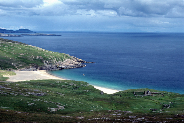
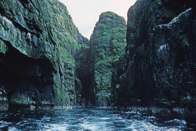
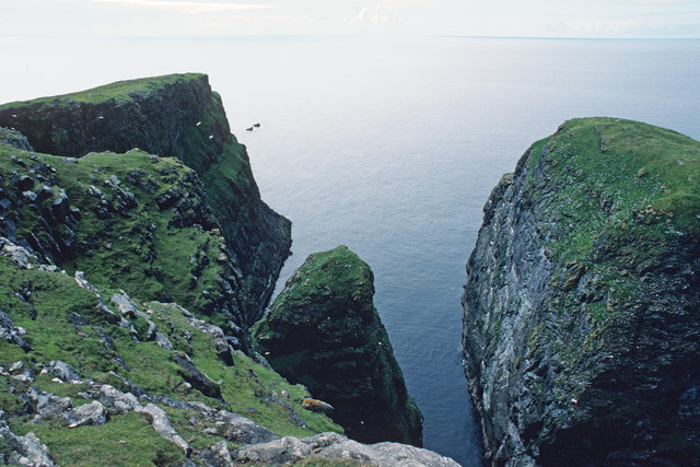
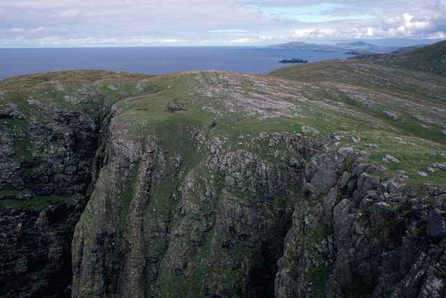
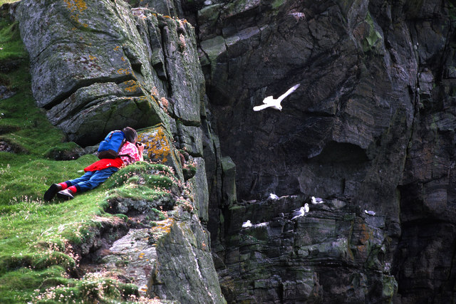
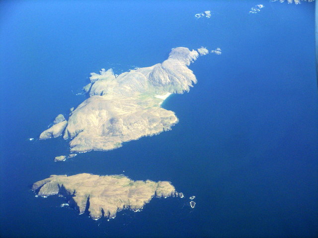
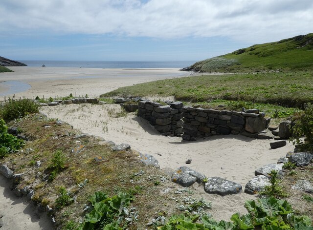
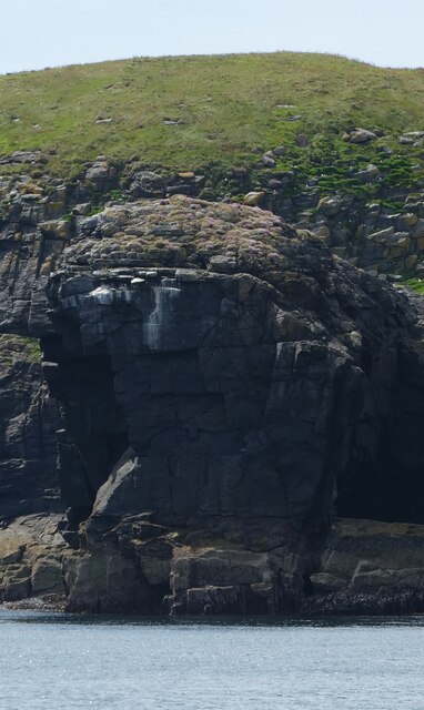
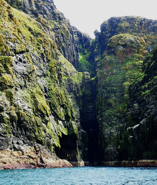
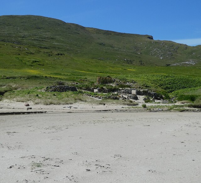
Gunamuil is a picturesque headland located in Inverness-shire, Scotland. Situated along the rugged coastline, Gunamuil offers stunning views of the surrounding landscape and the vast expanse of the North Sea. The headland is characterized by its rocky cliffs, which jut out into the sea, creating a dramatic and rugged coastline.

The area around Gunamuil is rich in wildlife, with seabirds such as puffins, guillemots, and razorbills often seen nesting on the cliffs. The headland is also a popular spot for birdwatching, with many species of seabirds and migratory birds passing through the area.

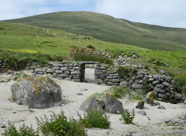
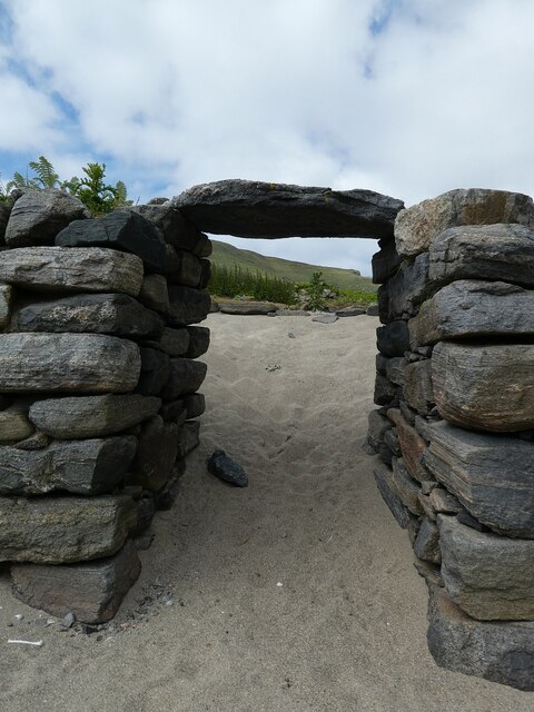
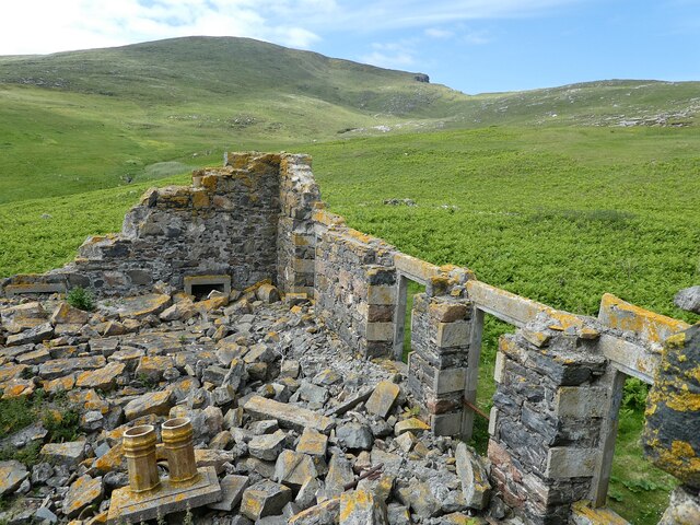
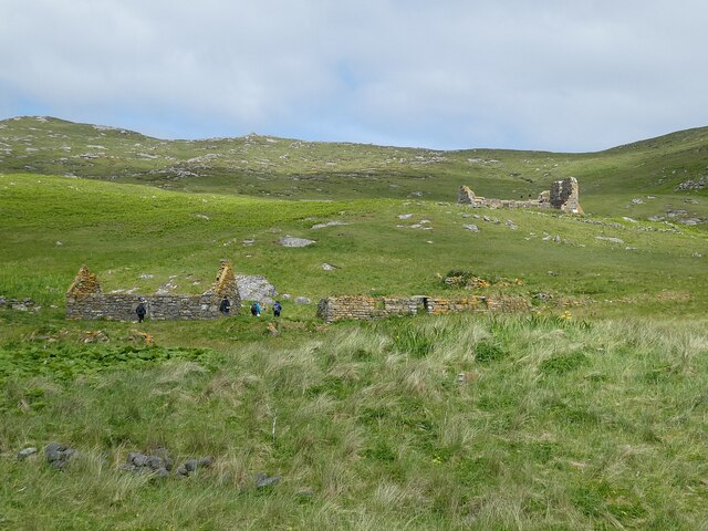
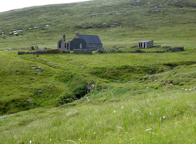
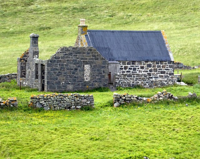
In addition to its natural beauty, Gunamuil also has a rich history. The headland is home to several archaeological sites, including ancient stone circles and burial mounds, which provide insight into the area's past.

Overall, Gunamuil is a must-visit destination for nature lovers, history enthusiasts, and anyone looking to experience the rugged beauty of the Scottish coastline. Its stunning views, diverse wildlife, and fascinating history make it a truly unique and special place to explore.

If you have any feedback on the listing, please let us know in the comments section below.

Gunamuil Images

Images are sourced within 2km of 56.804793/-7.6597033 or Grid Reference NL5482. Thanks to Geograph Open Source API. All images are credited.

Mingulay Bay and schoolhouse A visit possible by the small Barra boat that took 20 or so folk on a tour of the southern Hebrides with time to explore the cliffs of Mingulay.
Mingulay Bay and schoolhouse
A visit possible by the small Barra boat that took 20 or so folk on a tour of the southern Hebrides with time to explore the cliffs of Mingulay.
Passage beside Arnamuil and Mingulay Looking back after the fastest left turn by a boat I have experienced. The channel narrows to just a little wider than a small 20-passenger boat.  Bob Jones shared the same experience from August 2006.  <a href="https://www.geograph.org.uk/photo/228967">NL5482 : Natural arch, Mingulay</a>
Passage beside Arnamuil and Mingulay
Looking back after the fastest left turn by a boat I have experienced. The channel narrows to just a little wider than a small 20-passenger boat. Bob Jones shared the same experience from August 2006. NL5482 : Natural arch, Mingulay
Passage between Arnamuil and Gunamuil Later that day we were to sail up the passage.  Dun Mingulay lies at the end of the left ridge.
Passage between Arnamuil and Gunamuil
Later that day we were to sail up the passage. Dun Mingulay lies at the end of the left ridge.
Cliffs of Mingulay Precipitous cliffs descending to narrow channels.
Cliffs of Mingulay
Precipitous cliffs descending to narrow channels.
Birdwatching on the Mingulay cliffs A very calm day so no problems for the birds foraging.
Birdwatching on the Mingulay cliffs
A very calm day so no problems for the birds foraging.
Mingulay/Miughlaigh and Berneray/Bearnaraigh An aerial view from the south. Mingulay is the larger of the two islands.
Mingulay/Miughlaigh and Berneray/Bearnaraigh
An aerial view from the south. Mingulay is the larger of the two islands.
Mingulay - Abandoned village - entrance to former dwelling Mingulay was abandoned in 1912, some 18 years before its more famous (and more distant) twin, St. Kilda.
Remnants of many of the houses still stand, but few exceed about 6' (2m) in height. Here we see the entrance to one of these former dwellings.
See <a href="https://www.geograph.org.uk/photo/6888621">NL5683 : Mingulay - former entrance to dwelling</a> for close-up of the doorway.
Mingulay - Abandoned village - entrance to former dwelling
Mingulay was abandoned in 1912, some 18 years before its more famous (and more distant) twin, St. Kilda. Remnants of many of the houses still stand, but few exceed about 6' (2m) in height. Here we see the entrance to one of these former dwellings. See NL5683 : Mingulay - former entrance to dwelling for close-up of the doorway.
Mingulay - former entrance to dwelling The narrow (and low) entrance to a former dwelling on Mingulay. See <a href="https://www.geograph.org.uk/photo/6888618">NL5683 : Mingulay - Abandoned village - entrance to former dwelling</a> to see this in context.
Mingulay - former entrance to dwelling
The narrow (and low) entrance to a former dwelling on Mingulay. See NL5683 : Mingulay - Abandoned village - entrance to former dwelling to see this in context.
Mingulay - sand-filled ruined house Being next to the beach, the abandoned buildings of the former village on the island of Mingulay have had sand blown in to cover their floors.
Mingulay - sand-filled ruined house
Being next to the beach, the abandoned buildings of the former village on the island of Mingulay have had sand blown in to cover their floors.
Mingulay - former chapel The utterly ruinous remains of the former chapel on Mingulay. This was the only building in the former village with a "Dangerous Building - Keep Out" sign on it. It retains its concrete steps on its north-east side from which I took this photo looking down into the devastation.
Mingulay - former chapel
The utterly ruinous remains of the former chapel on Mingulay. This was the only building in the former village with a "Dangerous Building - Keep Out" sign on it. It retains its concrete steps on its north-east side from which I took this photo looking down into the devastation.
Gèarum Beag - Sphinx-like rock This rock feature looks to me as though Marty Feldman had posed for a Scottish version of the Sphinx.
Gèarum Beag - Sphinx-like rock
This rock feature looks to me as though Marty Feldman had posed for a Scottish version of the Sphinx.
Mingulay - Sloc Hèisegeo The west coast of Mingulay has amazing cliff scenery such as this at Sloc Hèisegeo.
Mingulay - Sloc Hèisegeo
The west coast of Mingulay has amazing cliff scenery such as this at Sloc Hèisegeo.
Mingulay - Sloc Dubh an Duin One of many superb inlets on the western coast of Mingulay. There was an amazing range of colours in the rocks - some the actual rock colours, some from the vegetation ... and a splash of white from the guano.
Mingulay - Sloc Dubh an Duin
One of many superb inlets on the western coast of Mingulay. There was an amazing range of colours in the rocks - some the actual rock colours, some from the vegetation ... and a splash of white from the guano.
Mingulay - Abandoned village from the beach Looking back from the beach to the abandoned village of Mingulay.
See <a href="https://www.geograph.org.uk/photo/6890287">NL5683 : Mingulay - The abandoned village</a>
 for a closer view.
Mingulay - Abandoned village from the beach
Looking back from the beach to the abandoned village of Mingulay. See NL5683 : Mingulay - The abandoned village for a closer view.
Mingulay - The abandoned village Looking at the ruins of the abandoned village of Mingulay from the beach.
See also <a href="https://www.geograph.org.uk/photo/6890285">NL5683 : Mingulay - Abandoned village from the beach</a>
Mingulay - The abandoned village
Looking at the ruins of the abandoned village of Mingulay from the beach. See also NL5683 : Mingulay - Abandoned village from the beach
Mingulay - Ruined houses and chapel above the main village There were a few houses higher up the slope from the main area of the abandoned village on Mingulay, with the collapsed chapel yet further up the hill.
Mingulay - Ruined houses and chapel above the main village
There were a few houses higher up the slope from the main area of the abandoned village on Mingulay, with the collapsed chapel yet further up the hill.
Mingulay - former school, now NTS base This building is the former school on Mingulay, which had at one time as many as forty pupils. It is now the only habitable property on the little island, and is lived in (I'm not sure how permanently) by an NTS (National Trust for Scotland) warden, whom we met.
For some reason this school was situated at some distance south of the village and replaced an earlier school which was nearer to the dwellings.
For a closer view of the building see <a href="https://www.geograph.org.uk/photo/6891868">NL5682 : Mingulay - Former school</a>.
Mingulay - former school, now NTS base
This building is the former school on Mingulay, which had at one time as many as forty pupils. It is now the only habitable property on the little island, and is lived in (I'm not sure how permanently) by an NTS (National Trust for Scotland) warden, whom we met. For some reason this school was situated at some distance south of the village and replaced an earlier school which was nearer to the dwellings. For a closer view of the building see NL5682 : Mingulay - Former school.
Mingulay - Former school This is the former school on Mingulay which closed a little time before the departure of the residents of the village. See it in wider context here <a href="https://www.geograph.org.uk/photo/6891864">NL5682 : Mingulay - former school, now NTS base</a>
Mingulay - Former school
This is the former school on Mingulay which closed a little time before the departure of the residents of the village. See it in wider context here NL5682 : Mingulay - former school, now NTS base
Show me another place!

Gunamuil is located at Grid Ref: NL5482 (Lat: 56.804793, Lng: -7.6597033)

Unitary Authority: Na h-Eileanan an Iar

Police Authority: Highlands and Islands

What 3 Words

///lovely.openly.texted. Near CastleBay, Na h-Eileanan Siar

Related Wikis

Arnamul

Arnamul (Scottish Gaelic: Arnamuil) is a stack off the west coast of Mingulay in the Western Isles, Scotland. Although precipitous, sheep were grazed on...

Barra Isles

The Barra Isles, also known as the Bishop's Isles, are a small archipelago in the Outer Hebrides of Scotland. They lie south of the island of Barra, for...

Mingulay

Mingulay (Scottish Gaelic: Miughalaigh) is the second largest of the Bishop's Isles in the Outer Hebrides of Scotland. Located 12 nautical miles (22 kilometres...

Barra Head Lighthouse

Barra Head Lighthouse on Barra Head identifies the southern entrance to The Minch, roughly halfway between the Eilean Glas and Rinns of Islay lighthouses...

Nearby Amenities

Located within 500m of 56.804793,-7.6597033
Dùn Mhiùghlaigh
Place: locality
Lat/Long: 56.8019452/-7.6617866
Sloc Dubh an Dùine
Natural: bay
Lat/Long: 56.8005236/-7.6591043
Gunamuil
Natural: cape
Lat/Long: 56.8047413/-7.6596837
The data included in this document is from www.openstreetmap.org. The data is made available under ODbL.

Have you been to Gunamuil?

Leave your review of Gunamuil below (or comments, questions and feedback).