Binness Rithe

Sea, Estuary, Creek in Hampshire Havant

England

Binness Rithe

Path across marshland, Southmoor Nature Reserve
Path across marshland, Southmoor Nature Reserve Credit: David Martin

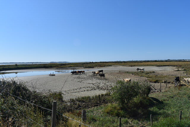
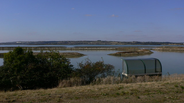
Binness Rithe is a picturesque coastal area located in Hampshire, England. Situated on the south coast, it encompasses a serene combination of sea, estuary, and creek. The name "Rithe" derives from the Old English word for a small stream or watercourse, reflecting the area's unique geographical features.

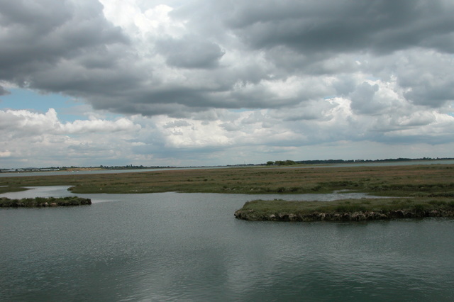
The centerpiece of Binness Rithe is its expansive sea, offering breathtaking views and opportunities for leisure activities. The pristine sandy beaches attract visitors who enjoy swimming, sunbathing, and beachcombing. The sea is also ideal for water sports enthusiasts, with popular activities including sailing, windsurfing, and kayaking.

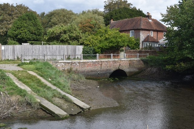
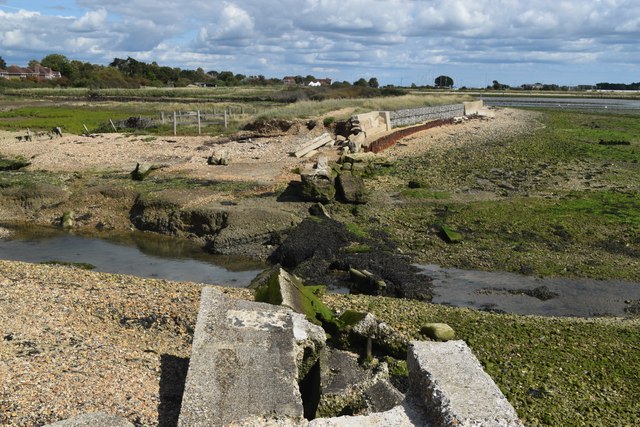
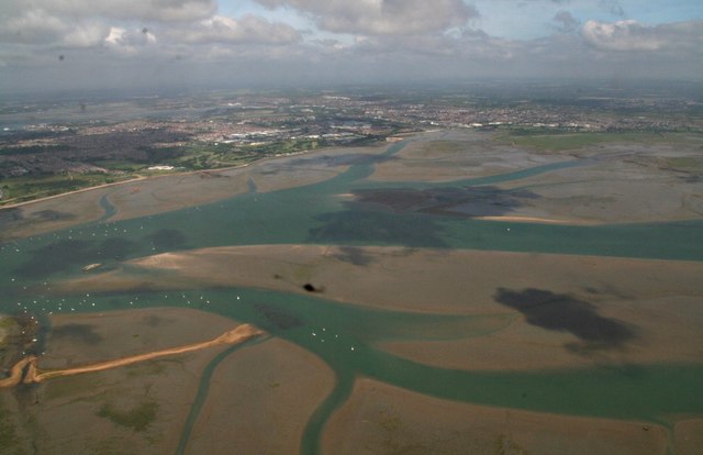
Adjacent to the sea is the estuary, a shallow body of water where the river meets the sea. This dynamic ecosystem is home to a variety of bird species and marine life. Birdwatchers flock to Binness Rithe to observe migratory birds, such as waders and terns, as they feed and rest in the estuary's mudflats.

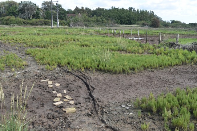
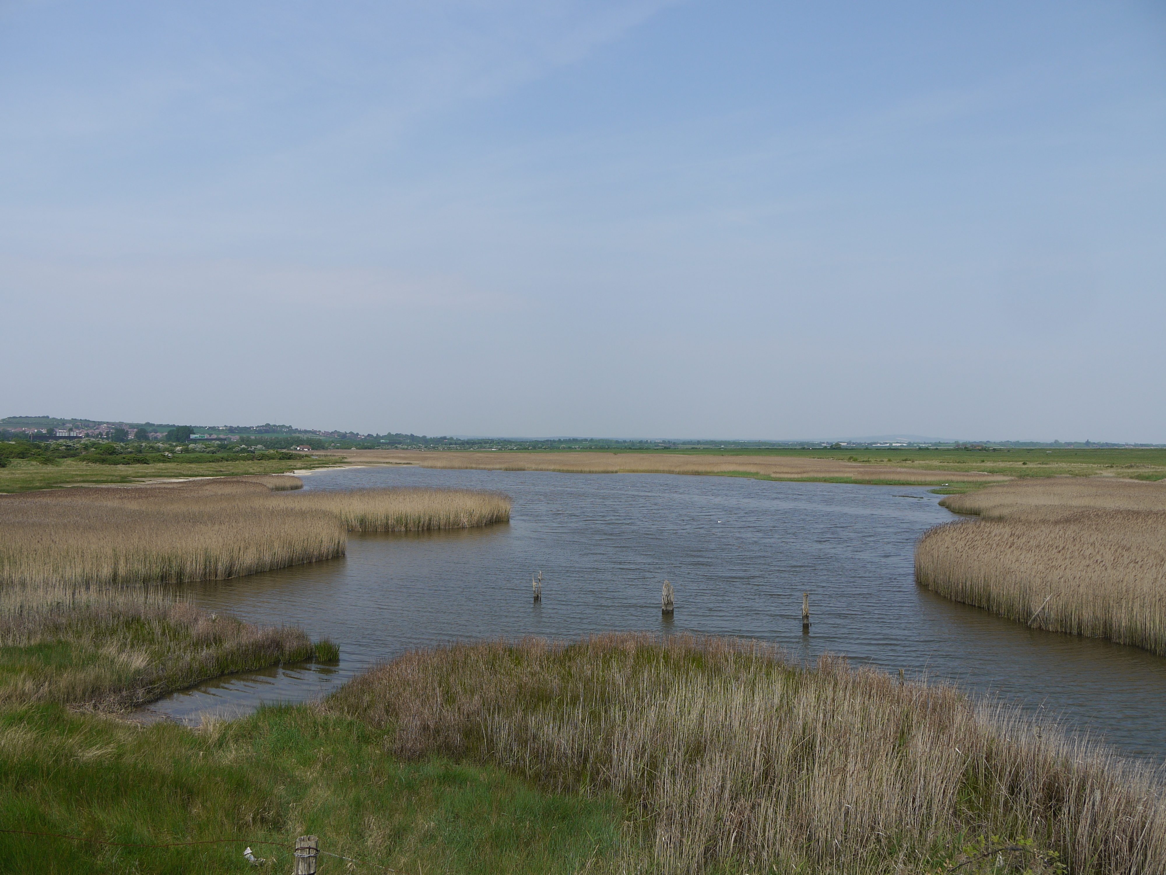
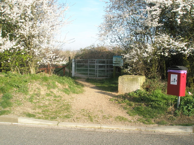
The creek, another remarkable feature of Binness Rithe, meanders through the landscape, providing a tranquil setting for nature enthusiasts. Surrounded by lush vegetation and reed beds, the creek is an ideal spot for walking, picnicking, and wildlife spotting. Visitors can often catch glimpses of otters, water voles, and other creatures that call the creek home.

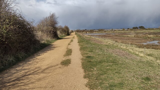
In addition to its natural beauty, Binness Rithe offers excellent amenities for visitors. There are well-maintained coastal paths, picnic areas, and a range of local establishments, including cafes, restaurants, and shops. Whether seeking a relaxing day at the beach or an opportunity to immerse oneself in nature, Binness Rithe is a hidden gem along the Hampshire coast.

If you have any feedback on the listing, please let us know in the comments section below.

Binness Rithe Images

Images are sourced within 2km of 50.830248/-1.0113316 or Grid Reference SU6903. Thanks to Geograph Open Source API. All images are credited.

Path across marshland, Southmoor Nature Reserve
Bridge and former West Mill, Langstone
Channel in marshland, Southmoor Nature Reserve This area is now inundated by high tides, following <a href="https://www.geograph.org.uk/photo/7592560">SU7104 : Breach in sea wall, Southmoor Nature Reserve</a>. Compare <a href="https://www.geograph.org.uk/photo/5887297">SU7104 : South Moor Langstone</a> which shows the same fence in the foreground.
Channel in marshland, Southmoor Nature Reserve
This area is now inundated by high tides, following SU7104 : Breach in sea wall, Southmoor Nature Reserve. Compare SU7104 : South Moor Langstone which shows the same fence in the foreground.
Breach in sea wall, Southmoor Nature Reserve The breach occurred in 2020 and the marshland habitat has changed dramatically, with some areas now under water at each high tide: see <a href="https://www.geograph.org.uk/photo/7592550">SU7104 : Channel in marshland, Southmoor Nature Reserve</a>. The coastal footpath is officially closed.
Breach in sea wall, Southmoor Nature Reserve
The breach occurred in 2020 and the marshland habitat has changed dramatically, with some areas now under water at each high tide: see SU7104 : Channel in marshland, Southmoor Nature Reserve. The coastal footpath is officially closed.
On the shore at Southmoor Nature Reserve The projecting sea wall is at the end of Southmoor Lane.
On the shore at Southmoor Nature Reserve
The projecting sea wall is at the end of Southmoor Lane.
On the shore at Budd's Wall
Path on Budd's Wall Looking back towards Southmoor Lane.
Path on Budd's Wall
Looking back towards Southmoor Lane.
Hayling Billy Line Hayling Billy Line (old railway between Hayling and Havant) path heading to the Bridge car park
Hayling Billy Line
Hayling Billy Line (old railway between Hayling and Havant) path heading to the Bridge car park
Starfish decoy control bunker Farlington no. 2 Control, one of two controlling the WWII bombing decoy for Portsmouth sited on Farlington Marshes.
Starfish decoy control bunker
Farlington no. 2 Control, one of two controlling the WWII bombing decoy for Portsmouth sited on Farlington Marshes.
Saltings with derelict boat, Langstone Harbour
The Deeps, Farlington Marsh This lake is called The Deeps, it's formed by a combination of overwash from the sea and retention of rainfall draining from the marsh. Following a recent extended hot and dry spell it's drying up and currently looks more like something from an African documentary than an English coastal lake.
The Deeps, Farlington Marsh
This lake is called The Deeps, it's formed by a combination of overwash from the sea and retention of rainfall draining from the marsh. Following a recent extended hot and dry spell it's drying up and currently looks more like something from an African documentary than an English coastal lake.
Hayling Island foreshore Close to high tide.
Hayling Island foreshore
Close to high tide.
Water and shingle and grass This was a pleasant spot where I took a break from the Shipwrights' Way.
Water and shingle and grass
This was a pleasant spot where I took a break from the Shipwrights' Way.
Shipwrights' Way 186 The view southwards is into Langstone Harbour.
Shipwrights' Way 186
The view southwards is into Langstone Harbour.
Shipwrights' Way 188 The Shipwrights' Way uses the Hayling Billy Trail for two or three miles.
Shipwrights' Way 188
The Shipwrights' Way uses the Hayling Billy Trail for two or three miles.
Harts Farm Way (9)
Harts Farm Way (9)
Harts Farm Way (10)
Harts Farm Way (10)
Langstone Harbour: aerial 2017
Show me another place!

Binness Rithe is located at Grid Ref: SU6903 (Lat: 50.830248, Lng: -1.0113316)

Administrative County: Hampshire

District: Havant

Police Authority: Hampshire

What 3 Words

///trucks.ports.hungry. Near Havant, Hampshire

Related Wikis

Baker's Island

Baker's Island is an island in Langstone Harbour, Hampshire, England. It is 400 m (1,300 ft) long and up to 300 m (980 ft) wide but only rises to a little...

Long Island (Hampshire)

Long Island is an island in Langstone Harbour in Hampshire, England. It is 750 metres (820 yd) long and up to 250 metres (270 yd) wide. Three Bronze Age...

South Binness Island

South Binness Island is an island in Langstone Harbour. It is 600 metres (660 yd) long and up to 240 metres (260 yd) wide but only rises to 2 metres (7...

North Binness Island

North Binness Island is an island in Langstone Harbour It is 900 metres (980 yd) long and up to 250 metres (270 yd) wide but only rises to 2.5 metres...

Langstone Harbour

Langstone Harbour is a 2,085.4-hectare (5,153-acre) biological Site of Special Scientific Interest in Hampshire. It is an inlet of the English Channel...

Farlington Marshes

Farlington Marshes is a 119.7-hectare (296-acre) Local Nature Reserve in Portsmouth in Hampshire. It is owned by Portsmouth City Council and managed by...

West Hayling

West Hayling is a 76.2-hectare (188-acre) Local Nature Reserve on Hayling Island in Hampshire. It is owned by Havant Borough Council and managed by the...

Southmoor Nature Reserve

Southmoor Nature Reserve is a 11-hectare (27-acre) nature reserve in Havant in Hampshire. It is managed by the Hampshire and Isle of Wight Wildlife Trust...

Nearby Amenities

Located within 500m of 50.830248,-1.0113316
Source: PGS
Lat/Long: 50.828287/-1.0161421
Ruins
Addr Housename: Ruins
Lat/Long: 50.8278095/-1.0156013
The data included in this document is from www.openstreetmap.org. The data is made available under ODbL.

Have you been to Binness Rithe?

Leave your review of Binness Rithe below (or comments, questions and feedback).