Acharn

Settlement in Perthshire

Scotland

Acharn

Lane along Loch Tay
Lane along Loch Tay Credit: N Chadwick

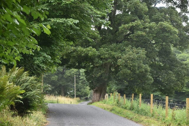
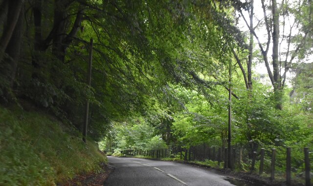
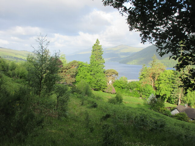
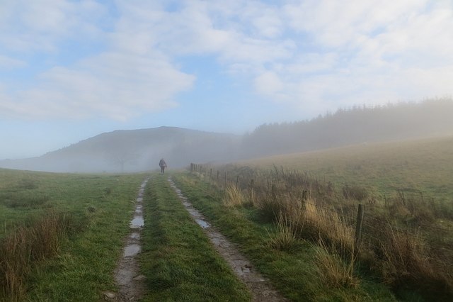
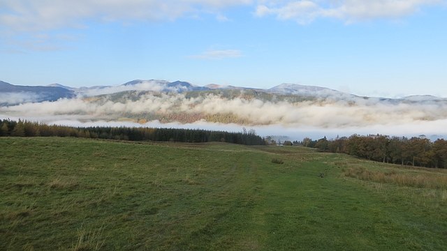
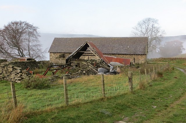
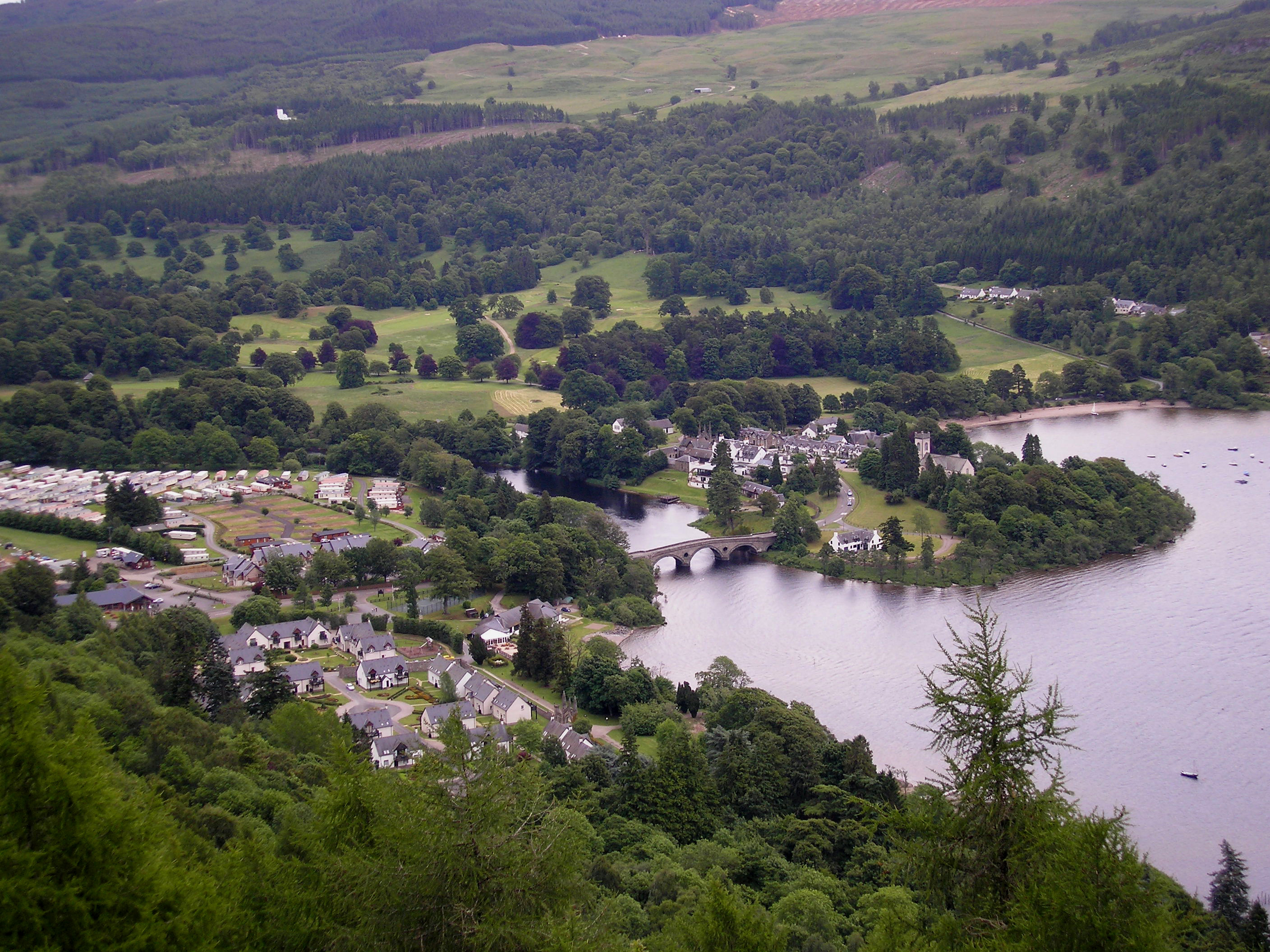
Acharn is a small village located in the county of Perthshire, Scotland. Situated on the southern shore of Loch Tay, it offers breathtaking views of the surrounding mountains and the tranquil waters of the loch. With a population of around 100 inhabitants, Acharn is a secluded and peaceful destination that attracts visitors seeking a serene getaway.

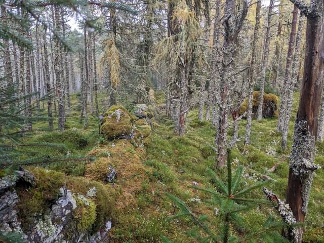
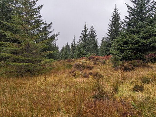
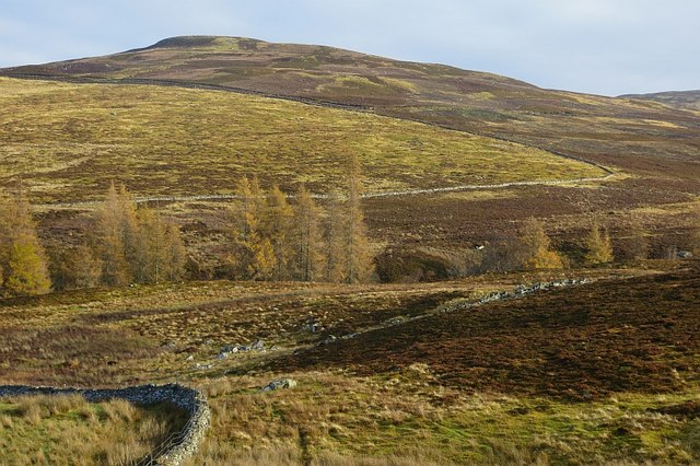
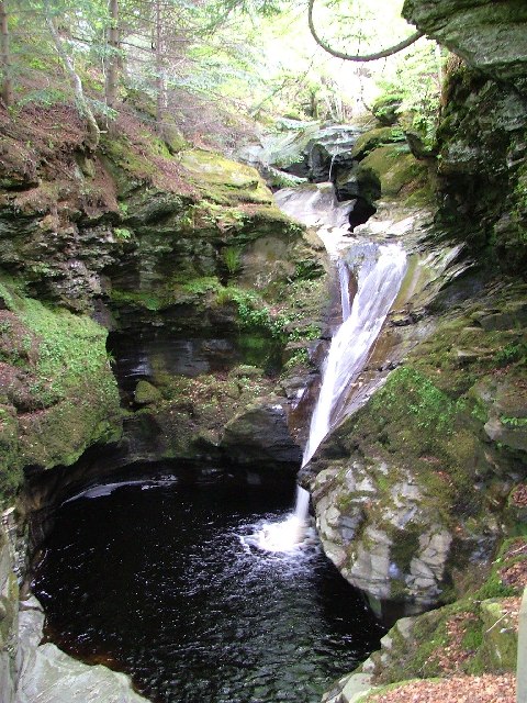
The village is known for its stunning natural beauty, with the nearby Acharn Falls being a particularly popular attraction. This picturesque waterfall cascades down a rocky gorge, creating a mesmerizing spectacle that draws in photographers and nature enthusiasts alike. Additionally, Acharn is surrounded by lush forests, making it an ideal spot for hiking, birdwatching, and exploring the diverse flora and fauna of the region.

History buffs will find Acharn intriguing, as it is home to several ancient sites. The Acharn Iron Age Fort, for instance, provides a glimpse into Scotland's ancient past, with remnants of defensive walls and structures dating back thousands of years. In addition, the village is in close proximity to the historic Scottish Crannog Centre, where visitors can learn about the ancient dwellings built on stilts over the loch.

While Acharn is a small village, it offers a range of amenities for visitors, including a charming tearoom and a handful of holiday cottages for those wishing to stay longer. The village provides a perfect base for exploring the stunning Perthshire countryside and experiencing the tranquility of Loch Tay.

If you have any feedback on the listing, please let us know in the comments section below.

Acharn Images

Images are sourced within 2km of 56.570192/-4.025664 or Grid Reference NN7543. Thanks to Geograph Open Source API. All images are credited.

Lane along Loch Tay
Lane along Loch Tay
Entering Acharn
Entering Acharn
Acharn
Acharn
A827, Tay Forest Park The A827 is a cross-country route through the glens of central Scotland, running 35 miles along the entire length of Loch Tay, from Lix Toll to Ballinluig. 
<span class="nowrap"><a title="https://www.sabre-roads.org.uk/wiki/index.php?title=A827" rel="nofollow ugc noopener" href="https://www.sabre-roads.org.uk/wiki/index.php?title=A827">Link</a><img style="margin-left:2px;" alt="External link" title="External link - shift click to open in new window" src="https://s1.geograph.org.uk/img/external.png" width="10" height="10"/></span>
A827, Tay Forest Park
The A827 is a cross-country route through the glens of central Scotland, running 35 miles along the entire length of Loch Tay, from Lix Toll to Ballinluig. LinkExternal link
A827 The A827 is a cross-country route through the glens of central Scotland, running 35 miles along the entire length of Loch Tay, from Lix Toll to Ballinluig. 
<span class="nowrap"><a title="https://www.sabre-roads.org.uk/wiki/index.php?title=A827" rel="nofollow ugc noopener" href="https://www.sabre-roads.org.uk/wiki/index.php?title=A827">Link</a><img style="margin-left:2px;" alt="External link" title="External link - shift click to open in new window" src="https://s1.geograph.org.uk/img/external.png" width="10" height="10"/></span>
A827
The A827 is a cross-country route through the glens of central Scotland, running 35 miles along the entire length of Loch Tay, from Lix Toll to Ballinluig. LinkExternal link
Woodland above Loch Tay Looking west from above Kenmore to mixed woodland, with Loch Tay beyond.
Woodland above Loch Tay
Looking west from above Kenmore to mixed woodland, with Loch Tay beyond.
A827 towards Kenmore
Drummond Hill summit Looking east from the top of the hill along the summit wall.
Drummond Hill summit
Looking east from the top of the hill along the summit wall.
Drummond Hill trees At a slight col on Drummond Hill's ridge.
Drummond Hill trees
At a slight col on Drummond Hill's ridge.
Queen's Drive At the edge of the fog in a temperature inversion.
Queen's Drive
At the edge of the fog in a temperature inversion.
Track above Acharn A grassy track links up with moorland roads further up the hill.  Inversion conditions over Loch Tay with a view over Drummond Hill towards Schiehallion.
Track above Acharn
A grassy track links up with moorland roads further up the hill. Inversion conditions over Loch Tay with a view over Drummond Hill towards Schiehallion.
Autumn moorland, Acharn View towards Meall Greigh from the stone circle.
Autumn moorland, Acharn
View towards Meall Greigh from the stone circle.
Trees, Upper Acharn
Trees, Upper Acharn
Queen's Drive
Queen's Drive
Ruined byre, Balmacnaughton
Show me another place!

Acharn is located at Grid Ref: NN7543 (Lat: 56.570192, Lng: -4.025664)

Unitary Authority: Perth and Kinross

Police Authority: Tayside

What 3 Words

///cost.sleepless.dunk. Near Aberfeldy, Perth & Kinross

Nearby Locations

Acharn Falls of Acharn

Related Wikis

Acharn, Perth and Kinross

Acharn (Scottish Gaelic: Àth a' Chàirn meaning 'Field of the Cairn[s]') is a hamlet in the Kenmore parish of the Scottish council area of Perth and Kinross...

Falls of Acharn

Falls of Acharn is a waterfall of Scotland. == See also == Acharn Waterfalls of Scotland == References ==

Kenmore, Perth and Kinross

Kenmore (Scottish Gaelic: A' Cheannmhor, IPA:[ˈaˈçaun̴̪auvɔɾ]) is a small village in Perthshire, in the Highlands of Scotland, located where Loch Tay drains...

Càrn na Marbh

Càrn na Marbh (meaning "mound" or "cairn of the dead") is a re-used Bronze Age tumulus, located in Fortingall in Perthshire, Scotland. The mound was used...
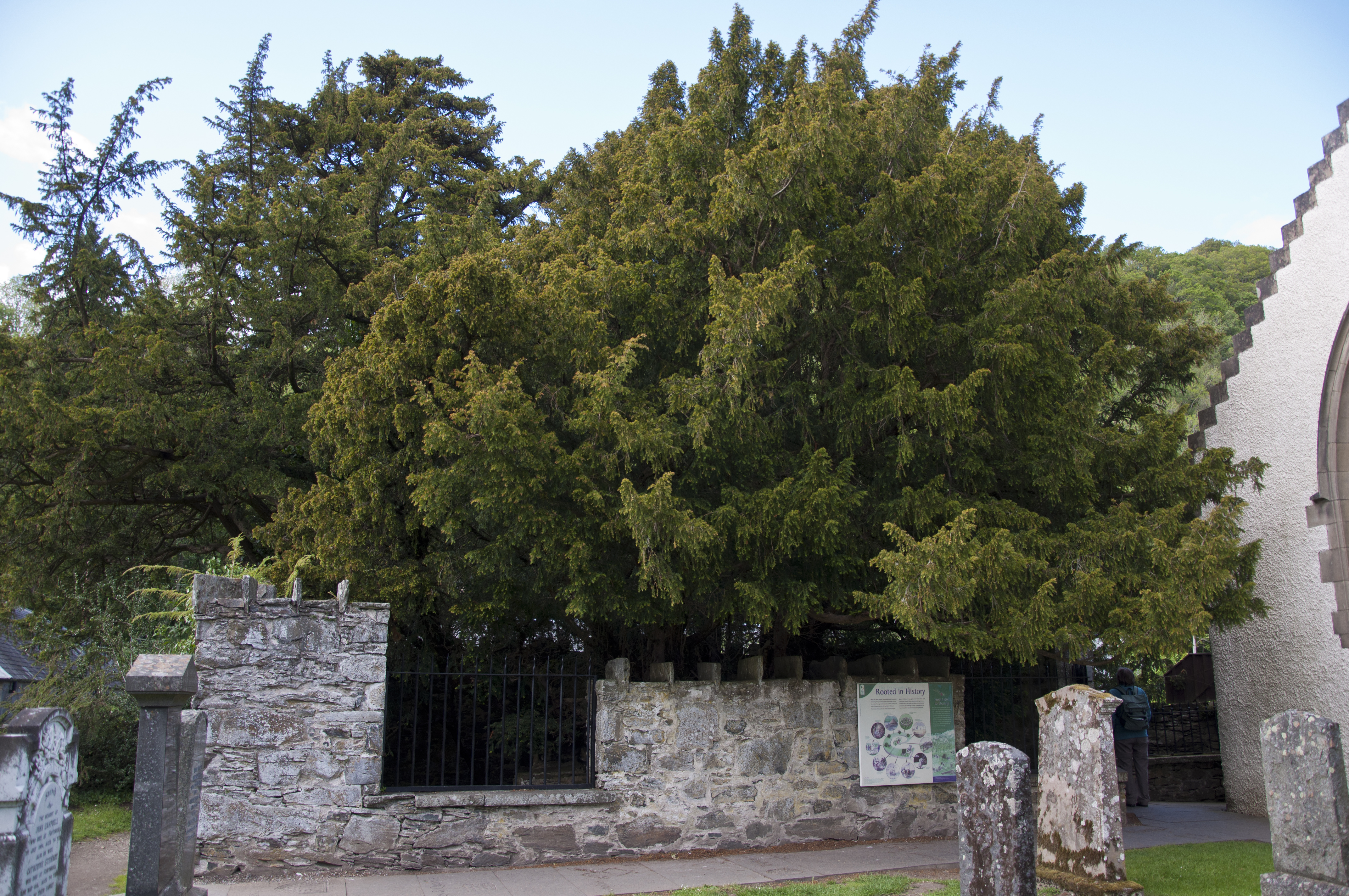
Fortingall Yew

The Fortingall Yew is an ancient European yew (Taxus baccata) in the churchyard of the village of Fortingall in Perthshire, Scotland. Considered one of...

Fearnan

Fearnan (Gaelic Feàrnan, 'Alders') is a small crofting village on the north shore of Loch Tay in Perthshire, Scotland.The village lies at the junction...

Fortingall

Fortingall (Scottish Gaelic: Fartairchill) (lit. "Escarpment Church"—i.e. "church at the foot of an escarpment or steep slope") is a small village in Glen...

Harpswell Cattle Pound

The Harpswell Cattle Pound is a stone enclosure in Harpswell, Maine, United States. It was used to hold stray animals until they could be reunited with...

Related Videos

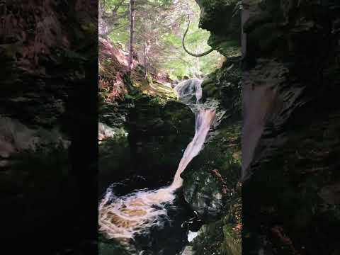
Falls of Acharn #scotland #nature #perth #travel

scotland #perth #uk #countrysideroad #green #mountains #nature #happiness Falls of Acharn ...

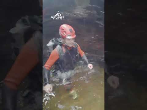
An Incredible Natural Playground! The Acharn Burn is so much Fun! Falls of Acharn #shorts #travel

A super fun wee canyon, packed full of cool features! Smooth rocks and quirky formations make this short decent a great place to ...

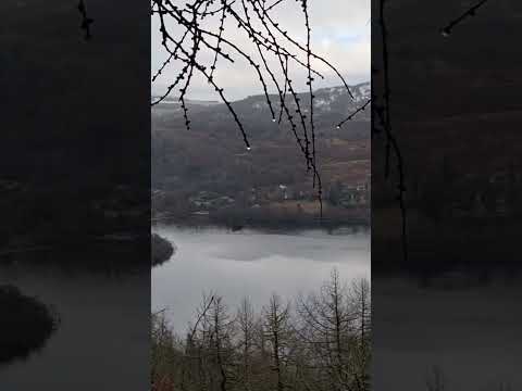
Kenmore, Scotland,UK

Traveling Youtube channel: Please, subscribe to: Lina Ivanova https://www.youtube.com/channel/UCitHjmX4IOs2jHHmBoqOUUw ...

Nearby Amenities

Located within 500m of 56.570192,-4.025664
Acharn
Name Gd: Achadh Chàrn
Place: village
Wikidata: Q3775756
Wikipedia: en:Acharn, Perth and Kinross
Lat/Long: 56.5697796/-4.0263934
Noexit: yes
Lat/Long: 56.5685942/-4.0252679
Post Box
Collection Times: Mo-Sa 13:00
Operator: Royal Mail
Post Box Type: wall
Ref: PH15 50
Royal Cypher: GVIR
Royal Cypher Wikidata: Q33102169
Lat/Long: 56.5699365/-4.0256623
Remony Lade Mill
Pont: no
Stobie1783: no
Description: Historic Mill, old_name of 1869.
Historic: archaeological_site
Old Name: Saw Mill, Dyeing Mill
Source: OS Six inch 1st series
Lat/Long: 56.5714325/-4.0181581
Acharn
1860name: Corn Mill, Saw Mill
Pont: yes
Stobie1783: no
Designation: Historic Mill
Historic: archaeological_site
Source: OS Six inch 1st series
Lat/Long: 56.5702305/-4.0258772
Material: wood
Power: pole
Lat/Long: 56.5674249/-4.0308076
Material: wood
Power: pole
Lat/Long: 56.5677293/-4.0297294
Material: wood
Power: pole
Lat/Long: 56.5680603/-4.0285546
Material: wood
Power: pole
Lat/Long: 56.5692337/-4.0197837
Material: wood
Power: pole
Lat/Long: 56.5691849/-4.0210176
Material: wood
Power: pole
Lat/Long: 56.5691302/-4.0224016
Material: wood
Power: pole
Lat/Long: 56.5690859/-4.0233859
Material: wood
Power: pole
Lat/Long: 56.5690445/-4.0243274
Material: wood
Power: pole
Lat/Long: 56.5689425/-4.0253614
Material: wood
Power: pole
Lat/Long: 56.5683574/-4.0275568
Power: pole
Lat/Long: 56.5693414/-4.0176455
Defibrillator
Defibrillator Location: end wall of house
Emergency: defibrillator
Opening Hours: 24/7
Lat/Long: 56.5700566/-4.0252425
Bus Stop
Bench: yes
Naptan AtcoCode: 64801680
Naptan NaptanCode: 73726934
Shelter: yes
Lat/Long: 56.569954/-4.0256135
Booth: K6
Covered: booth
Disused Amenity: telephone
Man Made: telephone_box
Lat/Long: 56.5698351/-4.0260369
Material: wood
Power: pole
Transformer: distribution
Lat/Long: 56.5686765/-4.0264598
Bench
Lat/Long: 56.5699489/-4.0256306
Bench
Lat/Long: 56.5701593/-4.0256833
The data included in this document is from www.openstreetmap.org. The data is made available under ODbL.

Have you been to Acharn?

Leave your review of Acharn below (or comments, questions and feedback).