Achargary
Settlement in Sutherland
Scotland
Achargary

Achargary is a small village located in the county of Sutherland, in the northern part of Scotland. Situated amidst breathtaking Highland landscapes, the village is nestled in a valley surrounded by rolling hills and picturesque forests. It is part of the North West Sutherland Community Council area and lies within the Highland council region.
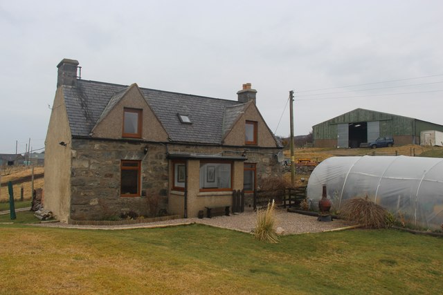
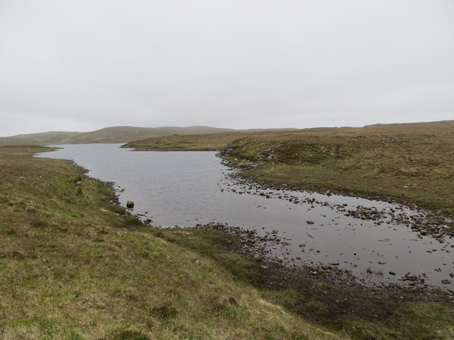
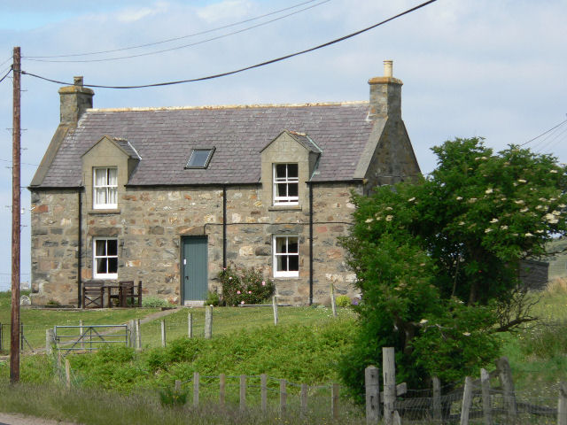
With a population of around 200 residents, Achargary is known for its peaceful and close-knit community. The village primarily consists of traditional stone-built houses and cottages, adding to its charm and character. The nearby River Shin flows through the village, offering picturesque views and opportunities for fishing.
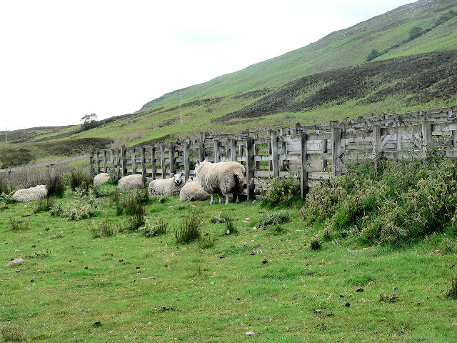
The main economic activities in Achargary revolve around agriculture and tourism. The fertile lands surrounding the village are ideal for farming, with fields often filled with sheep and cattle. Visitors are drawn to Achargary for its untouched natural beauty, providing ample opportunities for hiking, biking, and wildlife watching. The nearby Shin Falls is a popular tourist attraction, known for its impressive cascades and salmon leap.
Despite being a small village, Achargary has a strong sense of community spirit. The village has a primary school, a church, and a community hall, where local events and gatherings take place. The stunning landscapes and tranquil atmosphere make Achargary an ideal destination for those seeking a peaceful escape or a taste of rural Scottish life.
If you have any feedback on the listing, please let us know in the comments section below.
Achargary Images
Images are sourced within 2km of 58.455445/-4.1952862 or Grid Reference NC7254. Thanks to Geograph Open Source API. All images are credited.


Achargary is located at Grid Ref: NC7254 (Lat: 58.455445, Lng: -4.1952862)
Unitary Authority: Highland
Police Authority: Highlands and Islands
What 3 Words
///motion.employ.satin. Near Forsinard, Highland
Nearby Locations
Related Wikis

Skelpick
Skelpick (Scottish Gaelic: Sgeilpeach) is a small remote crofting hamlet, 2 miles south of Bettyhill, in the far north of Sutherland, Scottish Highlands...
Achina, Highland
Achina is a village in Highland, Scotland. == References ==
Leckfurin
Leckfurin is a small remote village, which lies on the left bank of the River Naver, in northern Sutherland in Scottish Highlands and is in the Scottish...

Borgie
Borgie (Scottish Gaelic: Borghaidh) is a hamlet in Sutherland, Highland, Scotland. Historically it was part of the 12,600-acre (5,100-hectare) Tongue estate...

Invernaver
Invernaver (Gaelic: Inbhir Nabhair) is a small, remote hamlet, situated on the west bank of the River Naver as it flows into Torrisdale Bay, in Sutherland...

Baile Mhargaite (Sandy Dun)
Baile Mhargaite (also known as Lochan Druim An Duin, the Sandy Dun, or Invernaver Broch) is an Iron Age broch in Strathnaver, Sutherland. It is a scheduled...
Inshlampie Broch
Broch of Inshlampie is an Iron Age broch in Scotland. == Location == Located in Farr, Sutherland, this possible broch is situated in a highly defensible...
Strathnaver Museum
Strathnaver Museum is located in Bettyhill, Sutherland, Scotland. It is a fully accredited volunteer-run independent museum which first opened in 1976...
Nearby Amenities
Located within 500m of 58.455445,-4.1952862Have you been to Achargary?
Leave your review of Achargary below (or comments, questions and feedback).