Falls of Acharn

Waterfall in Perthshire

Scotland

Falls of Acharn

Lane along Loch Tay
Lane along Loch Tay Credit: N Chadwick

Falls of Acharn, located in Perthshire, Scotland, is a breathtaking waterfall renowned for its natural beauty and tranquil surroundings. Nestled within the picturesque village of Acharn, this enchanting waterfall is a popular destination for nature enthusiasts and outdoor adventurers.

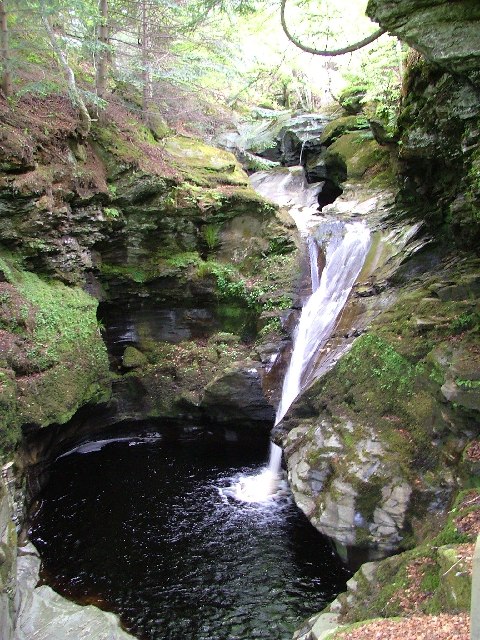
The Falls of Acharn cascade down a series of rocky steps, creating a mesmerizing spectacle that captivates visitors. The water plunges into a gorge, surrounded by lush greenery and towering trees, providing a serene and peaceful atmosphere. The sound of rushing water adds to the magical ambiance, creating a soothing and calming experience for all who visit.

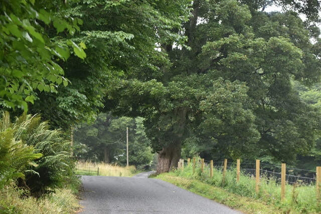
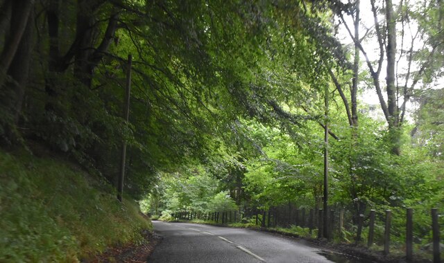
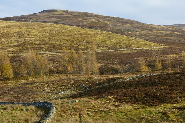
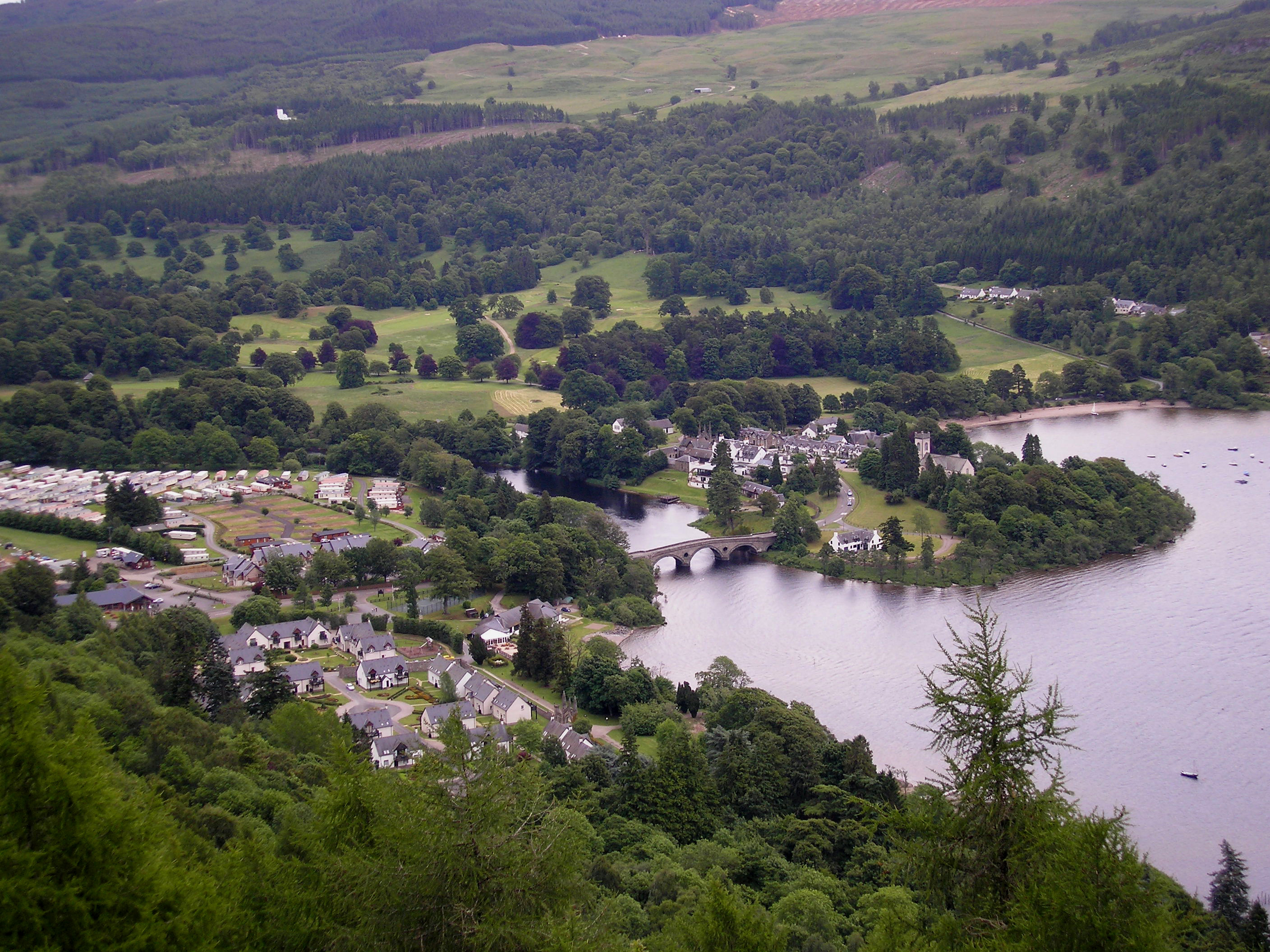
To reach the Falls of Acharn, visitors embark on a scenic walk through a well-maintained path that winds its way through ancient woodlands and along the banks of the Acharn Burn. Along the way, visitors can enjoy the stunning views of the surrounding countryside, including the expansive Loch Tay.

Upon reaching the waterfall, there is a viewing platform that offers a spectacular vantage point to admire the cascading water and the surrounding natural beauty. The area around the waterfall is also adorned with ancient stone carvings, adding a touch of historical significance to the site.

Falls of Acharn is not only a visual delight but also a place of cultural significance. The waterfall has been a source of inspiration for artists and writers throughout history, with its ethereal beauty often depicted in paintings and literature.

Overall, Falls of Acharn is a must-visit destination for those seeking a tranquil retreat in the heart of Scotland's stunning countryside. Its natural splendor, combined with its historical and cultural significance, make it a truly remarkable and unforgettable experience for all who venture there.

If you have any feedback on the listing, please let us know in the comments section below.

Falls of Acharn Images

Images are sourced within 2km of 56.564046/-4.0236316 or Grid Reference NN7543. Thanks to Geograph Open Source API. All images are credited.

Lane along Loch Tay
Lane along Loch Tay
Entering Acharn
Entering Acharn
Acharn
Acharn
A827 The A827 is a cross-country route through the glens of central Scotland, running 35 miles along the entire length of Loch Tay, from Lix Toll to Ballinluig. 
<span class="nowrap"><a title="https://www.sabre-roads.org.uk/wiki/index.php?title=A827" rel="nofollow ugc noopener" href="https://www.sabre-roads.org.uk/wiki/index.php?title=A827">Link</a><img style="margin-left:2px;" alt="External link" title="External link - shift click to open in new window" src="https://s1.geograph.org.uk/img/external.png" width="10" height="10"/></span>
A827
The A827 is a cross-country route through the glens of central Scotland, running 35 miles along the entire length of Loch Tay, from Lix Toll to Ballinluig. LinkExternal link
A827 towards Kenmore
Queen's Drive At the edge of the fog in a temperature inversion.
Queen's Drive
At the edge of the fog in a temperature inversion.
Track above Acharn A grassy track links up with moorland roads further up the hill.  Inversion conditions over Loch Tay with a view over Drummond Hill towards Schiehallion.
Track above Acharn
A grassy track links up with moorland roads further up the hill. Inversion conditions over Loch Tay with a view over Drummond Hill towards Schiehallion.
Autumn moorland, Acharn View towards Meall Greigh from the stone circle.
Autumn moorland, Acharn
View towards Meall Greigh from the stone circle.
Slopes of Meall Greigh A newish (and unmapped) road on moorland above Kenmore and Acharn. There are new native woodland plantations on Creag an Fhùdair (Kenmore Hill).
Slopes of Meall Greigh
A newish (and unmapped) road on moorland above Kenmore and Acharn. There are new native woodland plantations on Creag an Fhùdair (Kenmore Hill).
Creagan Odhar A sheep and cairn on a small knoll overlooking a cloud filled Loch Tay basin. The distant hills are on the north side of Glen Lyon (Carn Gorm, Carn Mairg etc).
Creagan Odhar
A sheep and cairn on a small knoll overlooking a cloud filled Loch Tay basin. The distant hills are on the north side of Glen Lyon (Carn Gorm, Carn Mairg etc).
Road above the Acharn Burn and Creagan Odhar Moorland road with a fine view northwards to Schiehallion, Dùn Coillich and Drummond Hill.
Road above the Acharn Burn and Creagan Odhar
Moorland road with a fine view northwards to Schiehallion, Dùn Coillich and Drummond Hill.
Sheep above Acharn Moorland beside the big drop into the Acharn Burn.
Sheep above Acharn
Moorland beside the big drop into the Acharn Burn.
Trees, Upper Acharn
Trees, Upper Acharn
Queen's Drive
Queen's Drive
Ruined byre, Balmacnaughton
Show me another place!

Falls of Acharn is located at Grid Ref: NN7543 (Lat: 56.564046, Lng: -4.0236316)

Unitary Authority: Perth and Kinross

Police Authority: Tayside

What 3 Words

///decompose.indicate.angle. Near Aberfeldy, Perth & Kinross

Nearby Locations

Acharn Falls of Acharn

Related Wikis

Falls of Acharn

Falls of Acharn is a waterfall of Scotland. == See also == Acharn Waterfalls of Scotland == References ==

Acharn, Perth and Kinross

Acharn (Scottish Gaelic: Àth a' Chàirn meaning 'Field of the Cairn[s]') is a hamlet in the Kenmore parish of the Scottish council area of Perth and Kinross...

Kenmore, Perth and Kinross

Kenmore (Scottish Gaelic: A' Cheannmhor, IPA:[ˈaˈçaun̴̪auvɔɾ]) is a small village in Perthshire, in the Highlands of Scotland, located where Loch Tay drains...

Fearnan

Fearnan (Gaelic Feàrnan, 'Alders') is a small crofting village on the north shore of Loch Tay in Perthshire, Scotland.The village lies at the junction...

Nearby Amenities

Located within 500m of 56.564046,-4.0236316
Falls of Acharn
Waterway: waterfall
Wikidata: Q5432506
Wikipedia: en:Falls of Acharn
Lat/Long: 56.5640124/-4.0232196
Falls of Acharn Viewpoint
Tourism: viewpoint
Lat/Long: 56.5640646/-4.0246603
Ford: yes
Lat/Long: 56.5651/-4.0273275
Ford: yes
Lat/Long: 56.5641547/-4.0308787
The data included in this document is from www.openstreetmap.org. The data is made available under ODbL.

Have you been to Falls of Acharn?

Leave your review of Falls of Acharn below (or comments, questions and feedback).