Marsh Coombe

Sea, Estuary, Creek in Cornwall

England

Marsh Coombe

Footbridge at Wivelscombe This bridge lies on the footpath between Shillingham and Wivelscombe, that runs along the top of Wivelscombe creek.
Footbridge at Wivelscombe Credit: Kevin Hale

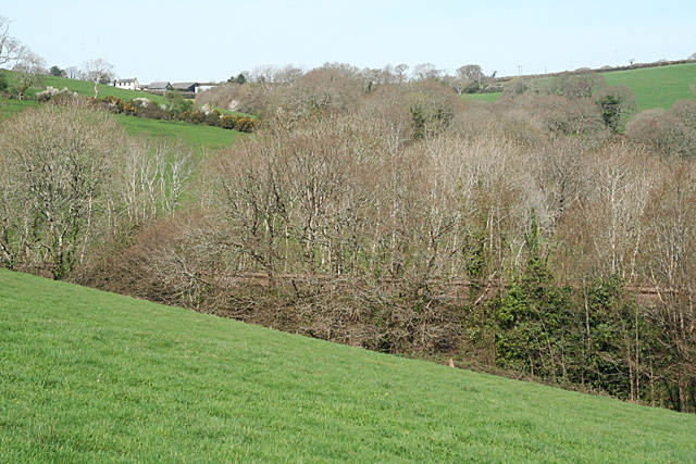
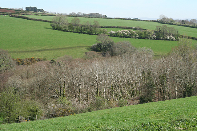
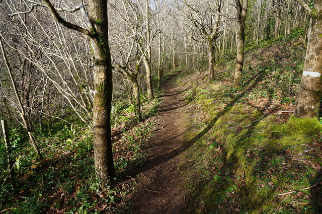
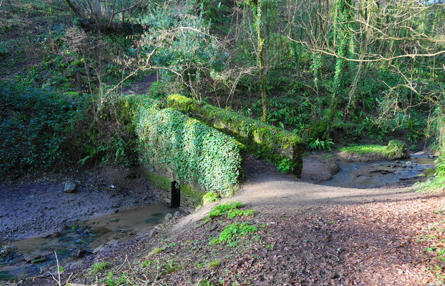
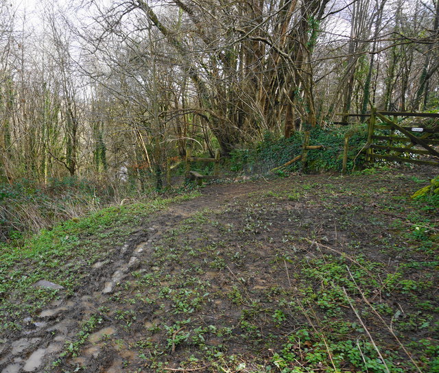
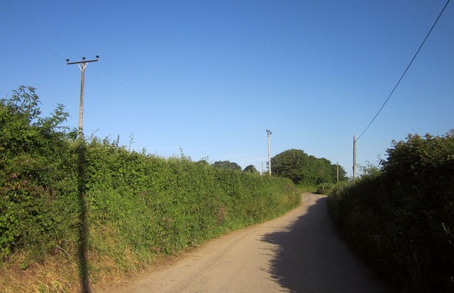
Marsh Coombe is a picturesque coastal area located in Cornwall, England. It is situated along the south-western coast, offering breathtaking views of the sea, estuary, and creek. The area is known for its natural beauty and tranquil atmosphere, making it a popular destination for nature lovers and outdoor enthusiasts.

The sea at Marsh Coombe is a prominent feature, with its crystal-clear waters and sandy beaches. Visitors can enjoy a variety of water activities such as swimming, surfing, and boating. The coastline is also dotted with rocky cliffs and dramatic headlands, providing stunning vistas and opportunities for coastal walks.

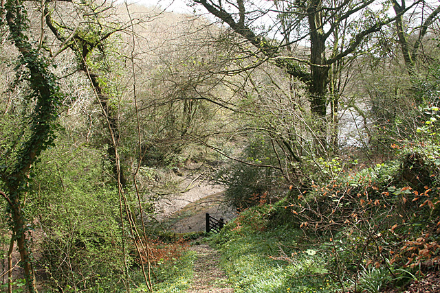
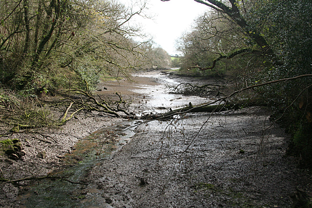
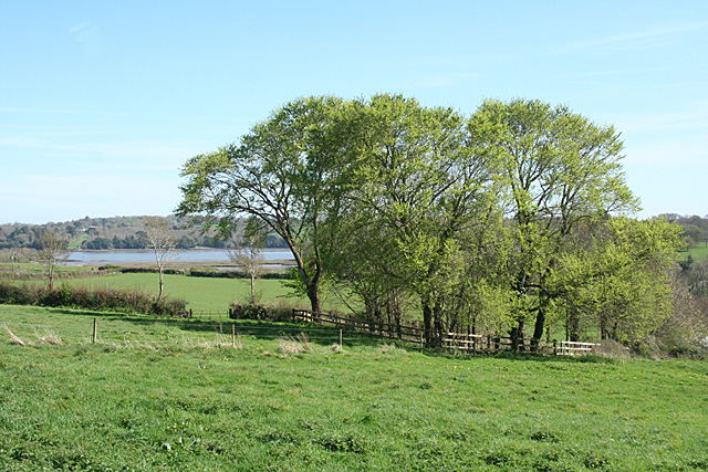
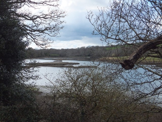
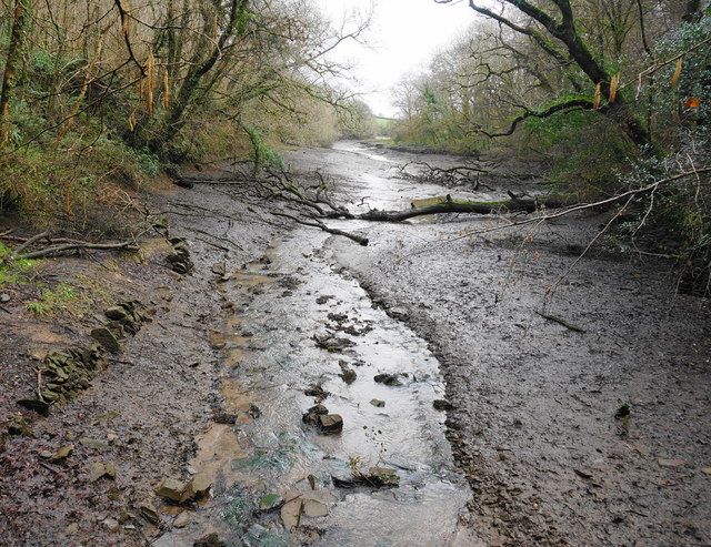
The estuary at Marsh Coombe is formed where a river meets the sea, creating a unique ecosystem that supports a diverse range of marine and birdlife. The estuary is a haven for birdwatchers, as it attracts various species of wading birds, gulls, and wildfowl. It is also a popular spot for fishing, with ample opportunities to catch sea bass, mackerel, and other local species.

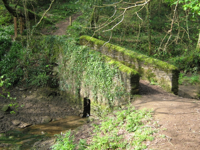
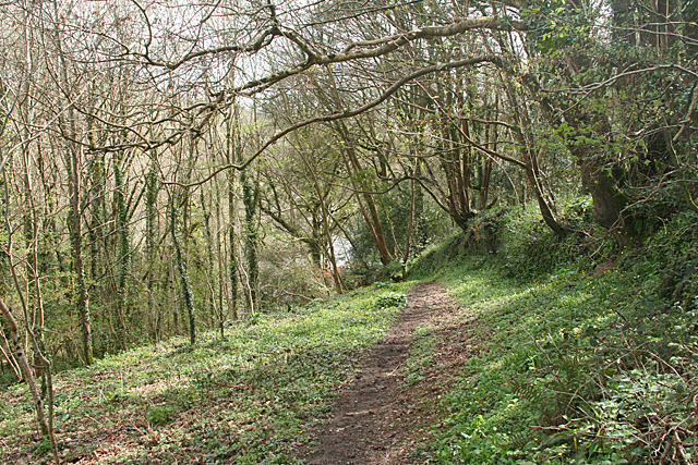
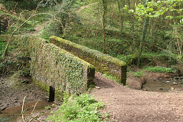
Nestled within the estuary is a picturesque creek, offering a peaceful retreat away from the bustling coastline. The creek is characterized by its calm waters and lush vegetation, creating an idyllic setting for boating, kayaking, and paddleboarding. The creek is also home to an abundance of wildlife, including otters, herons, and kingfishers, making it a haven for nature enthusiasts.

Overall, Marsh Coombe in Cornwall offers a unique blend of sea, estuary, and creek, providing a diverse range of natural attractions and recreational opportunities for visitors to enjoy.

If you have any feedback on the listing, please let us know in the comments section below.

Marsh Coombe Images

Images are sourced within 2km of 50.396554/-4.2307017 or Grid Reference SX4157. Thanks to Geograph Open Source API. All images are credited.

Footbridge at Wivelscombe This bridge lies on the footpath between Shillingham and Wivelscombe, that runs along the top of Wivelscombe creek.
Footbridge at Wivelscombe
This bridge lies on the footpath between Shillingham and Wivelscombe, that runs along the top of Wivelscombe creek.
Saltash: path from Elm Gate A public footpath leading to a creek, an arm of Wiveliscombe Lake. In Saltash parish
Saltash: path from Elm Gate
A public footpath leading to a creek, an arm of Wiveliscombe Lake. In Saltash parish
Saltash: nearing a creek Descending to an arm of Wiveliscombe Lake, in Saltash parish. Quite steep, but with steps cut in the public footpath
Saltash: nearing a creek
Descending to an arm of Wiveliscombe Lake, in Saltash parish. Quite steep, but with steps cut in the public footpath
Saltash: creek below railway An arm of Wiveliscombe Lake, by the edge of the Wiveliscombe estate. With the tide out
Saltash: creek below railway
An arm of Wiveliscombe Lake, by the edge of the Wiveliscombe estate. With the tide out
Saltash: bridge at head of creek Now used to carry a public footpath. The bridge stands at the normal tide limit, at the north west end of Wiveliscombe Lake, in Saltash parish
Saltash: bridge at head of creek
Now used to carry a public footpath. The bridge stands at the normal tide limit, at the north west end of Wiveliscombe Lake, in Saltash parish
Saltash: below Broadmoor The Great Western's 1908 deviation from Brunel's original Cornwall Railway route of 1859 crosses a wooded valley on a high embankment before entering a cutting to the west, on the approach to the 452-yard long Shillingham Tunnel, which was excavated through hard blue elvan rock. Looking up the valley towards Broadmoor; the embankment is partly shrouded by trees. In Saltash parish
Saltash: below Broadmoor
The Great Western's 1908 deviation from Brunel's original Cornwall Railway route of 1859 crosses a wooded valley on a high embankment before entering a cutting to the west, on the approach to the 452-yard long Shillingham Tunnel, which was excavated through hard blue elvan rock. Looking up the valley towards Broadmoor; the embankment is partly shrouded by trees. In Saltash parish
Saltash: towards the railway Looking down on the Plymouth-Penzance main line railway as it enters a cutting to the east of Shillingham Tunnel. The tree-lined route was opened in 1908, replacing the original Cornwall Railway which, opened in 1859, ran across creeks and salt marshes to the south. In Saltash parish
Saltash: towards the railway
Looking down on the Plymouth-Penzance main line railway as it enters a cutting to the east of Shillingham Tunnel. The tree-lined route was opened in 1908, replacing the original Cornwall Railway which, opened in 1859, ran across creeks and salt marshes to the south. In Saltash parish
Saltash: towards the Lynher With trees in new leaf and the grounds of Antony House in the distance, on the far side of the Lynher estuary, well beyond the square. In Saltash parish
Saltash: towards the Lynher
With trees in new leaf and the grounds of Antony House in the distance, on the far side of the Lynher estuary, well beyond the square. In Saltash parish
Inlet north of Ince This inlet on the north, and the St Germans River on the south and east, create a peninsula over one kilometre long
Inlet north of Ince
This inlet on the north, and the St Germans River on the south and east, create a peninsula over one kilometre long
Path through young woodland The trees here are mostly young Oak and Beech.
Path through young woodland
The trees here are mostly young Oak and Beech.
Small footbridge Notice how small the exit for the stream is under the bridge, in times of heavy rain the stream comes over the bank on this side of the bridge. The bridge is in a small steep sided valley at the head of one arm of Wivelscombe Lake on the path between Shillingford Manor and Elm Gate.
Small footbridge
Notice how small the exit for the stream is under the bridge, in times of heavy rain the stream comes over the bank on this side of the bridge. The bridge is in a small steep sided valley at the head of one arm of Wivelscombe Lake on the path between Shillingford Manor and Elm Gate.
Footpath to near Shillingham Manor Seen here just entering woodland above Wivelscombe Lake. Through the gate on right is private.
Footpath to near Shillingham Manor
Seen here just entering woodland above Wivelscombe Lake. Through the gate on right is private.
Part of Wivelscombe Lake Taken from the small bridge in a previous photo by me, looking up one arm of the tidal Wivelscombe Lake.
Part of Wivelscombe Lake
Taken from the small bridge in a previous photo by me, looking up one arm of the tidal Wivelscombe Lake.
Lane to Trematon Running between hedgebanks near Winstone Beacon.
Lane to Trematon
Running between hedgebanks near Winstone Beacon.
Field boundary near Trehan From the same point as <a href="https://www.geograph.org.uk/photo/4031811">SX3958 : Lane to Trematon</a>, looking to the right, with a bending hedge beginning to descend a valley towards Latchbrook.
Field boundary near Trehan
From the same point as SX3958 : Lane to Trematon, looking to the right, with a bending hedge beginning to descend a valley towards Latchbrook.
Viaduct at Saltash Carries the West of England Main Line over an inlet off the River Lynher
Viaduct at Saltash
Carries the West of England Main Line over an inlet off the River Lynher
Saltash Fire Station Saltash Fire Station, Callington Road, Saltash, Cornwall. This new station was built on the same site as the previous combined ambulance and fire station which dated from the Second World War.
Saltash Fire Station
Saltash Fire Station, Callington Road, Saltash, Cornwall. This new station was built on the same site as the previous combined ambulance and fire station which dated from the Second World War.
Barrage Balloon Mountings World War 2 Concrete Barrage Balloon Mountings, Point Field, Wearde, Saltash. The site now forms part of the Churchtown Farm Nature Reserve.
Barrage Balloon Mountings
World War 2 Concrete Barrage Balloon Mountings, Point Field, Wearde, Saltash. The site now forms part of the Churchtown Farm Nature Reserve.
Show me another place!

Marsh Coombe is located at Grid Ref: SX4157 (Lat: 50.396554, Lng: -4.2307017)

Unitary Authority: Cornwall

Police Authority: Devon and Cornwall

What 3 Words

///profiled.nozzle.stowing. Near Saltash, Cornwall

Related Wikis

Churchtown Farm

Churchtown Farm is a community nature reserve one mile south of Saltash, Cornwall, England. It is leased from Antony Estate and managed by Cornwall Wildlife...

Trematon Castle

Trematon Castle (Cornish: Kastel Tremen) is situated near Saltash in Cornwall, England, United Kingdom. It was the caput of the feudal barony of Trematon...

Antony Passage

Antony Passage is a hamlet in south-east Cornwall, England, UK. It stands beside the tidal section of the River Lynher (a tributary of the River Tamar...

Forder, Cornwall

Forder is a village near Saltash in Cornwall, England.Forder viaduct was formerly at Milepost 252.25, 1.25 miles (2.0 km) west of Saltash (50.395087°N...

Saltash Community School

Saltash Community School is a mixed 11 to 18 academy school established in its present form in 1965, in Saltash, Cornwall, England. The school was previously...

Trehan

Trehan is a hamlet near Saltash in Cornwall, England, United Kingdom. == References ==

Wearde

Wearde is a southeastern suburb of Saltash in Cornwall, England, UK. == References ==

Saltash United F.C.

Saltash United Football Club is an English football club based in Saltash, Cornwall. They currently play in the Western League Premier Division. Since...

Nearby Amenities

Located within 500m of 50.396554,-4.2307017
Source: PGS
Lat/Long: 50.393471/-4.2332244
Source: PGS
Lat/Long: 50.3934915/-4.2330547
Source: PGS
Lat/Long: 50.3935224/-4.2329983
Source: PGS
Lat/Long: 50.3936129/-4.2329075
Source: PGS
Lat/Long: 50.3941706/-4.2325814
Source: PGS
Lat/Long: 50.3944169/-4.2320128
Source: PGS
Lat/Long: 50.3947028/-4.2320326
Source: PGS
Lat/Long: 50.3949726/-4.2325061
Source: PGS
Lat/Long: 50.3951881/-4.2327198
Source: PGS
Lat/Long: 50.3954799/-4.2330938
Source: PGS
Lat/Long: 50.3959622/-4.2323802
Source: PGS
Lat/Long: 50.396125/-4.2323207
Source: PGS
Lat/Long: 50.3970627/-4.2334357
Source: PGS
Lat/Long: 50.3996137/-4.2335255
Source: PGS
Lat/Long: 50.3999133/-4.2334392
Source: PGS
Lat/Long: 50.4002388/-4.2338033
Source: PGS
Lat/Long: 50.4007011/-4.2332557
Source: PGS
Lat/Long: 50.4004663/-4.2331102
Source: PGS
Lat/Long: 50.4001656/-4.2329191
Source: PGS
Lat/Long: 50.3984201/-4.2330159
Source: PGS
Lat/Long: 50.3979748/-4.23259
Source: PGS
Lat/Long: 50.3978288/-4.2325705
Source: PGS
Lat/Long: 50.3976565/-4.2326846
Source: PGS
Lat/Long: 50.3974757/-4.2327075
Source: PGS
Lat/Long: 50.397142/-4.2322102
Source: PGS
Lat/Long: 50.3970142/-4.2317413
Source: PGS
Lat/Long: 50.3969252/-4.2301856
Source: PGS
Lat/Long: 50.3964204/-4.2298589
Source: PGS
Lat/Long: 50.3963443/-4.2301054
Source: PGS
Lat/Long: 50.3961858/-4.230515
Source: PGS
Lat/Long: 50.3958746/-4.2304778
Source: PGS
Lat/Long: 50.3955594/-4.230029
Source: PGS
Lat/Long: 50.3953624/-4.2295703
Source: PGS
Lat/Long: 50.3950318/-4.2296304
Source: PGS
Lat/Long: 50.394746/-4.2298017
Source: PGS
Lat/Long: 50.3942267/-4.2302334
Source: PGS
Lat/Long: 50.3941286/-4.230081
Source: PGS
Lat/Long: 50.3937735/-4.2299632
Source: PGS
Lat/Long: 50.3935195/-4.2297982
Source: PGS
Lat/Long: 50.3935418/-4.2289635
Source: PGS
Lat/Long: 50.3933619/-4.2287512
Source: PGS
Lat/Long: 50.3934478/-4.228012
Source: PGS
Lat/Long: 50.3935349/-4.2265879
Source: PGS
Lat/Long: 50.3937831/-4.2256117
Source: PGS
Lat/Long: 50.394357/-4.225194
Source: PGS
Lat/Long: 50.3949152/-4.2254018
Source: PGS
Lat/Long: 50.3949945/-4.2258175
Source: PGS
Lat/Long: 50.39645/-4.2253662
Source: PGS
Lat/Long: 50.396519/-4.224424
Source: PGS
Lat/Long: 50.3966184/-4.2238326
Antony Passage
Name En: Antony Passage
Name Kw: Trethanton
Place: hamlet
Wikidata: Q4777242
Lat/Long: 50.3943366/-4.2330419
Forder Lake
Place: locality
Lat/Long: 50.3964922/-4.2318671
Source: PGS
Lat/Long: 50.3931272/-4.2267062
Source: PGS
Lat/Long: 50.3932086/-4.228125
Source: PGS
Lat/Long: 50.3933616/-4.2290178
Source: PGS
Lat/Long: 50.3934585/-4.2281859
Source: PGS
Lat/Long: 50.3936663/-4.2294976
Source: PGS
Lat/Long: 50.3938559/-4.2260589
Source: PGS
Lat/Long: 50.3943737/-4.2256547
Churchtown Farm Community Nature Reserve
Place: locality
Lat/Long: 50.3989532/-4.2294487
Source: PGS
Lat/Long: 50.3976066/-4.2323522
Source: PGS
Lat/Long: 50.3979748/-4.23259
Source: PGS
Lat/Long: 50.3979748/-4.23259
Source: PGS
Lat/Long: 50.3977487/-4.2320383
Source: PGS
Lat/Long: 50.3976785/-4.2323636
Bench
Backrest: yes
Survey Date: 2022-03-20
Lat/Long: 50.3940123/-4.2284349
Waste Basket
Survey Date: 2022-03-20
Lat/Long: 50.3984287/-4.2248827
Barrier: bollard
Lat/Long: 50.3973238/-4.2261462
Barrier: stile
Lat/Long: 50.3977537/-4.2257642
Fire Hydrant
Emergency: fire_hydrant
Fire Hydrant Type: underground
Survey Date: 2022-04-03
Lat/Long: 50.3951485/-4.2328583
Post Box
Collection Times: Mo-Fr 10:15; Sa 09:30
Post Box Type: lamp
Ref: PL12 549
Royal Cypher: EIIR
Royal Cypher Wikidata: Q33102113
Survey Date: 2022-04-03
Lat/Long: 50.3944703/-4.2320565
Fire Hydrant
Emergency: fire_hydrant
Fire Hydrant Type: underground
Survey Date: 2022-04-03
Lat/Long: 50.3991389/-4.2343708
Fire Hydrant
Emergency: fire_hydrant
Fire Hydrant Type: underground
Survey Date: 2022-04-03
Lat/Long: 50.3965533/-4.2355948
Fire Hydrant
Emergency: fire_hydrant
Fire Hydrant Type: underground
Survey Date: 2022-04-03
Lat/Long: 50.3942031/-4.2327095
Sand Acre Bay
Place: locality
Lat/Long: 50.3957445/-4.2249689
Point Field
Place: locality
Lat/Long: 50.3945123/-4.2279005
The data included in this document is from www.openstreetmap.org. The data is made available under ODbL.

Have you been to Marsh Coombe?

Leave your review of Marsh Coombe below (or comments, questions and feedback).