West Tamana
Sea, Estuary, Creek in Ross-shire
Scotland
West Tamana

West Tamana is a picturesque coastal area located in Ross-shire, Scotland. Situated along the eastern coast of the North Sea, it offers a unique blend of natural beauty and tranquility. The area is renowned for its stunning sea views, estuary, and creek, which add to its charm and allure.
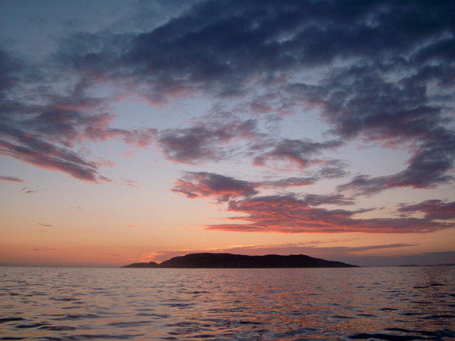
The sea at West Tamana is a captivating sight, with its deep blue hues and rhythmic waves crashing against the rugged shoreline. It provides an ideal setting for various water activities such as sailing, kayaking, and fishing. The coastal landscape boasts dramatic cliffs and stretches of golden sandy beaches, offering a perfect retreat for beach lovers and nature enthusiasts.
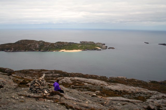
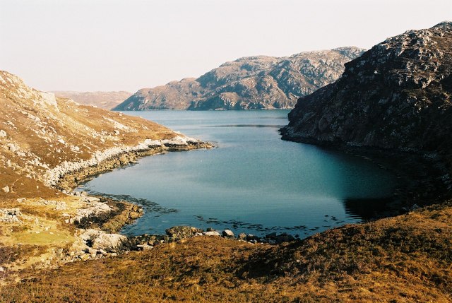
The estuary at West Tamana is formed by the convergence of a river and the sea, creating a distinctive ecosystem that supports a rich diversity of flora and fauna. The estuary is home to numerous species of birds, including wading birds such as herons and curlews, making it a popular spot for birdwatching. The tranquil waters of the estuary also attract a variety of marine life, including seals and dolphins, providing a delightful experience for wildlife enthusiasts.
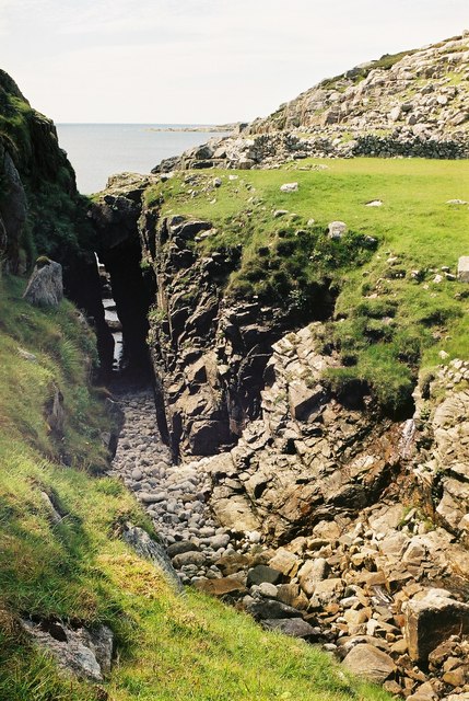
Nestled within this coastal haven is a charming creek, meandering through the landscape and offering a peaceful escape from the hustle and bustle of everyday life. The creek provides an idyllic spot for leisurely walks and picnics, with its serene surroundings and gentle babbling sounds of water.
In summary, West Tamana in Ross-shire presents a stunning combination of a breathtaking sea, a thriving estuary, and a tranquil creek. Its natural beauty and diverse wildlife make it a haven for nature lovers and a perfect destination for those seeking solace amidst the beauty of the Scottish coastline.
If you have any feedback on the listing, please let us know in the comments section below.
West Tamana Images
Images are sourced within 2km of 58.067719/-7.0882684 or Grid Reference NB0020. Thanks to Geograph Open Source API. All images are credited.


West Tamana is located at Grid Ref: NB0020 (Lat: 58.067719, Lng: -7.0882684)
Unitary Authority: Na h-Eileanan an Iar
Police Authority: Highlands and Islands
What 3 Words
///momentous.behave.gracing. Near Tarbert, Na h-Eileanan Siar
Nearby Locations
Related Wikis

Eilean Mhealasta
Eilean Mhealasta (Mealista Island) is an uninhabited island off the west coast of Lewis in the Outer Hebrides of Scotland. It takes its name from Mealista...

Mealista
Mealista (Scottish Gaelic: Mealasta) was a township in the west of the Isle of Lewis. It is currently largely uninhabited due to the Highland Clearances...

Game pieces of the Lewis chessmen hoard
Game pieces of the Lewis chessmen hoard include the ninety-three game pieces of the Lewis chessmen hoard found on the Isle of Lewis in the Outer Hebrides...

Scarp, Scotland
Scarp (Scottish Gaelic: An Sgarp) is an uninhabited island in the Outer Hebrides of Scotland, west of Hushinish on Harris. Once inhabited, the island was...
Nearby Amenities
Located within 500m of 58.067719,-7.0882684Have you been to West Tamana?
Leave your review of West Tamana below (or comments, questions and feedback).