Boatsroom Voe

Sea, Estuary, Creek in Shetland

Scotland

Boatsroom Voe

Gateway at Lunna This gateway presumably once served Lunna House on the hillside to the north. On either side of the gate opening are what look like step=stiles, or maybe a series of mounting blocks for horse riders.
Gateway at Lunna Credit: Oliver Dixon

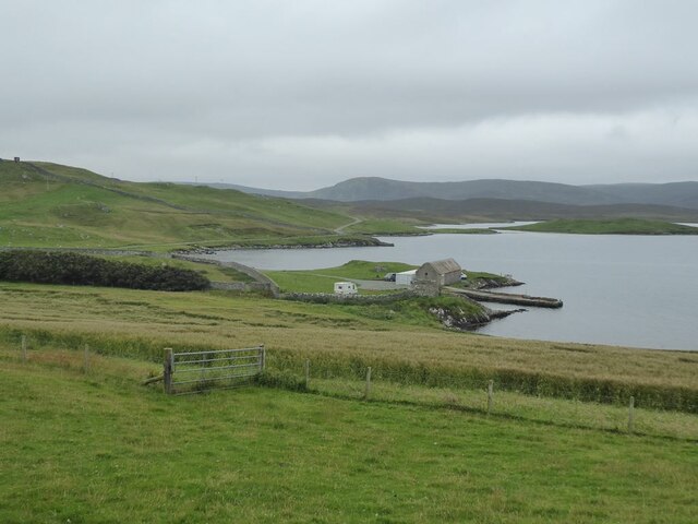
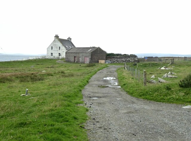
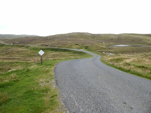
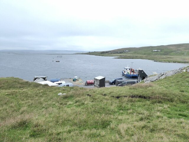
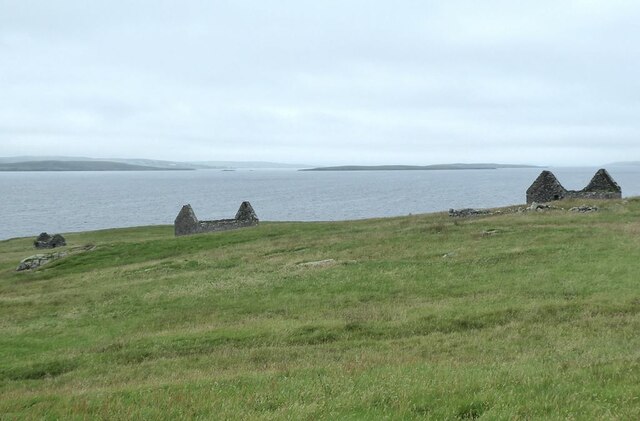
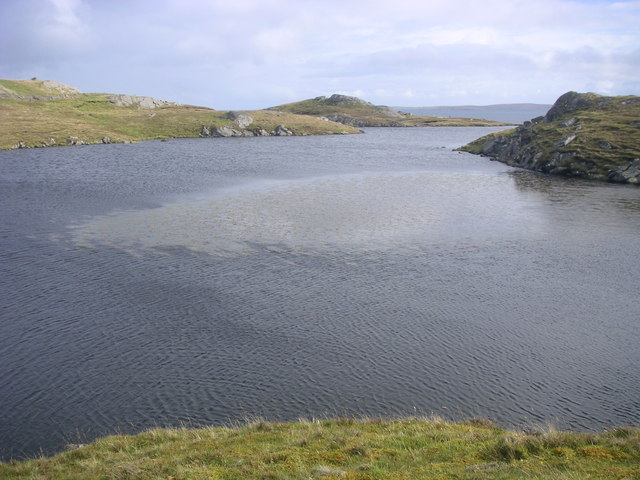
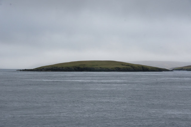
Boatsroom Voe is a picturesque inlet located in the Shetland Islands, off the north coast of Scotland. This natural harbor is nestled between rugged cliffs and rolling hills, offering breathtaking views of the surrounding landscape. It is situated on the east coast of Shetland's mainland, approximately 13 miles northeast of the town of Lerwick.

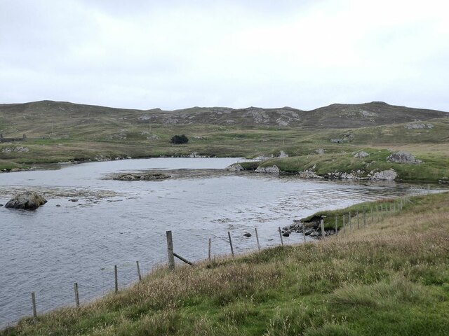
The Voe, which is the Shetland word for an inlet or a narrow sea channel, is fed by both freshwater streams and the North Sea. The combination of these two water sources creates a unique ecosystem in Boatsroom Voe, supporting a diverse range of marine life. It is home to a variety of fish species, including cod, haddock, and mackerel, making it a popular spot for fishing enthusiasts.

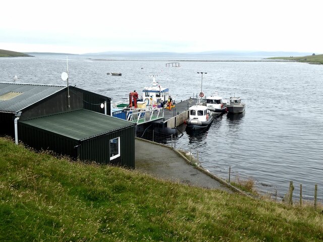
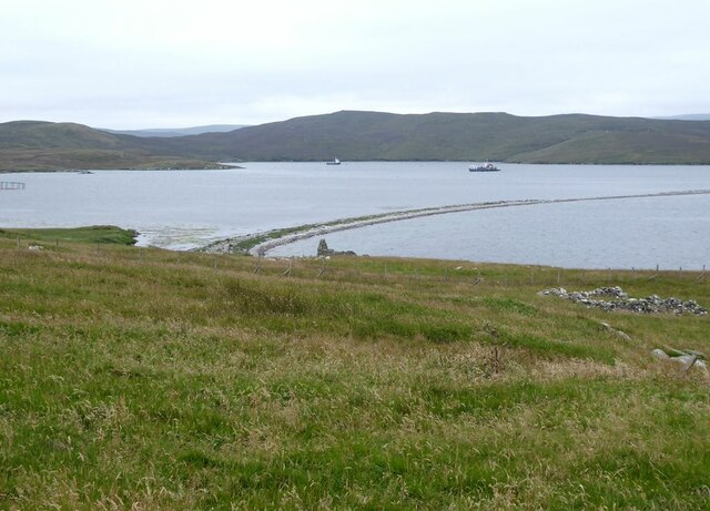
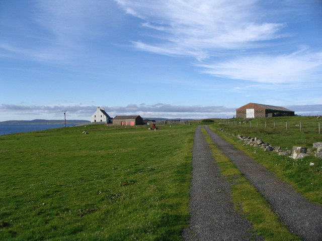
The sheltered nature of this inlet also makes it an ideal location for boating and sailing. Its calm waters provide a safe haven for small boats, and there is a small boatyard nearby where vessels can be repaired or maintained.

The surrounding area of Boatsroom Voe is rich in natural beauty, with rolling green hills and cliffs that offer stunning panoramic views. The inlet itself is flanked by grassy shores, which are often dotted with wildflowers during the summer months. It is a tranquil and serene spot, perfect for those seeking a peaceful escape from the hustle and bustle of everyday life.

Boatsroom Voe is a hidden gem in the Shetland Islands, offering visitors a chance to immerse themselves in the raw beauty of nature and experience the rich maritime heritage of the region.

If you have any feedback on the listing, please let us know in the comments section below.

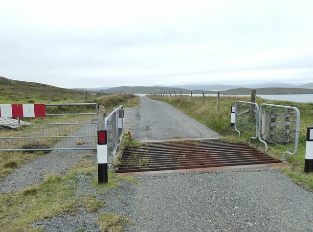
Boatsroom Voe Images

Images are sourced within 2km of 60.419794/-1.1061261 or Grid Reference HU4970. Thanks to Geograph Open Source API. All images are credited.

Gateway at Lunna This gateway presumably once served Lunna House on the hillside to the north. On either side of the gate opening are what look like step=stiles, or maybe a series of mounting blocks for horse riders.
Gateway at Lunna
This gateway presumably once served Lunna House on the hillside to the north. On either side of the gate opening are what look like step=stiles, or maybe a series of mounting blocks for horse riders.
Lunna House With an old driveway leading down to the gateway seen in <a href="https://www.geograph.org.uk/photo/7270642">HU4869 : Gateway at Lunna</a>.
Lunna House
With an old driveway leading down to the gateway seen in HU4869 : Gateway at Lunna.
West Lunna Voe With the island of Pund <a href="https://www.geograph.org.uk/gridref/HU4769">HU4769</a> in the middle distance.
West Lunna Voe
With the island of Pund HU4769 in the middle distance.
Livestock pen on the slopes of the Ward of Loomishun
Cattle grid on the Lunnasting road.
Stile on Lunna Ness
Stile on Lunna Ness
Outrabister End of the road along the Lunnasting peninsula.
Outrabister
End of the road along the Lunnasting peninsula.
Moorland road at Mara Field
Fish farm jetty in the Vadills
Fish farm jetty in the Vadills A long spit extends out into Boatsroom Voe in the distance.
Fish farm jetty in the Vadills
A long spit extends out into Boatsroom Voe in the distance.
The Vadills Inner bay at the head of Boatsroom Voe.
The Vadills
Inner bay at the head of Boatsroom Voe.
The Ayre of Hamnavoe Long shingle spit which separates Boatsroom Voe (to the left) from Hamna Voe which is open to the sea.
The Ayre of Hamnavoe
Long shingle spit which separates Boatsroom Voe (to the left) from Hamna Voe which is open to the sea.
Three ruins at Heog Overlooking Hamna Voe. The island of Fish Holm <a href="https://www.geograph.org.uk/gridref/HU4774">HU4774</a> out to sea.
Three ruins at Heog
Overlooking Hamna Voe. The island of Fish Holm HU4774 out to sea.
Footpath to the Stones of Stofast The stones lie on the far side of the hill (see <a href="https://www.geograph.org.uk/photo/3927689">HU5071 : The Stones of Stofast above Loch Stofast</a>).
Footpath to the Stones of Stofast
The stones lie on the far side of the hill (see HU5071 : The Stones of Stofast above Loch Stofast).
Augen Gneiss in Grutwick Quarry This extraordinary rock is augen gneiss - 'Auge' is German for 'eye' and refers to the round white feldspars in the black rock.
Augen Gneiss in Grutwick Quarry
This extraordinary rock is augen gneiss - 'Auge' is German for 'eye' and refers to the round white feldspars in the black rock.
Mill Loch, Lunna Ness This is one of a group of three lochans to the west of Grutwick. They are surrounded by the rocky hills which make up the spine of this peninsula,
Mill Loch, Lunna Ness
This is one of a group of three lochans to the west of Grutwick. They are surrounded by the rocky hills which make up the spine of this peninsula,
Outrabister House
Outrabister House
Loch of Grutwick View SE with the island of Whalsay in the distance.
Loch of Grutwick
View SE with the island of Whalsay in the distance.
Show me another place!

Boatsroom Voe is located at Grid Ref: HU4970 (Lat: 60.419794, Lng: -1.1061261)

Unitary Authority: Shetland Islands

Police Authority: Highlands and Islands

What 3 Words

///monk.baguette.peachy. Near Vidlin, Shetland Islands

Related Wikis

Lunna Ness

Lunna Ness is a peninsula in the north east of Mainland, Shetland, Scotland , in the parish of Lunnasting near Vidlin. The island of Lunna Holm is nearby...
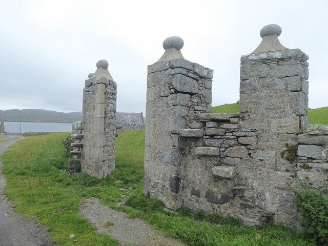
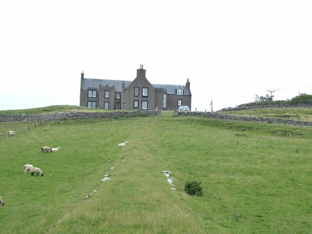
Lunna House

Lunna House is a 17th-century laird's house on Lunna Ness in the Shetland Islands. Lunna House is noted for having "the best historic designed landscape...

Linga, Yell Sound

Linga is one of the Shetland Islands, in Yell Sound. == Geography and geology == Linga is an extremely common name in Shetland, meaning heather island...

Fish Holm

Fish Holm is a small island, 1.5 miles (2.4 km) east of Mainland, Shetland. It is near the village of Mossbank. It is 20 metres (66 ft) at its highest...

Nearby Amenities

Located within 500m of 60.419794,-1.1061261
Barrier: cattle_grid
Lat/Long: 60.4173173/-1.1012428
Boatsroom Voe
Natural: bay
Lat/Long: 60.4208703/-1.1062288
Power: pole
Lat/Long: 60.4167299/-1.0995992
Power: pole
Lat/Long: 60.4173475/-1.1007523
Power: pole
Lat/Long: 60.4177657/-1.1015235
The data included in this document is from www.openstreetmap.org. The data is made available under ODbL.

Have you been to Boatsroom Voe?

Leave your review of Boatsroom Voe below (or comments, questions and feedback).