Swining Voe

Sea, Estuary, Creek in Shetland

Scotland

Swining Voe

Mouth of Vidlin Voe
Mouth of Vidlin Voe Credit: Oliver Dixon

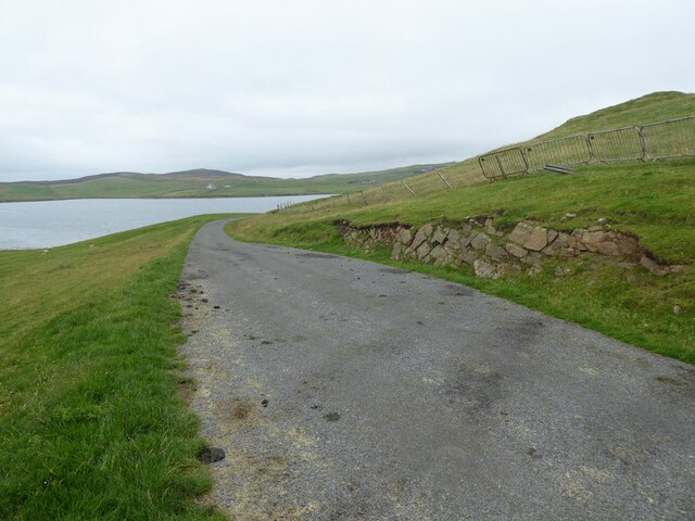
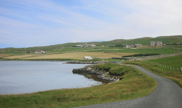
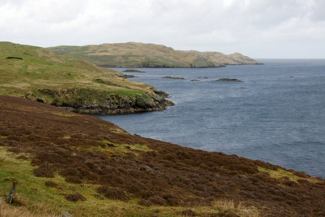
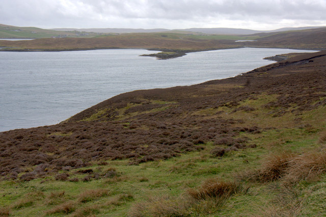
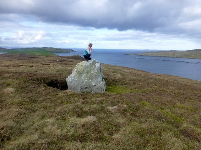
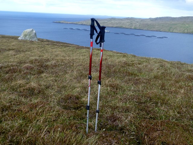
Swining Voe is a picturesque sea inlet located in the Shetland Isles, Scotland. It stretches approximately 1.5 kilometers inland, forming an estuary and creek that is surrounded by stunning natural beauty. Positioned on the eastern coast of the mainland, it is nestled between the villages of Virkie and Gulberwick.

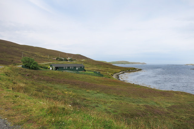
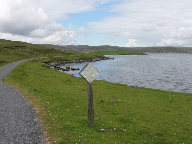
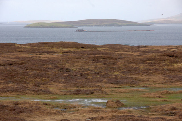
The Voe is characterized by its calm waters, making it an ideal spot for a variety of water-based activities. Boating enthusiasts can navigate the tranquil sea, while kayakers and paddleboarders can explore the peaceful estuary. The Voe is also renowned for its rich marine life, attracting fishermen and wildlife enthusiasts alike.

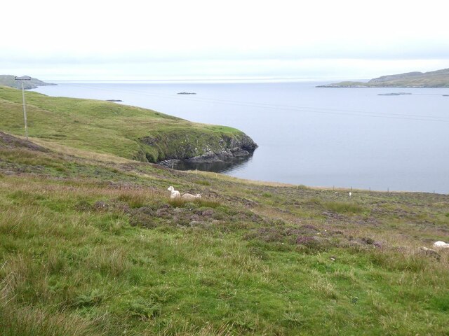
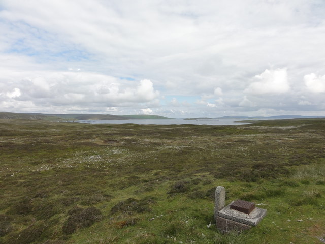
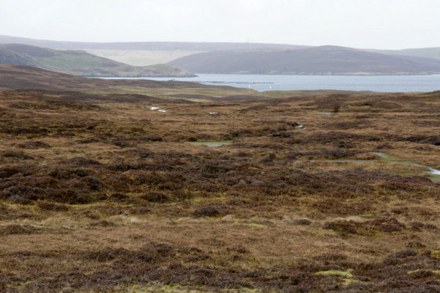
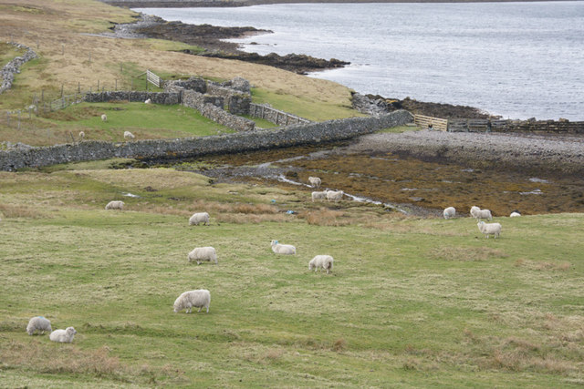
The surrounding landscape of Swining Voe is a treat for nature lovers. Rolling green hills dotted with sheep provide a picturesque backdrop, while wildflowers and shrubs add a touch of color. The area is a haven for birdwatchers, as numerous seabirds, waders, and waterfowl can be spotted along the shore.

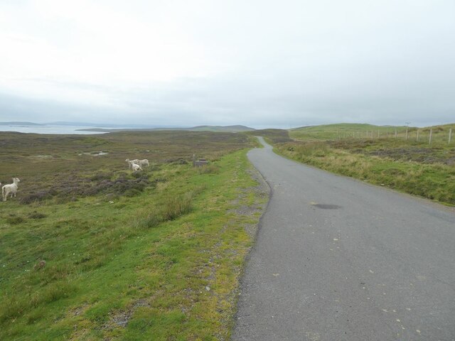
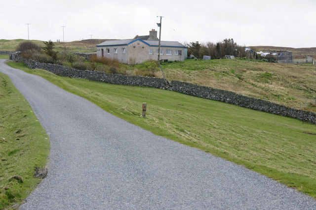
Access to Swining Voe is relatively easy, with a small car park available for visitors. A short walk from the car park leads to the shoreline, where visitors can enjoy stunning panoramic views of the Voe and its surroundings. The area is also well-served by public transportation, allowing easy exploration for those without private vehicles.

Swining Voe is a hidden gem in the Shetland Isles, offering a tranquil escape in a beautiful natural setting. Whether it's enjoying water activities, birdwatching, or simply taking in the peaceful atmosphere, this sea inlet provides a serene retreat for visitors of all interests.

If you have any feedback on the listing, please let us know in the comments section below.

Swining Voe Images

Images are sourced within 2km of 60.398291/-1.1602686 or Grid Reference HU4668. Thanks to Geograph Open Source API. All images are credited.

Mouth of Vidlin Voe
Mouth of Vidlin Voe
The road to Lunna
The road to Lunna
The road to Lunna West Lunna Voe in the distance.
The road to Lunna
West Lunna Voe in the distance.
Grunna Voe
Grunna Voe
Approaching Lunna Marine view from the road south of Lunna.
Approaching Lunna
Marine view from the road south of Lunna.
West Lunna Voe
West Lunna Voe
Road to Luna View across moorland on the road to Luna.
Road to Luna
View across moorland on the road to Luna.
Hunter's Monument View of Hunter's Monument
Hunter's Monument
View of Hunter's Monument
West Luna Voe A rather 'pot shot' damaged warning sign against the banks of West Luna Voe
West Luna Voe
A rather 'pot shot' damaged warning sign against the banks of West Luna Voe
Coastline on the west shore of Vidlin Voe Looking north past an apparently un-named geo towards Lunna Ness.
Coastline on the west shore of Vidlin Voe
Looking north past an apparently un-named geo towards Lunna Ness.
Coastline on the west shore of Vidlin Voe Looking south towards Grunna Voe.
Coastline on the west shore of Vidlin Voe
Looking south towards Grunna Voe.
 Moorland between Vidlin and Lunna Looking towards Cut Ness.
Moorland between Vidlin and Lunna
Looking towards Cut Ness.
Moorland between Vidlin and Lunna Looking towards Skeo Ness at Lunna.
Moorland between Vidlin and Lunna
Looking towards Skeo Ness at Lunna.
Sheep above the shoreline near West Lunna Voe
House above West Lunna Voe
Hunter's Monument The Hunters were long the main family at Lunna. They lived at <a href="https://www.geograph.org.uk/photo/2692933">HU4869 : Lunna House</a> and had <a href="https://www.geograph.org.uk/photo/2692901">HU4869 : Lunna Kirk</a> constructed, as well as this monument atop the local hill. In the foreground can be seen a few of the gravestones in the kirkyard.
Hunter's Monument
The Hunters were long the main family at Lunna. They lived at HU4869 : Lunna House and had HU4869 : Lunna Kirk constructed, as well as this monument atop the local hill. In the foreground can be seen a few of the gravestones in the kirkyard.
Richard Speirs On Boulder Richard Speirs on an erratic boulder with a view near the moorland summit of South Hill of Lunna.
Richard Speirs On Boulder
Richard Speirs on an erratic boulder with a view near the moorland summit of South Hill of Lunna.
South Hill of Lunna Bagged with Tricky Speirs after parking near the quarry with the "Beware Squirrel Crossing".
Name: South Hill of Lunna
Hill number: 103956
Height: 86m / 282ft
Area: 22: Shetland Islands
Class: 0
Grid ref: HU472673 (est)
Drop: 35m
Col: 51m
South Hill of Lunna
Bagged with Tricky Speirs after parking near the quarry with the "Beware Squirrel Crossing". Name: South Hill of Lunna Hill number: 103956 Height: 86m / 282ft Area: 22: Shetland Islands Class: 0 Grid ref: HU472673 (est) Drop: 35m Col: 51m
Show me another place!

Swining Voe is located at Grid Ref: HU4668 (Lat: 60.398291, Lng: -1.1602686)

Unitary Authority: Shetland Islands

Police Authority: Highlands and Islands

What 3 Words

///gentle.eventful.tensions. Near Vidlin, Shetland Islands

Related Wikis

Lunna House

Lunna House is a 17th-century laird's house on Lunna Ness in the Shetland Islands. Lunna House is noted for having "the best historic designed landscape...

Vidlin

Vidlin (from Old Norse: VaĆ°ill meaning a ford) is a small village located on Mainland, Shetland, Scotland. The settlement is within the parish of Nesting...

Linga, Yell Sound

Linga is one of the Shetland Islands, in Yell Sound. == Geography and geology == Linga is an extremely common name in Shetland, meaning heather island...

Lunna Ness

Lunna Ness is a peninsula in the north east of Mainland, Shetland, Scotland , in the parish of Lunnasting near Vidlin. The island of Lunna Holm is nearby...

Have you been to Swining Voe?

Leave your review of Swining Voe below (or comments, questions and feedback).