Easter Tammy's Hole

Sea, Estuary, Creek in Shetland

Scotland

Easter Tammy's Hole

Dale of Lumbister
Dale of Lumbister Credit: Mike Pennington

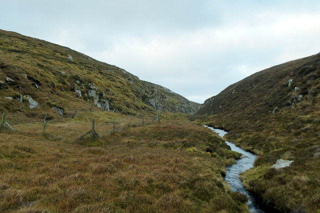
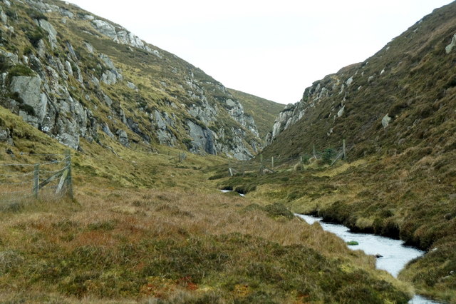
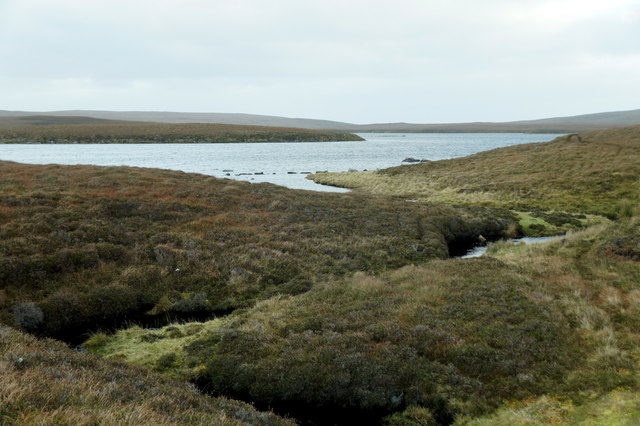
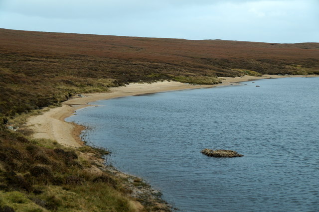
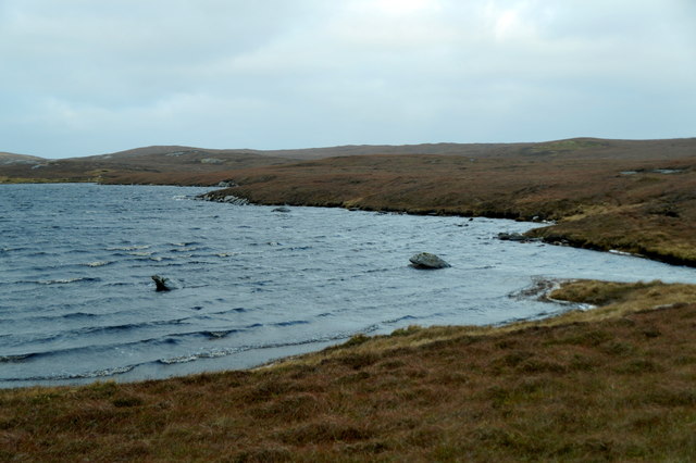
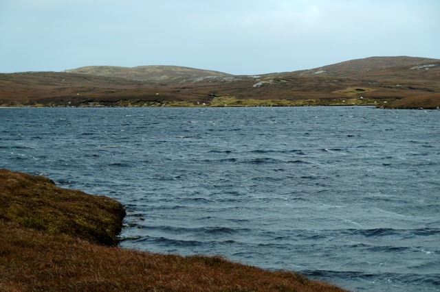
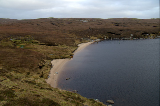
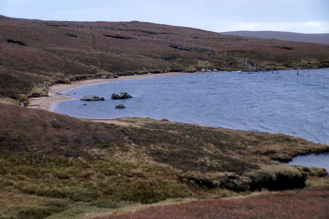
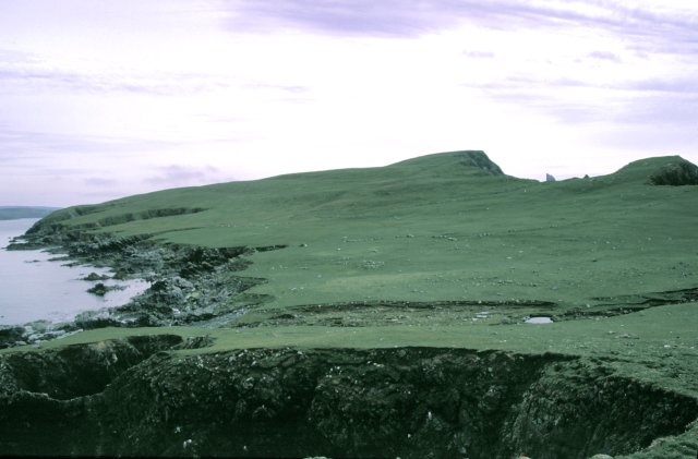
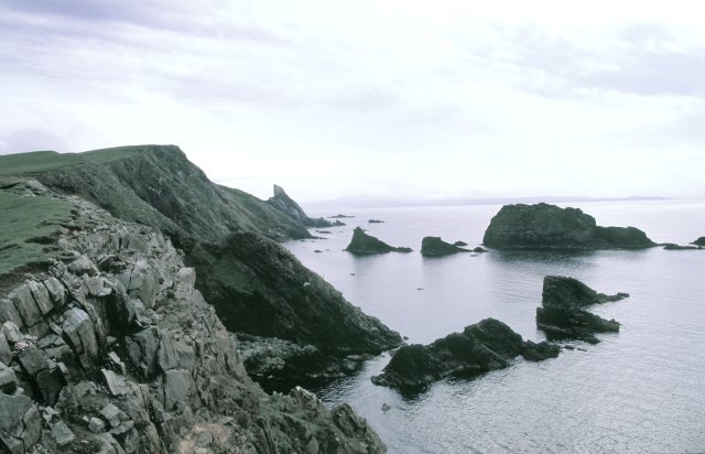
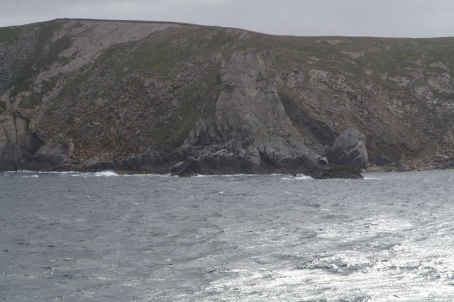
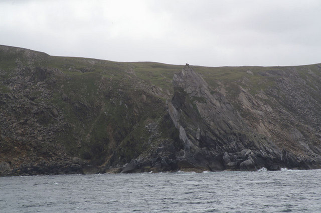
Easter Tammy's Hole is a small coastal feature located in Shetland, an archipelago in Scotland. Situated on the eastern side of the main island, it is a significant sea, estuary, and creek formation that has both historical and ecological importance.

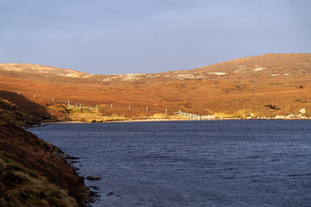
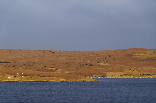
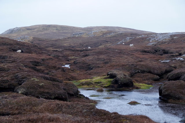
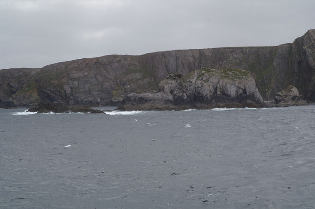
This coastal feature is characterized by a sheltered bay, formed by the convergence of the North Sea and a local creek. The estuary created by the creek provides a haven for a diverse range of marine life, including various fish species and seabirds. The rocky shoreline and surrounding cliffs add to the scenic beauty and make it an attractive spot for visitors and nature enthusiasts.

Easter Tammy's Hole has a rich history, dating back to ancient times. It is believed to have been a landing place for Viking settlers who arrived in Shetland around the 8th century. The location was strategically important for both fishing and trading activities, serving as a key hub for the local economy.

Today, Easter Tammy's Hole continues to be an important site for fishing, particularly for crab and lobster. The local community relies on the resources provided by the sea and estuary for their livelihoods. Additionally, the area is a popular destination for recreational activities such as boating, birdwatching, and coastal walks.

Overall, Easter Tammy's Hole in Shetland is a picturesque coastal feature that combines historical significance with ecological importance.

If you have any feedback on the listing, please let us know in the comments section below.

Easter Tammy's Hole Images

Images are sourced within 2km of 60.655973/-1.1544316 or Grid Reference HU4697. Thanks to Geograph Open Source API. All images are credited.

Dale of Lumbister
Dale of Lumbister
Dale of Lumbister
Dale of Lumbister
Burn of Lumbister leaving the southernmost of the Lochs of Lumbister
Sandy beach at the west end of the southernmost of the Lochs of Lumbister
The northernmost of the Lochs of Lumbister
Sandy beach on the northernmost of the Lochs of Lumbister
The wilds of Yell north of Lumbister A square with no named features.
The wilds of Yell north of Lumbister
A square with no named features.
The northernmost of the Lochs of Lumbister
Stacks of Stuis The coastline here is littered with loose stacks which provide plenty of nesting opportunities for the birds and resting spots for the seals.
Stacks of Stuis
The coastline here is littered with loose stacks which provide plenty of nesting opportunities for the birds and resting spots for the seals.
Stuis of Graveland This view is looking roughly south from the most northerly point on the headland.
Stuis of Graveland
This view is looking roughly south from the most northerly point on the headland.
Ern Stack A view from the landward side of Ern Stack looking towards the Ramna Stacks
Ern Stack
A view from the landward side of Ern Stack looking towards the Ramna Stacks
Coastline view towards Ern Stack A view along the western coastline of this square.  An image of the pasture in the easterly section of this grid square is available from grid HU4697 <a title="https://www.geograph.org.uk/photo/40051" href="https://www.geograph.org.uk/photo/40051">Link</a> .
Coastline view towards Ern Stack
A view along the western coastline of this square. An image of the pasture in the easterly section of this grid square is available from grid HU4697 Link .
Ern Stack from the sea The extraordinary pale colouration on the landward side is invisible from the sea. Taken from one of the Yell Sound ferries on a North Isles cruise.
Ern Stack from the sea
The extraordinary pale colouration on the landward side is invisible from the sea. Taken from one of the Yell Sound ferries on a North Isles cruise.
Ern Stack from the sea Erne is the old Shetland name for the White-tailed Eagle, and this was the site of one of the last nests of native British sea eagles, last used early in the 20th century. Taken from one of the Yell Sound ferries on a North Isles cruise.
Ern Stack from the sea
Erne is the old Shetland name for the White-tailed Eagle, and this was the site of one of the last nests of native British sea eagles, last used early in the 20th century. Taken from one of the Yell Sound ferries on a North Isles cruise.
Aastack With the north tip of the Graveland peninsula beyond. Taken from one of the Yell Sound ferries on a North Isles cruise.
Aastack
With the north tip of the Graveland peninsula beyond. Taken from one of the Yell Sound ferries on a North Isles cruise.
Show me another place!

Easter Tammy's Hole is located at Grid Ref: HU4697 (Lat: 60.655973, Lng: -1.1544316)

Unitary Authority: Shetland Islands

Police Authority: Highlands and Islands

What 3 Words

///truffles.living.tailwind. Near Gutcher, Shetland Islands

Related Wikis

Ern Stack

Ern Stack is a sea stack off Yell, in Shetland, Scotland. The word "ern" means an eagle (it is a cognate of, for example, Swedish "örn"), and it is said...

Yell, Shetland

Yell is one of the North Isles of Shetland, Scotland. In the 2011 census it had a usually resident population of 966. It is the second largest island in...

Basta, Shetland

Basta is a hamlet on the island of Yell in the Shetland islands of Scotland. It is on the shores of Basta Voe and is in the parish of Yell. == References... ==

Mid Yell

Mid Yell is a coastal settlement on the island of Yell, the second largest of Shetland Islands, Scotland. Mid Yell, the largest settlement on the island...

Nearby Amenities

Located within 500m of 60.655973,-1.1544316
Easter Tammy's Hole
Place: locality
Lat/Long: 60.6557466/-1.1537743
North Fiski Geo
Place: locality
Lat/Long: 60.6514985/-1.1547259
Moo Geo
Place: locality
Lat/Long: 60.6521939/-1.1539748
Gorsendi Geo
Place: locality
Lat/Long: 60.6532088/-1.154463
Stacks of Stuis
Place: locality
Lat/Long: 60.6572442/-1.1524299
Nev of Stuis
Place: locality
Lat/Long: 60.6570772/-1.1570862
Wester Tammy's Hole
Place: locality
Lat/Long: 60.6562465/-1.156936
The data included in this document is from www.openstreetmap.org. The data is made available under ODbL.

Have you been to Easter Tammy's Hole?

Leave your review of Easter Tammy's Hole below (or comments, questions and feedback).