South Cample

Sea, Estuary, Creek in Aberdeenshire

Scotland

South Cample

The derelict railway carriage at Cairnglass Farm
The derelict railway carriage at Cairnglass Farm Credit: Peter Aikman

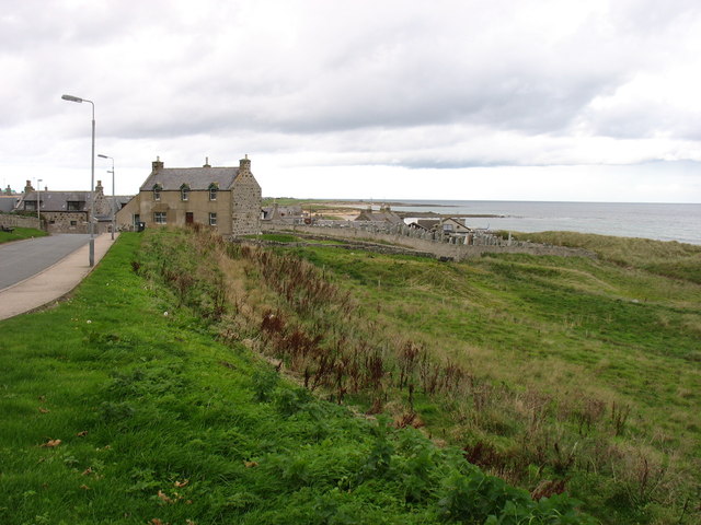
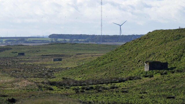
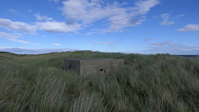
South Cample is a picturesque coastal village located in Aberdeenshire, Scotland. Situated on the eastern coast of the country, it is known for its stunning views of the North Sea and its proximity to an estuary and creek. The village is nestled between rolling hills and boasts a serene and tranquil atmosphere.

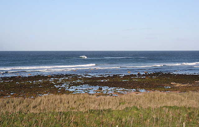
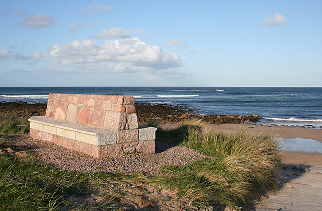
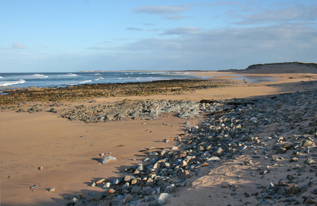
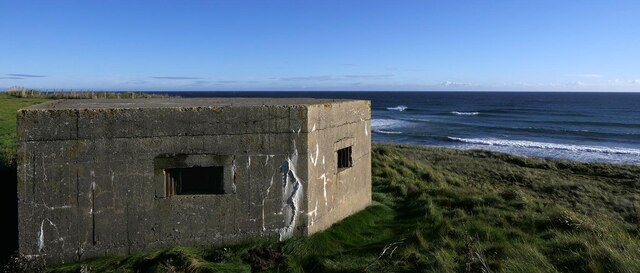
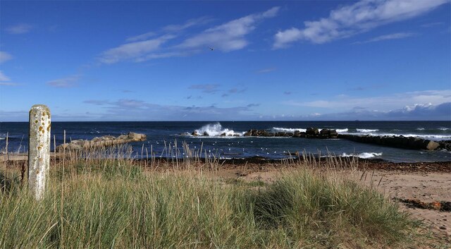
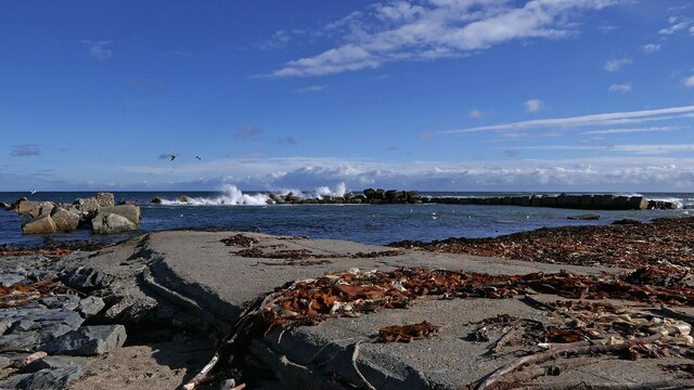
The village is characterized by its beautiful coastline, which stretches for miles along the North Sea. The sandy beaches offer a peaceful retreat for visitors, with the sound of crashing waves providing a soothing soundtrack. The sea itself is known for its rich marine life, making it a popular spot for fishing and wildlife enthusiasts.

Adjacent to the village is a serene estuary, where the river meets the sea. This estuary provides a unique ecosystem and serves as a habitat for various bird species, including wading birds and waterfowl. Birdwatchers flock to the area to observe these feathered inhabitants in their natural surroundings.

A small creek also flows through the village, adding to its charm. The creek is navigable at high tide and provides a tranquil setting for boating and other water activities. It is a popular spot for kayaking and paddleboarding, allowing visitors to explore the peaceful waters and admire the surrounding natural beauty.

South Cample is a hidden gem in Aberdeenshire, offering a combination of stunning coastal views, a diverse ecosystem, and a peaceful atmosphere. Whether one is seeking relaxation on the sandy beaches, observing wildlife in the estuary, or engaging in water activities in the creek, this village provides a serene escape from the hustle and bustle of everyday life.

If you have any feedback on the listing, please let us know in the comments section below.
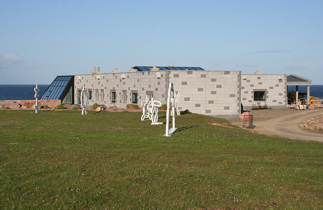
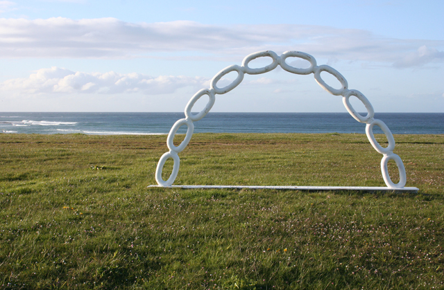
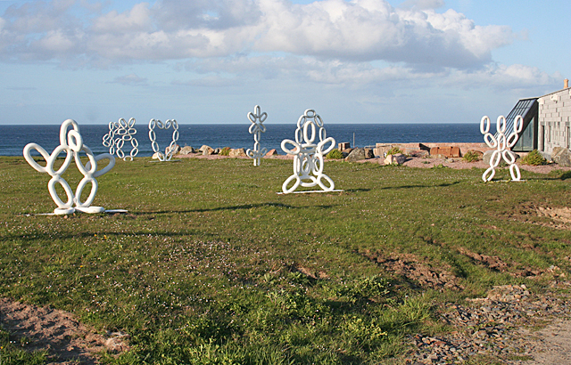
South Cample Images

Images are sourced within 2km of 57.652117/-1.896054 or Grid Reference NK0662. Thanks to Geograph Open Source API. All images are credited.

The derelict railway carriage at Cairnglass Farm
St Combs
St Combs
Field at Corsekelly The farm buildings are in the next square, but the foreground field is in this square.
Field at Corsekelly
The farm buildings are in the next square, but the foreground field is in this square.
Tufted Duck Hotel This is a very pleasant and, given its out-of-the-way location, surprisingly successful hotel. The building has been much improved since it was first built by the extension at the front. Compare with <a href="https://www.geograph.org.uk/photo/356901">NK0562 : Tufted Duck Hotel, St Combs</a>, taken eight years earlier.
Tufted Duck Hotel
This is a very pleasant and, given its out-of-the-way location, surprisingly successful hotel. The building has been much improved since it was first built by the extension at the front. Compare with NK0562 : Tufted Duck Hotel, St Combs, taken eight years earlier.
New House This building came as quite a surprise, and it isn't on the maps yet. On enquiring, I was informed that it is a private house, not yet completed. It certainly has a fine view to seaward.
New House
This building came as quite a surprise, and it isn't on the maps yet. On enquiring, I was informed that it is a private house, not yet completed. It certainly has a fine view to seaward.
Chain Arch This is one of a number of sculptures made out of links of chain and painted white standing on an area that used to have a bun in a hollow but has been filled in and levelled. See also <a href="https://www.geograph.org.uk/photo/4469272">NK0562 : Chain Sculptures</a>.
Chain Arch
This is one of a number of sculptures made out of links of chain and painted white standing on an area that used to have a bun in a hollow but has been filled in and levelled. See also NK0562 : Chain Sculptures.
Chain Sculptures I presume that these are some sort of environmental art. Amazing what can be done with some links of chain and a can or three of white paint. See also <a href="https://www.geograph.org.uk/photo/4469266">NK0562 : Chain Arch</a>.
Chain Sculptures
I presume that these are some sort of environmental art. Amazing what can be done with some links of chain and a can or three of white paint. See also NK0562 : Chain Arch.
North of Inzie Head A low rocky foreshore extends north from Inzie Head past St Combs.
North of Inzie Head
A low rocky foreshore extends north from Inzie Head past St Combs.
Bench with a View The bench is built of granite blocks so while it would be a wonderful place to sit and admire the view of Inzie Head and <a href="https://www.geograph.org.uk/photo/4469313">NK0662 : Beach at St Combs</a>, intending users would be well advised to take a cushion with them.
Bench with a View
The bench is built of granite blocks so while it would be a wonderful place to sit and admire the view of Inzie Head and NK0662 : Beach at St Combs, intending users would be well advised to take a cushion with them.
Beach at St Combs This is the north end of a sandy beach that stretches 17 kilometres (almost 11 miles) almost all the way to Peterhead, curving round to landward of <a href="https://www.geograph.org.uk/photo/195991">NK1157 : Rattray Head Lighthouse</a>.
Beach at St Combs
This is the north end of a sandy beach that stretches 17 kilometres (almost 11 miles) almost all the way to Peterhead, curving round to landward of NK1157 : Rattray Head Lighthouse.
Pallet Graveyard I have to admit that my first thought on spotting this was, "Firewood!" It would make enough kindling to keep me supplied for years.
Pallet Graveyard
I have to admit that my first thought on spotting this was, "Firewood!" It would make enough kindling to keep me supplied for years.
Builder's Yard? It looks as if the business here could be laying granite setts. There is a very fine example of such a path at the back of <a href="https://www.geograph.org.uk/photo/4469215">NK0562 : Tufted Duck Hotel</a>.
Builder's Yard?
It looks as if the business here could be laying granite setts. There is a very fine example of such a path at the back of NK0562 : Tufted Duck Hotel.
Pillbox, Inzie Head, Aberdeenshire The pillbox is one of five which overlooked an anti-tank ditch, most of which was a converted drainage ditch, running between Inzie Head and Loch of Strathbeg.
Pillbox, Inzie Head, Aberdeenshire
The pillbox is one of five which overlooked an anti-tank ditch, most of which was a converted drainage ditch, running between Inzie Head and Loch of Strathbeg.
Pillboxes below Gallow Hill, Aberdeenshire These pillboxes a part of a series of five which overlooked an anti-tank ditch, most of which was a converted drainage ditch, running between Inzie Head and Loch of Strathbeg.  As it didn't have the raised beach behind it, the anti-tank ditch in the vicinity of the two further pillboxes was supplemented by mine fields.
Pillboxes below Gallow Hill, Aberdeenshire
These pillboxes a part of a series of five which overlooked an anti-tank ditch, most of which was a converted drainage ditch, running between Inzie Head and Loch of Strathbeg. As it didn't have the raised beach behind it, the anti-tank ditch in the vicinity of the two further pillboxes was supplemented by mine fields.
Field margin, St Combs, Aberdeenshire The field margin has been planted with sunflowers, providing a good source of seeds for wild birds.

The road which can just be seen to the right is the C21B and the road sign is at its junction with the B9033.
Field margin, St Combs, Aberdeenshire
The field margin has been planted with sunflowers, providing a good source of seeds for wild birds. The road which can just be seen to the right is the C21B and the road sign is at its junction with the B9033.
Pillbox, Charlestown, Aberdeenshire The pillbox is a Scottish variant of the Type 24 design and is one of three which overlooked Whitelinks Bay.
Pillbox, Charlestown, Aberdeenshire
The pillbox is a Scottish variant of the Type 24 design and is one of three which overlooked Whitelinks Bay.
Harbour, Kittyloch Shore, Aberdeenshire The harbour has been built using WWII anti-tank blocks gathered from nearby beaches and so is not particularly old.
Harbour, Kittyloch Shore, Aberdeenshire
The harbour has been built using WWII anti-tank blocks gathered from nearby beaches and so is not particularly old.
Show me another place!

South Cample is located at Grid Ref: NK0662 (Lat: 57.652117, Lng: -1.896054)

Unitary Authority: Aberdeenshire

Police Authority: North East

What 3 Words

///defensive.exit.publisher. Near Fraserburgh, Aberdeenshire

Related Wikis

St Combs

St Combs is a small fishing village in Aberdeenshire, Scotland, immediately southeast of Inverallochy. It has existed since at least the 17th century,...

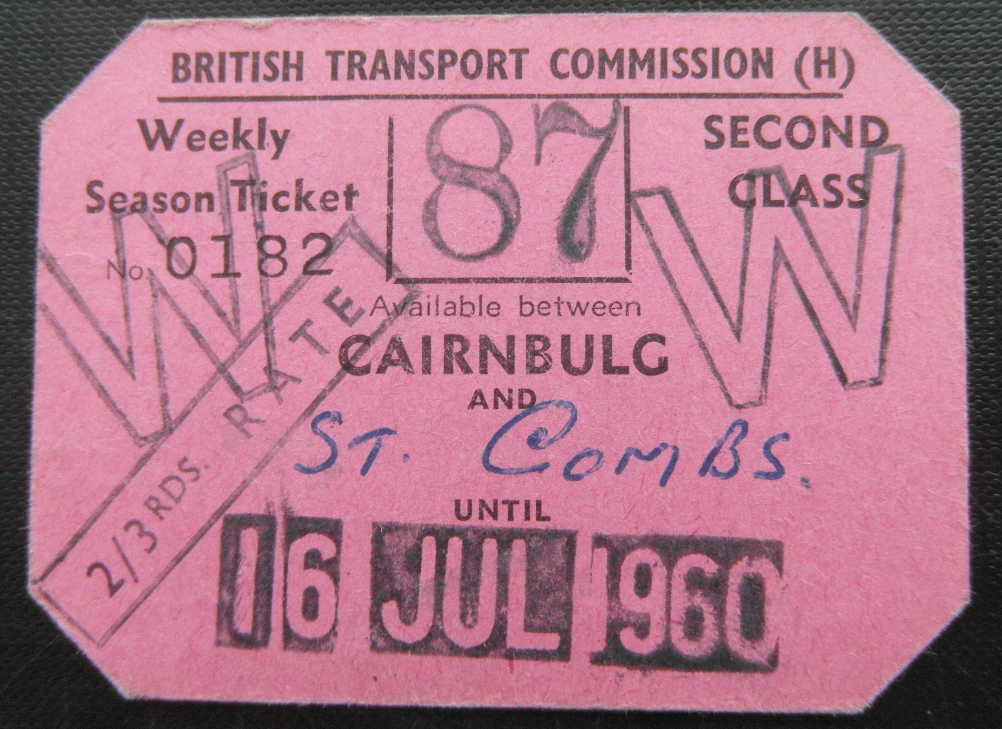
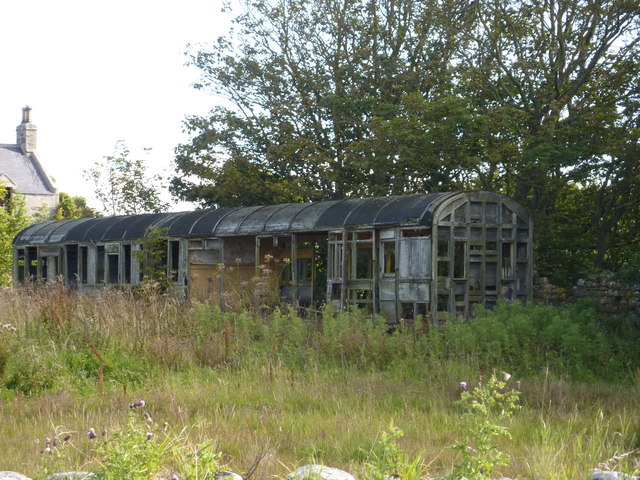
St Combs railway station

St. Combs railway station was a station on the Fraserburgh and St Combs Light Railway, Aberdeenshire. It was opened on 1 July 1903 and stood 5 1⁄8 miles...
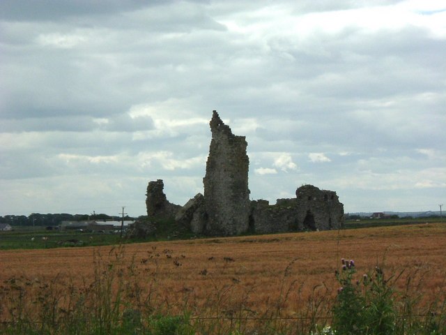
Lonmay Castle

The remains of the Castle of Lonmay are found near Netherton of Lonmay, to the north of Loch Strathbeg in Buchan, Scotland. The remains are not located...

Inverallochy Castle

Inverallochy Castle is a ruined courtyard castle, near the village of Inverallochy in the Buchan area of North-East Scotland, dating to 1504. It lies 0...

Related Videos

What Inspired You To Get Into Landscape Photography?

Join me as I head to St Combs beach in Aberdeenshire in an attempt to shoot Rattray Head Lighthouse from a new vantage point.

Saint Combs Village Walk, Scotland Countryside 4K

Saint Combs Village Walk, Scotland Countryside 4K. St Combs is a small fishing village in Aberdeenshire, Scotland, immediately ...

Tank goes walkabout in St Combs

Tank, the British Bulldog, enjoys a walk along the beach and village of St Combs Aberdeenshire.

MAVIC AIR 2 Visits 4 villages in one flight gorgeous day

We flew to 4 towns in single flight trying to give a little education on the way,too nice not to fly today !!

Nearby Amenities

Located within 500m of 57.652117,-1.896054
Source: Old Landsat image trace
Lat/Long: 57.6512394/-1.8980354
Source: Old Landsat image trace
Lat/Long: 57.649497/-1.8953318
Source: Old Landsat image trace
Lat/Long: 57.6506595/-1.8971939
Source: Old Landsat image trace
Lat/Long: 57.6485021/-1.8948765
The data included in this document is from www.openstreetmap.org. The data is made available under ODbL.

Have you been to South Cample?

Leave your review of South Cample below (or comments, questions and feedback).