Ash Cove

Sea, Estuary, Creek in Devon North Devon

England

Ash Cove

Heddon's Mouth North Devon - an excellent 4km walk from and to the nearest parking place
Heddon's Mouth Credit: John Phillips

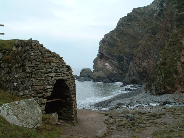
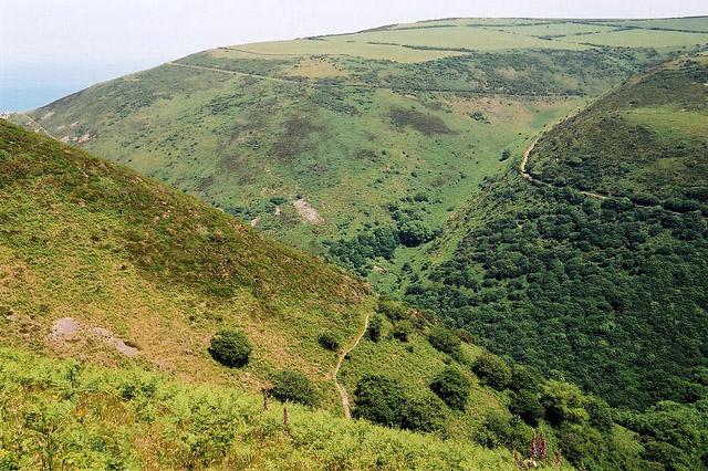
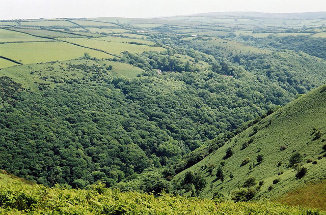
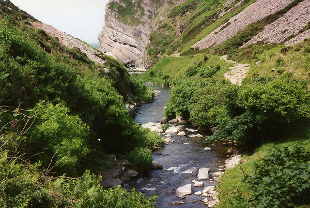
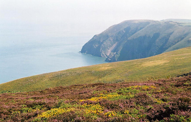
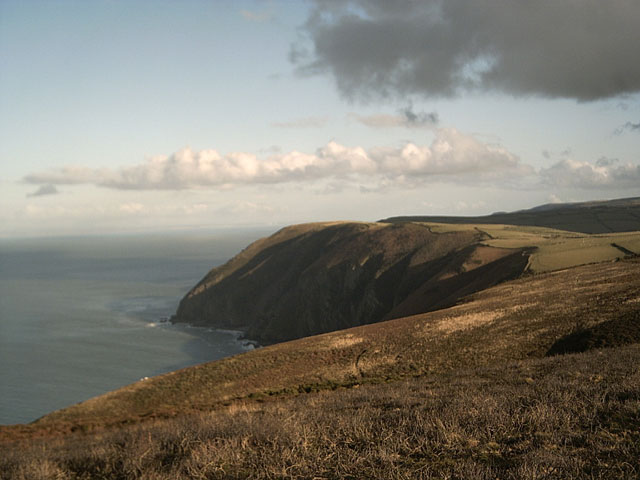
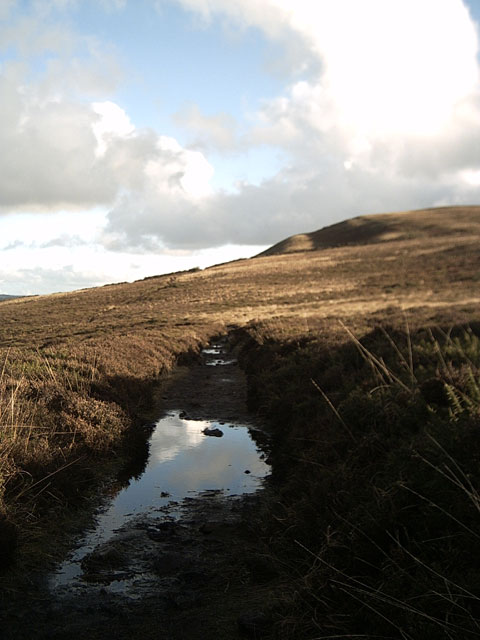
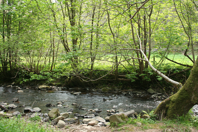
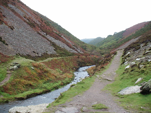
Ash Cove is a picturesque coastal area located in the county of Devon, England. It is renowned for its stunning natural beauty and is a popular destination for tourists and locals alike. Situated on the southern coast of Devon, Ash Cove is a combination of sea, estuary, and creek, making it a diverse and unique landscape.

The cove is characterized by its charming sandy beach, which stretches along the coastline. The crystal-clear waters of the sea provide an ideal spot for swimming and other water activities. The beach is also home to a variety of marine life, making it a haven for snorkelers and divers.

The estuary at Ash Cove is formed by the convergence of a river and the sea, resulting in a tranquil and sheltered area. This makes it a prime location for boating and fishing enthusiasts. The calm waters are perfect for kayaking and paddleboarding, allowing visitors to explore the area at their own pace.

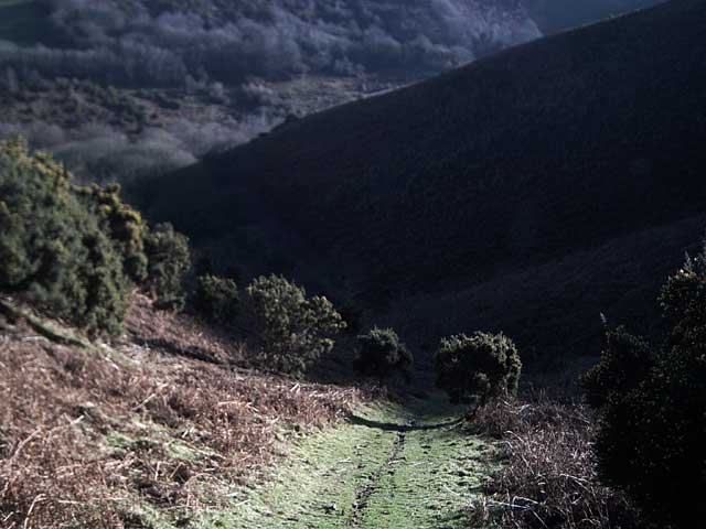
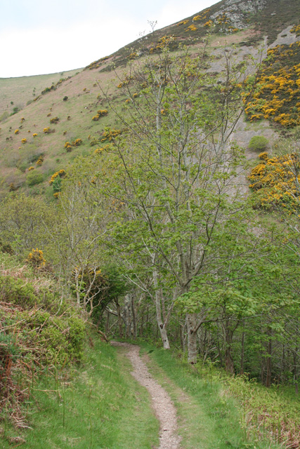
In addition to the sea and estuary, Ash Cove is also home to a picturesque creek. This narrow waterway winds through the lush surrounding countryside, creating a serene and idyllic atmosphere. The creek is a haven for wildlife, including birds and small mammals, making it a popular spot for birdwatching and nature enthusiasts.

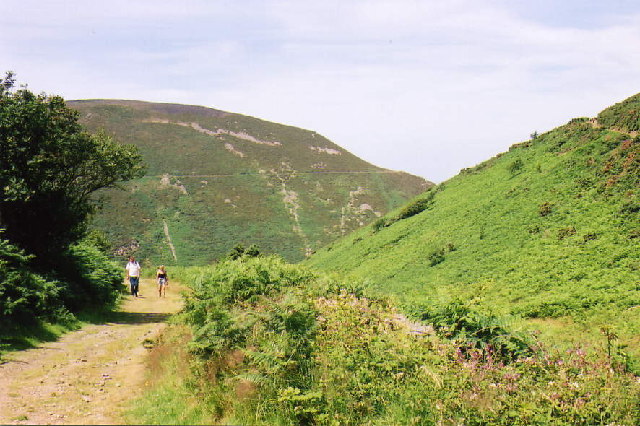
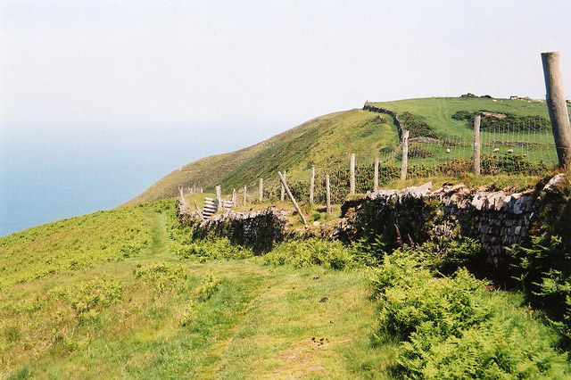
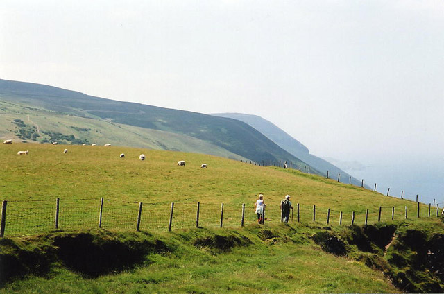
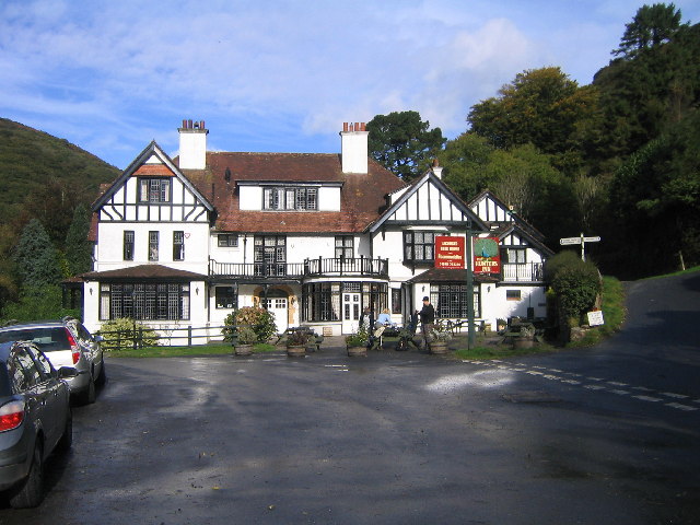
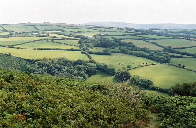
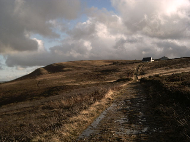
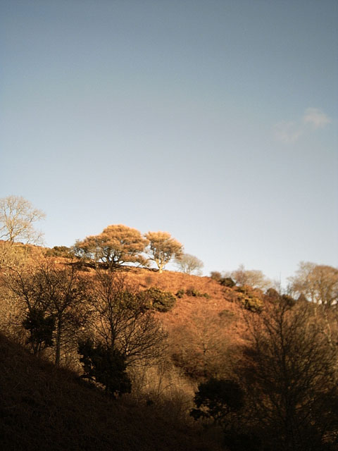
Surrounded by rolling hills and green pastures, Ash Cove offers breathtaking views and a peaceful ambiance. The area is also dotted with charming villages and historic landmarks, providing visitors with a glimpse into the rich cultural heritage of Devon.

Overall, Ash Cove is a hidden gem along the Devon coastline, offering a perfect blend of natural beauty, recreational activities, and a peaceful atmosphere.

If you have any feedback on the listing, please let us know in the comments section below.

Ash Cove Images

Images are sourced within 2km of 51.221047/-3.9523577 or Grid Reference SS6348. Thanks to Geograph Open Source API. All images are credited.

Heddon's Mouth North Devon - an excellent 4km walk from and to the nearest parking place
Heddon's Mouth
North Devon - an excellent 4km walk from and to the nearest parking place
Martinhoe: upper path near Heddon's Mouth Cleave The second of two coast paths between Heddon's Mouth and Woody Bay
Martinhoe: upper path near Heddon's Mouth Cleave
The second of two coast paths between Heddon's Mouth and Woody Bay
Trentishoe: the South West Coast Path Looking east
Trentishoe: the South West Coast Path
Looking east
Trentishoe: the South West Coast Path West to Holdstone Down and the Great Hangman
Trentishoe: the South West Coast Path
West to Holdstone Down and the Great Hangman
Trentishoe: overlooking Heddon's Mouth Cleave The South West Coast Path is just visible on both sides of the valley. The higher path on the hills opposite leads to Woody Bay
Trentishoe: overlooking Heddon's Mouth Cleave
The South West Coast Path is just visible on both sides of the valley. The higher path on the hills opposite leads to Woody Bay
Trentishoe: looking south over the Heddon Valley Seen from the footpath that runs around the hill east from Trentishoe church
Trentishoe: looking south over the Heddon Valley
Seen from the footpath that runs around the hill east from Trentishoe church
Hunters Inn, Heddons Mouth
Trentishoe: River Heddon Near Heddon’s Mouth
Trentishoe: River Heddon
Near Heddon’s Mouth
Combe Martin: overlooking Elwill Bay, Trentishoe On Holdstone Down. Seen from the South West Coast Path, looking roughly north east
Combe Martin: overlooking Elwill Bay, Trentishoe
On Holdstone Down. Seen from the South West Coast Path, looking roughly north east
Trentishoe: Heale Down from Trentishoe Down On a path on National Trust land above Trentishoe Manor, looking south east. Parracombe is hidden behind Heale Down. The high ground on the skyline is Challacombe Common
Trentishoe: Heale Down from Trentishoe Down
On a path on National Trust land above Trentishoe Manor, looking south east. Parracombe is hidden behind Heale Down. The high ground on the skyline is Challacombe Common
Trentishoe Down Viewed from the South West Coastpath on Holdstone Down.
Trentishoe Down
Viewed from the South West Coastpath on Holdstone Down.
View of Highveer Point from Holdstone Down Taken on the South West Coastpath
View of Highveer Point from Holdstone Down
Taken on the South West Coastpath
Coastpath reflections Puddles near Trentishoe Down. Taken on the South West Coastpath.
Coastpath reflections
Puddles near Trentishoe Down. Taken on the South West Coastpath.
Heading down from Trentishoe Down Heading down towards the Ladies Mile and Trentishoe Manor
Heading down from Trentishoe Down
Heading down towards the Ladies Mile and Trentishoe Manor
Winter Trees, Trentishoe Taken from the footpath leading to the Ladies Mile
Winter Trees, Trentishoe
Taken from the footpath leading to the Ladies Mile
Martinhoe: near Heddon’s Mouth Cleave Approaching Heddon’s Mouth Cleave on the lower path from Woody Bay; the path leads on to The Hunters Inn, National Trust shop and car park. Looking south west
Martinhoe: near Heddon’s Mouth Cleave
Approaching Heddon’s Mouth Cleave on the lower path from Woody Bay; the path leads on to The Hunters Inn, National Trust shop and car park. Looking south west
Martinhoe: the Heddon between Hunters Inn and Heddon’s Mouth Seen from the lower path from Woody Bay
Martinhoe: the Heddon between Hunters Inn and Heddon’s Mouth
Seen from the lower path from Woody Bay
Heddon's Mouth, Exmoor Looking up the River Heddon valley showing the loose rocks on the valley side.
Heddon's Mouth, Exmoor
Looking up the River Heddon valley showing the loose rocks on the valley side.
Show me another place!

Ash Cove is located at Grid Ref: SS6348 (Lat: 51.221047, Lng: -3.9523577)

Administrative County: Devon

District: North Devon

Police Authority: Devon and Cornwall

What 3 Words

///sunbeam.surface.ogre. Near Combe Martin, Devon

Related Wikis

Trentishoe

Trentishoe is a village and civil parish in North Devon, England. The parish lies on the coast of the Bristol Channel. The village is 5 miles (8 km) east...

Exmoor Coastal Heaths

Exmoor Coastal Heaths (grid reference SS620480) is a 1758.3 hectare (4344.7 acre) biological Site of Special Scientific Interest in Devon and Somerset...

Heddon's Mouth

Heddon's Mouth is a rocky cove on the coast of North Devon, England, about a mile down the River Heddon from the Hunter's Inn. It is preserved for the...

Voley Castle

Voley Castle is an Iron Age hill fort situated close to Parracombe in north Devon, England. The fort is situated on a promontory on the eastern side of...

Martinhoe

Martinhoe is a small settlement and civil parish in North Devon district of Devon, England. Martinhoe is within the Exmoor National Park, the smallest...

Beacon Castle

Beacon Castle is an Iron Age hill fort close to Parracombe in Devon, England. It is situated on a hilltop some 290 metres (950 ft) above sea level, overlooking...

Woody Bay, Devon

Woody Bay is a bay on the North Devon coast of England, 3 miles (4.8 km) west of Lynton and 8 miles (13 km) east of Combe Martin with a stony beach. It...

Killington Lane railway station

Killington Lane is a temporary terminus about one mile (1.6 km) southwest of Woody Bay on the Lynton and Barnstaple Railway (L&B), the narrow gauge line...

Nearby Amenities

Located within 500m of 51.221047,-3.9523577
Barrier: stile
Bicycle: yes
Foot: yes
Lat/Long: 51.2185741/-3.9468231
The data included in this document is from www.openstreetmap.org. The data is made available under ODbL.

Have you been to Ash Cove?

Leave your review of Ash Cove below (or comments, questions and feedback).