Elwill Bay

Bay in Devon

England

Elwill Bay

Trentishoe: the South West Coast Path Looking east
Trentishoe: the South West Coast Path Credit: Martin Bodman

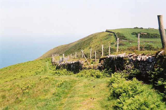
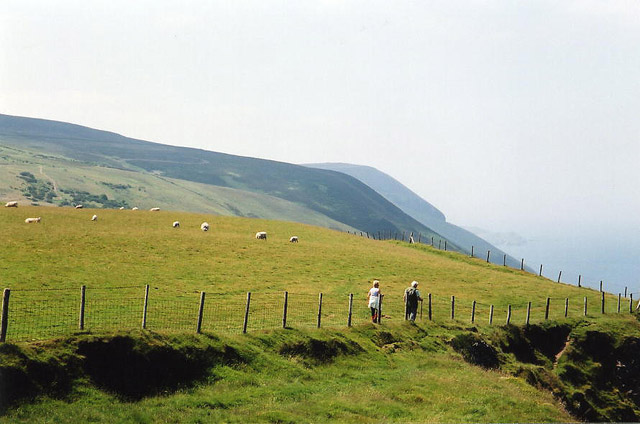
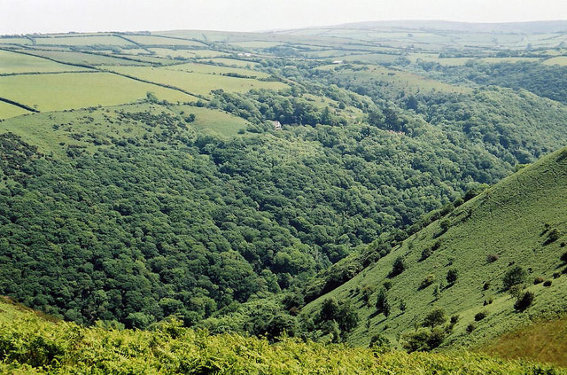
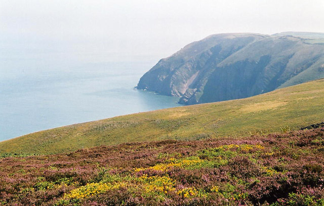
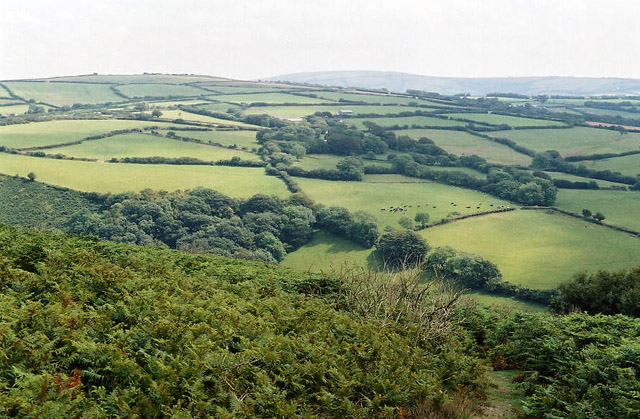
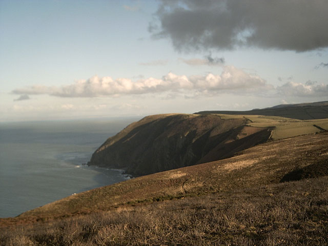
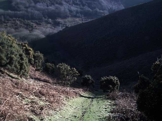
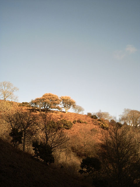
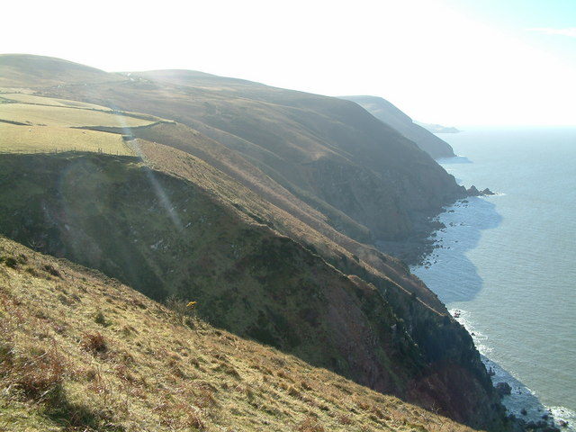
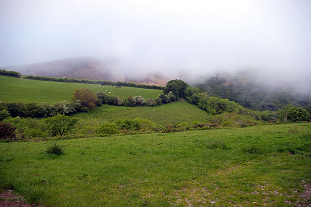
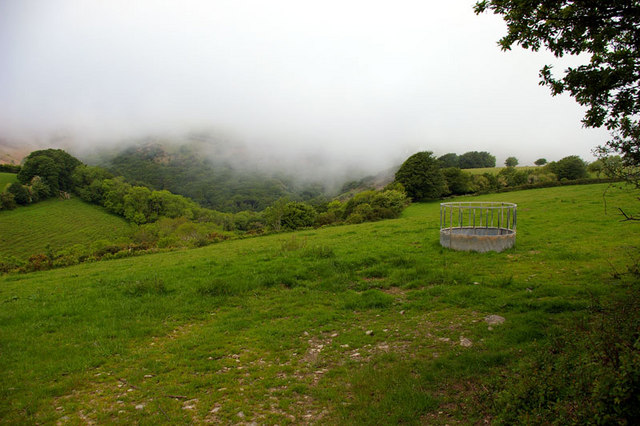
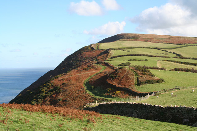
Elwill Bay is a picturesque coastal area located in Devon, England. Situated along the southern coast of the county, it is known for its stunning natural beauty and serene atmosphere. The bay stretches for approximately 2 miles and is encompassed by rolling hills and lush greenery.

The bay's beach is its main attraction, featuring soft golden sand and crystal-clear waters. It offers a perfect spot for sunbathing, picnicking, and building sandcastles. The calmness of the bay's waters also makes it an ideal location for swimming and other water activities, such as kayaking and paddleboarding.

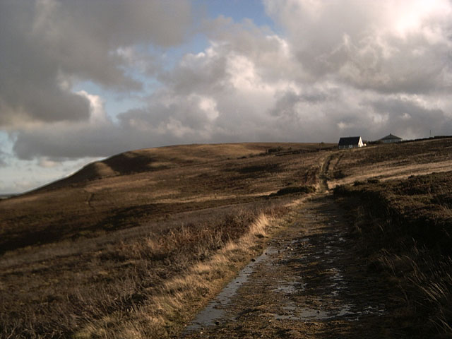
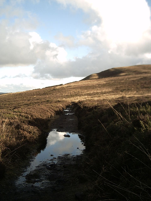
Surrounding the bay, visitors can find a variety of coastal paths and trails, providing breathtaking views of the sea and the surrounding countryside. These paths are popular among hikers and nature enthusiasts, offering the opportunity to spot local wildlife, including seabirds and seals.

Elwill Bay is also home to a small fishing community, with colorful fishing boats dotting the shoreline. This adds to the charm of the area and provides visitors with a glimpse into the local maritime heritage.

Facilities in the bay include a café, public toilets, and a small car park for visitors' convenience. Additionally, there are a few accommodation options nearby, ranging from cozy bed and breakfasts to holiday cottages.

Overall, Elwill Bay is a hidden gem in Devon, offering a tranquil escape from the hustle and bustle of everyday life. Its natural beauty, sandy beach, and coastal paths make it an idyllic destination for those seeking relaxation and a connection with nature.

If you have any feedback on the listing, please let us know in the comments section below.

Elwill Bay Images

Images are sourced within 2km of 51.221975/-3.9565787 or Grid Reference SS6348. Thanks to Geograph Open Source API. All images are credited.

Trentishoe: the South West Coast Path Looking east
Trentishoe: the South West Coast Path
Looking east
Trentishoe: the South West Coast Path West to Holdstone Down and the Great Hangman
Trentishoe: the South West Coast Path
West to Holdstone Down and the Great Hangman
Trentishoe: looking south over the Heddon Valley Seen from the footpath that runs around the hill east from Trentishoe church
Trentishoe: looking south over the Heddon Valley
Seen from the footpath that runs around the hill east from Trentishoe church
Combe Martin: overlooking Elwill Bay, Trentishoe On Holdstone Down. Seen from the South West Coast Path, looking roughly north east
Combe Martin: overlooking Elwill Bay, Trentishoe
On Holdstone Down. Seen from the South West Coast Path, looking roughly north east
Combe Martin: west to Great Hangman On Holdstone Down. Seen from the South West Coast Path, looking west
Combe Martin: west to Great Hangman
On Holdstone Down. Seen from the South West Coast Path, looking west
Trentishoe: Heale Down from Trentishoe Down On a path on National Trust land above Trentishoe Manor, looking south east. Parracombe is hidden behind Heale Down. The high ground on the skyline is Challacombe Common
Trentishoe: Heale Down from Trentishoe Down
On a path on National Trust land above Trentishoe Manor, looking south east. Parracombe is hidden behind Heale Down. The high ground on the skyline is Challacombe Common
Trentishoe Down Viewed from the South West Coastpath on Holdstone Down.
Trentishoe Down
Viewed from the South West Coastpath on Holdstone Down.
View towards Highveer Point from Holdstone Down Taken on the South West Coastpath.
View towards Highveer Point from Holdstone Down
Taken on the South West Coastpath.
View of Highveer Point from Holdstone Down Taken on the South West Coastpath
View of Highveer Point from Holdstone Down
Taken on the South West Coastpath
Coastpath reflections Puddles near Trentishoe Down. Taken on the South West Coastpath.
Coastpath reflections
Puddles near Trentishoe Down. Taken on the South West Coastpath.
Heading down from Trentishoe Down Heading down towards the Ladies Mile and Trentishoe Manor
Heading down from Trentishoe Down
Heading down towards the Ladies Mile and Trentishoe Manor
Winter Trees, Trentishoe Taken from the footpath leading to the Ladies Mile
Winter Trees, Trentishoe
Taken from the footpath leading to the Ladies Mile
Martinhoe: the Heddon between Hunters Inn and Heddon’s Mouth Seen from the lower path from Woody Bay
Martinhoe: the Heddon between Hunters Inn and Heddon’s Mouth
Seen from the lower path from Woody Bay
North Cleave and Elwill Bay The deep gully at North Cleave and beyond it, the steep cliffs with the Mare and Colt in the near distance, Blackstone Point in the middle distance, and just visible, Hangman Point in the far distance.
North Cleave and Elwill Bay
The deep gully at North Cleave and beyond it, the steep cliffs with the Mare and Colt in the near distance, Blackstone Point in the middle distance, and just visible, Hangman Point in the far distance.
Sea Mist Offshore winds drove sea mist up the deep valleys (combes) which persisted well into the late afternoon; picture taken late morning. Elevation 210m above sea level.
Sea Mist
Offshore winds drove sea mist up the deep valleys (combes) which persisted well into the late afternoon; picture taken late morning. Elevation 210m above sea level.
Sea Mist - left More westerly view
Sea Mist - left
More westerly view
Sea Mist - right More Northerly view over Heal Brake; is that the name of the location or feature?
Sea Mist - right
More Northerly view over Heal Brake; is that the name of the location or feature?
Coastal path looking west
Show me another place!

Elwill Bay is located at Grid Ref: SS6348 (Lat: 51.221975, Lng: -3.9565787)

Administrative County: Devon

Police Authority: Devon and Cornwall

What 3 Words

///sung.views.compliant. Near Combe Martin, Devon

Related Wikis

Trentishoe

Trentishoe is a village and civil parish in North Devon, England. The parish lies on the coast of the Bristol Channel. The village is 5 miles (8 km) east...

Exmoor Coastal Heaths

Exmoor Coastal Heaths (grid reference SS620480) is a 1758.3 hectare (4344.7 acre) biological Site of Special Scientific Interest in Devon and Somerset...

Heddon's Mouth

Heddon's Mouth is a rocky cove on the coast of North Devon, England, about a mile down the River Heddon from the Hunter's Inn. It is preserved for the...

Voley Castle

Voley Castle is an Iron Age hill fort situated close to Parracombe in north Devon, England. The fort is situated on a promontory on the eastern side of...

Martinhoe

Martinhoe is a small settlement and civil parish in North Devon district of Devon, England. Martinhoe is within the Exmoor National Park, the smallest...

Beacon Castle

Beacon Castle is an Iron Age hill fort close to Parracombe in Devon, England. It is situated on a hilltop some 290 metres (950 ft) above sea level, overlooking...

Hangman cliffs

Hangman cliffs, consisting of Great Hangman and Little Hangman, are near Combe Martin on the north coast of Devon, England, where Exmoor meets the sea...

Woody Bay, Devon

Woody Bay is a bay on the North Devon coast of England, 3 miles (4.8 km) west of Lynton and 8 miles (13 km) east of Combe Martin with a stony beach. It...

Nearby Amenities

Located within 500m of 51.221975,-3.9565787
The data included in this document is from www.openstreetmap.org. The data is made available under ODbL.

Have you been to Elwill Bay?

Leave your review of Elwill Bay below (or comments, questions and feedback).