Port nan Cuiseag

Sea, Estuary, Creek in Argyllshire

Scotland

Port nan Cuiseag

Crops harvested and baled at Balephetrish
Crops harvested and baled at Balephetrish Credit: Alan Reid

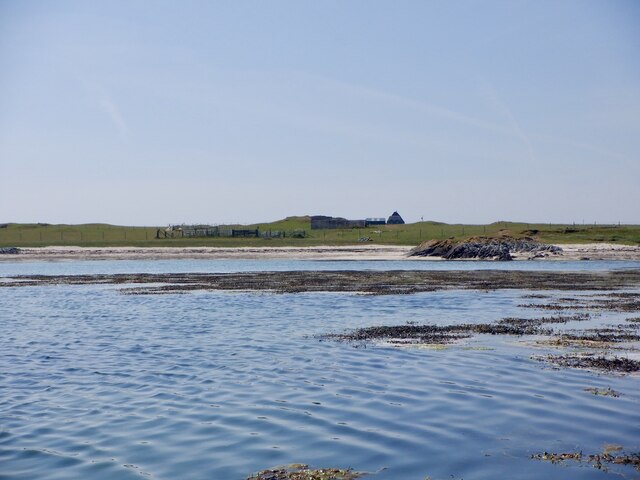
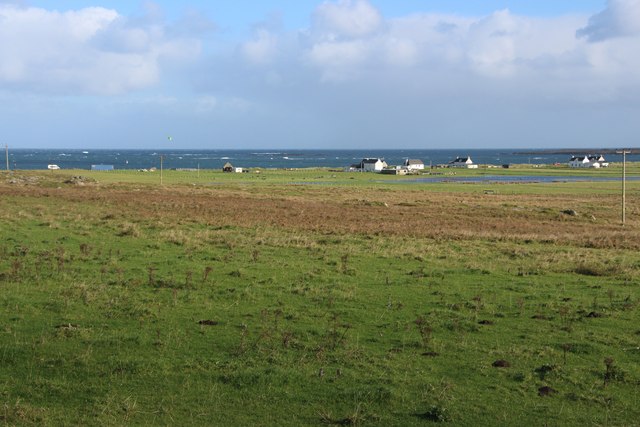
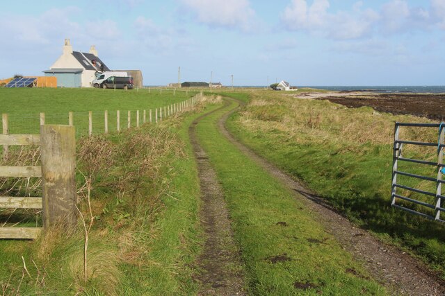
Port nan Cuiseag is a picturesque coastal inlet located in Argyllshire, Scotland. Nestled along the western shores of the region, it is renowned for its scenic beauty and tranquil atmosphere. The name, Port nan Cuiseag, translates to "Harbor of the Tides" in Gaelic, reflecting the area's strong connection to the sea.

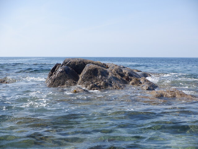
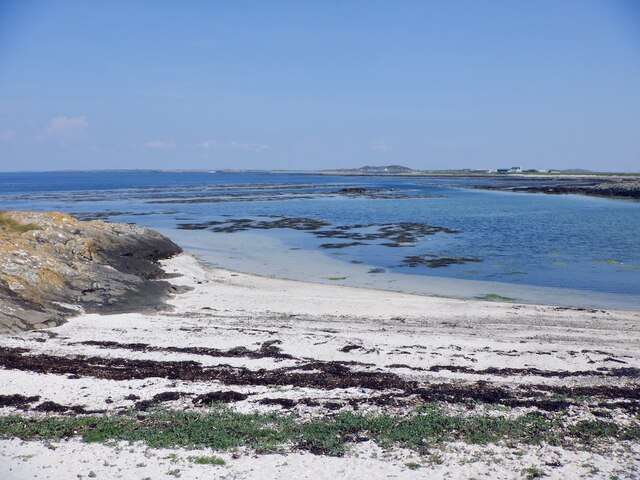
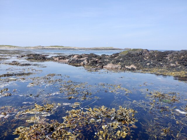
The port is characterized by its stunning natural surroundings, with rolling hills and rugged cliffs forming a dramatic backdrop. The crystal-clear waters of the sea gently lap against the sandy shore, creating a serene and idyllic setting. The tides ebb and flow, granting visitors the opportunity to witness the ever-changing beauty of the estuary.

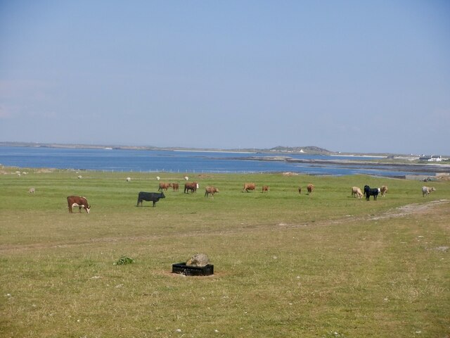
The port is a haven for wildlife enthusiasts, as it is home to a diverse range of flora and fauna. Seals can often be spotted basking on the rocks, while various seabirds soar above the water. The estuary itself teems with marine life, with fishermen often casting their lines in search of mackerel and salmon.

For those seeking outdoor activities, Port nan Cuiseag offers excellent opportunities for boating, kayaking, and fishing. Its calm waters and sheltered location make it an ideal spot for novice sailors and water sports enthusiasts.

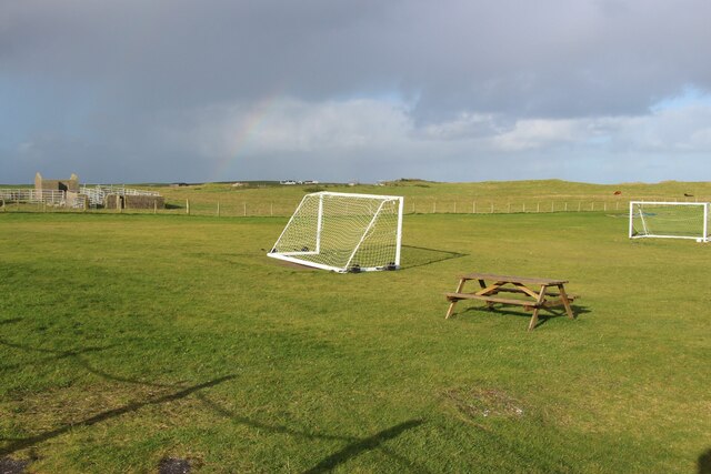
The port also boasts a small, close-knit community, with a handful of charming cottages dotting the shoreline. Local amenities include a quaint seafood restaurant, serving freshly caught seafood delicacies.

Overall, Port nan Cuiseag is a hidden gem in Argyllshire, offering visitors a tranquil retreat where they can immerse themselves in the beauty of Scotland's coastal landscape.

If you have any feedback on the listing, please let us know in the comments section below.

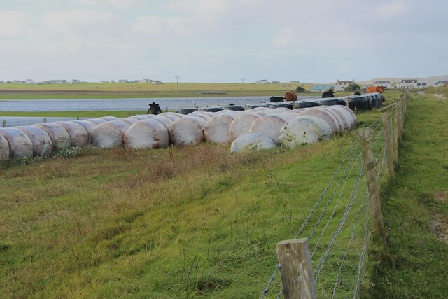
Port nan Cuiseag Images

Images are sourced within 2km of 56.526716/-6.895488 or Grid Reference NL9947. Thanks to Geograph Open Source API. All images are credited.

Crops harvested and baled at Balephetrish
Wrack, Port Fada High water, this area dries at low tide.
Wrack, Port Fada
High water, this area dries at low tide.
Sgeir Fada Very little of the skerry emerges from a neap high water. Another rock nearby was also dry.
Sgeir Fada
Very little of the skerry emerges from a neap high water. Another rock nearby was also dry.
Beach at Port Fada Near high water.
Beach at Port Fada
Near high water.
Port Fada Rocks and seaweed near high water. Most of the square dries.
Port Fada
Rocks and seaweed near high water. Most of the square dries.
Beach, Port Fada
Beach, Port Fada
Cattle near Ainshval North coast of Tiree.
Cattle near Ainshval
North coast of Tiree.
A playing field at Tiree High School
A burn draining moorland bogs at Cornaigbeg
House at Cornaigbeg
House at Cornaigbeg
Houses at Balephetrish Bay
Road to Kenovay Farm and Ard Mor The west side of Balephetrish Bay on Tiree.
Road to Kenovay Farm and Ard Mor
The west side of Balephetrish Bay on Tiree.
Windsurfing on Loch Bhasapoli, Tiree
Natural Arch, Balephetrish Bay, Tiree one of a number of arches at the west end of the bay
Natural Arch, Balephetrish Bay, Tiree
one of a number of arches at the west end of the bay
Loch Bhasapoll
Loch Bhasapoll
Rocky outcrops This area has many outcrops of Lewesian Gneiss.
Rocky outcrops
This area has many outcrops of Lewesian Gneiss.
Torosa farm track The track leading to the farm in the background.  The coastal areas of Tiree 
are fertile machair.
Torosa farm track
The track leading to the farm in the background. The coastal areas of Tiree are fertile machair.
West coast of Balephetrish Bay A lot of seaweed on this corner of the beach, and very rocky further along.
West coast of Balephetrish Bay
A lot of seaweed on this corner of the beach, and very rocky further along.
Show me another place!

Port nan Cuiseag is located at Grid Ref: NL9947 (Lat: 56.526716, Lng: -6.895488)

Unitary Authority: Argyll and Bute

Police Authority: Argyll and West Dunbartonshire

What 3 Words

///snitch.land.fights. Near Scarinish, Argyll & Bute

Related Wikis

Tiree Airport

Tiree Airport (Scottish Gaelic: Port-adhair Thiriodh) (IATA: TRE, ICAO: EGPU) is located 2.5 nautical miles (4.6 km; 2.9 mi) north northeast of Balemartine...

Tiree Music Festival

Tiree Music Festival is a Scottish folk music festival held annually on the Island of Tiree in the Inner Hebrides. The festival was founded in 2010 by...

Tiree

Tiree (; Scottish Gaelic: Tiriodh, pronounced [ˈtʲʰiɾʲəɣ]) is the most westerly island in the Inner Hebrides of Scotland. The low-lying island, southwest...

Dun Mor Vaul

Dun Mor Vaul (or simply Dun Mor; Scottish Gaelic: Dùn Mòr) is an iron-age broch located on the north coast of the island of Tiree, in Scotland. ��2�...

Scarinish

Scarinish (Scottish Gaelic: Sgairinis [ˈs̪kaɾʲɪnɪʃ]) is the main village on the island of Tiree, in the Inner Hebrides of Scotland. It is located on the...

Mannal

Mannal is a coastal hamlet on the west side of Hynish Bay, on the island of Tiree, Scotland. The township of Mannal lies on the southwest corner of Tiree...

Nearby Amenities

Located within 500m of 56.526716,-6.895488
Created By: dmgroom_coastlines
Source: PGS
Lat/Long: 56.5283/-6.90259
Created By: dmgroom_coastlines
Source: PGS
Lat/Long: 56.52779/-6.90262
Created By: dmgroom_coastlines
Source: PGS
Lat/Long: 56.52651/-6.90269
Created By: dmgroom_coastlines
Source: PGS
Lat/Long: 56.52625/-6.90248
Created By: dmgroom_coastlines
Source: PGS
Lat/Long: 56.52574/-6.90251
Created By: dmgroom_coastlines
Source: PGS
Lat/Long: 56.52563/-6.90274
Created By: dmgroom_coastlines
Source: PGS
Lat/Long: 56.52549/-6.90298
Created By: dmgroom_coastlines
Source: PGS
Lat/Long: 56.5251/-6.90277
Created By: dmgroom_coastlines
Source: PGS
Lat/Long: 56.52535/-6.90229
Created By: dmgroom_coastlines
Source: PGS
Lat/Long: 56.52547/-6.90182
Created By: dmgroom_coastlines
Source: PGS
Lat/Long: 56.52521/-6.90161
Created By: dmgroom_coastlines
Source: PGS
Lat/Long: 56.52495/-6.90116
Created By: dmgroom_coastlines
Source: PGS
Lat/Long: 56.52443/-6.90095
Created By: dmgroom_coastlines
Source: PGS
Lat/Long: 56.52454/-6.90003
Created By: dmgroom_coastlines
Source: PGS
Lat/Long: 56.52453/-6.8991
Created By: dmgroom_coastlines
Source: PGS
Lat/Long: 56.52424/-6.89725
Created By: dmgroom_coastlines
Source: PGS
Lat/Long: 56.52423/-6.8968
Created By: dmgroom_coastlines
Source: PGS
Lat/Long: 56.52433/-6.89494
Created By: dmgroom_coastlines
Source: PGS
Lat/Long: 56.52484/-6.89468
Created By: dmgroom_coastlines
Source: PGS
Lat/Long: 56.52535/-6.89442
Created By: dmgroom_coastlines
Source: PGS
Lat/Long: 56.52534/-6.89349
Created By: dmgroom_coastlines
Source: PGS
Lat/Long: 56.52584/-6.89346
Created By: dmgroom_coastlines
Source: PGS
Lat/Long: 56.52583/-6.89254
Created By: dmgroom_coastlines
Source: PGS
Lat/Long: 56.52634/-6.89275
Created By: dmgroom_coastlines
Source: PGS
Lat/Long: 56.5266/-6.89296
Created By: dmgroom_coastlines
Source: PGS
Lat/Long: 56.52672/-6.89249
Created By: dmgroom_coastlines
Source: PGS
Lat/Long: 56.52684/-6.89202
Created By: dmgroom_coastlines
Source: PGS
Lat/Long: 56.52658/-6.8918
Created By: dmgroom_coastlines
Source: PGS
Lat/Long: 56.52607/-6.8916
Source: PGS
Lat/Long: 56.5253663/-6.89115
Source: PGS
Lat/Long: 56.5247859/-6.8905158
Source: PGS
Lat/Long: 56.5248309/-6.889965
Source: PGS
Lat/Long: 56.5248592/-6.8895127
Source: PGS
Lat/Long: 56.5246723/-6.8891988
Source: PGS
Lat/Long: 56.524242/-6.8888611
Power: pole
Lat/Long: 56.5236966/-6.9010849
Power: pole
Lat/Long: 56.52348/-6.8992351
Power: pole
Lat/Long: 56.5233845/-6.898327
Power: pole
Lat/Long: 56.5230292/-6.8974359
Power: pole
Lat/Long: 56.5226413/-6.8965216
Power: pole
Lat/Long: 56.523897/-6.8910556
Power: pole
Lat/Long: 56.5231864/-6.8920713
Power: pole
Lat/Long: 56.5224782/-6.8931376
The data included in this document is from www.openstreetmap.org. The data is made available under ODbL.

Have you been to Port nan Cuiseag?

Leave your review of Port nan Cuiseag below (or comments, questions and feedback).