Strom na Fùirneis

Sea, Estuary, Creek in Inverness-shire

Scotland

Strom na Fùirneis

Lochmaddy/Loch nam Madadh
Lochmaddy/Loch nam Madadh Credit: Sandy Gerrard

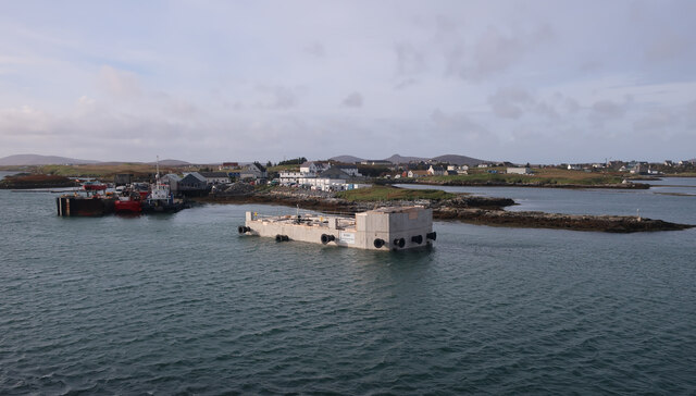
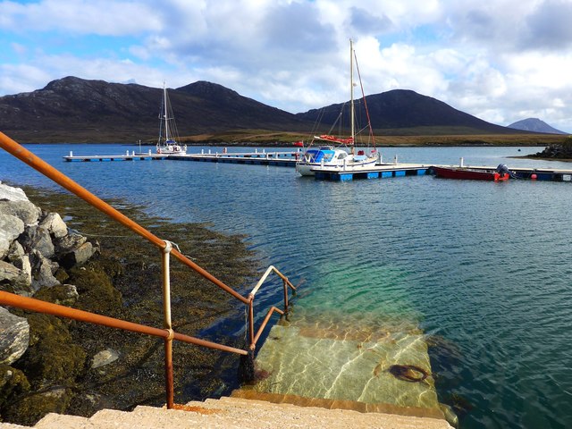
Strom na Fùirneis is a small sea inlet located in Inverness-shire, Scotland. It is situated on the west coast of the county and is surrounded by beautiful natural landscapes. The name "Strom na Fùirneis" translates to "Sea, Estuary, Creek" in English, accurately describing the features of this area.

The sea inlet is characterized by its calm waters and stunning views of the surrounding hills and mountains. The water in Strom na Fùirneis is a mix of fresh and saltwater, as it is influenced by both the nearby river and the sea. This unique blend of waters creates an ecosystem rich in biodiversity.

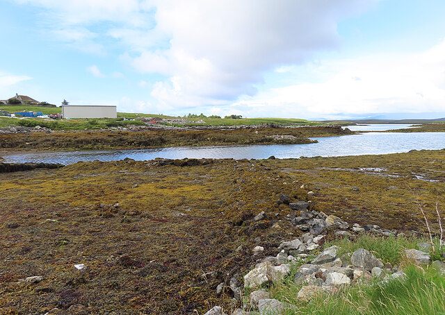
The estuary of Strom na Fùirneis is a haven for various species of birds, including gulls, herons, and wading birds. It provides an important feeding ground and shelter for these avian inhabitants. Additionally, the estuary supports a variety of marine life, such as seals, otters, and even occasional sightings of dolphins.

The creek in Strom na Fùirneis is a small stream that flows into the sea, adding to the overall charm of the area. It is surrounded by lush vegetation and provides a refreshing escape for those seeking a leisurely walk or a peaceful moment in nature.

Visitors to Strom na Fùirneis can enjoy various recreational activities, such as fishing, boating, and birdwatching. The scenic beauty and tranquil atmosphere of this sea inlet make it a popular destination for nature enthusiasts and photographers.

In conclusion, Strom na Fùirneis in Inverness-shire is a picturesque sea inlet, estuary, and creek that offers breathtaking views, diverse wildlife, and recreational opportunities for visitors to enjoy.

If you have any feedback on the listing, please let us know in the comments section below.

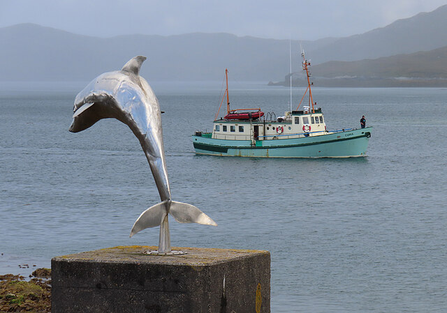
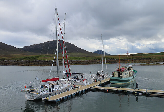
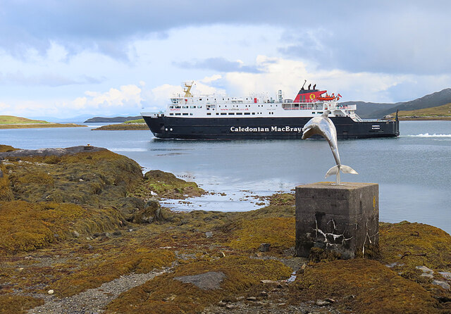
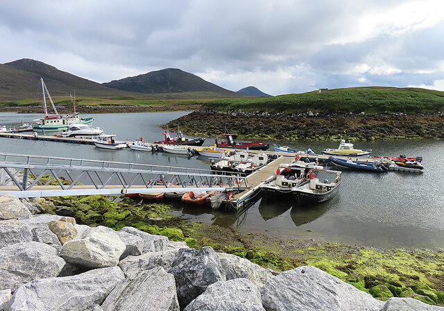
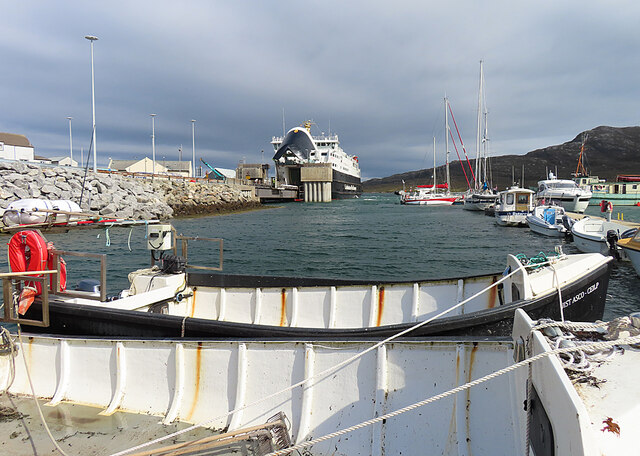
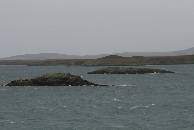
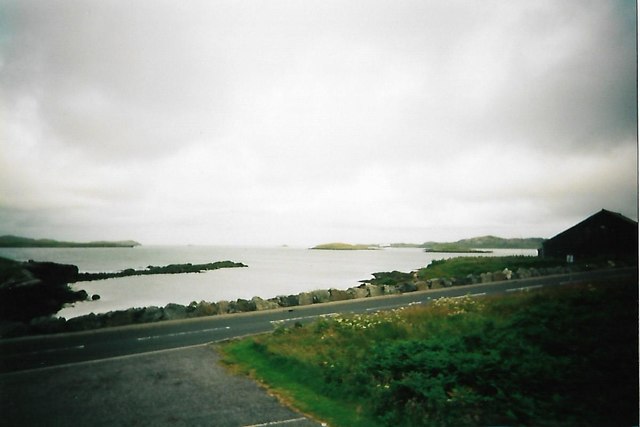
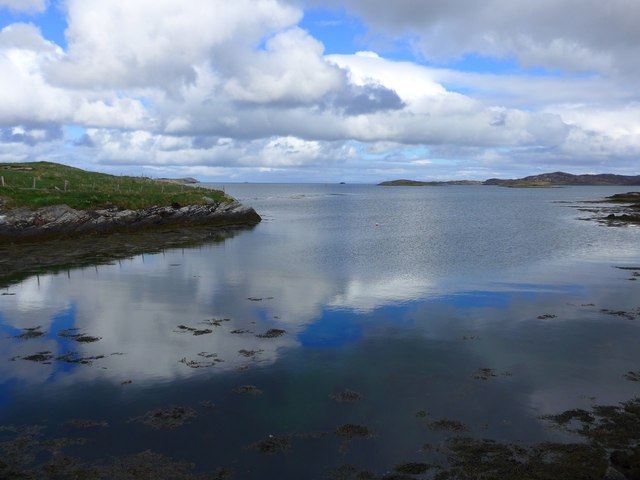
Strom na Fùirneis Images

Images are sourced within 2km of 57.60398/-7.1585135 or Grid Reference NF9168. Thanks to Geograph Open Source API. All images are credited.

Lochmaddy/Loch nam Madadh
Works ongoing at Lochmaddy Pier See <a href="https://www.geograph.org.uk/photo/2897842">NF9267 : Lochmaddy Pier</a> for an earlier view.
Works ongoing at Lochmaddy Pier
See NF9267 : Lochmaddy Pier for an earlier view.
Hamarsaigh From the ferry into Lochmaddy.
Hamarsaigh
From the ferry into Lochmaddy.
Seaweed at Lochmaddy At low tide there is a very large expanse of rocks covered in vegetation here.
Seaweed at Lochmaddy
At low tide there is a very large expanse of rocks covered in vegetation here.
Taigh Chearsabhagh The buildings house a museum and arts centre, and a café with excellent home baking.
Taigh Chearsabhagh
The buildings house a museum and arts centre, and a café with excellent home baking.
MV 'Hebrides' at Lochmaddy The MV 'Hebrides' is the ferry from Uig in Skye to Tarbert in Harris and Lochmaddy in South Uist. Until the Berneray causeway was built and the Sound of Harris ferry service started, this was the only way to get from the northern to the southern Western Isles.
MV 'Hebrides' at Lochmaddy
The MV 'Hebrides' is the ferry from Uig in Skye to Tarbert in Harris and Lochmaddy in South Uist. Until the Berneray causeway was built and the Sound of Harris ferry service started, this was the only way to get from the northern to the southern Western Isles.
MV 'Cuma' The MV 'Cuma' is available for charter and regularly makes trips to St Kilda from her base in Miavaig in West Lewis. This week she was coming in to pick up a party of botanists on their way to survey the islands south of Barra. Pictured passing the dolphin statue outside the Caledonian MacBrayne office and terminal at Lochmaddy.
MV 'Cuma'
The MV 'Cuma' is available for charter and regularly makes trips to St Kilda from her base in Miavaig in West Lewis. This week she was coming in to pick up a party of botanists on their way to survey the islands south of Barra. Pictured passing the dolphin statue outside the Caledonian MacBrayne office and terminal at Lochmaddy.
Lochmaddy Marina The outermost pontoons at Lochmaddy, in use by a handful of pleasure boats.
Lochmaddy Marina
The outermost pontoons at Lochmaddy, in use by a handful of pleasure boats.
MV 'Hebrides' Leaving Lochmaddy The ferry is setting off for Uig in the Isle of Skye.
MV 'Hebrides' Leaving Lochmaddy
The ferry is setting off for Uig in the Isle of Skye.
Lochmaddy Marina This is very nearly the whole of the marina, which is used by commercial and pleasure boats.
Lochmaddy Marina
This is very nearly the whole of the marina, which is used by commercial and pleasure boats.
Lochmaddy Marina and Ferry Terminal MV 'Hebrides' at the ferry pier, from the pontoon giving access to the marina.
Lochmaddy Marina and Ferry Terminal
MV 'Hebrides' at the ferry pier, from the pontoon giving access to the marina.
On final approach to Loch Maddy I boarded the ferry at Tarbert, Isle of Harris a couple of hours ago and was told that the ferry had a change of plan and instead of going directly to Uig on Skye was now going via Loch Maddy on North Uist. All at no extra cost!
On final approach to Loch Maddy
I boarded the ferry at Tarbert, Isle of Harris a couple of hours ago and was told that the ferry had a change of plan and instead of going directly to Uig on Skye was now going via Loch Maddy on North Uist. All at no extra cost!
Go on, read it for yourself...
An Glais-eilean Meadhonach Mind your navigation in these waters! Can you imagine sailing into Loch Maddy on foggy days prior to the advent of radar, radio beacons, and sonar?
An Glais-eilean Meadhonach
Mind your navigation in these waters! Can you imagine sailing into Loch Maddy on foggy days prior to the advent of radar, radio beacons, and sonar?
Shore and small islands at Lochmaddy
Bagh Kersavagh, Lochmaddy The English is, I guess, Kersavay Bay.
Bagh Kersavagh, Lochmaddy
The English is, I guess, Kersavay Bay.
Pontoons at Lochmaddy And just look at the clarity of the water!
Pontoons at Lochmaddy
And just look at the clarity of the water!
Fish quay, Lochmaddy
Show me another place!

Strom na Fùirneis is located at Grid Ref: NF9168 (Lat: 57.60398, Lng: -7.1585135)

Unitary Authority: Na h-Eileanan an Iar

Police Authority: Highlands and Islands

What 3 Words

///spurned.songbook.decompose. Near Lochmaddy, Na h-Eileanan Siar

Related Wikis

Lochmaddy

Lochmaddy (Scottish Gaelic: Loch nam Madadh [l̪ˠɔx nə ˈmat̪əɣ], "Loch of the Hounds") is the administrative centre of North Uist in the Outer Hebrides...
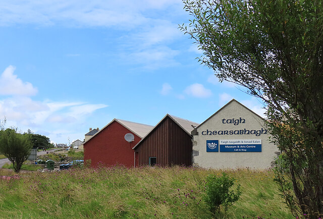
Taigh Chearsabhagh

Taigh Chearsabhagh is an arts centre and museum in Lochmaddy on the island of North Uist, Scotland.Taigh Chearsabhagh was built in 1741 and originally...
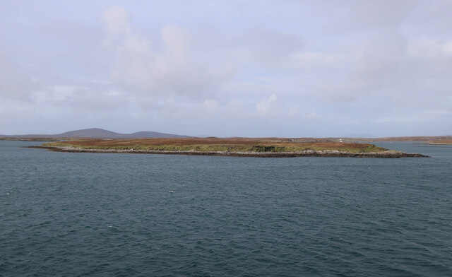
Ceallasaigh Beag

Ceallasaigh Beag (or Keallasay Beg) is a low-lying island in Loch Maddy off North Uist in the Outer Hebrides of Scotland. This an area of shallow lagoons...

Weavers Point

Weavers Point (Scottish Gaelic: Rubha an Fhigheadair) is a headland to the north of the entrance to Loch Maddy, on the north eastern coastline of North...

Nearby Amenities

Located within 500m of 57.60398,-7.1585135
Barrier: cattle_grid
Lat/Long: 57.6053624/-7.1648294
Post Box
Collection Times: Mo-Fr 12:45; Sa 08:00
Drive Through: yes
Post Box Type: lamp
Ref: HS6 28
Lat/Long: 57.6045354/-7.1623549
Bus Stop
Bench: yes
Bus: yes
Naptan AtcoCode: 6010696
Naptan NaptanCode: 94726437
Public Transport: platform
Shelter: yes
Wheelchair: yes
Lat/Long: 57.6013419/-7.1630592
Bench
Backrest: yes
Colour: grey
Material: wood
Seats: 5
Lat/Long: 57.6021514/-7.1625447
Telephone
Booth: KX100
Covered: booth
Payment Coins: yes
Phone: +44 1876 500381
Lat/Long: 57.6045531/-7.1624021
Telephone
Booth: KX100
Covered: booth
Operator: BT
Operator Wikidata: Q593786
Payment Coins: yes
Phone: +44 1876 500357
Lat/Long: 57.6013239/-7.1630262
Bench
Backrest: yes
Colour: red
Material: wood
Seats: 3
Lat/Long: 57.6007111/-7.1619639
Charging Station
Lat/Long: 57.6046676/-7.1610662
Leisure: slipway
Lat/Long: 57.6000753/-7.158384
Leisure: slipway
Lat/Long: 57.603842/-7.1598566
Bagh nan Togsaidean
Natural: bay
Lat/Long: 57.6076759/-7.1600175
Strom na Fuirneis
Place: locality
Lat/Long: 57.60398/-7.1578074
Bagh an t-Salainn
Natural: bay
Lat/Long: 57.5997376/-7.1581721
Bench
Backrest: yes
Lat/Long: 57.6046409/-7.1607651
Bench
Backrest: yes
Seats: 4
Lat/Long: 57.600085/-7.1611737
uist outdoor centre
Office: company
Lat/Long: 57.6070683/-7.1599276
Entrance: yes
Wheelchair: yes
Lat/Long: 57.6044752/-7.1622024
Entrance: main
Wheelchair: no
Lat/Long: 57.6043264/-7.1621887
Restaurant
Hamersay House
Opening Hours: "Evening Meals"
Operator: Hamersay House
Lat/Long: 57.6048666/-7.1620882
Parking Space
Parking Space: disabled
Lat/Long: 57.6045735/-7.1607712
Parking Space
Parking Space: disabled
Lat/Long: 57.6045979/-7.1607564
Power: pole
Lat/Long: 57.6001733/-7.1614743
Power: pole
Lat/Long: 57.6018436/-7.1652074
Power: pole
Lat/Long: 57.6021217/-7.1655602
Power: pole
Lat/Long: 57.6025951/-7.1662683
Power: pole
Lat/Long: 57.6015756/-7.164447
Power: pole
Lat/Long: 57.6030831/-7.1661985
Power: pole
Lat/Long: 57.6021494/-7.1635759
Generator Method: wind_turbine
Generator Source: wind
Generator Type: horizontal_axis
Power: generator
Lat/Long: 57.6073352/-7.1627141
Generator Method: wind_turbine
Generator Source: wind
Generator Type: horizontal_axis
Power: generator
Lat/Long: 57.6072748/-7.1622072
Passing Place
Lat/Long: 57.6051176/-7.1638722
Passing Place
Lat/Long: 57.6048502/-7.1630774
Power: pole
Lat/Long: 57.6009977/-7.1641268
Power: pole
Lat/Long: 57.6052873/-7.1642192
Power: pole
Lat/Long: 57.6066761/-7.160039
Power: pole
Lat/Long: 57.6064749/-7.1610529
Power: pole
Lat/Long: 57.6066889/-7.1591162
Power: pole
Lat/Long: 57.6062623/-7.1620516
Power: pole
Lat/Long: 57.6060239/-7.163193
Power: pole
Lat/Long: 57.60834/-7.1589071
Power: pole
Lat/Long: 57.6078714/-7.1588985
Power: pole
Lat/Long: 57.6072338/-7.1588802
Post Box
Brand: Royal Mail
Brand Wikidata: Q638098
Collection Times: Mo-Fr 12:45; Sa 08:00
Operator: Royal Mail
Operator Wikidata: Q638098
Post Box Mounting: wall
Post Box Type: wall
Ref: HS6 1
Royal Cypher: scottish_crown
Lat/Long: 57.6015442/-7.163522
Rubha nan Gall
Natural: cape
Lat/Long: 57.605455/-7.1543336
Crossing
Lat/Long: 57.600986/-7.1623917
Generator Method: photovoltaic
Generator Output Electricity: small_installation
Generator Source: solar
Generator Type: solar_photovoltaic_panel
Power: generator
Lat/Long: 57.6056985/-7.1622208
The data included in this document is from www.openstreetmap.org. The data is made available under ODbL.

Have you been to Strom na Fùirneis?

Leave your review of Strom na Fùirneis below (or comments, questions and feedback).