Poll an Oir

Sea, Estuary, Creek in Inverness-shire

Scotland

Poll an Oir

Stubble fields, Berneray
Stubble fields, Berneray Credit: Hugh Venables

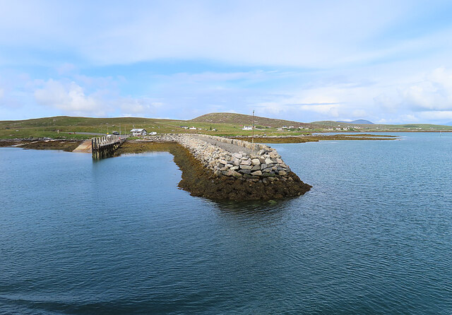
Poll an Oir is a picturesque and idyllic sea loch located in Inverness-shire, Scotland. Also known as the "Golden Pool" in Gaelic, Poll an Oir is renowned for its serene beauty and stunning natural surroundings. Situated on the west coast of Scotland, it lies within the Great Glen, a famous geological fault line that stretches from Fort William to Inverness.

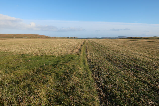
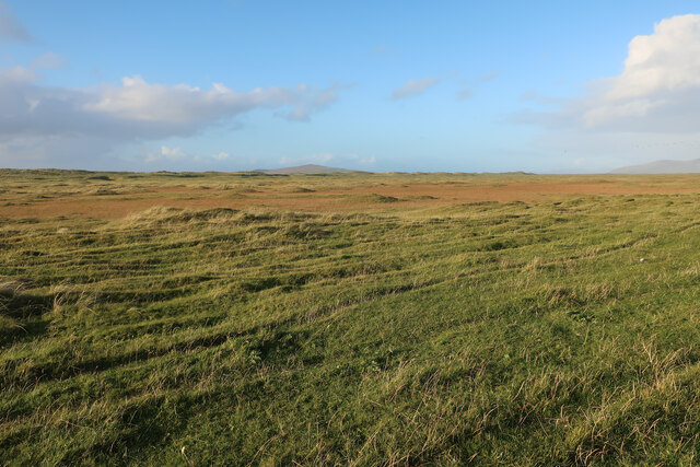
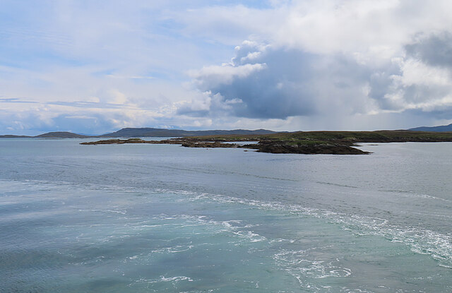
The sea loch is characterized by its calm and tranquil waters, which are protected by towering mountains that provide a majestic backdrop. The loch is surrounded by lush greenery, with dense forests and rolling hills adding to its scenic charm. Its pristine sandy beaches and rocky coves make it a popular destination for outdoor enthusiasts and nature lovers.

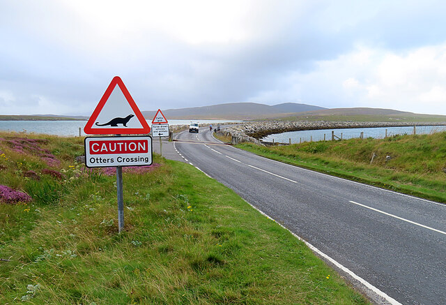
Poll an Oir is home to a diverse range of marine life, including seals, otters, and a variety of bird species. The loch is also a haven for fishing, with salmon and trout being commonly caught in its clear waters. It offers ample opportunities for water-based activities such as kayaking, sailing, and paddleboarding.

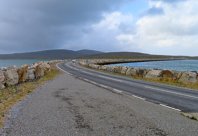
For those seeking a peaceful retreat, Poll an Oir provides the perfect escape. Its remote location and lack of development make it a secluded and unspoiled haven. Visitors can enjoy breathtaking sunsets over the water and take in the tranquility of the surroundings.

In summary, Poll an Oir in Inverness-shire is a stunning sea loch with a serene and untouched beauty. Its scenic landscape, diverse wildlife, and range of outdoor activities make it a must-visit destination for nature enthusiasts and those seeking a peaceful getaway.

If you have any feedback on the listing, please let us know in the comments section below.
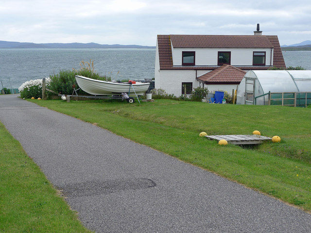
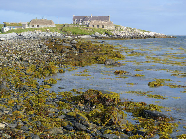
Poll an Oir Images

Images are sourced within 2km of 57.709604/-7.1746417 or Grid Reference NF9180. Thanks to Geograph Open Source API. All images are credited.

Stubble fields, Berneray
Machair on Berneray
Machair on Berneray
The Berneray Ferry Terminal A view of the Berneray Ferry terminal taken from the adjacent causeway. The Calmac Ferry 'Loch Portain' can be seen moored at the slipway.
The Berneray Ferry Terminal
A view of the Berneray Ferry terminal taken from the adjacent causeway. The Calmac Ferry 'Loch Portain' can be seen moored at the slipway.
Approaching Berneray/Bearnaraigh
Berneray Pier Seen from the deck of MV 'Lochportain'.
Berneray Pier
Seen from the deck of MV 'Lochportain'.
Eilean Fuam The last skerry that the Sound of Harris ferry needs to avoid before docking in Berneray.
Eilean Fuam
The last skerry that the Sound of Harris ferry needs to avoid before docking in Berneray.
Berneray Causeway The construction of the causeway linking the island to North Uist in the 1990s made life much easier for the human residents of Berneray, but possibly not for the otter population.
Berneray Causeway
The construction of the causeway linking the island to North Uist in the 1990s made life much easier for the human residents of Berneray, but possibly not for the otter population.
Berneray Causeway The causeway linking the island of Berneray to North Uist was officially opened in 1998. See <span class="nowrap"><a title="https://www.cne-siar.gov.uk/roads-travel-and-parking/bridges-causeways-and-ferries/berneray-causeway/" rel="nofollow ugc noopener" href="https://www.cne-siar.gov.uk/roads-travel-and-parking/bridges-causeways-and-ferries/berneray-causeway/">Link</a><img style="margin-left:2px;" alt="External link" title="External link - shift click to open in new window" src="https://s1.geograph.org.uk/img/external.png" width="10" height="10"/></span> for details.
Berneray Causeway
The causeway linking the island of Berneray to North Uist was officially opened in 1998. See LinkExternal link for details.
Commemorative Plaque The plaque is self-explanatory, though I am a little surprised to see that it gives HRH his English title rather than his Scottish one, Duke of Rothesay.
Commemorative Plaque
The plaque is self-explanatory, though I am a little surprised to see that it gives HRH his English title rather than his Scottish one, Duke of Rothesay.
MV 'Lochportain' at Berneray The ferry from Leverburgh is just approaching the slipway at Aird Ma-Ruibhe on Berneray.
MV 'Lochportain' at Berneray
The ferry from Leverburgh is just approaching the slipway at Aird Ma-Ruibhe on Berneray.
A Deluge I was enjoying wandering about with the camera when it began to rain, and I barely made it back to the shelter of the car before the heavens opened, threatening to drown me and anyone else out in it. This was the view through the windscreen as I waited to board the Sound of Harris ferry.
A Deluge
I was enjoying wandering about with the camera when it began to rain, and I barely made it back to the shelter of the car before the heavens opened, threatening to drown me and anyone else out in it. This was the view through the windscreen as I waited to board the Sound of Harris ferry.
New house above Loch Bhrusda on Berneray At the junction with the track to Trealigarry (or in Gaelic as displayed on the road sign).  The Sound of Pabbay and Pabbay lie beyond the coastline of Berneray.
New house above Loch Bhrusda on Berneray
At the junction with the track to Trealigarry (or in Gaelic as displayed on the road sign). The Sound of Pabbay and Pabbay lie beyond the coastline of Berneray.
Modern house on Berneray Now Berneray is no longer an island and not reliant on a car ferry to reach North Uist there has been a spate of house building.
Modern house on Berneray
Now Berneray is no longer an island and not reliant on a car ferry to reach North Uist there has been a spate of house building.
Between the road and the sea, Berneray The flowers brighten up the landscape immensely.
Between the road and the sea, Berneray
The flowers brighten up the landscape immensely.
Small boat harbour, Berneray Fit for purpose!
Small boat harbour, Berneray
Fit for purpose!
Converted black houses and school by Loch a Bhaigh An enjoyable walk takes you between Loch Bhatarsaidh and the sea.
Converted black houses and school by Loch a Bhaigh
An enjoyable walk takes you between Loch Bhatarsaidh and the sea.
The turning for the Harris ferry Looking over the blue seas to North Uist and the glimmer of more perfect Hebridean beaches.
The turning for the Harris ferry
Looking over the blue seas to North Uist and the glimmer of more perfect Hebridean beaches.
The Lobster Pot Tearoom, Berneray A convenient short walk from the ferry terminal, if you have time to spare before the Leverburgh ferry departs.
The Lobster Pot Tearoom, Berneray
A convenient short walk from the ferry terminal, if you have time to spare before the Leverburgh ferry departs.
Show me another place!

Poll an Oir is located at Grid Ref: NF9180 (Lat: 57.709604, Lng: -7.1746417)

Unitary Authority: Na h-Eileanan an Iar

Police Authority: Highlands and Islands

What 3 Words

///supporter.sweetened.finest. Near Lochmaddy, Na h-Eileanan Siar

Related Wikis

Berneray (North Uist)

Berneray (Scottish Gaelic: Beàrnaraigh na Hearadh) is an island and community in the Sound of Harris, Scotland. It is one of fifteen inhabited islands...
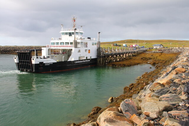
Otternish

Otternish is the former North Uist terminal for the ferry to Berneray, in the Outer Hebrides, Scotland. The slipway lies 6 miles (10 km) north of Lochmaddy...
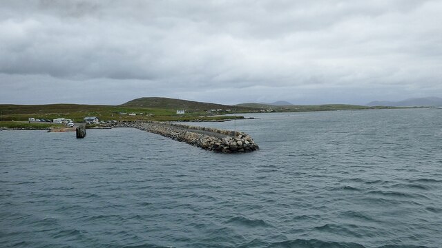
Newtonferry

Newtonferry (Scottish Gaelic: Port nan Long, "the harbour of the ships") is a small crofting community on the island of North Uist in the Western Isles...

Dun an Sticir

Dun an Sticir (Scottish Gaelic: Dùn an Sticir [ˈt̪un əɲ ˈʃtʲiçkʲɪɾʲ]) is an Iron Age broch situated approximately 9.5 kilometers north of Lochmaddy in...

Nearby Amenities

Located within 500m of 57.709604,-7.1746417
Source: PGS
Lat/Long: 57.711481/-7.1674901
Source: PGS
Lat/Long: 57.7122371/-7.1685425
Source: PGS
Lat/Long: 57.7121014/-7.1692778
Source: PGS
Lat/Long: 57.712016/-7.1697226
Source: PGS
Lat/Long: 57.7111443/-7.170049
Source: PGS
Lat/Long: 57.7110368/-7.1706122
Source: PGS
Lat/Long: 57.7109165/-7.1728921
Source: PGS
Lat/Long: 57.7112555/-7.17503
Source: PGS
Lat/Long: 57.711274/-7.1751706
Source: PGS
Lat/Long: 57.7106626/-7.1756858
Source: PGS
Lat/Long: 57.7106703/-7.1761086
Source: PGS
Lat/Long: 57.7101702/-7.1759872
Source: PGS
Lat/Long: 57.7101979/-7.1767176
Source: PGS
Lat/Long: 57.709998/-7.1764836
Source: PGS
Lat/Long: 57.7089553/-7.1770938
Source: PGS
Lat/Long: 57.7087507/-7.1770147
Source: PGS
Lat/Long: 57.7084122/-7.1766772
Source: PGS
Lat/Long: 57.7078895/-7.1768068
Source: PGS
Lat/Long: 57.707772/-7.176953
Source: PGS
Lat/Long: 57.7074518/-7.1771581
Source: PGS
Lat/Long: 57.7071523/-7.1777469
Source: PGS
Lat/Long: 57.7070527/-7.1786267
Source: PGS
Lat/Long: 57.7069588/-7.1788748
Source: PGS
Lat/Long: 57.7058189/-7.1786159
Post Box
Source: survey
Lat/Long: 57.7119341/-7.1762076
Cafe
Berneray Bistro
Contact Facebook: https://www.facebook.com/pages/category/Restaurant/Berneray-Shop-and-Bistro-514008445639497/
Internet Access: wlan
Toilets: yes
Toilets Wheelchair: designated
Website: https://www.bernerayshopandbistro.co.uk/bistro/
Wheelchair: limited
Lat/Long: 57.7066019/-7.1805447
Berneray Shop
Contact Facebook: https://www.facebook.com/pages/category/Restaurant/Berneray-Shop-and-Bistro-514008445639497/
Opening Hours: Mo-Sa 09:00-17:30
Phone: +44 1876 540288
Shop: convenience
Website: https://www.bernerayshopandbistro.co.uk/shop/
Wheelchair: limited
Lat/Long: 57.7066503/-7.1804339
Pol an Oir
Place: hamlet
Lat/Long: 57.7119609/-7.175441
Shelter
Shelter Type: public_transport
Lat/Long: 57.7111285/-7.1777362
Barrier: stile
Foot: yes
Material: wood
Stile: stepover
Lat/Long: 57.7095084/-7.1790859
Information: guidepost
Osmc Symbol: blue_bar
Symbol: light blue bar
Tourism: information
Lat/Long: 57.7095182/-7.1811388
Information: guidepost
Osmc Symbol: blue_bar
Symbol: Light blue bar
Tourism: information
Lat/Long: 57.7094108/-7.1798743
Information: guidepost
Osmc Symbol: blue_bar
Tourism: information
Lat/Long: 57.7094878/-7.1790887
Barrier: cattle_grid
Bicycle: yes
Foot: yes
Motorcycle: yes
Lat/Long: 57.7105303/-7.1781412
Poll an Oir
Natural: bay
Lat/Long: 57.709369/-7.1747697
Leisure: picnic_table
Lat/Long: 57.706554/-7.180464
Leisure: picnic_table
Lat/Long: 57.7065644/-7.1803848
Barrier: cattle_grid
Lat/Long: 57.7119822/-7.1768349
Barrier: cattle_grid
Lat/Long: 57.7119841/-7.1804416
Barrier: cattle_grid
Lat/Long: 57.7121787/-7.1803464
Passing Place
Lat/Long: 57.7120535/-7.1803135
Passing Place
Lat/Long: 57.7123973/-7.1812299
Barrier: cattle_grid
Lat/Long: 57.7135795/-7.1713927
Barrier: cattle_grid
Bicycle: yes
Foot: yes
Motorcycle: yes
Lat/Long: 57.710277/-7.1783787
Entrance: main
Lat/Long: 57.7066406/-7.180517
Toilets
Access: customers
Changing Table: yes
Female: yes
Male: yes
Wheelchair: yes
Lat/Long: 57.7066155/-7.1804821
Power: pole
Lat/Long: 57.7111278/-7.1807335
Power: pole
Lat/Long: 57.7113327/-7.1813732
Power: pole
Lat/Long: 57.7115362/-7.1820451
Power: pole
Lat/Long: 57.7120849/-7.174948
Power: pole
Lat/Long: 57.7120068/-7.1733776
Power: pole
Lat/Long: 57.7122898/-7.1728103
Power: pole
Lat/Long: 57.7126029/-7.1718219
Power: pole
Lat/Long: 57.7131043/-7.1799356
Power: pole
Lat/Long: 57.7129281/-7.1792087
Power: pole
Lat/Long: 57.712706/-7.1781975
Power: pole
Lat/Long: 57.7124753/-7.1772024
Power: pole
Lat/Long: 57.7122561/-7.1762301
Power: pole
Lat/Long: 57.708904/-7.1793576
Power: pole
Lat/Long: 57.7095316/-7.1797331
Power: pole
Lat/Long: 57.7103276/-7.1801984
Power: pole
Lat/Long: 57.7107166/-7.1794085
Power: pole
Lat/Long: 57.7112202/-7.1783772
Power: pole
Lat/Long: 57.7119223/-7.1769315
Power: pole
Lat/Long: 57.711592/-7.1776021
Power: pole
Lat/Long: 57.7114645/-7.1770375
Power: pole
Lat/Long: 57.7111851/-7.1762422
Power: pole
Lat/Long: 57.7082012/-7.1789512
Power: pole
Lat/Long: 57.7079705/-7.1797974
Power: pole
Lat/Long: 57.7076266/-7.181046
Power: pole
Lat/Long: 57.7073916/-7.1819204
Power: pole
Lat/Long: 57.7068259/-7.1799968
Power: pole
Lat/Long: 57.7069825/-7.1799441
Power: pole
Lat/Long: 57.7072179/-7.1793531
Power: pole
Lat/Long: 57.707487/-7.1787572
Power: pole
Lat/Long: 57.7077267/-7.1788797
Power: pole
Lat/Long: 57.7064546/-7.1799758
Passing Place
Lat/Long: 57.7130471/-7.1719975
The data included in this document is from www.openstreetmap.org. The data is made available under ODbL.

Have you been to Poll an Oir?

Leave your review of Poll an Oir below (or comments, questions and feedback).