Bàgh Cnoc nan Gobhar

Sea, Estuary, Creek in Inverness-shire

Scotland

Bàgh Cnoc nan Gobhar

Marestail (Hippuris vulgaris) A plant that always grows in water, for once conveniently close enough to the land to be photographed.
Marestail (Hippuris vulgaris) Credit: Anne Burgess

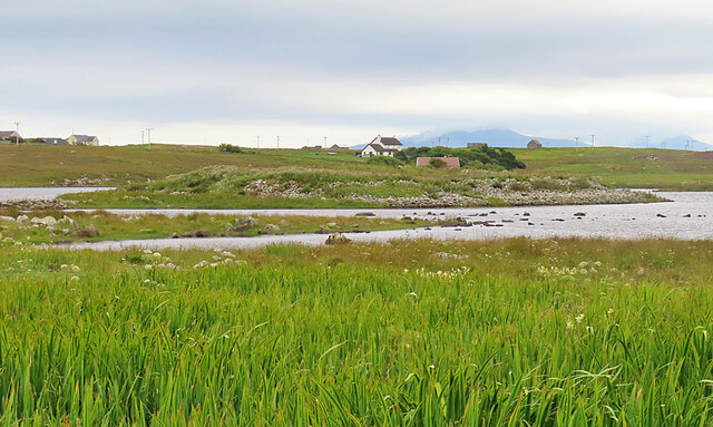
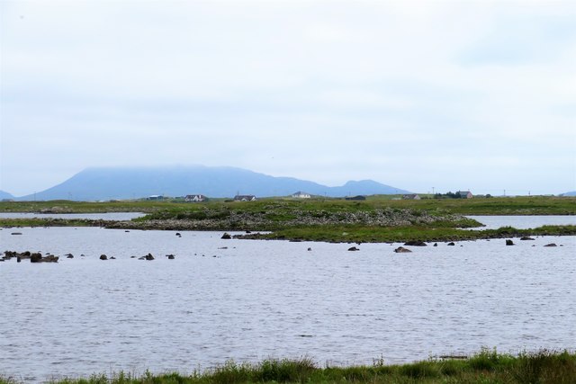
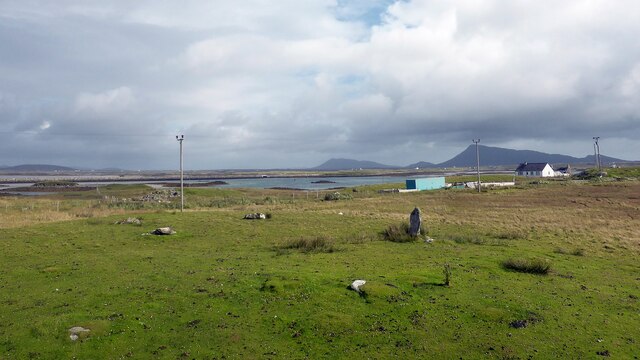
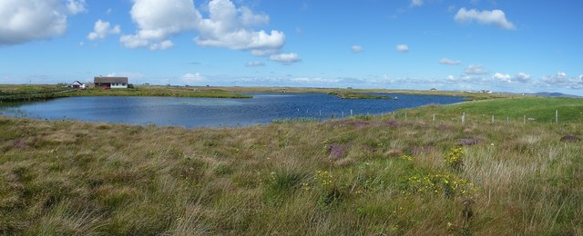
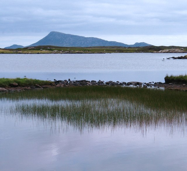
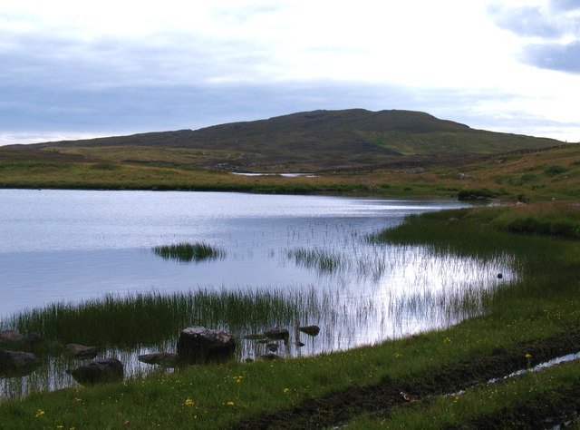
Bàgh Cnoc nan Gobhar, located in Inverness-shire, Scotland, is a picturesque coastal area that comprises a unique blend of sea, estuary, and creek environments. This stunning natural landscape is nestled between towering hillsides and offers visitors a serene and tranquil setting.

The main attraction of Bàgh Cnoc nan Gobhar is its pristine coastline, which stretches for several miles. The crystal-clear waters of the sea are perfect for swimming, snorkeling, and even fishing, attracting avid water sports enthusiasts. The area is also home to a diverse range of marine life, making it a popular spot for wildlife enthusiasts and nature lovers.

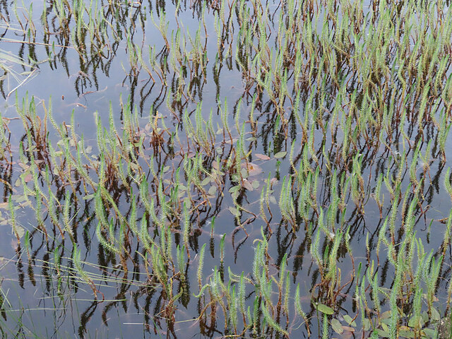
At the mouth of the estuary, where the sea meets the land, visitors can witness a spectacular display of tidal movements. The changing tides create dynamic and ever-changing patterns, providing a mesmerizing sight for onlookers.

Within Bàgh Cnoc nan Gobhar, there are also several small creeks that wind their way through the landscape. These creeks are lined with lush vegetation, adding to the area's natural beauty. Exploring these creeks offers visitors a chance to observe the local flora and fauna up close, as well as enjoy peaceful walks along their banks.

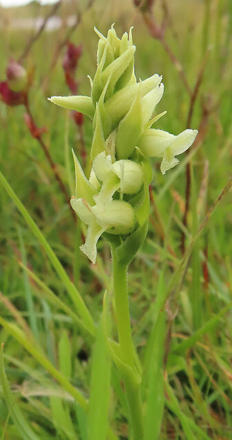
The surrounding hillsides provide a breathtaking backdrop to Bàgh Cnoc nan Gobhar, offering opportunities for scenic hikes and panoramic views. The area is also home to a variety of bird species, making it a haven for birdwatchers.

Overall, Bàgh Cnoc nan Gobhar is a captivating coastal destination that offers visitors a chance to immerse themselves in the beauty of Scotland's natural environment. Whether it's exploring the sea, estuary, or creek, there is something for everyone to appreciate in this idyllic corner of Inverness-shire.

If you have any feedback on the listing, please let us know in the comments section below.

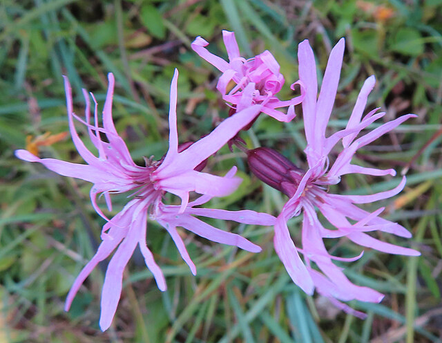
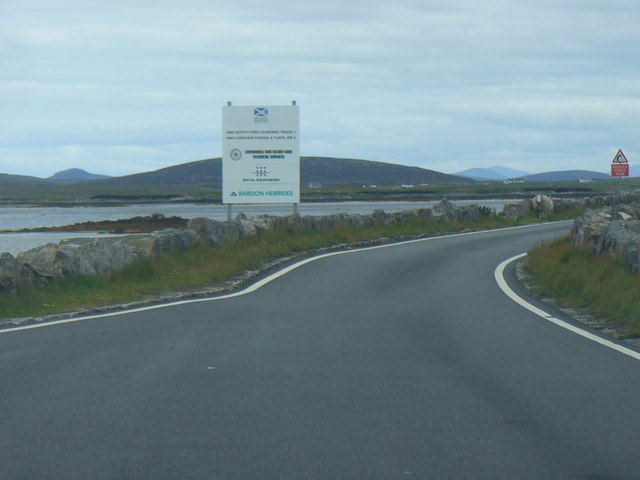
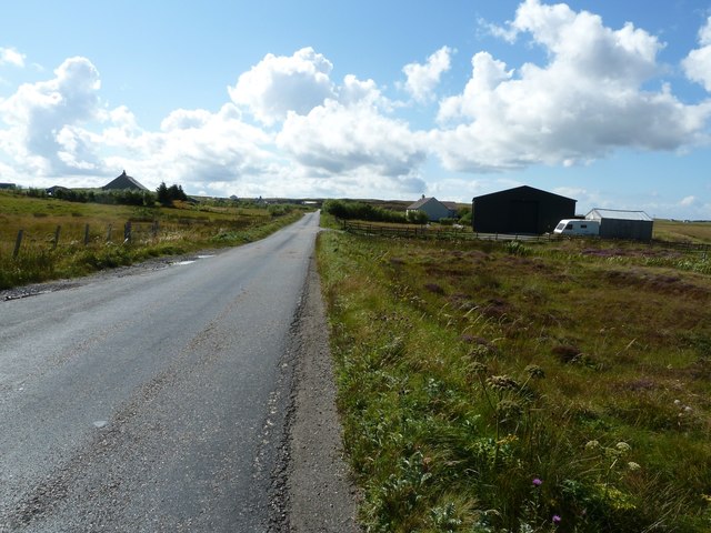
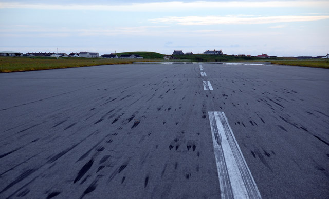
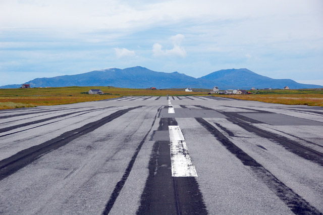
Bàgh Cnoc nan Gobhar Images

Images are sourced within 2km of 57.482113/-7.3326366 or Grid Reference NF8056. Thanks to Geograph Open Source API. All images are credited.

Marestail (Hippuris vulgaris) A plant that always grows in water, for once conveniently close enough to the land to be photographed.
Marestail (Hippuris vulgaris)
A plant that always grows in water, for once conveniently close enough to the land to be photographed.
Irish Lady's-tresses (Spiranthes romanzoffiana) A member of the orchid family, with a very western distribution.
Irish Lady's-tresses (Spiranthes romanzoffiana)
A member of the orchid family, with a very western distribution.
Dùn Buidhe The 'yellow fort' is on a peninsula, almost an islet, in Loch Dùn Mhurchaidh.
Dùn Buidhe
The 'yellow fort' is on a peninsula, almost an islet, in Loch Dùn Mhurchaidh.
Boulder Dyke On a peninsula in Loch Dùn Mhurchaidh.
Boulder Dyke
On a peninsula in Loch Dùn Mhurchaidh.
Ragged Robin (Silene flos-cuculi) Previously known as Lychnis flos-cuculi.
Ragged Robin (Silene flos-cuculi)
Previously known as Lychnis flos-cuculi.
Dun Buidhe The dun is situated on the further island, and although there's a lot of stones around it, one would be hard pressed to identify anything of a built nature.
Dun Buidhe
The dun is situated on the further island, and although there's a lot of stones around it, one would be hard pressed to identify anything of a built nature.
Gramisdale stone circle Rather mutilated prehistoric stone circle. <span class="nowrap"><a title="https://canmore.org.uk/site/10186/benbecula-gramisdale" rel="nofollow ugc noopener" href="https://canmore.org.uk/site/10186/benbecula-gramisdale">Link</a><img style="margin-left:2px;" alt="External link" title="External link - shift click to open in new window" src="https://s1.geograph.org.uk/img/external.png" width="10" height="10"/></span>
Gramisdale stone circle
Rather mutilated prehistoric stone circle. LinkExternal link
Uachdar: postbox № HS6 29 This small postbox is comfortably within the HS7 postcode district (Benbecula), but has an HS6 (North Uist) number. It is emptied at 2pm on weekdays and at 9:45am on Saturdays.
Uachdar: postbox № HS6 29
This small postbox is comfortably within the HS7 postcode district (Benbecula), but has an HS6 (North Uist) number. It is emptied at 2pm on weekdays and at 9:45am on Saturdays.
North Ford Causeway On the north edge of Benbecula, the modern causeway leads across the Oitir Mhor to Grimsay and North Uist.
<span class="nowrap"><a title="http://www.isle-of-benbecula.co.uk/" rel="nofollow ugc noopener" href="http://www.isle-of-benbecula.co.uk/">Link</a><img style="margin-left:2px;" alt="External link" title="External link - shift click to open in new window" src="https://s1.geograph.org.uk/img/external.png" width="10" height="10"/></span>
North Ford Causeway
On the north edge of Benbecula, the modern causeway leads across the Oitir Mhor to Grimsay and North Uist. LinkExternal link
A865 south of Loch na Smalaig, Benbecula The A865 runs through the centre of the loch-laced flat isle of Benbecula. The large dark green shed or barn seen on the right is just beyond the track to Ardgarbh, and must be quite recent as it does not appear on Google's Streetview (see <span class="nowrap"><a title="http://maps.google.com/maps?q=Gramsdale,+Benbecula&hl=en&ll=57.47317,-7.32846&spn=0.000023,0.027788&sll=41.890062,12.492549&sspn=0.004394,0.006947&vpsrc=6&hnear=Gramsdale,+Isle+Of+Benbecula,+Eilean+Siar,+United+Kingdom&t=h&z=16&layer=c&cbll=57.473554,-7.3282&panoid=nm1zCQ5DOfBW2LblAN-U4g&cbp=12,203.83,,0,13.56" rel="nofollow ugc noopener" href="http://maps.google.com/maps?q=Gramsdale,+Benbecula&hl=en&ll=57.47317,-7.32846&spn=0.000023,0.027788&sll=41.890062,12.492549&sspn=0.004394,0.006947&vpsrc=6&hnear=Gramsdale,+Isle+Of+Benbecula,+Eilean+Siar,+United+Kingdom&t=h&z=16&layer=c&cbll=57.473554,-7.3282&panoid=nm1zCQ5DOfBW2LblAN-U4g&cbp=12,203.83,,0,13.56">Link</a><img style="margin-left:2px;" alt="External link" title="External link - shift click to open in new window" src="https://s1.geograph.org.uk/img/external.png" width="10" height="10"/></span> ) 
Note: The maps show "Shieling" just south of this point, but that simply means roughly constructed hut or pasture for cattle, and is not a placename.
A865 south of Loch na Smalaig, Benbecula
The A865 runs through the centre of the loch-laced flat isle of Benbecula. The large dark green shed or barn seen on the right is just beyond the track to Ardgarbh, and must be quite recent as it does not appear on Google's Streetview (see LinkExternal link ) Note: The maps show "Shieling" just south of this point, but that simply means roughly constructed hut or pasture for cattle, and is not a placename.
Loch na Smalaig Benbecula doesn't get rave reviews in most of the guidebooks, which generally urge the visitor on to the delights of the Uists to north and south. But on a beautiful sunny day like this, the inky blue lochs and lochans have a distinct charm.
The house on the left is Ardgarbh with its track forming the southern border of the loch.
Loch na Smalaig
Benbecula doesn't get rave reviews in most of the guidebooks, which generally urge the visitor on to the delights of the Uists to north and south. But on a beautiful sunny day like this, the inky blue lochs and lochans have a distinct charm. The house on the left is Ardgarbh with its track forming the southern border of the loch.
Loch Olabhat A shallow loch, almost at sea level and with numerous small islands. Looking towards the distinctive profile of Eabhal on North Uist.
Loch Olabhat
A shallow loch, almost at sea level and with numerous small islands. Looking towards the distinctive profile of Eabhal on North Uist.
Loch Olabhat An unpleasantly wet track leads from the road down to this reedy loch.
Loch Olabhat
An unpleasantly wet track leads from the road down to this reedy loch.
Gramsdale: postbox № HS6 40 and phone One of several postboxes which seem to have a prefix misnomer - being on Benbecula, this box is actually in the HS7, not HS6, postcode district. It stands alongside a red telephone box and this may be evidence that the post office, which opened in the summer of 1935 and closed on 5 October 1974, was in the adjacent house.
Gramsdale: postbox № HS6 40 and phone
One of several postboxes which seem to have a prefix misnomer - being on Benbecula, this box is actually in the HS7, not HS6, postcode district. It stands alongside a red telephone box and this may be evidence that the post office, which opened in the summer of 1935 and closed on 5 October 1974, was in the adjacent house.
Gramsdale: Welcome to Benbecula A bilingual welcome to motorists travelling southward on the A865 as they arrive on the isle of Benbecula on the causeway from Grimsay.
Gramsdale: Welcome to Benbecula
A bilingual welcome to motorists travelling southward on the A865 as they arrive on the isle of Benbecula on the causeway from Grimsay.
Benbecula Golf club These buildings form part of Benbecula golf club, beside the taxi-way at the airport.
Benbecula Golf club
These buildings form part of Benbecula golf club, beside the taxi-way at the airport.
Benbecula Airport runway looking south west from the point where most planes land.
Benbecula Airport runway
looking south west from the point where most planes land.
The short runway at Benbecula Airport The shorter runway (to allow taking off/landing into the wind when it's markedly different to the prevailing trend) is a lot bumpier than the main one.
Hecla and Beinn Mhor on South Uist in the background.
The short runway at Benbecula Airport
The shorter runway (to allow taking off/landing into the wind when it's markedly different to the prevailing trend) is a lot bumpier than the main one. Hecla and Beinn Mhor on South Uist in the background.
Show me another place!

Bàgh Cnoc nan Gobhar is located at Grid Ref: NF8056 (Lat: 57.482113, Lng: -7.3326366)

Unitary Authority: Na h-Eileanan an Iar

Police Authority: Highlands and Islands

What 3 Words

///tint.surnames.crunches. Near Balivanich, Na h-Eileanan Siar

Related Wikis

Uachdar

Uachdar (Scottish Gaelic: An t-Uachdar [ən̪ˠ ˈt̪ʰuəxkəɾ]) is a settlement on the Outer Hebridean Island of Benbecula. Uachdar is within the parish of South...

Benbecula Airport

Benbecula Airport (Scottish Gaelic: Port-adhair Bheinn na Faoghla) (IATA: BEB, ICAO: EGPL) is located on the island of Benbecula in the Outer Hebrides...

Balivanich

Balivanich (Scottish Gaelic: Baile a' Mhanaich [palə ˈvanɪç]) is a village on the island of Benbecula in the Outer Hebrides off the west coast of Scotland...
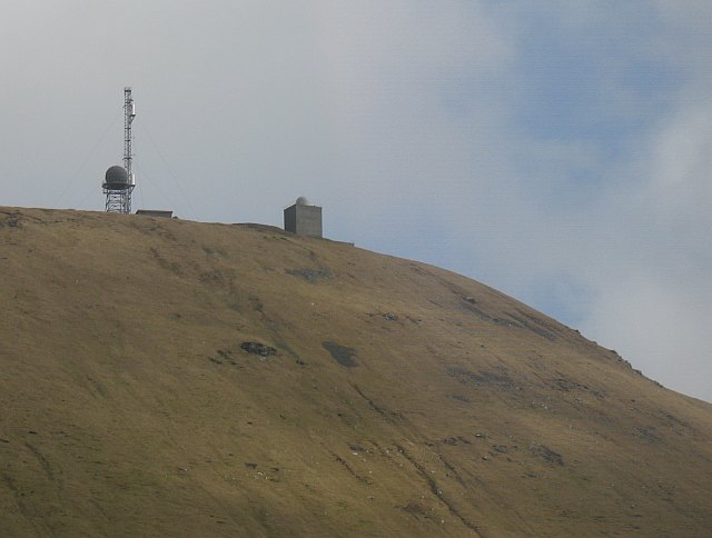
Deep Sea Range

The Deep Sea Range is an RAF missile range in the Outer Hebrides. It has also been known as the Hebrides Guided Weapon Range and the South Uist Missile...

Nearby Amenities

Located within 500m of 57.482113,-7.3326366
An t-Uachdar
Name En: Uachdar
Name Gd: An t-Uachdar
Place: village
Wikidata: Q7876328
Wikipedia: en:Uachdar
Lat/Long: 57.4788576/-7.3342216
Power: pole
Lat/Long: 57.4787895/-7.3374759
Power: pole
Lat/Long: 57.4788305/-7.3360736
Power: pole
Lat/Long: 57.4788453/-7.3352965
Power: pole
Lat/Long: 57.478851/-7.3345321
Power: pole
Lat/Long: 57.4788544/-7.3332439
Power: pole
Lat/Long: 57.4788672/-7.332036
Power: pole
Lat/Long: 57.4788887/-7.330757
Power: pole
Lat/Long: 57.478918/-7.329443
Power: pole
Lat/Long: 57.4789358/-7.3283456
Power: pole
Lat/Long: 57.478952/-7.327242
Power: pole
Lat/Long: 57.4789702/-7.3352606
Power: pole
Lat/Long: 57.4794844/-7.3359173
Power: pole
Lat/Long: 57.4794304/-7.3369352
Power: pole
Lat/Long: 57.4793915/-7.3376862
Power: pole
Lat/Long: 57.4793538/-7.3382707
Power: pole
Lat/Long: 57.479404/-7.3387514
Power: pole
Lat/Long: 57.4784616/-7.334606
Power: pole
Lat/Long: 57.4781074/-7.3344624
Power: pole
Lat/Long: 57.4805413/-7.3371656
Power: pole
Lat/Long: 57.4799162/-7.3364199
Power: pole
Lat/Long: 57.4809919/-7.3370087
Power: pole
Lat/Long: 57.4813293/-7.3368719
Power: pole
Lat/Long: 57.4819017/-7.3365849
Power: pole
Lat/Long: 57.4825376/-7.3362657
Power: pole
Lat/Long: 57.4831821/-7.3359358
Power: pole
Lat/Long: 57.4836579/-7.3356863
Power: pole
Lat/Long: 57.4842173/-7.3354476
The data included in this document is from www.openstreetmap.org. The data is made available under ODbL.

Have you been to Bàgh Cnoc nan Gobhar?

Leave your review of Bàgh Cnoc nan Gobhar below (or comments, questions and feedback).