Moasound

Sea, Estuary, Creek in Orkney

Scotland

Moasound

Longhope: heading down to The Ayre The road along the south side of South Walls descends towards The Ayre, the causeway that links South Walls with the neighbouring island of Hoy.
Longhope: heading down to The Ayre Credit: Chris Downer

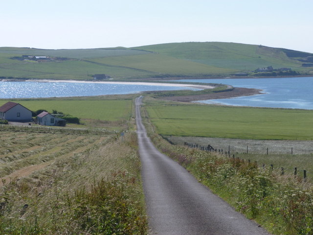
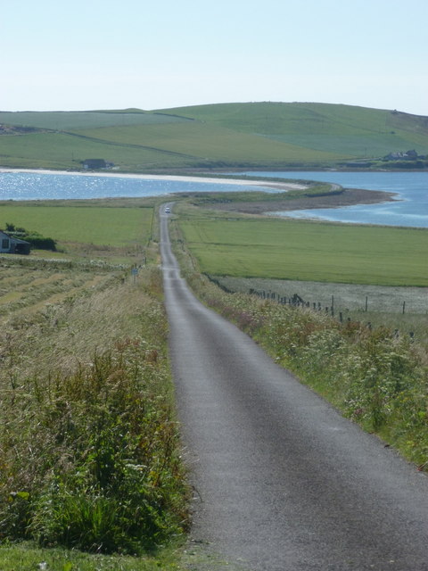
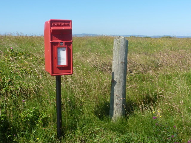
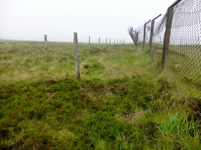
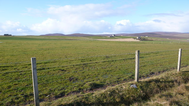
Moasound is a picturesque sea inlet located on the island of Orkney, Scotland. Nestled between towering cliffs and rolling hills, it stretches inland to form an estuary and eventually merges into a calm creek. The area is known for its outstanding natural beauty and diverse wildlife.

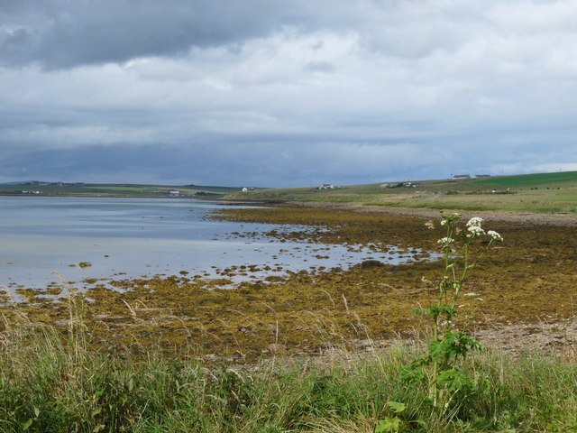
The sea surrounding Moasound is a captivating turquoise blue, contrasting with the rugged coastline. The clear waters provide a habitat for a variety of marine life, including seals, otters, and an array of fish species. The estuary, formed by the convergence of fresh and saltwater, is a haven for migratory birds, attracting a range of waders and waterfowl throughout the year.

The creek, further inland, offers a tranquil and sheltered environment. Its calm waters make it a popular spot for boating and fishing enthusiasts. The surrounding landscape is a mix of lush green meadows and ancient woodlands, providing a rich habitat for flora and fauna.

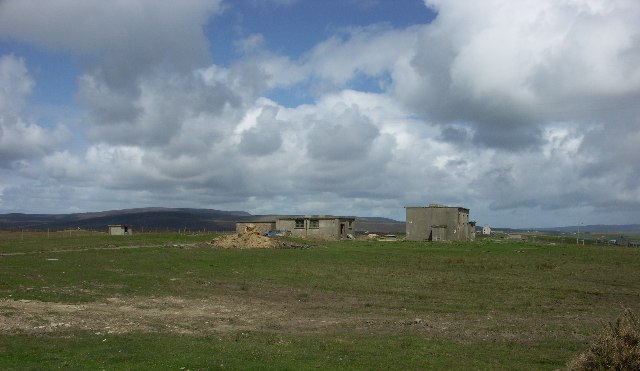
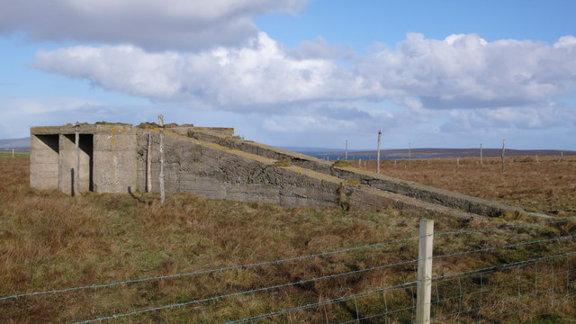
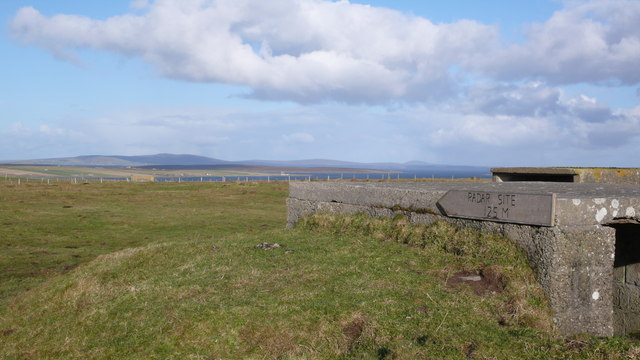
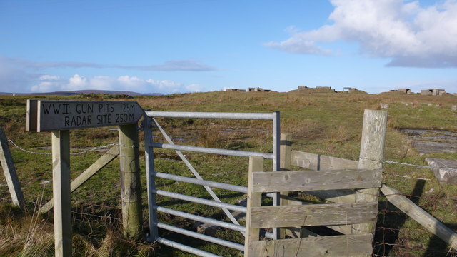
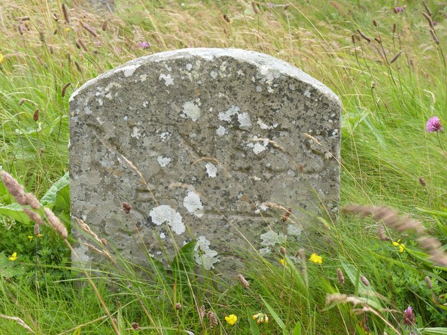
Moasound is not only a natural treasure but also a site of historical significance. Remains of ancient settlements and burial sites have been discovered in the area, providing valuable insights into the island's past.

Visitors to Moasound can enjoy various activities, such as hiking along the coastal paths, bird-watching, or simply immersing themselves in the serene atmosphere. With its stunning scenery and abundant wildlife, Moasound is a must-visit destination for nature lovers and those seeking a peaceful retreat.

If you have any feedback on the listing, please let us know in the comments section below.
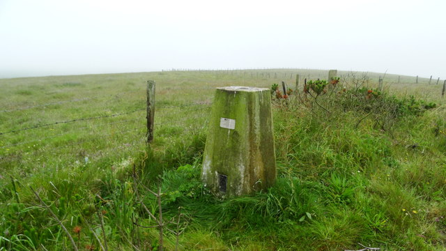
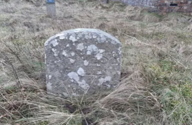
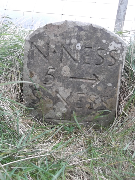
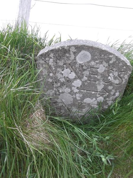
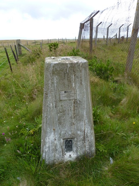
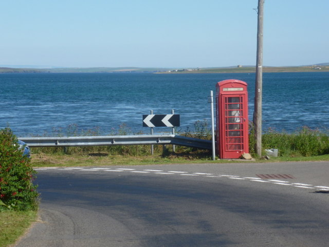
Moasound Images

Images are sourced within 2km of 58.801839/-3.2056507 or Grid Reference ND3091. Thanks to Geograph Open Source API. All images are credited.

Longhope: heading down to The Ayre The road along the south side of South Walls descends towards The Ayre, the causeway that links South Walls with the neighbouring island of Hoy.
Longhope: heading down to The Ayre
The road along the south side of South Walls descends towards The Ayre, the causeway that links South Walls with the neighbouring island of Hoy.
South Walls: dropping down to The Ayre The more minor, southern road across the island heads down towards <a href="https://www.geograph.org.uk/photo/2608323">ND2889 : South Walls: The Ayre</a>, the causeway linking South Walls with the neighbouring island of Hoy.
South Walls: dropping down to The Ayre
The more minor, southern road across the island heads down towards ND2889 : South Walls: The Ayre, the causeway linking South Walls with the neighbouring island of Hoy.
Shore at The Ayre, South Walls
Old Milestone, South Walls, Orkney Milestone by the UC road, in parish of Walls and Flotta (Hoy District), South Walls, West of entrance to Aithsdale.

Inscription reads:- 
L'Ness
5
{arrow->} 
(To Lyness)

HES Grade C(S) listed.
Reference: LB48335 <span class="nowrap"><a title="http://portal.historicenvironment.scot/designation/LB48335" rel="nofollow ugc noopener" href="http://portal.historicenvironment.scot/designation/LB48335">Link</a><img style="margin-left:2px;" alt="External link" title="External link - shift click to open in new window" src="https://s1.geograph.org.uk/img/external.png" width="10" height="10"/></span>

Surveyed

Milestone Society National ID: OR_HYNNKH05
Old Milestone, South Walls, Orkney
Milestone by the UC road, in parish of Walls and Flotta (Hoy District), South Walls, West of entrance to Aithsdale. Inscription reads:- L'Ness 5 {arrow->} (To Lyness) HES Grade C(S) listed. Reference: LB48335 LinkExternal link Surveyed Milestone Society National ID: OR_HYNNKH05
South Walls (Hoy) - Trig point at Gallow Tuag
Old Milestone, South Walls, Orkney Milestone by the UC road, in parish of Walls and Flotta (Hoy District), South Walls, West of entrance to Aithsdale.

Inscription reads:- 
L'Ness
5
{arrow->} 
(To Lyness)

HES Grade C(S) listed.
Reference: LB48335 <span class="nowrap"><a title="https://portal.historicenvironment.scot/designation/LB48335" rel="nofollow ugc noopener" href="https://portal.historicenvironment.scot/designation/LB48335">Link</a><img style="margin-left:2px;" alt="External link" title="External link - shift click to open in new window" src="https://s1.geograph.org.uk/img/external.png" width="10" height="10"/></span>

Surveyed

Milestone Society National ID: OR_HYNNKH05
Old Milestone, South Walls, Orkney
Milestone by the UC road, in parish of Walls and Flotta (Hoy District), South Walls, West of entrance to Aithsdale. Inscription reads:- L'Ness 5 {arrow->} (To Lyness) HES Grade C(S) listed. Reference: LB48335 LinkExternal link Surveyed Milestone Society National ID: OR_HYNNKH05
Old Milestone by the B9047, Lythes, Walls & Flotta parish Milestone by the B9047, in parish of Walls & Flotta (Hoy District), Lythes, near farm gate, on banking, East side of road.

Inscription reads:-
N.NESS
5 {arrow->}
S.NESS
{<-arrow}

Grade C(S) listed.
Reference: LB48342 <span class="nowrap"><a title="http://portal.historicenvironment.scot/designation/LB48342" rel="nofollow ugc noopener" href="http://portal.historicenvironment.scot/designation/LB48342">Link</a><img style="margin-left:2px;" alt="External link" title="External link - shift click to open in new window" src="https://s1.geograph.org.uk/img/external.png" width="10" height="10"/></span>

Surveyed

Milestone Society National ID: OR_HYNNSN05
Old Milestone by the B9047, Lythes, Walls & Flotta parish
Milestone by the B9047, in parish of Walls & Flotta (Hoy District), Lythes, near farm gate, on banking, East side of road. Inscription reads:- N.NESS 5 {arrow->} S.NESS {<-arrow} Grade C(S) listed. Reference: LB48342 LinkExternal link Surveyed Milestone Society National ID: OR_HYNNSN05
Old Milestone by the B9047, Heldale, Walls & Flotta parish Milestone by the B9047, in parish of Walls &amp;amp; Flotta (Hoy District), Heldale, on banking, South side of road.

Inscription reads:-
N.NESS
1 {arrow-&amp;gt;}
S.NESS
{&amp;lt;-arrow} 4

Surveyed

Milestone Society National ID: OR_HYNNSN01
Old Milestone by the B9047, Heldale, Walls & Flotta parish
Milestone by the B9047, in parish of Walls & Flotta (Hoy District), Heldale, on banking, South side of road. Inscription reads:- N.NESS 1 {arrow->} S.NESS {<-arrow} 4 Surveyed Milestone Society National ID: OR_HYNNSN01
South Walls: postbox &#8470; KW17 94, Eastbister A small postbox on the southern road across the island, emptied at 7:45 each weekday and Saturday morning.

Although Hoy and South Walls are postally within KW16 (Stromness), all the postboxes on the two islands are numbered KW17, presumably in error.
South Walls: postbox № KW17 94, Eastbister
A small postbox on the southern road across the island, emptied at 7:45 each weekday and Saturday morning. Although Hoy and South Walls are postally within KW16 (Stromness), all the postboxes on the two islands are numbered KW17, presumably in error.
Gallow Tuag Parked beside Orkney Islands Council Gallowtuag Landfill Site then backed the TuMP and the Aithsdale trig with Jim Bloomer and Tricky Speirs.
Name: Gallow Tuag
Hill number: 12240
Height: 57m / 187ft
Parent (Ma/M):none
Area:23: Orkney Islands
Class: 0
Grid ref: ND304895 (est)
Drop: 57m
Col: Sea
Gallow Tuag
Parked beside Orkney Islands Council Gallowtuag Landfill Site then backed the TuMP and the Aithsdale trig with Jim Bloomer and Tricky Speirs. Name: Gallow Tuag Hill number: 12240 Height: 57m / 187ft Parent (Ma/M):none Area:23: Orkney Islands Class: 0 Grid ref: ND304895 (est) Drop: 57m Col: Sea
South Walls Gallow Tuag WWII Royal Navy Wireless Station
South Walls
Gallow Tuag WWII Royal Navy Wireless Station
WW2 Radar Station Despite looking at this building from all different angles I couldn&amp;#039;t see how this was ever a radar station!  Just visible in the background are some of the many wooden posts which I assume were once part of the station.
WW2 Radar Station
Despite looking at this building from all different angles I couldn't see how this was ever a radar station! Just visible in the background are some of the many wooden posts which I assume were once part of the station.
Hill of Wards Gun Battery Many ruined buildings which once held artillery posts.
Hill of Wards Gun Battery
Many ruined buildings which once held artillery posts.
Grazing on South Walls South Walls is well known for the quality of its livestock.
Grazing on South Walls
South Walls is well known for the quality of its livestock.
Hill of Wards Gun Site
Milestone, South Walls, Orkney L&amp;#039;Ness 5 (Lyness)
Milestone, South Walls, Orkney
L'Ness 5 (Lyness)
Trigpoint at Aithsdale, South Walls, Orkney An easy trigpoint to access, though right by a landfill site so not very attractive, though in an otherwise attractive location.
Trigpoint at Aithsdale, South Walls, Orkney
An easy trigpoint to access, though right by a landfill site so not very attractive, though in an otherwise attractive location.
Lyness: phone box at North Ness This telephone box, correctly located on the 1:50,000 map but wrongly positioned on the 1:25,000, occupies an attractive position right by the shore.
Lyness: phone box at North Ness
This telephone box, correctly located on the 1:50,000 map but wrongly positioned on the 1:25,000, occupies an attractive position right by the shore.
Show me another place!

Moasound is located at Grid Ref: ND3091 (Lat: 58.801839, Lng: -3.2056507)

Unitary Authority: Orkney Islands

Police Authority: Highlands and Islands

What 3 Words

///purifier.play.triads. Near Lyness, Orkney Islands

Related Wikis

Longhope, Orkney

Longhope is a coastal settlement on the island of South Walls, in Orkney, Scotland. South Walls is linked to Hoy by causeway; Longhope is the largest settlement...

South Walls

South Walls (Scots: Sooth Waas), often referred to as Walls, is an inhabited island adjacent to Hoy in Orkney, Scotland. The name is a corruption of "Sooth...

RNLB Thomas McCunn (ON 759)

RNLB Thomas McCunn (ON 759) is a 45ft 6in Watson-class lifeboat stationed at Longhope in Orkney, Scotland, from January 1933 until April 1962. During...

Brims, Orkney

Brims is a village at the southern point of the island of Hoy, in Orkney, Scotland. The settlement is within the parish of Walls and Flotta. The RNLI lifeboat...

Lyness

Lyness is a village on the east coast of the island of Hoy, Orkney, Scotland. The village is within the parish of Walls and Flotta, and is situated at...

Crockness Martello tower

Crockness Martello Tower is a Martello Tower on Hoy, Orkney, Scotland. It was built during the Napoleonic Wars, at the same time as the Martello Tower...

Hackness Martello Tower and Battery

Hackness Martello Tower and Battery is a British Army barracks and museum located on the island of South Walls, in Orkney, Scotland. == History == The...

Scapa Flow Museum

Scapa Flow Museum is a war museum in Lyness on the Island of Hoy, Orkney, Scotland. Housed within a refurbished Romney hut and oil fuel pump house at the...

Nearby Amenities

Located within 500m of 58.801839,-3.2056507
RNLI shop
Operator: Royal National Lifeboat Institution
Operator Short: RNLI
Shop: charity
Lat/Long: 58.8005396/-3.2070208
Shop: convenience
Lat/Long: 58.8004497/-3.207378
Longhope
Name Sco: Longhop
Place: village
Wikidata: Q6673878
Lat/Long: 58.7987794/-3.2037988
North Ness
Place: locality
Lat/Long: 58.8056947/-3.2052064
Seamark Light 1 Character: Fl
Seamark Light 1 Colour: green
Seamark Light 1 Height: 6
Seamark Light 1 Period: 3
Seamark Light 1 Range: 5
Seamark Light 1 Sector End: 242
Seamark Light 1 Sector Start: 82
Seamark Light 1 Sequence: 0.7+(2.3)
Seamark Light 2 Character: Fl
Seamark Light 2 Colour: white
Seamark Light 2 Height: 6
Seamark Light 2 Period: 3
Seamark Light 2 Range: 7
Seamark Light 2 Sector End: 252
Seamark Light 2 Sector Start: 242
Seamark Light 2 Sequence: 0.7+(2.3)
Seamark Light 3 Character: Fl
Seamark Light 3 Colour: red
Seamark Light 3 Height: 6
Seamark Light 3 Period: 3
Seamark Light 3 Range: 5
Seamark Light 3 Sector End: 82
Seamark Light 3 Sector Start: 252
Seamark Light 3 Sequence: 0.7+(2.3)
Seamark Light Reference: A 3606
Seamark Type: light_minor
Source: US NGA Pub. 114. 2011-05-26.
Lat/Long: 58.8009718/-3.2055538
Post Office
Longhope Post Office
Addr Country: GB
Addr Postcode: KW16 3PG
Brand: Post Office
Brand Wikidata: Q1783168
Opening Hours: Mo,We 09:00-12:30,14:00-17:30; Tu,Th-Sa 09:30-12:30,14:00-17:30
Ref Pol Id: 1954
Website: https://www.postoffice.co.uk/branch-finder/1208454/longhope
Lat/Long: 58.8003548/-3.2073214
Ferry Terminal
Longhope
Ferry: yes
Fixme: Add routes of ferries
Public Transport: stop_position
Lat/Long: 58.8008406/-3.2057645
Post Box
Post Box Type: wall
Lat/Long: 58.8003244/-3.2071073
Telephone
Booth: K6
Covered: booth
Lat/Long: 58.8001245/-3.2068208
Walls War Memorial
Historic: memorial
Inscription: To the glory of God and in grateful memory of those from this parish who gave their lives for King and country in the Great War 1914 – 1918.
Memorial: war_memorial
Lat/Long: 58.7994868/-3.2064576
Leisure: slipway
Seamark Small Craft Facility Category: slipway
Seamark Type: small_craft_facility
Lat/Long: 58.8004858/-3.2066901
Power: pole
Lat/Long: 58.7989842/-3.2080668
Power: pole
Lat/Long: 58.7983214/-3.207686
Marker: cable
Lat/Long: 58.7996811/-3.2109247
Generator Method: photovoltaic
Generator Output Electricity: yes
Generator Source: solar
Generator Type: solar_photovoltaic_panel
Location: roof
Power: generator
Lat/Long: 58.7982005/-3.2071348
Generator Method: photovoltaic
Generator Output Electricity: yes
Generator Source: solar
Generator Type: solar_photovoltaic_panel
Location: roof
Power: generator
Lat/Long: 58.7982283/-3.2069027
Generator Method: photovoltaic
Generator Output Electricity: yes
Generator Source: solar
Generator Type: solar_photovoltaic_panel
Location: roof
Power: generator
Lat/Long: 58.7993233/-3.2066023
Generator Method: photovoltaic
Generator Output Electricity: yes
Generator Source: solar
Generator Type: solar_photovoltaic_panel
Location: roof
Power: generator
Lat/Long: 58.7993219/-3.2068598
Generator Method: photovoltaic
Generator Output Electricity: yes
Generator Source: solar
Generator Type: solar_photovoltaic_panel
Location: roof
Power: generator
Lat/Long: 58.7993177/-3.2071146
Generator Method: photovoltaic
Generator Output Electricity: yes
Generator Source: solar
Generator Type: solar_photovoltaic_panel
Location: roof
Power: generator
Lat/Long: 58.7988633/-3.2071146
Generator Method: photovoltaic
Generator Output Electricity: yes
Generator Source: solar
Generator Type: solar_photovoltaic_panel
Location: roof
Power: generator
Lat/Long: 58.7988745/-3.20701
Generator Method: photovoltaic
Generator Output Electricity: yes
Generator Source: solar
Generator Type: solar_photovoltaic_panel
Location: roof
Power: generator
Lat/Long: 58.7989578/-3.2061464
Generator Method: photovoltaic
Generator Output Electricity: yes
Generator Source: solar
Generator Type: solar_photovoltaic_panel
Location: roof
Power: generator
Lat/Long: 58.7989648/-3.2060525
Generator Method: photovoltaic
Generator Output Electricity: yes
Generator Source: solar
Generator Type: solar_photovoltaic_panel
Location: roof
Power: generator
Lat/Long: 58.799119/-3.2051405
Generator Method: photovoltaic
Generator Output Electricity: yes
Generator Source: solar
Generator Type: solar_photovoltaic_panel
Location: roof
Power: generator
Lat/Long: 58.7987758/-3.2049957
Generator Method: photovoltaic
Generator Output Electricity: yes
Generator Source: solar
Generator Type: solar_photovoltaic_panel
Location: roof
Power: generator
Lat/Long: 58.7987716/-3.2051003
Generator Method: photovoltaic
Generator Output Electricity: yes
Generator Source: solar
Generator Type: solar_photovoltaic_panel
Location: roof
Power: generator
Lat/Long: 58.7987383/-3.2054517
Generator Method: photovoltaic
Generator Output Electricity: yes
Generator Source: solar
Generator Type: solar_photovoltaic_panel
Location: roof
Power: generator
Lat/Long: 58.7987425/-3.205559
Generator Method: photovoltaic
Generator Output Electricity: yes
Generator Source: solar
Generator Type: solar_photovoltaic_panel
Location: roof
Power: generator
Lat/Long: 58.7984145/-3.2059318
Generator Method: photovoltaic
Generator Output Electricity: yes
Generator Source: solar
Generator Type: solar_photovoltaic_panel
Location: roof
Power: generator
Lat/Long: 58.7984187/-3.2058165
Generator Method: photovoltaic
Generator Output Electricity: yes
Generator Source: solar
Generator Type: solar_photovoltaic_panel
Location: roof
Power: generator
Lat/Long: 58.7984729/-3.2053283
Generator Method: photovoltaic
Generator Output Electricity: yes
Generator Source: solar
Generator Type: solar_photovoltaic_panel
Location: roof
Power: generator
Lat/Long: 58.7984673/-3.2054517
Power: pole
Lat/Long: 58.7984812/-3.2110816
Power: pole
Lat/Long: 58.7982325/-3.2098559
Power: pole
Lat/Long: 58.7978962/-3.2083538
Power: pole
Lat/Long: 58.7976934/-3.2073775
Power: pole
Lat/Long: 58.7976447/-3.2058781
Power: pole
Lat/Long: 58.7975947/-3.2046095
Helen Comrie
Water Rescue
Emergency: water_rescue
Lifeboat: offshore
Lifeboat Class: RNLI Tamar
Operator: Royal National Lifeboat Institution
Operator Short: RNLI
Ref: 16-05
Seamark Name: Helen Comrie
Seamark Radio Station Category: ais
Seamark Radio Station Mmsi: 235030387
Seamark Rescue Station Category: lifeboat_on_mooring
Seamark Source: https://map.openseamap.org/ (ais)
Seamark Type: rescue_station
Website: https://rnli.org/find-my-nearest/lifeboat-stations/longhope-lifeboat-station/longhope-lifeboat
Lat/Long: 58.8011948/-3.2061034
Bench
Backrest: yes
Lat/Long: 58.800546/-3.2068491
Power: pole
Lat/Long: 58.7987411/-3.1999002
Power: pole
Lat/Long: 58.8059022/-3.2040798
Man Made: mast
Tower Type: communication
Lat/Long: 58.7988087/-3.2119608
The data included in this document is from www.openstreetmap.org. The data is made available under ODbL.

Have you been to Moasound?

Leave your review of Moasound below (or comments, questions and feedback).