North Ness

Coastal Feature, Headland, Point in Orkney

Scotland

North Ness

Old Milestone, South Walls, Orkney Milestone by the UC road, in parish of Walls and Flotta (Hoy District), South Walls, West of entrance to Aithsdale.

Inscription reads:- 
L'Ness
5
{arrow->} 
(To Lyness)

HES Grade C(S) listed.
Reference: LB48335 <span class="nowrap"><a title="http://portal.historicenvironment.scot/designation/LB48335" rel="nofollow ugc noopener" href="http://portal.historicenvironment.scot/designation/LB48335">Link</a><img style="margin-left:2px;" alt="External link" title="External link - shift click to open in new window" src="https://s1.geograph.org.uk/img/external.png" width="10" height="10"/></span>

Surveyed

Milestone Society National ID: OR_HYNNKH05
Old Milestone, South Walls, Orkney Credit: Milestone Society

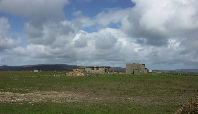
North Ness is a prominent coastal feature located in the Orkney Islands, situated off the northeastern coast of Scotland. It is a headland that juts out into the North Sea, forming a distinctive point on the island's coastline.

Standing at an elevation of approximately 20 meters above sea level, North Ness offers stunning panoramic views of the surrounding area. The headland is characterized by rugged cliffs and rocky outcrops, adding to its dramatic beauty. The coastline is dotted with small caves and sea stacks, which provide a habitat for various seabirds, including puffins, guillemots, and razorbills.

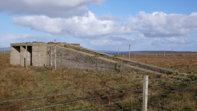
The area surrounding North Ness is also rich in history and archaeology. The headland is home to several ancient sites, including the remains of a prehistoric settlement known as Skara Brae. This UNESCO World Heritage Site offers a glimpse into Neolithic life, with well-preserved stone houses and artifacts dating back over 5,000 years.

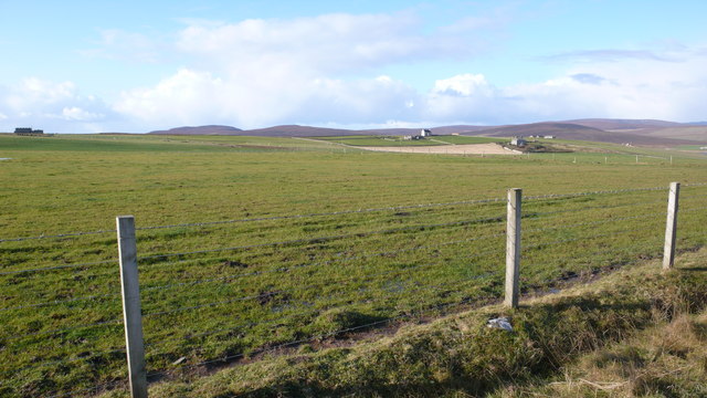
North Ness is a popular destination for nature enthusiasts, hikers, and photographers. Visitors can explore the coastal path that winds along the headland, offering breathtaking views of the sea and the nearby islands. The area is known for its diverse wildlife, with seals often seen basking on the rocks and otters occasionally spotted along the shoreline.

Overall, North Ness is a captivating coastal feature that combines natural beauty, archaeological significance, and abundant wildlife. Whether it is for its stunning landscapes, historical importance, or wildlife encounters, this headland attracts visitors from all over the world.

If you have any feedback on the listing, please let us know in the comments section below.
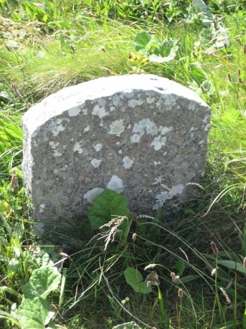
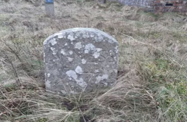
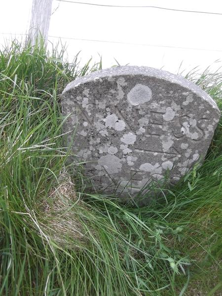
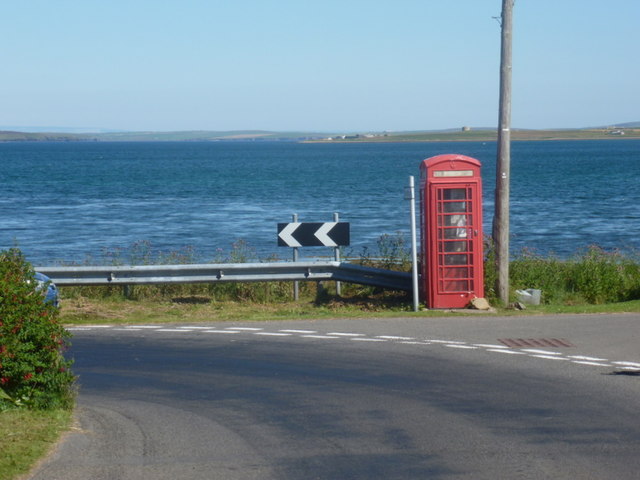
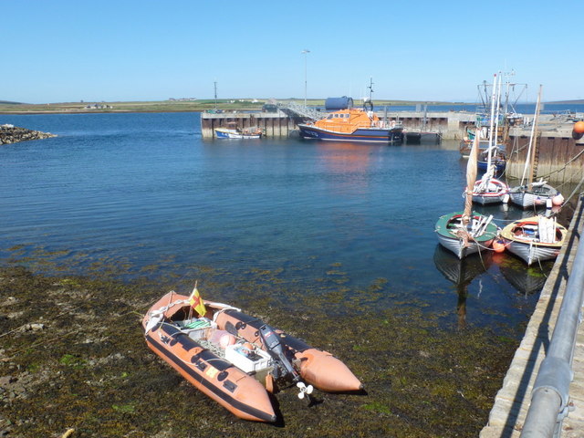
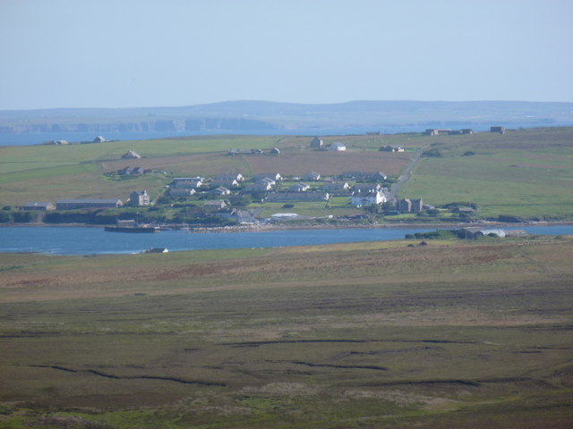
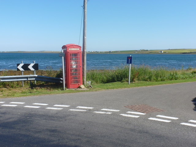
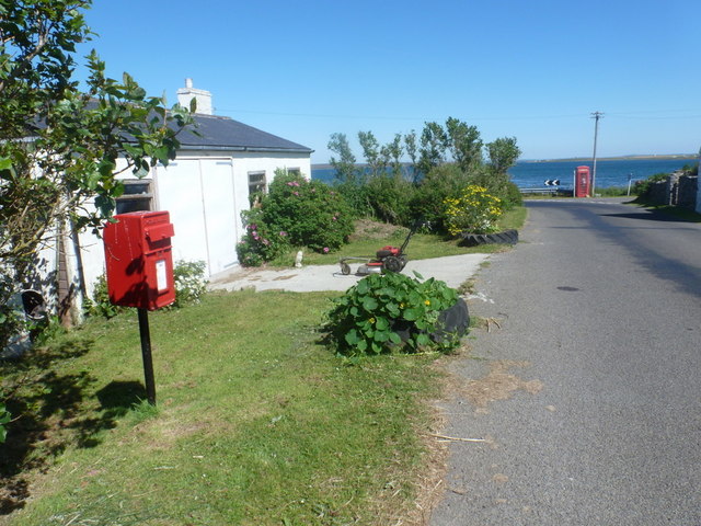
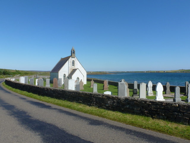
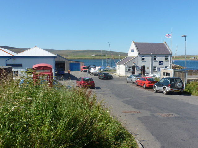
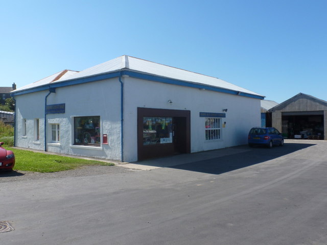
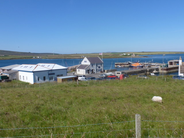
North Ness Images

Images are sourced within 2km of 58.806482/-3.205656 or Grid Reference ND3091. Thanks to Geograph Open Source API. All images are credited.

Old Milestone, South Walls, Orkney Milestone by the UC road, in parish of Walls and Flotta (Hoy District), South Walls, West of entrance to Aithsdale.

Inscription reads:- 
L'Ness
5
{arrow->} 
(To Lyness)

HES Grade C(S) listed.
Reference: LB48335 <span class="nowrap"><a title="http://portal.historicenvironment.scot/designation/LB48335" rel="nofollow ugc noopener" href="http://portal.historicenvironment.scot/designation/LB48335">Link</a><img style="margin-left:2px;" alt="External link" title="External link - shift click to open in new window" src="https://s1.geograph.org.uk/img/external.png" width="10" height="10"/></span>

Surveyed

Milestone Society National ID: OR_HYNNKH05
Old Milestone, South Walls, Orkney
Milestone by the UC road, in parish of Walls and Flotta (Hoy District), South Walls, West of entrance to Aithsdale. Inscription reads:- L'Ness 5 {arrow->} (To Lyness) HES Grade C(S) listed. Reference: LB48335 LinkExternal link Surveyed Milestone Society National ID: OR_HYNNKH05
Old Milestone, South Walls, Orkney Milestone by the UC road, in parish of Walls and Flotta (Hoy District), South Walls, West of entrance to Aithsdale.

Inscription reads:- 
L'Ness
5
{arrow->} 
(To Lyness)

HES Grade C(S) listed.
Reference: LB48335 <span class="nowrap"><a title="https://portal.historicenvironment.scot/designation/LB48335" rel="nofollow ugc noopener" href="https://portal.historicenvironment.scot/designation/LB48335">Link</a><img style="margin-left:2px;" alt="External link" title="External link - shift click to open in new window" src="https://s1.geograph.org.uk/img/external.png" width="10" height="10"/></span>

Surveyed

Milestone Society National ID: OR_HYNNKH05
Old Milestone, South Walls, Orkney
Milestone by the UC road, in parish of Walls and Flotta (Hoy District), South Walls, West of entrance to Aithsdale. Inscription reads:- L'Ness 5 {arrow->} (To Lyness) HES Grade C(S) listed. Reference: LB48335 LinkExternal link Surveyed Milestone Society National ID: OR_HYNNKH05
Old Milestone by the B9047, Lythes, Walls & Flotta parish Milestone by the B9047, in parish of Walls & Flotta (Hoy District), Lythes, near farm gate, on banking, East side of road.

Inscription reads:-
N.NESS
5 {arrow->}
S.NESS
{<-arrow}

Grade C(S) listed.
Reference: LB48342 <span class="nowrap"><a title="http://portal.historicenvironment.scot/designation/LB48342" rel="nofollow ugc noopener" href="http://portal.historicenvironment.scot/designation/LB48342">Link</a><img style="margin-left:2px;" alt="External link" title="External link - shift click to open in new window" src="https://s1.geograph.org.uk/img/external.png" width="10" height="10"/></span>

Surveyed

Milestone Society National ID: OR_HYNNSN05
Old Milestone by the B9047, Lythes, Walls & Flotta parish
Milestone by the B9047, in parish of Walls & Flotta (Hoy District), Lythes, near farm gate, on banking, East side of road. Inscription reads:- N.NESS 5 {arrow->} S.NESS {<-arrow} Grade C(S) listed. Reference: LB48342 LinkExternal link Surveyed Milestone Society National ID: OR_HYNNSN05
Old Milestone by the B9047, Heldale, Walls & Flotta parish Milestone by the B9047, in parish of Walls &amp;amp; Flotta (Hoy District), Heldale, on banking, South side of road.

Inscription reads:-
N.NESS
1 {arrow-&amp;gt;}
S.NESS
{&amp;lt;-arrow} 4

Surveyed

Milestone Society National ID: OR_HYNNSN01
Old Milestone by the B9047, Heldale, Walls & Flotta parish
Milestone by the B9047, in parish of Walls & Flotta (Hoy District), Heldale, on banking, South side of road. Inscription reads:- N.NESS 1 {arrow->} S.NESS {<-arrow} 4 Surveyed Milestone Society National ID: OR_HYNNSN01
South Walls Gallow Tuag WWII Royal Navy Wireless Station
South Walls
Gallow Tuag WWII Royal Navy Wireless Station
WW2 Radar Station Despite looking at this building from all different angles I couldn&amp;#039;t see how this was ever a radar station!  Just visible in the background are some of the many wooden posts which I assume were once part of the station.
WW2 Radar Station
Despite looking at this building from all different angles I couldn't see how this was ever a radar station! Just visible in the background are some of the many wooden posts which I assume were once part of the station.
Grazing on South Walls South Walls is well known for the quality of its livestock.
Grazing on South Walls
South Walls is well known for the quality of its livestock.
Milestone, South Walls, Orkney L&amp;#039;Ness 5 (Lyness)
Milestone, South Walls, Orkney
L'Ness 5 (Lyness)
Lyness: phone box at North Ness This telephone box, correctly located on the 1:50,000 map but wrongly positioned on the 1:25,000, occupies an attractive position right by the shore.
Lyness: phone box at North Ness
This telephone box, correctly located on the 1:50,000 map but wrongly positioned on the 1:25,000, occupies an attractive position right by the shore.
Longhope: the harbour Small harbour and lifeboat at Longhope on the island of South Walls.
Longhope: the harbour
Small harbour and lifeboat at Longhope on the island of South Walls.
Longhope: view from Wee Fea A view over Longhope from the viewpoint a mile or two northwest above Lyness.
Longhope: view from Wee Fea
A view over Longhope from the viewpoint a mile or two northwest above Lyness.
Hoy: telephone box at North Ness This red phone box is correctly positioned on the 1:50,000 map but wrongly placed a little south on the 1:25,000.
Hoy: telephone box at North Ness
This red phone box is correctly positioned on the 1:50,000 map but wrongly placed a little south on the 1:25,000.
Hoy: postbox &#8470; KW17 105, Little Ayre This small postbox is emptied at 8 o&amp;#039;clock each morning, except Sunday.

Although Hoy and South Walls are postally within KW16 (Stromness), all the postboxes on the two islands are numbered KW17, presumably in error.

In the background is the &lt;a href=&quot;https://www.geograph.org.uk/photo/2608294&quot;&gt;ND3091 : Hoy: telephone box at North Ness&lt;/a&gt;.
Hoy: postbox № KW17 105, Little Ayre
This small postbox is emptied at 8 o'clock each morning, except Sunday. Although Hoy and South Walls are postally within KW16 (Stromness), all the postboxes on the two islands are numbered KW17, presumably in error. In the background is the ND3091 : Hoy: telephone box at North Ness.
Hoy: North Walls kirk The parish church of North Walls occupies a splendid position by the shore of North Bay.
Hoy: North Walls kirk
The parish church of North Walls occupies a splendid position by the shore of North Bay.
Longhope: approaching the harbour The little road leading down to the village centre, with the lifeboat station ahead of us and the general store/post office behind the telephone box on the left.
Longhope: approaching the harbour
The little road leading down to the village centre, with the lifeboat station ahead of us and the general store/post office behind the telephone box on the left.
Longhope: John F.M. Groat & Sons Ltd. Directly facing the harbour, this shop is Longhope&amp;#039;s well-stocked general merchant and post office.
Longhope: John F.M. Groat & Sons Ltd.
Directly facing the harbour, this shop is Longhope's well-stocked general merchant and post office.
Longhope: the postbox at the post office This is the postbox set into the wall of &lt;a href=&quot;https://www.geograph.org.uk/photo/2608352&quot;&gt;ND3090 : Longhope: John F.M. Groat &amp;amp; Sons Ltd.&lt;/a&gt; which is the village stores and post office.

I would usually title a photo like this, &amp;quot;postbox № ...&amp;quot; but it has escaped being listed on the Royal Mail&amp;#039;s listing. This is possibly because the list is chiefly used for the type of collection plate should it need replacing, and this, being a nonstandard box without an information plate, does not need to be included.
Longhope: the postbox at the post office
This is the postbox set into the wall of ND3090 : Longhope: John F.M. Groat & Sons Ltd. which is the village stores and post office. I would usually title a photo like this, "postbox № ..." but it has escaped being listed on the Royal Mail's listing. This is possibly because the list is chiefly used for the type of collection plate should it need replacing, and this, being a nonstandard box without an information plate, does not need to be included.
Longhope: looking over the harbour Looking from the main road across the harbour - with the lifeboat station, general stores/post office and telephone box.
Longhope: looking over the harbour
Looking from the main road across the harbour - with the lifeboat station, general stores/post office and telephone box.
Show me another place!

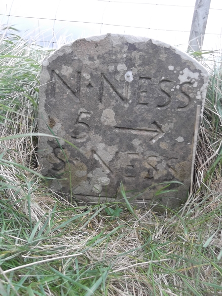
North Ness is located at Grid Ref: ND3091 (Lat: 58.806482, Lng: -3.205656)

Unitary Authority: Orkney Islands

Police Authority: Highlands and Islands

What 3 Words

///clock.sidelined.feed. Near Lyness, Orkney Islands

Related Wikis

Longhope, Orkney

Longhope is a coastal settlement on the island of South Walls, in Orkney, Scotland. South Walls is linked to Hoy by causeway; Longhope is the largest settlement...

South Walls

South Walls (Scots: Sooth Waas), often referred to as Walls, is an inhabited island adjacent to Hoy in Orkney, Scotland. The name is a corruption of "Sooth...

Lyness

Lyness is a village on the east coast of the island of Hoy, Orkney, Scotland. The village is within the parish of Walls and Flotta, and is situated at...

Crockness Martello tower

Crockness Martello Tower is a Martello Tower on Hoy, Orkney, Scotland. It was built during the Napoleonic Wars, at the same time as the Martello Tower...

Scapa Flow Museum

Scapa Flow Museum is a war museum in Lyness on the Island of Hoy, Orkney, Scotland. Housed within a refurbished Romney hut and oil fuel pump house at the...

RNLB Thomas McCunn (ON 759)

RNLB Thomas McCunn (ON 759) is a 45ft 6in Watson-class lifeboat stationed at Longhope in Orkney, Scotland, from January 1933 until April 1962. During...

Brims, Orkney

Brims is a village at the southern point of the island of Hoy, in Orkney, Scotland. The settlement is within the parish of Walls and Flotta. The RNLI lifeboat...

Hackness Martello Tower and Battery

Hackness Martello Tower and Battery is a British Army barracks and museum located on the island of South Walls, in Orkney, Scotland. == History == The...

Nearby Amenities

Located within 500m of 58.806482,-3.205656
Little Ayre
Place: locality
Lat/Long: 58.8080351/-3.2049502
North Ness
Place: locality
Lat/Long: 58.8056947/-3.2052064
Telephone
Booth: K6
Covered: booth
Lat/Long: 58.8063417/-3.2033419
Post Box
Post Box Type: lamp
Ref: KW17 105
Royal Cypher: scottish_crown
Lat/Long: 58.8063931/-3.2040688
Marker: cable
Lat/Long: 58.80637/-3.2076404
Power: pole
Lat/Long: 58.810197/-3.2032791
Power: pole
Lat/Long: 58.8096248/-3.2039362
Power: pole
Lat/Long: 58.8076397/-3.2059774
Power: pole
Lat/Long: 58.8069938/-3.2066774
Power: pole
Lat/Long: 58.8066819/-3.2069846
Location Transition: yes
Power: pole
Lat/Long: 58.8063061/-3.2073882
Power: pole
Lat/Long: 58.8089413/-3.2045987
Power: pole
Lat/Long: 58.8087594/-3.2061893
Power: pole
Lat/Long: 58.8086079/-3.2074311
Power: pole
Lat/Long: 58.8084607/-3.2088554
Power: pole
Lat/Long: 58.8082857/-3.2102528
Power: pole
Lat/Long: 58.8081509/-3.211441
Power: pole
Lat/Long: 58.8080231/-3.2125863
Power: pole
Lat/Long: 58.8078925/-3.2138658
Power: pole
Lat/Long: 58.8059022/-3.2040798
The data included in this document is from www.openstreetmap.org. The data is made available under ODbL.

Have you been to North Ness?

Leave your review of North Ness below (or comments, questions and feedback).