Kingston Beach
Beach in Sussex Adur
England
Kingston Beach

Kingston Beach is a picturesque pebble beach located in the county of Sussex, England. Situated in the village of Kingston near Lewes, it is a popular destination for locals and tourists alike. The beach is nestled between the stunning chalk cliffs of Seaford Head and the serene waters of the English Channel.
With its peaceful and unspoiled surroundings, Kingston Beach offers a tranquil escape from the hustle and bustle of city life. The beach boasts a wide expanse of pebbles, perfect for leisurely walks or picnics with family and friends. Visitors can enjoy breathtaking views of the rolling hills and dramatic coastline, providing ample opportunities for photography enthusiasts.
The beach is also a haven for nature lovers, as it is a designated Site of Special Scientific Interest (SSSI). It is home to a diverse range of flora and fauna, including rare plants and bird species. The area is protected, ensuring the preservation of its natural beauty and ecological significance.
For those seeking outdoor activities, Kingston Beach offers ample opportunities for water sports such as swimming, kayaking, and paddleboarding. The beach is ideal for those looking to unwind and soak up the sun, with plenty of space to relax and enjoy the peaceful atmosphere.
Facilities at Kingston Beach include public toilets and a nearby car park, providing convenience for visitors. There are also several charming cafes and pubs in the village, where visitors can indulge in delicious local cuisine and refreshing beverages.
Overall, Kingston Beach is a hidden gem along the Sussex coastline, offering a serene and scenic retreat for visitors seeking natural beauty and tranquility.
If you have any feedback on the listing, please let us know in the comments section below.
Kingston Beach Images
Images are sourced within 2km of 50.829954/-0.24804344 or Grid Reference TQ2304. Thanks to Geograph Open Source API. All images are credited.


Kingston Beach is located at Grid Ref: TQ2304 (Lat: 50.829954, Lng: -0.24804344)
Administrative County: West Sussex
District: Adur
Police Authority: Sussex
What 3 Words
///tapes.park.speaks. Near Shoreham-by-Sea, West Sussex
Nearby Locations
Related Wikis
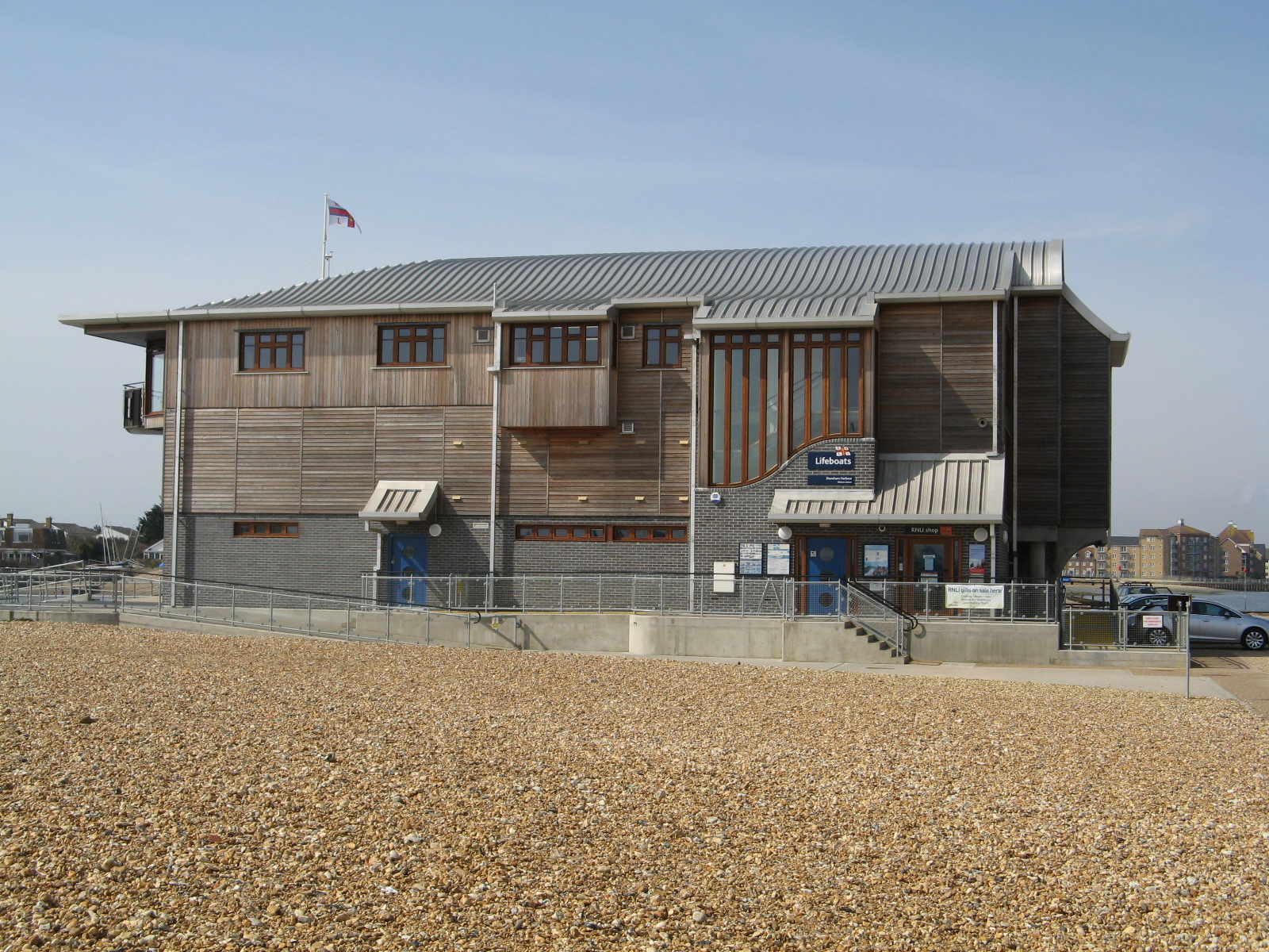
Shoreham Harbour Lifeboat Station
Shoreham Harbour Lifeboat Station is a Royal National Lifeboat Institution (RNLI) station located in the town of Shoreham-by-Sea in the English county...

Shoreham College
Shoreham College is a private day school for boys and girls aged 3 to 16, which is located in Shoreham-by-Sea on the Sussex coast between Brighton and...
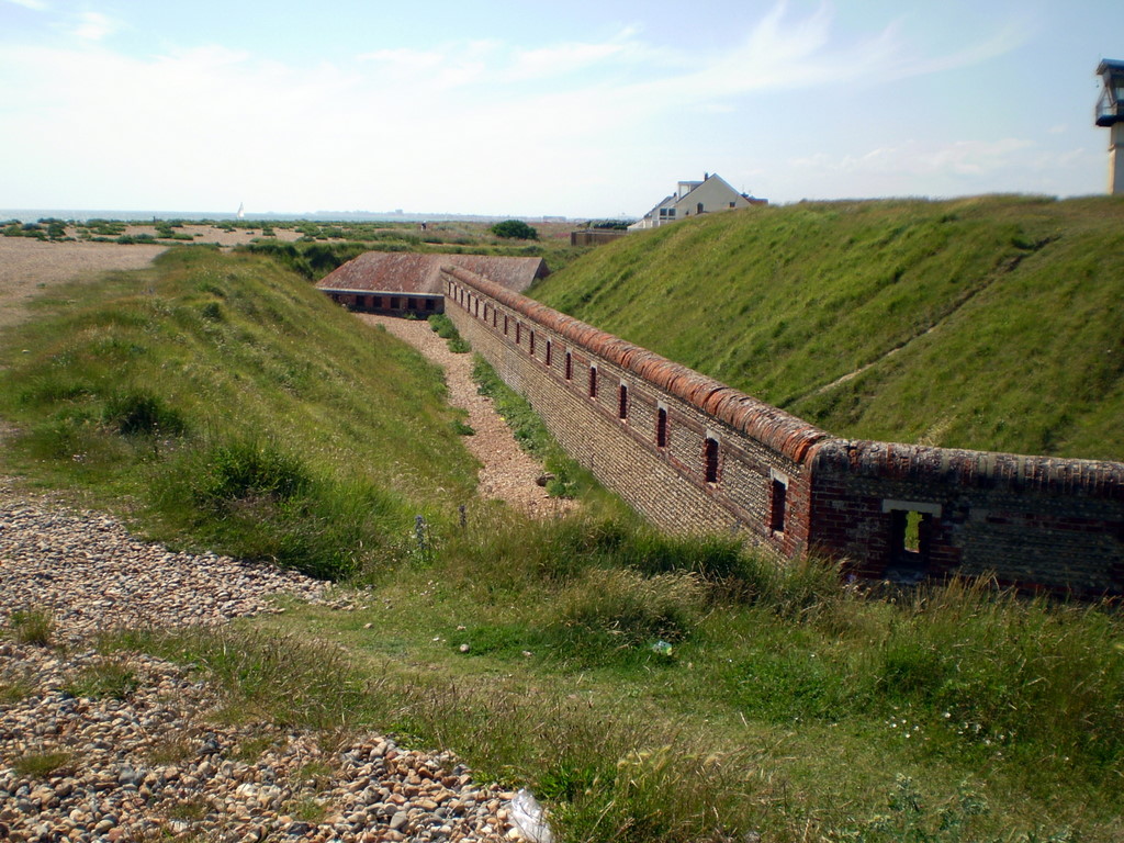
Shoreham Redoubt
Shoreham Redoubt (also known as Shoreham Fort or Kingston Redoubt) is a historical military defensive structure and scheduled monument at the entrance...

St Julian's Church, Kingston Buci
St Julian's Church is an Anglican church in Kingston Buci (also known as Kingston by Sea) in the district of Adur, one of seven local government districts...
Nearby Amenities
Located within 500m of 50.829954,-0.24804344Have you been to Kingston Beach?
Leave your review of Kingston Beach below (or comments, questions and feedback).