North Landing

Beach in Yorkshire

England

North Landing

Selwicks Bay Chalk cliffs and Selwicks Bay by Flamborough Head.
Selwicks Bay Credit: Jonathan Wilkins

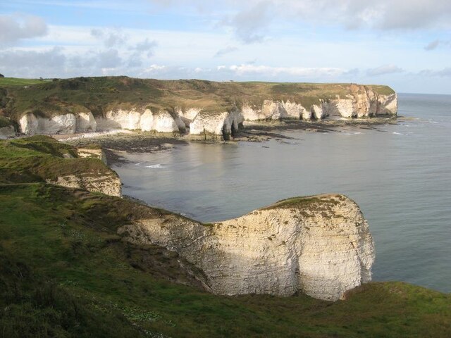
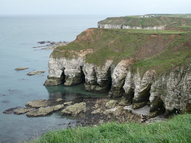
North Landing is a picturesque beach located on the East Yorkshire coast in England. Situated near the village of Flamborough, it is part of the Flamborough Headland Heritage Coast, renowned for its stunning natural beauty and diverse wildlife.

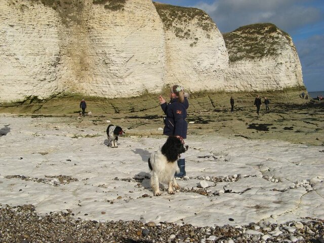
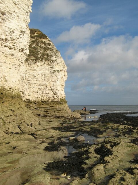
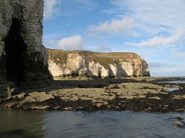
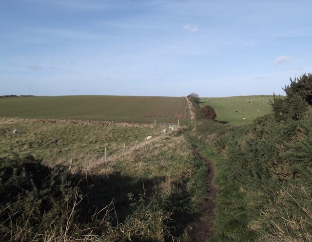
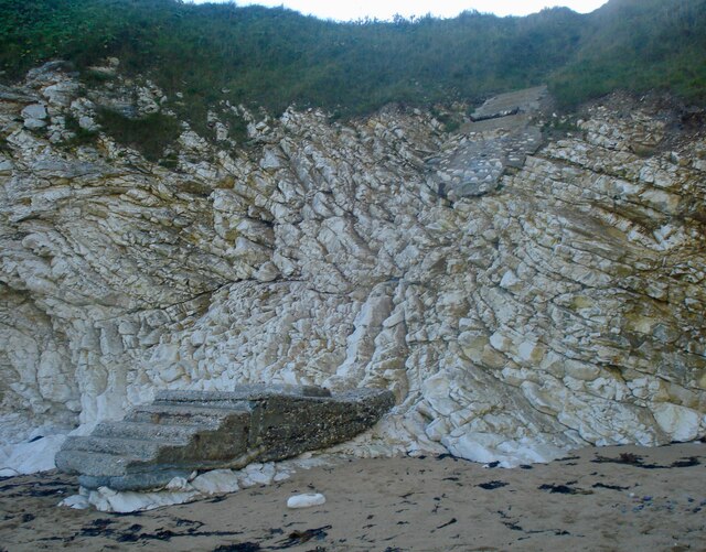
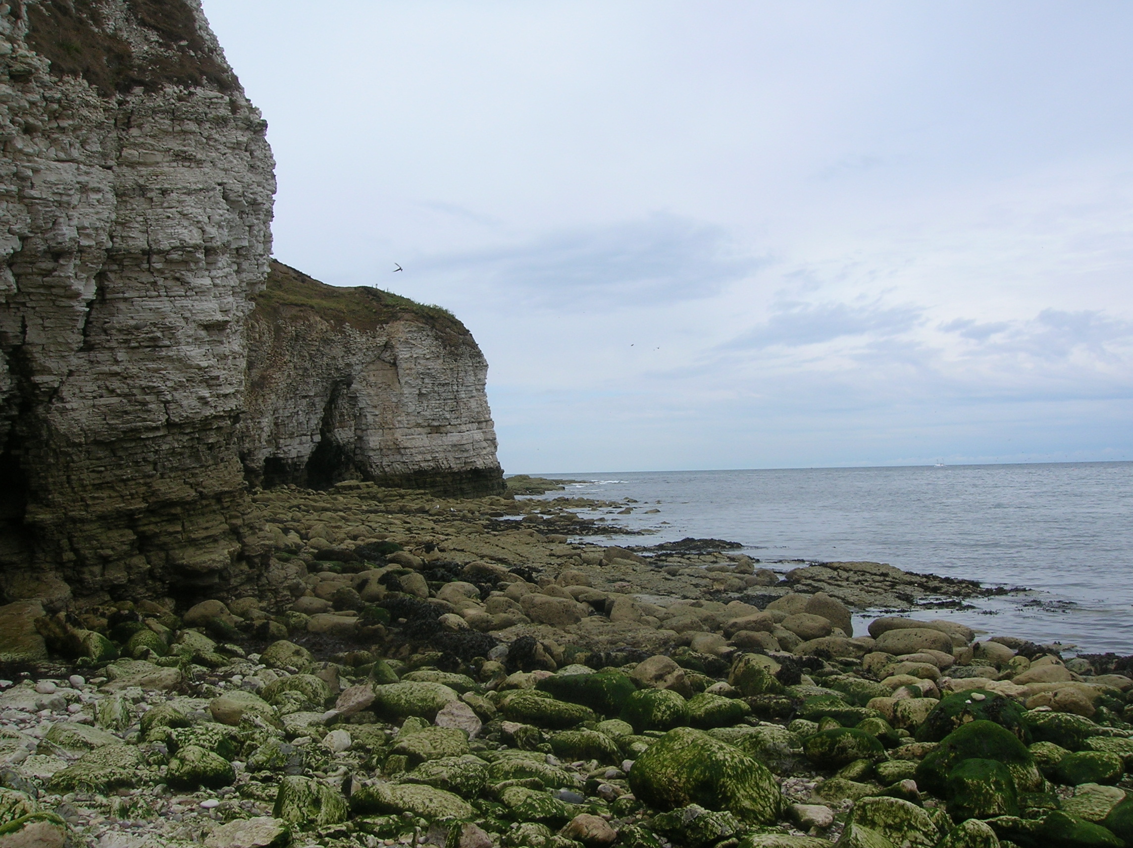
The beach itself is a hidden gem, nestled between towering chalk cliffs and rugged rock formations. Accessible via a steep path, it offers a secluded and tranquil environment, perfect for those seeking a peaceful retreat. The sandy beach stretches out to the North Sea, providing ample space for sunbathing, beach games, and long walks along the shore.

North Landing is also a popular spot for water activities. The clear and calm waters make it ideal for swimming, paddleboarding, and kayaking. Visitors can rent equipment from nearby facilities and explore the coastal area at their own pace. The beach is also a popular spot for fishing, with an abundance of marine life to be found just offshore.

Nature lovers will delight in the rich biodiversity of North Landing. The area is home to a variety of seabirds, including puffins, gannets, and kittiwakes, making it a haven for birdwatching enthusiasts. The cliffs surrounding the beach also provide nesting sites for seabird colonies, offering a unique opportunity to observe these fascinating creatures in their natural habitat.

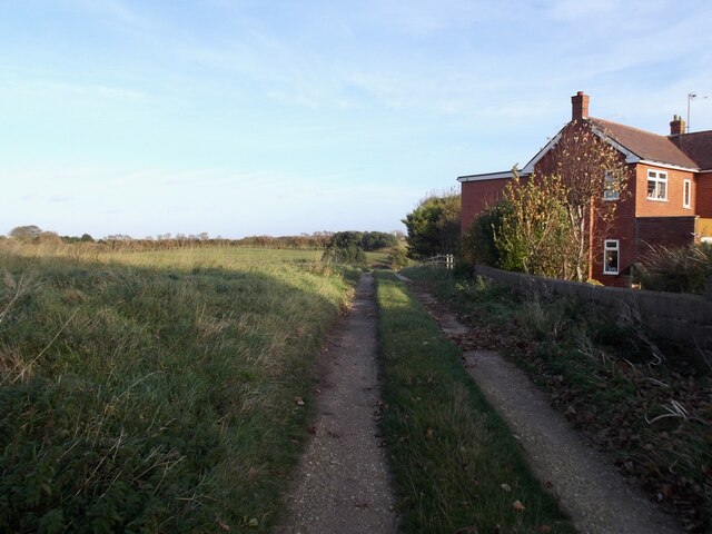
Facilities at North Landing include a small café serving refreshments and snacks, as well as public toilets. There is also a car park available for visitors' convenience. The beach is easily accessible by road, and nearby coastal paths offer scenic walks and opportunities to explore the surrounding area. With its stunning natural beauty and diverse wildlife, North Landing is a true hidden gem on the Yorkshire coast.

If you have any feedback on the listing, please let us know in the comments section below.

North Landing Images

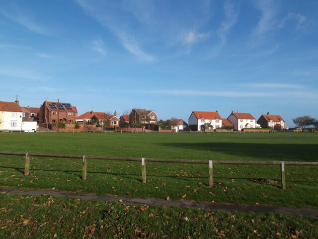
Images are sourced within 2km of 54.129583/-0.105392 or Grid Reference TA2372. Thanks to Geograph Open Source API. All images are credited.

Selwicks Bay Chalk cliffs and Selwicks Bay by Flamborough Head.
Selwicks Bay
Chalk cliffs and Selwicks Bay by Flamborough Head.
Chalk platform Flat-lying chalk strata have eroded into a smooth, white platform which is unlike any which I have encountered before. At lower levels on the beach, algae have attached, as can be seen in the background and on the cliffs, but this part of the shore appears to be scoured by powerful waves carrying shingle.
Chalk platform
Flat-lying chalk strata have eroded into a smooth, white platform which is unlike any which I have encountered before. At lower levels on the beach, algae have attached, as can be seen in the background and on the cliffs, but this part of the shore appears to be scoured by powerful waves carrying shingle.
Cliffs by Molk Hole Chalk cliffs and beach platform. Young, soft rocks such as these are not my normal subject, and it was very interesting to examine these chalk outcrops. In fact, diagenetic variation means that the rock is actually harder here than in other places with this archetypal English rock. Cliffs here comprise the Flamborough Chalk Formation, which is notably free of flint. The underlying Burnham Chalk Formation, which is found on the wave-cut platform at the south of the bay, is locally rich in flints.
Cliffs by Molk Hole
Chalk cliffs and beach platform. Young, soft rocks such as these are not my normal subject, and it was very interesting to examine these chalk outcrops. In fact, diagenetic variation means that the rock is actually harder here than in other places with this archetypal English rock. Cliffs here comprise the Flamborough Chalk Formation, which is notably free of flint. The underlying Burnham Chalk Formation, which is found on the wave-cut platform at the south of the bay, is locally rich in flints.
Wave-cut platform Gently-inclined chalk strata have eroded into an extensive wave-cut platform, backed by cliffs with numerous caves.
Wave-cut platform
Gently-inclined chalk strata have eroded into an extensive wave-cut platform, backed by cliffs with numerous caves.
North Mere Green, Flamborough
Expanding the Holiday Village at Flamborough
Footpath to the coast
Track off Ogle Road
Track off Ogle Road
Molk Hole, Selwicks Bay Molk Hole in Selwicks Bay, from the Flamborough Head car park
Molk Hole, Selwicks Bay
Molk Hole in Selwicks Bay, from the Flamborough Head car park
Weathered steps Weathered steps between Selwicks Bay and Flamborough Head car park
Weathered steps
Weathered steps between Selwicks Bay and Flamborough Head car park
Cliffs north of Flamborough Head
The Tower, Flamborough Head
The Rose & Crown, Flamborough Corner of High Street and North End.
With recent new signage. Cf. <a href="https://www.geograph.org.uk/photo/4318812">TA2270 : The Rose & Crown, Flamborough</a>
Day 54: Praktica DCZ 6.2  digital camera. 1/160 sec. f/5.88, 5.8 mm, ISO 70.
The Rose & Crown, Flamborough
Corner of High Street and North End. With recent new signage. Cf. TA2270 : The Rose & Crown, Flamborough Day 54: Praktica DCZ 6.2 digital camera. 1/160 sec. f/5.88, 5.8 mm, ISO 70.
Thornwick Nab Chalk cliffs and sea caves seen from the clifftop at Gull Nook.
Thornwick Nab
Chalk cliffs and sea caves seen from the clifftop at Gull Nook.
North Cliff Chalk cliffs and sea caves.
North Cliff
Chalk cliffs and sea caves.
Thornwick Bay Holiday Village Vast caravan park near North Landing.
Thornwick Bay Holiday Village
Vast caravan park near North Landing.
Lang Ness Chalk cliffs and sea caves.
Lang Ness
Chalk cliffs and sea caves.
Lang Ness Chalk cliffs and sea caves.
Lang Ness
Chalk cliffs and sea caves.
Show me another place!

North Landing is located at Grid Ref: TA2372 (Lat: 54.129583, Lng: -0.105392)

Division: East Riding

Unitary Authority: East Riding of Yorkshire

Police Authority: Humberside

What 3 Words

///closed.soup.shrubbery. Near Flamborough, East Yorkshire

Related Wikis

Flamborough

Flamborough is a village and civil parish in the East Riding of Yorkshire, England. It is situated approximately 4 miles (6 km) north-east of Bridlington...

Flamborough Head

Flamborough Head () is a promontory, 8 miles (13 km) long on the Yorkshire coast of England, between the Filey and Bridlington bays of the North Sea. It...

Flamborough Lifeboat Station

Flamborough Lifeboat Station is a Royal National Lifeboat Institution (RNLI) lifeboat station located at Flamborough in the East Riding of Yorkshire, England...

Battle of Flamborough Head

The Battle of Flamborough Head was a naval battle that took place on 23 September 1779 in the North Sea off the coast of Yorkshire between a combined Franco...

Nearby Amenities

Located within 500m of 54.129583,-0.105392
Cafe
North Landing Cafe
Addr City: Bridlington
Addr Postcode: YO15 1BJ
Addr Street: North Marine Road
Source: survey
Lat/Long: 54.1281898/-0.1051308
Bus Stop
Flamborough North Marine Road
Naptan AtcoCode: 2200YEA00590
Naptan Bearing: SW
Naptan CommonName: Flamborough North Marine Road
Naptan Street: North Marine Road
Note: no sign board; moved NE
Shelter: yes
Source: naptan + survey
Lat/Long: 54.1277664/-0.1061916
North Landing Car Park
Naptan AtcoCode: 2200YEA11674
Naptan Bearing: SW
Naptan BusStopType: CUS
Naptan CommonName: North Landing Car Park
Naptan Landmark: Lifeboat House
Naptan Street: North Marine Road
Physically Present: no
Source: naptan + survey
Lat/Long: 54.1281865/-0.1057737
Pub
Caravel Bar
Addr City: Bridlington
Addr Postcode: YO15 1BJ
Addr Street: North Marine Road
Source: survey
Lat/Long: 54.1283444/-0.1047903
The North Star Hotel
Addr City: Bridlington
Addr Postcode: YO15 1BL
Addr Street: North Marine Road
Source: survey
Tourism: hotel
Lat/Long: 54.1272293/-0.1069292
Toilets
Source: survey
Lat/Long: 54.1282502/-0.106109
Barrier: stile
Foot: yes
Lat/Long: 54.13124/-0.1109295
Barrier: stile
Foot: yes
Lat/Long: 54.132075/-0.1105339
North Marine Estate
Place: neighbourhood
Lat/Long: 54.1264758/-0.1062099
Robin Lythes Hole
Natural: cave_entrance
Lat/Long: 54.1304777/-0.1045506
Mermaid Hole
Natural: cave_entrance
Lat/Long: 54.1306755/-0.1045998
Robin Lythes Hole
Natural: cave_entrance
Lat/Long: 54.1311058/-0.1038571
Horse Hole
Access: yes
Description: A small cave down on the beach at North Landing - the ceilings are high and wide. It goes back in under the clifftops appx 20 yards.
Direction: 90
Fee: no
Natural: cave_entrance
Lat/Long: 54.1294733/-0.1062599
Direction: 290
Information: board
Tourism: information
Lat/Long: 54.1284108/-0.1035633
Teddy Bear hole
Natural: cave_entrance
Lat/Long: 54.1301317/-0.1047991
Fast Food
Boat House Burger & Grill
Cuisine: burger;ice_cream;coffee_shop;sandwich;english_breakfast
Lat/Long: 54.1290888/-0.1045122
Bench
Lat/Long: 54.1281239/-0.1054898
Operator: National Grid Electricity Distribution
Operator Wikidata: Q7988183
Power: pole
Lat/Long: 54.1278918/-0.1051678
Defibrillator
Access: yes
Defibrillator Location: outside Caravel Bar, North Marine Road, Flamborough - on south west side of building
Emergency: defibrillator
Indoor: no
Lat/Long: 54.128091/-0.1051351
The data included in this document is from www.openstreetmap.org. The data is made available under ODbL.

Have you been to North Landing?

Leave your review of North Landing below (or comments, questions and feedback).