South Landing

Beach in Yorkshire

England

South Landing

Danes Dyke Danes’ Dyke consists of prehistoric earthworks, possibly intended as a defence, and woodland that runs 2½ miles across Flamborough Head. Despite its name, Danes’ Dyke had nothing to do with the Danes, and was a much earlier site - probably dating back to the Bronze Age.
Danes Dyke Credit: Paul Allison

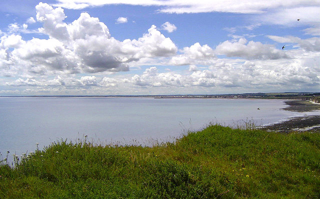
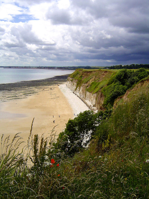
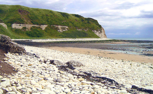
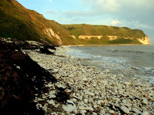
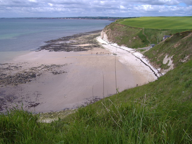
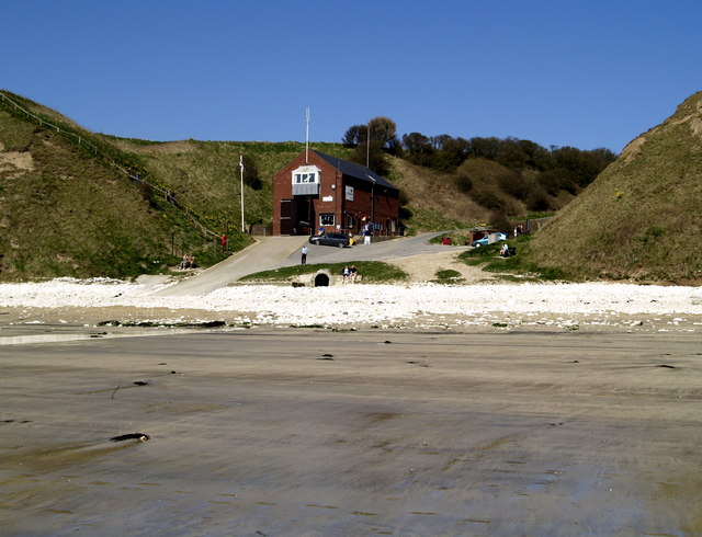
South Landing is a picturesque coastal area located in the East Riding of Yorkshire, England. Situated on the rugged coastline of Flamborough Headland, it is a popular destination for locals and tourists alike. The beach at South Landing offers a unique blend of natural beauty and historical significance.

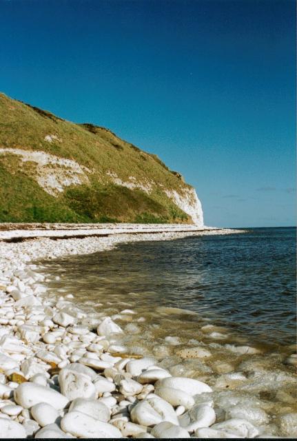
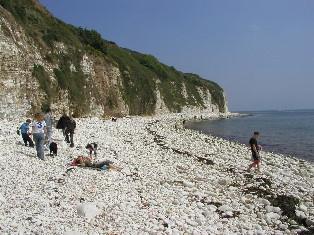
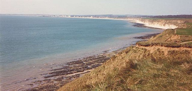
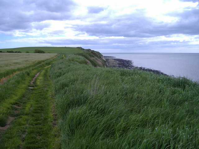
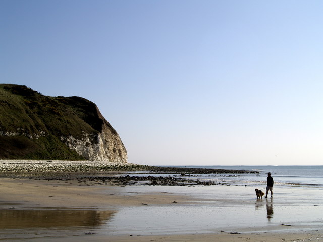
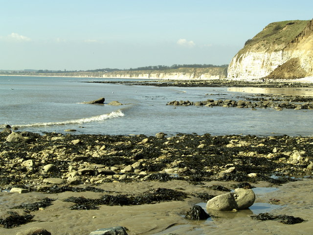
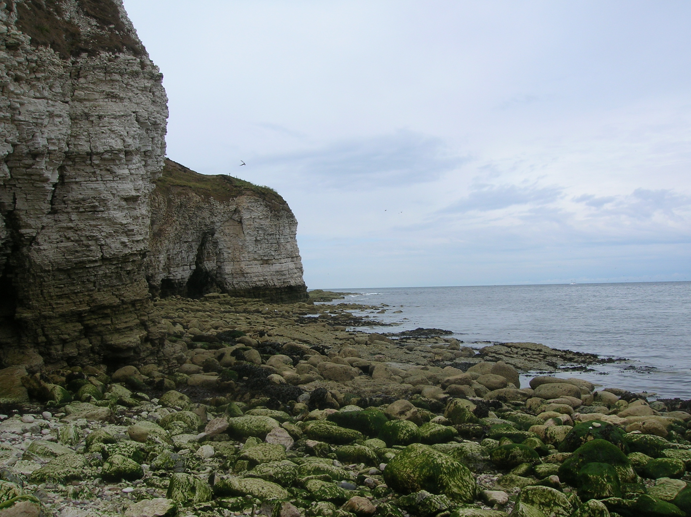
The beach itself is a mix of sand and pebbles, with towering cliffs providing a dramatic backdrop. The clear, turquoise waters of the North Sea provide a refreshing swimming experience for visitors, and the beach is also a haven for wildlife enthusiasts. The area is home to a wide variety of seabirds, including puffins, gannets, and kittiwakes, making it a birdwatcher's paradise.

South Landing is also known for its rich history. It was the site of an ancient Roman signal station, and remnants of this historical structure can still be seen today. The area was also a hotspot for smugglers in the past, and visitors can explore the hidden caves and tunnels that were used for illicit activities.

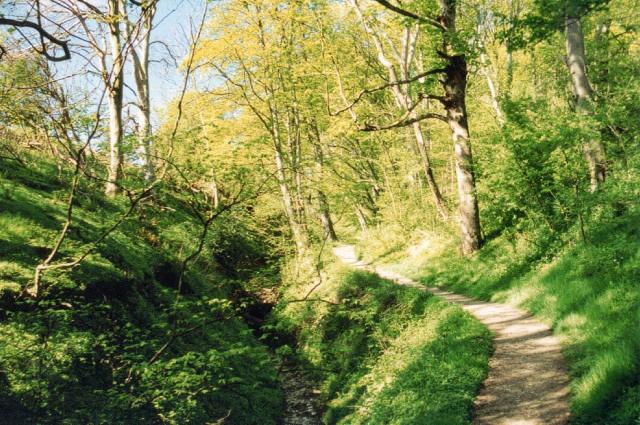
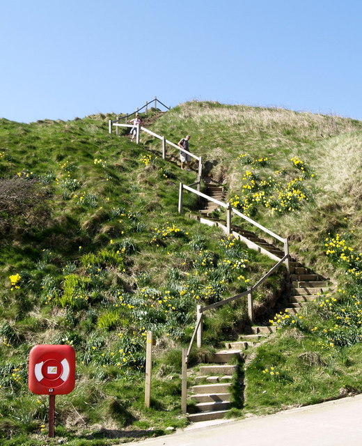
Facilities at South Landing include a car park, public toilets, and a small café offering refreshments. The beach is accessible via a steep pathway, and there are designated areas for picnicking and barbecues. Lifeguards are not present, so visitors are advised to take caution when swimming in the sea.

Overall, South Landing offers a unique and picturesque experience for beachgoers. Its combination of natural beauty, wildlife, and historical significance make it a must-visit destination for those exploring the East Riding of Yorkshire.

If you have any feedback on the listing, please let us know in the comments section below.

South Landing Images

Images are sourced within 2km of 54.103851/-0.11823608 or Grid Reference TA2369. Thanks to Geograph Open Source API. All images are credited.

Danes Dyke Danes’ Dyke consists of prehistoric earthworks, possibly intended as a defence, and woodland that runs 2½ miles across Flamborough Head. Despite its name, Danes’ Dyke had nothing to do with the Danes, and was a much earlier site - probably dating back to the Bronze Age.
Danes Dyke
Danes’ Dyke consists of prehistoric earthworks, possibly intended as a defence, and woodland that runs 2½ miles across Flamborough Head. Despite its name, Danes’ Dyke had nothing to do with the Danes, and was a much earlier site - probably dating back to the Bronze Age.
Flamborough Head, South Landing
Where Dane's Dyke meets the North Sea
View towards Bridlington from Southern end of Danes Dyke
South Cliff Views The view across the North Sea towards Bridlington.
South Cliff Views
The view across the North Sea towards Bridlington.
Beacon Hill Views The South Landing and cliffs at Flamborough Head from just beyond Beacon Hill. Looking out across Danes Dyke End, you can just make out Bridlington in the distance.
Beacon Hill Views
The South Landing and cliffs at Flamborough Head from just beyond Beacon Hill. Looking out across Danes Dyke End, you can just make out Bridlington in the distance.
East Nook Taken from the beach at the South Landing, Flamborough Head. More great rock pooling to be had when the tide is out!
East Nook
Taken from the beach at the South Landing, Flamborough Head. More great rock pooling to be had when the tide is out!
South landing, Flamborough Head
Old Fall Plantation Looking northwards from the cliff top path towards Old fall Plantation.
Old Fall Plantation
Looking northwards from the cliff top path towards Old fall Plantation.
South Landing South Landing viewed from East Nook
South Landing
South Landing viewed from East Nook
Beacon Hill The view eastwards along the cliff top from the very edge of the gridsquare towards Beacon Hill.
Beacon Hill
The view eastwards along the cliff top from the very edge of the gridsquare towards Beacon Hill.
Flamborough South Landing Beach
The Beach at South Landing, Flamborough
Cliff Steps at Flamborough South Landing
Flamborough South Landing
Flamborough South Landing Lifeboat Station
Cliffs at Flamborough South Landing
Flamborough South Landing
Show me another place!

South Landing is located at Grid Ref: TA2369 (Lat: 54.103851, Lng: -0.11823608)

Division: East Riding

Unitary Authority: East Riding of Yorkshire

Police Authority: Humberside

What 3 Words

///eggplants.spurned.repair. Near Flamborough, East Yorkshire

Related Wikis

Flamborough Lifeboat Station

Flamborough Lifeboat Station is a Royal National Lifeboat Institution (RNLI) lifeboat station located at Flamborough in the East Riding of Yorkshire, England...

Flamborough

Flamborough is a village and civil parish in the East Riding of Yorkshire, England. It is situated approximately 4 miles (6 km) north-east of Bridlington...

Flamborough Head

Flamborough Head () is a promontory, 8 miles (13 km) long on the Yorkshire coast of England, between the Filey and Bridlington bays of the North Sea. It...

Sewerby Hall

Sewerby Hall (also known as Sewerby House) is a Grade I listed Georgian country house set in 50 acres (20 ha) of landscaped gardens in the village of Sewerby...

Nearby Amenities

Located within 500m of 54.103851,-0.11823608
Bench
Source: survey
Lat/Long: 54.1060404/-0.118999
Bench
Source: survey
Lat/Long: 54.1053213/-0.1189246
Bench
Source: survey
Lat/Long: 54.1046333/-0.1185302
Bench
Source: survey
Lat/Long: 54.1045035/-0.1188889
Bench
Source: survey
Lat/Long: 54.1049798/-0.1179085
Bench
Source: survey
Lat/Long: 54.1058278/-0.1157838
Bench
Source: survey
Lat/Long: 54.1063182/-0.1127734
Bench
Source: survey
Lat/Long: 54.105381/-0.1180093
Bench
Source: survey
Lat/Long: 54.1059316/-0.1178536
Bench
Source: survey
Lat/Long: 54.1067453/-0.1166673
Bench
Source: survey
Lat/Long: 54.1072334/-0.1159641
Bench
Source: survey
Lat/Long: 54.1070309/-0.1176773
Source: survey
Tourism: picnic_site
Lat/Long: 54.1076794/-0.116757
Bench
Source: survey
Lat/Long: 54.1050944/-0.1156793
Flamborough Heritage Coast Centre
Naptan AtcoCode: 2200YEA01595
Naptan Bearing: SE
Naptan BusStopType: CUS
Naptan CommonName: Flamborough Heritage Coast Centre
Naptan Landmark: Picnic Site
Naptan Street: South Sea Road
Physically Present: no
Source: naptan + survey
Lat/Long: 54.107098/-0.1201207
Beacon Hill
Place: locality
Lat/Long: 54.1045454/-0.1243752
South Landing
Place: locality
Lat/Long: 54.1042257/-0.1174199
Defibrillator
Access: yes
Check Date: 2023-03-10
Defibrillator Location: outside Living Seas Centre, Flamborough
Emergency: defibrillator
Indoor: no
Postal Code: YO15 1AE
Ref: DFS-1K-0690
Lat/Long: 54.1068519/-0.1196532
Toilets
Lat/Long: 54.1069156/-0.1197272
The data included in this document is from www.openstreetmap.org. The data is made available under ODbL.

Have you been to South Landing?

Leave your review of South Landing below (or comments, questions and feedback).