East Arm
Sea, Estuary, Creek in Sussex Adur
England
East Arm

East Arm is a geographical feature located in Sussex, England. It is characterized by its position as a sea arm, estuary, and creek, making it a unique and diverse area. The arm is situated on the southeastern coast of England, stretching from the English Channel into the landmass.
The East Arm offers a stunning seascape, with its picturesque beaches and breathtaking views of the ocean. The area is known for its diverse marine life, attracting both researchers and tourists interested in exploring its underwater ecosystem. The estuary within the arm is formed by the blending of freshwater rivers and saltwater from the sea, creating a habitat that supports various species of fish and birds.
The creek is another fascinating feature of East Arm, as it winds its way through the surrounding landscape. This narrow and shallow watercourse provides a haven for many animals and plants, including waterfowl and reed beds. The creek is also a popular spot for recreational activities such as boating, fishing, and birdwatching.
East Arm's location makes it an essential site for maritime trade and transportation, with several ports and harbors found along its coast. These ports play a vital role in the regional economy by facilitating the movement of goods and connecting Sussex with other parts of the country and beyond.
Overall, East Arm in Sussex offers a rich blend of natural beauty, biodiversity, and economic significance. Its combination of a sea arm, estuary, and creek makes it a captivating destination for nature enthusiasts and a vital hub for trade and commerce.
If you have any feedback on the listing, please let us know in the comments section below.
East Arm Images
Images are sourced within 2km of 50.829617/-0.24302916 or Grid Reference TQ2304. Thanks to Geograph Open Source API. All images are credited.


East Arm is located at Grid Ref: TQ2304 (Lat: 50.829617, Lng: -0.24302916)
Administrative County: West Sussex
District: Adur
Police Authority: Sussex
What 3 Words
///rushed.racing.bound. Near Shoreham-by-Sea, West Sussex
Nearby Locations
Related Wikis
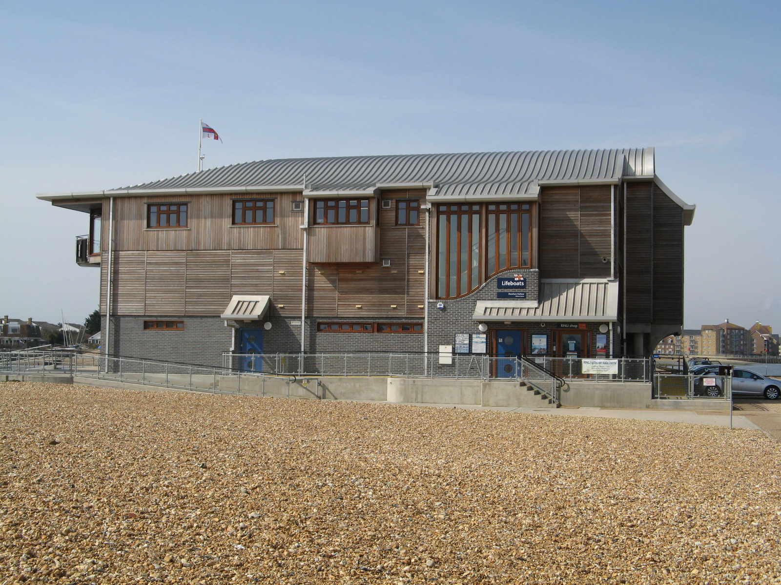
Shoreham Harbour Lifeboat Station
Shoreham Harbour Lifeboat Station is a Royal National Lifeboat Institution (RNLI) station located in the town of Shoreham-by-Sea in the English county...

Shoreham College
Shoreham College is a private day school for boys and girls aged 3 to 16, which is located in Shoreham-by-Sea on the Sussex coast between Brighton and...

St Julian's Church, Kingston Buci
St Julian's Church is an Anglican church in Kingston Buci (also known as Kingston by Sea) in the district of Adur, one of seven local government districts...
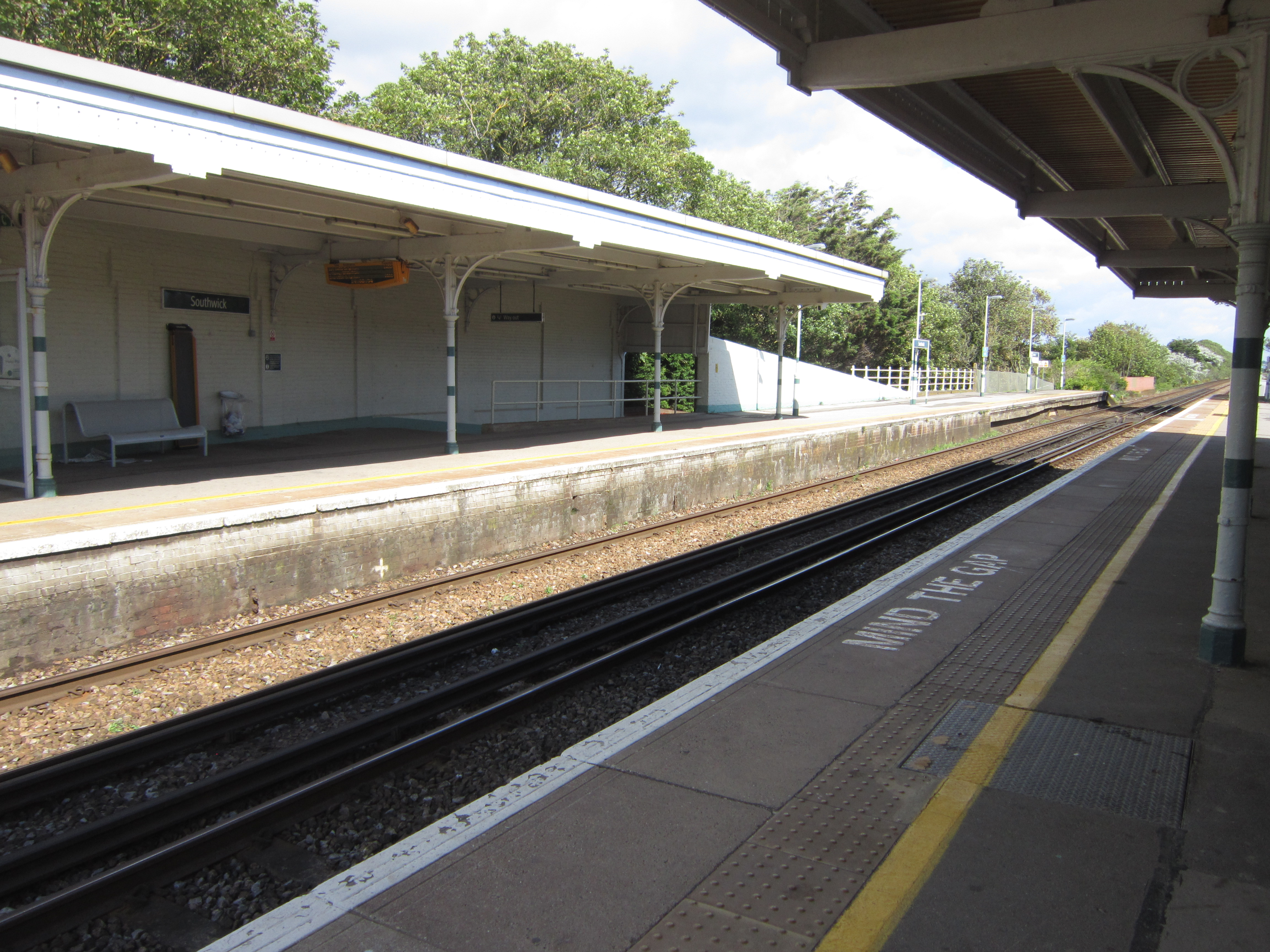
Southwick railway station
Southwick railway station serves the town of Southwick in West Sussex, England. It is on the West Coastway Line, 4 miles 30 chains (7.0 km) from Brighton...
Nearby Amenities
Located within 500m of 50.829617,-0.24302916Have you been to East Arm?
Leave your review of East Arm below (or comments, questions and feedback).