Stephen's Ayre

Beach in Shetland

Scotland

Stephen's Ayre

Fish farm in Ronas Voe from Heylor
Fish farm in Ronas Voe from Heylor Credit: Mike Pennington

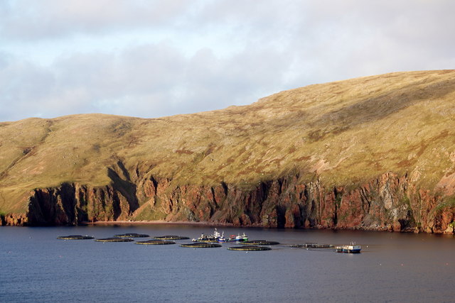
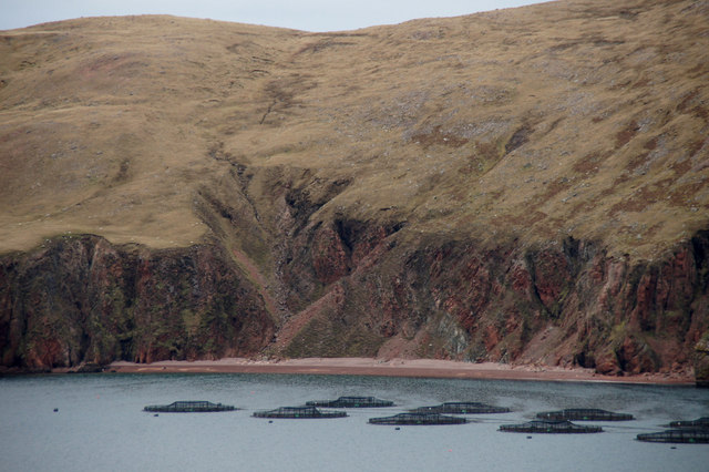
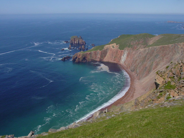
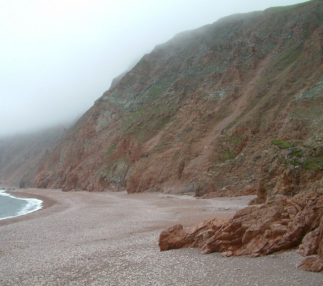
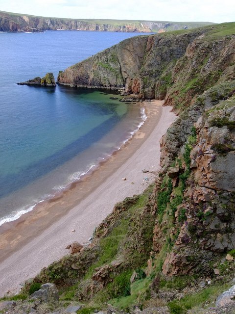
Stephen's Ayre is a picturesque beach located on the island of Shetland, which is part of Scotland. With its stunning natural beauty and tranquil atmosphere, it has become a popular destination for nature lovers and beach enthusiasts alike.

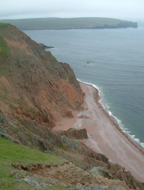
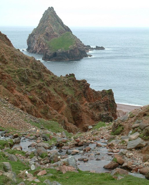
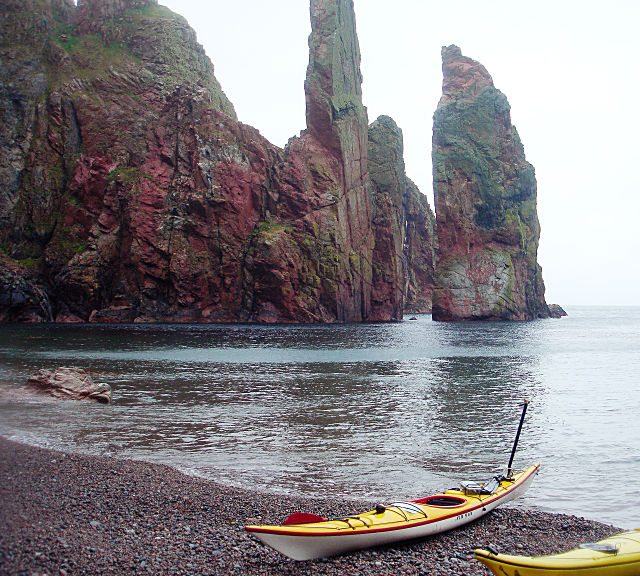
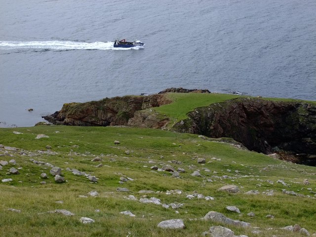
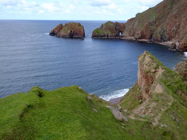
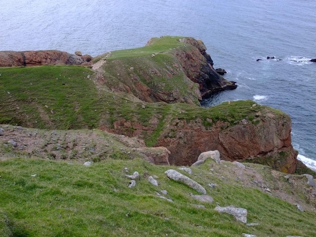
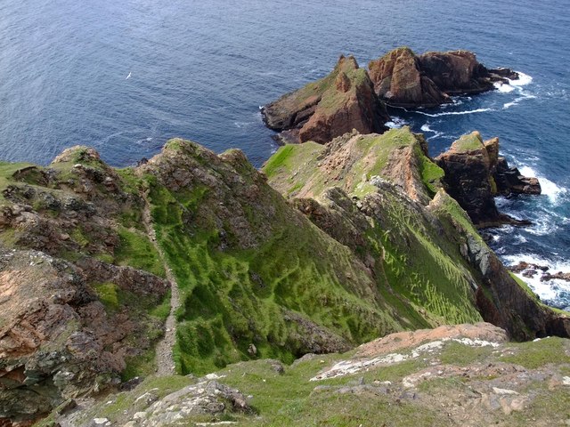
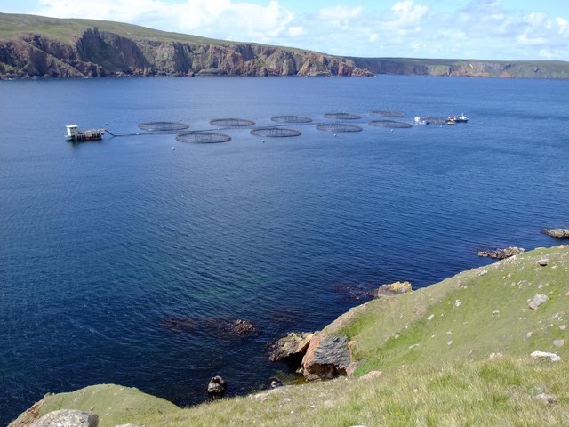
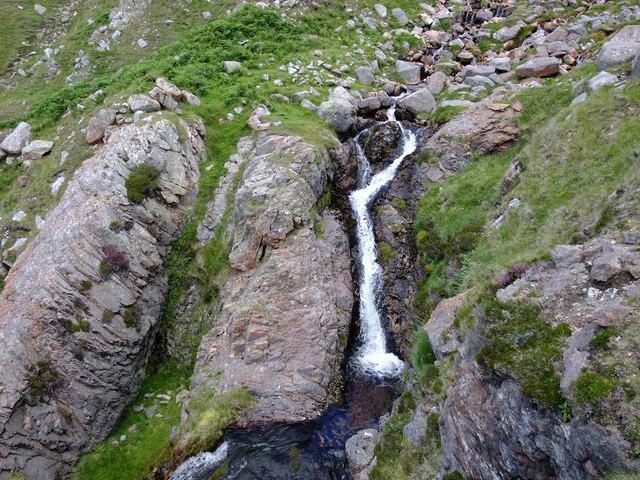
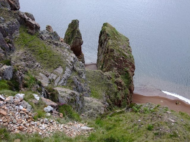
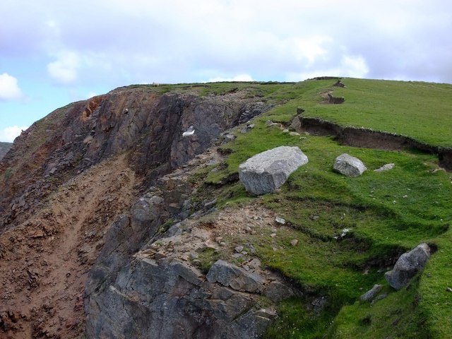
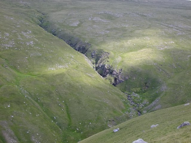
The beach is situated on the west side of Shetland's mainland, near the village of Sandness. It can be reached easily by car or on foot, as there are well-maintained paths and roads leading to the area. The beach itself is a long stretch of golden sand, bordered by rolling green hills and rugged cliffs, creating a captivating contrast against the turquoise waters of the North Atlantic Ocean.

Stephen's Ayre offers visitors a sense of peace and serenity, as it is relatively untouched and less crowded compared to other beaches in the area. Its remote location adds to its charm, making it an ideal spot for quiet walks, picnics, or simply soaking up the stunning views.

The beach is also known for its abundant wildlife. Seals can often be spotted lounging on the rocks or swimming offshore, while a variety of seabirds soar above, including puffins, fulmars, and guillemots. During certain times of the year, it is also possible to catch a glimpse of whales or dolphins in the distance.

Overall, Stephen's Ayre is a hidden gem on the Shetland Islands. Its natural beauty, tranquility, and diverse wildlife make it a must-visit destination for those seeking a peaceful retreat in the heart of nature.

If you have any feedback on the listing, please let us know in the comments section below.

Stephen's Ayre Images

Images are sourced within 2km of 60.542406/-1.4947889 or Grid Reference HU2784. Thanks to Geograph Open Source API. All images are credited.

Fish farm in Ronas Voe from Heylor
Fish farm beside Hill of Burriesness, Ronas Voe Taken from Heylor.
Fish farm beside Hill of Burriesness, Ronas Voe
Taken from Heylor.
On Stonga Banks, view to Turls Head and Gruna Stack If the weather is fine, it is well worth the walk from Collafirth Hill via Ronas Hill to Stonga Banks to be rewarded by this spectacular view eight hundred feet above the sea.
On Stonga Banks, view to Turls Head and Gruna Stack
If the weather is fine, it is well worth the walk from Collafirth Hill via Ronas Hill to Stonga Banks to be rewarded by this spectacular view eight hundred feet above the sea.
Lang Ayre Walking on this beach was the ambition of a lifetime.  Such a beautiful, remote spot.
Lang Ayre
Walking on this beach was the ambition of a lifetime. Such a beautiful, remote spot.
Ketligill Head The western end of Lang Ayre, with the crumbling red granite cliffs of Ketligill Head rising from the beach.
Ketligill Head
The western end of Lang Ayre, with the crumbling red granite cliffs of Ketligill Head rising from the beach.
The Cleiver, Ketligill Head
Lunch stop in Ronas Voe, below The Cupps With a forecast of SE 7-9 changing to SW 7-9 perhaps 10 later, this was a day for seeking shelter at the foot of cliffs in the fjord-like Ronas Voe. Although deceptively calm in this photo, squalls as the wind dropped sharply over the cliffs were strong enough to stop progress and several of us had difficulty paddling against gusts through the gap centre-right of the photo to visit Point of Quida-stack and the caves just round the corner.
Lunch stop in Ronas Voe, below The Cupps
With a forecast of SE 7-9 changing to SW 7-9 perhaps 10 later, this was a day for seeking shelter at the foot of cliffs in the fjord-like Ronas Voe. Although deceptively calm in this photo, squalls as the wind dropped sharply over the cliffs were strong enough to stop progress and several of us had difficulty paddling against gusts through the gap centre-right of the photo to visit Point of Quida-stack and the caves just round the corner.
Beach below the Cupps, Ronas Voe Rain and very strong winds made this an interesting trip in the shelter of the cliffs in Ronas Voe. After crossing from the NE side to this beach on the SW side with a crosswind and some rough water, we took a well-deserved lunch break on this beach with red granite shingle from the eroded cliffs which were providing limited shelter from the weather.
Beach below the Cupps, Ronas Voe
Rain and very strong winds made this an interesting trip in the shelter of the cliffs in Ronas Voe. After crossing from the NE side to this beach on the SW side with a crosswind and some rough water, we took a well-deserved lunch break on this beach with red granite shingle from the eroded cliffs which were providing limited shelter from the weather.
Fishing boat and Burries Ness The boat had been working the nearby fish farms in Ronas Voe, and was returning to port.
Fishing boat and Burries Ness
The boat had been working the nearby fish farms in Ronas Voe, and was returning to port.
The Roodrans from Whal Horn Red granite forms the coastline in this part of Shetland, and the colour adds a special touch to spectacular cliff scenery.
The Roodrans from Whal Horn
Red granite forms the coastline in this part of Shetland, and the colour adds a special touch to spectacular cliff scenery.
Whal Horn Presumably this narrow red granite peninsula gets its name from similarity to the shape of a Narwhal horn.
Whal Horn
Presumably this narrow red granite peninsula gets its name from similarity to the shape of a Narwhal horn.
The Roodrans from Ketligill Head The path in view snakes down the cliffs and eventually leads to Lang Ayre (HU2885).  The lower part of the path has eroded badly, and makes the descent quite hair-raising.
The Roodrans from Ketligill Head
The path in view snakes down the cliffs and eventually leads to Lang Ayre (HU2885). The lower part of the path has eroded badly, and makes the descent quite hair-raising.
Fish farm in Ronas Voe Salmon are farmed here.  The small boat in the HU2783 geograph can be seen at the far right of the photograph.
Fish farm in Ronas Voe
Salmon are farmed here. The small boat in the HU2783 geograph can be seen at the far right of the photograph.
Waterfall above Ronas Voe
The Kirk, Ronas Voe
The Kirk, Ronas Voe
Slocka, Ronas Voe This beautiful beach has no name on the 1:25,000 Ordnance Survey map, and is only accessible by boat.
Slocka, Ronas Voe
This beautiful beach has no name on the 1:25,000 Ordnance Survey map, and is only accessible by boat.
Ketligill Head The crumbling red granite cliffs fall away over 130 metres to Lang Ayre, below.
Ketligill Head
The crumbling red granite cliffs fall away over 130 metres to Lang Ayre, below.
Burn of Monius from Ketligill Head
Show me another place!

Stephen's Ayre is located at Grid Ref: HU2784 (Lat: 60.542406, Lng: -1.4947889)

Unitary Authority: Shetland Islands

Police Authority: Highlands and Islands

What 3 Words

///lamplight.bleat.disputes. Near Toft, Shetland Islands

Related Wikis

Lang Ayre

The Lang Ayre is a beach on the west side of Ronas Hill, Northmavine, Shetland. At 1 kilometre (0.6 mi) in length it is the archipelago's longest. It is...

Ronas Voe

Ronas Voe (pronounced [ˈrø̞nis ˌvo̞:] Shetland Dialect: Rønies Voe) is a voe in Northmavine, Shetland. It divides the land between Ronas Hill, Shetland...

Ronas Hill

Ronas Hill (or Rönies Hill) is a hill in Shetland, Scotland. It is classed as a Marilyn, and is the highest point in the Shetland Islands at an elevation...

Tingon

Tingon is a peninsula in the north-west of Northmavine, Shetland. It is delineated on the east by Ronas Voe, and on the west by Hamnavoe. It is designated...

Have you been to Stephen's Ayre?

Leave your review of Stephen's Ayre below (or comments, questions and feedback).