Ronas Voe

Sea, Estuary, Creek in Shetland

Scotland

Ronas Voe

Fish farm beside Hill of Burriesness, Ronas Voe Taken from Heylor.
Fish farm beside Hill of Burriesness, Ronas Voe Credit: Mike Pennington

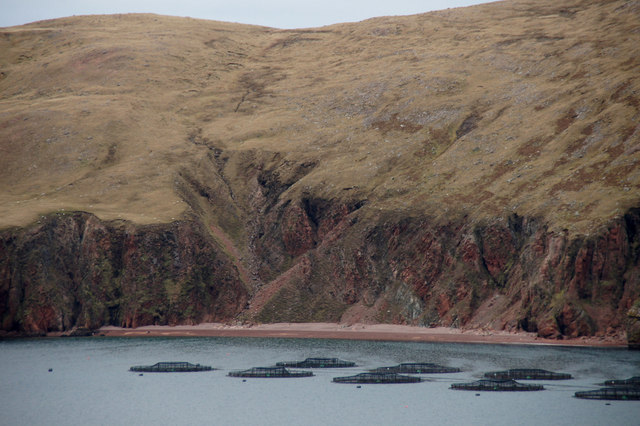
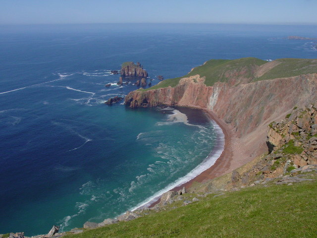
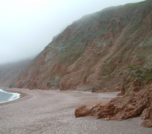
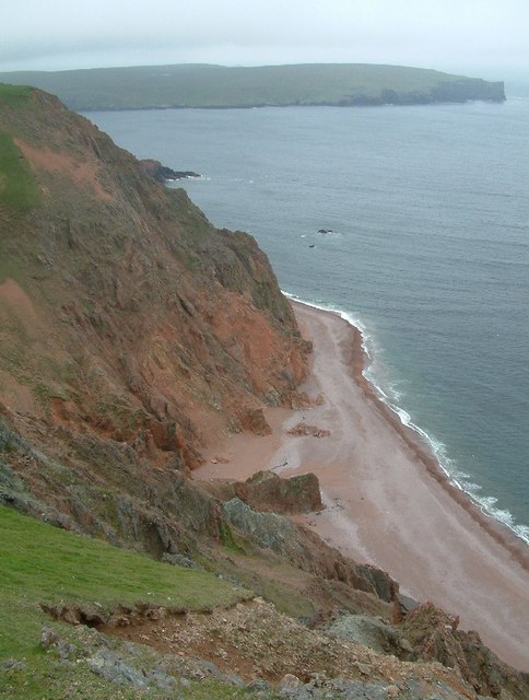
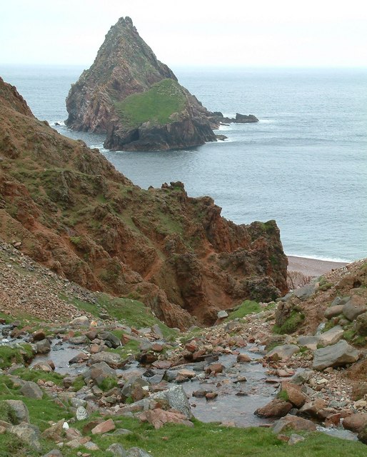
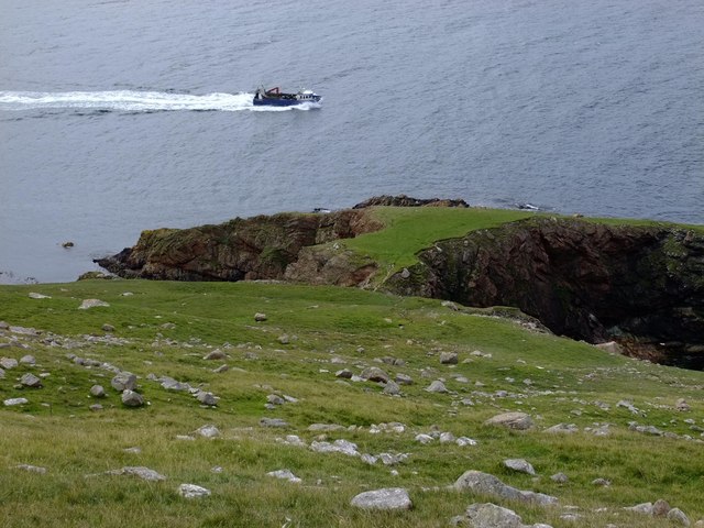
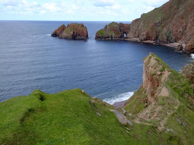
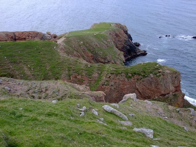
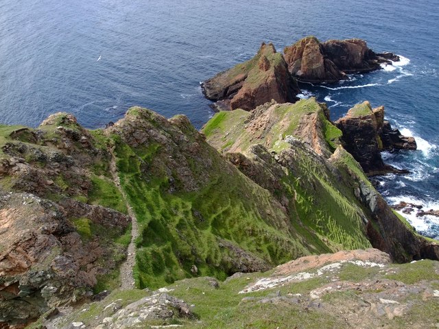
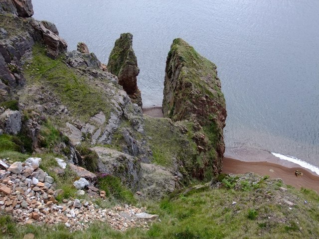
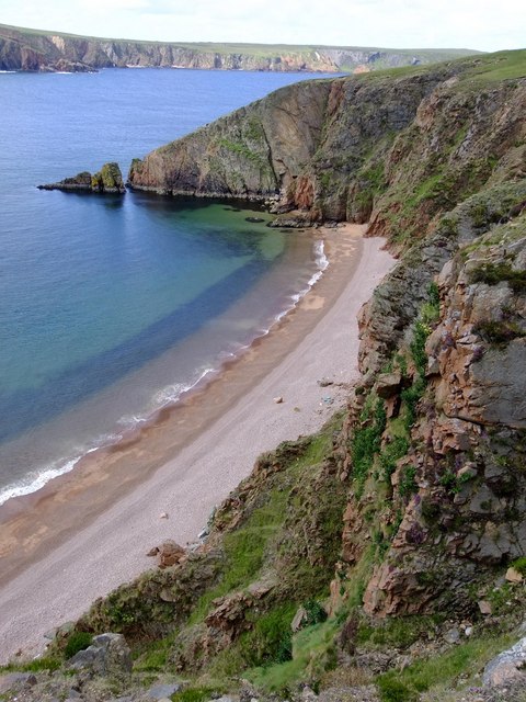
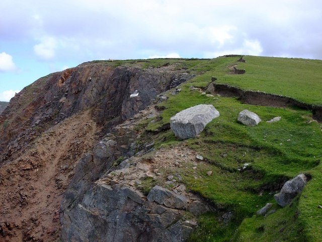
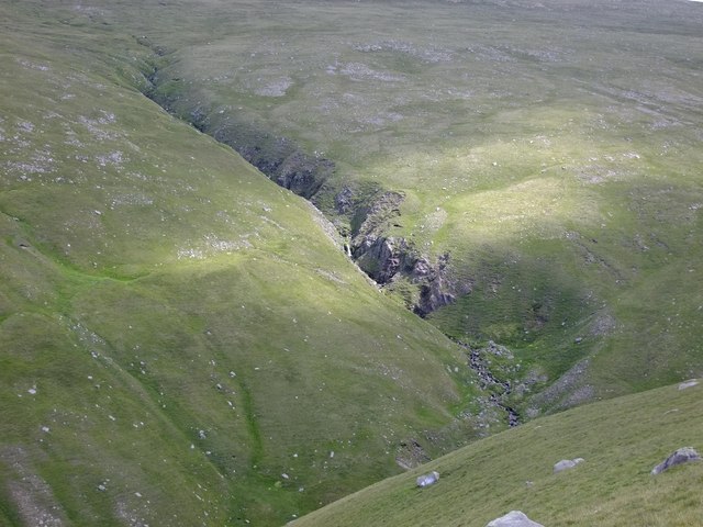
Ronas Voe is a picturesque natural feature located on the northernmost tip of the Shetland Islands, Scotland. It is a stunning sea inlet, also known as an estuary or creek, that stretches for approximately 4 miles (6.4 kilometers) in length. The Voe is surrounded by dramatic cliffs, rolling hills, and lush greenery, making it a truly breathtaking sight.

The crystal-clear waters of Ronas Voe are influenced by the North Atlantic Ocean, creating a unique marine ecosystem. The Voe is home to a rich variety of marine life, including seals, otters, and numerous species of fish. It is a popular spot for fishing enthusiasts, who flock to its shores in search of a variety of fish species, such as cod, haddock, and mackerel.

The area surrounding Ronas Voe is also rich in historical significance. There are remnants of ancient settlements and archaeological sites nearby, indicating human habitation in the area dating back thousands of years. The Voe itself has served as a natural harbor for centuries, providing shelter for boats and ships during inclement weather.

Ronas Voe is a beloved destination for outdoor enthusiasts and nature lovers. The surrounding landscape offers ample opportunities for hiking, birdwatching, and photography. The tranquil atmosphere and stunning natural beauty make it the perfect place to unwind and connect with nature.

Visitors to Ronas Voe can also enjoy the nearby Ronas Hill, the highest point in the Shetland Islands, offering panoramic views of the surrounding area. Whether exploring the rugged coastline, admiring the diverse marine life, or simply taking in the awe-inspiring scenery, Ronas Voe is a must-visit destination for anyone seeking a true natural wonder.

If you have any feedback on the listing, please let us know in the comments section below.

Ronas Voe Images

Images are sourced within 2km of 60.546419/-1.4970233 or Grid Reference HU2784. Thanks to Geograph Open Source API. All images are credited.

Fish farm beside Hill of Burriesness, Ronas Voe Taken from Heylor.
Fish farm beside Hill of Burriesness, Ronas Voe
Taken from Heylor.
Turls Head and Gruna Stack Picture taken from the 250 metre cliff top at Stonga Banks looking NNW.
Turls Head and Gruna Stack
Picture taken from the 250 metre cliff top at Stonga Banks looking NNW.
On Stonga Banks, view to Turls Head and Gruna Stack If the weather is fine, it is well worth the walk from Collafirth Hill via Ronas Hill to Stonga Banks to be rewarded by this spectacular view eight hundred feet above the sea.
On Stonga Banks, view to Turls Head and Gruna Stack
If the weather is fine, it is well worth the walk from Collafirth Hill via Ronas Hill to Stonga Banks to be rewarded by this spectacular view eight hundred feet above the sea.
Lang Ayre Walking on this beach was the ambition of a lifetime.  Such a beautiful, remote spot.
Lang Ayre
Walking on this beach was the ambition of a lifetime. Such a beautiful, remote spot.
Ketligill Head The western end of Lang Ayre, with the crumbling red granite cliffs of Ketligill Head rising from the beach.
Ketligill Head
The western end of Lang Ayre, with the crumbling red granite cliffs of Ketligill Head rising from the beach.
The Cleiver, Ketligill Head
Fishing boat and Burries Ness The boat had been working the nearby fish farms in Ronas Voe, and was returning to port.
Fishing boat and Burries Ness
The boat had been working the nearby fish farms in Ronas Voe, and was returning to port.
The Roodrans from Whal Horn Red granite forms the coastline in this part of Shetland, and the colour adds a special touch to spectacular cliff scenery.
The Roodrans from Whal Horn
Red granite forms the coastline in this part of Shetland, and the colour adds a special touch to spectacular cliff scenery.
Whal Horn Presumably this narrow red granite peninsula gets its name from similarity to the shape of a Narwhal horn.
Whal Horn
Presumably this narrow red granite peninsula gets its name from similarity to the shape of a Narwhal horn.
The Roodrans from Ketligill Head The path in view snakes down the cliffs and eventually leads to Lang Ayre (HU2885).  The lower part of the path has eroded badly, and makes the descent quite hair-raising.
The Roodrans from Ketligill Head
The path in view snakes down the cliffs and eventually leads to Lang Ayre (HU2885). The lower part of the path has eroded badly, and makes the descent quite hair-raising.
The Kirk, Ronas Voe
The Kirk, Ronas Voe
Slocka, Ronas Voe This beautiful beach has no name on the 1:25,000 Ordnance Survey map, and is only accessible by boat.
Slocka, Ronas Voe
This beautiful beach has no name on the 1:25,000 Ordnance Survey map, and is only accessible by boat.
Ketligill Head The crumbling red granite cliffs fall away over 130 metres to Lang Ayre, below.
Ketligill Head
The crumbling red granite cliffs fall away over 130 metres to Lang Ayre, below.
Burn of Monius from Ketligill Head
Ketligill Head from Burn of Monius
Stone shelter, SW flank of Ronas Hill This is the only interesting feature in an otherwise dull and stony moorland (see HU2983 geograph, for example).
Stone shelter, SW flank of Ronas Hill
This is the only interesting feature in an otherwise dull and stony moorland (see HU2983 geograph, for example).
Natural Arch, Turls Head Grey seals and fulmars are plentiful here.
Natural Arch, Turls Head
Grey seals and fulmars are plentiful here.
Looking down the N ridge of Ronas Hill
Show me another place!

Ronas Voe is located at Grid Ref: HU2784 (Lat: 60.546419, Lng: -1.4970233)

Unitary Authority: Shetland Islands

Police Authority: Highlands and Islands

What 3 Words

///viewer.digress.racked. Near Toft, Shetland Islands

Related Wikis

Lang Ayre

The Lang Ayre is a beach on the west side of Ronas Hill, Northmavine, Shetland. At 1 kilometre (0.6 mi) in length it is the archipelago's longest. It is...

Tingon

Tingon is a peninsula in the north-west of Northmavine, Shetland. It is delineated on the east by Ronas Voe, and on the west by Hamnavoe. It is designated...

Ronas Voe

Ronas Voe (pronounced [ˈrø̞nis ˌvo̞:] Shetland Dialect: Rønies Voe) is a voe in Northmavine, Shetland. It divides the land between Ronas Hill, Shetland...

Ronas Hill

Ronas Hill (or Rönies Hill) is a hill in Shetland, Scotland. It is classed as a Marilyn, and is the highest point in the Shetland Islands at an elevation...

Have you been to Ronas Voe?

Leave your review of Ronas Voe below (or comments, questions and feedback).