Seacombe Sand
Beach in Devon South Hams
England
Seacombe Sand

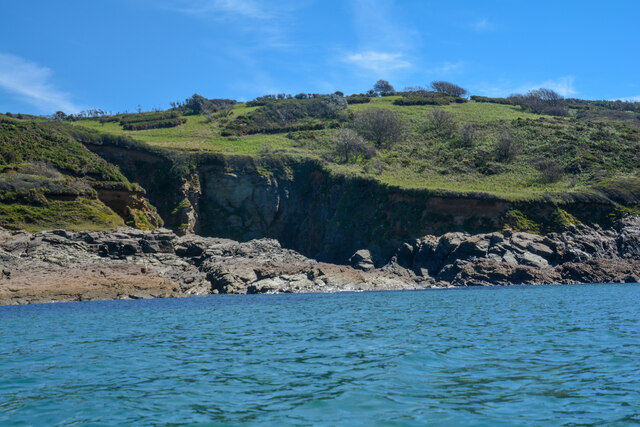
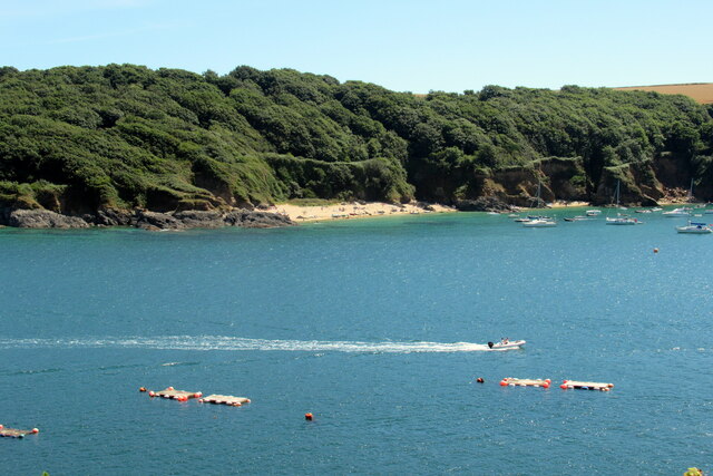
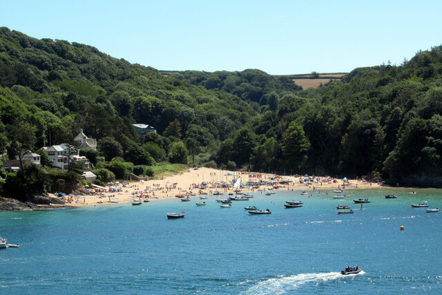
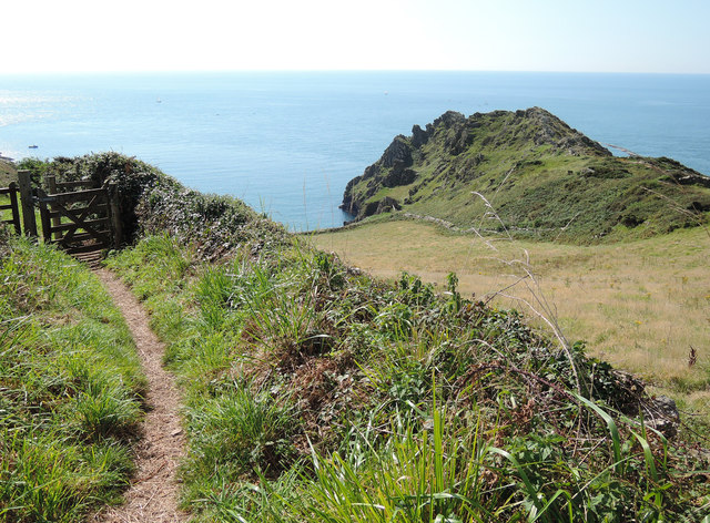
Seacombe Sand is a charming beach located on the southern coast of Devon, England. Situated near the village of Mortehoe, this picturesque stretch of coastline is known for its natural beauty and tranquil atmosphere.
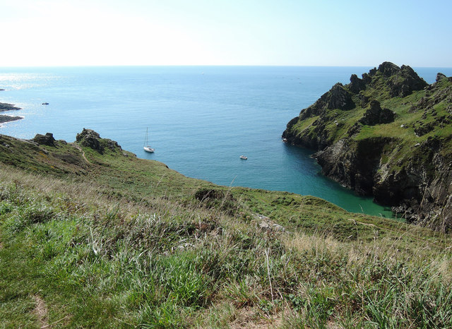
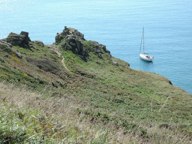
The beach itself is a mix of sand and shingle, with soft golden sands that are perfect for sunbathing and building sandcastles. At low tide, the beach reveals a series of fascinating rock pools, teeming with marine life and providing an excellent opportunity for exploration. The clear, turquoise waters are also ideal for swimming, although caution is advised as there are no lifeguards on duty.
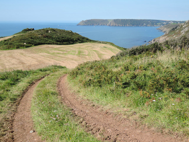
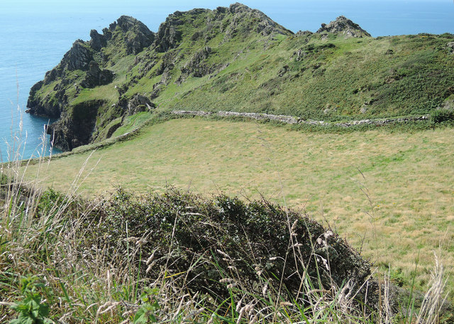
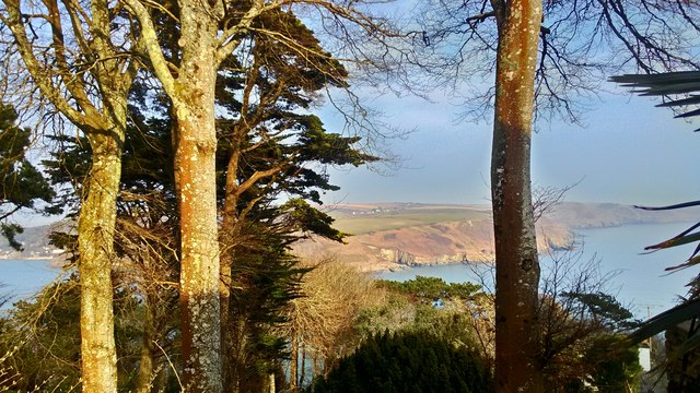
Seacombe Sand offers breathtaking views of the surrounding cliffs and rugged coastline, creating a dramatic backdrop for visitors. It is also part of the South West Coast Path, a popular walking trail that offers stunning vistas of the Atlantic Ocean and the chance to spot seals and seabirds.
The beach is relatively secluded and peaceful, making it a favorite spot for those seeking a quiet retreat away from the crowds. Facilities are limited, with no shops or cafes nearby, so visitors are advised to bring their own food and drinks. However, there are public toilets available for convenience.
Seacombe Sand is accessible by car, with a small parking area nearby. From there, a short walk along a footpath leads visitors down to the beach. Dogs are allowed on the beach year-round, making it popular among dog owners who can enjoy long walks along the shoreline. Overall, Seacombe Sand offers a truly idyllic coastal experience, combining natural beauty, tranquility, and stunning vistas.
If you have any feedback on the listing, please let us know in the comments section below.
Seacombe Sand Images
Images are sourced within 2km of 50.217878/-3.7475232 or Grid Reference SX7536. Thanks to Geograph Open Source API. All images are credited.


Seacombe Sand is located at Grid Ref: SX7536 (Lat: 50.217878, Lng: -3.7475232)
Administrative County: Devon
District: South Hams
Police Authority: Devon and Cornwall
What 3 Words
///selection.delight.snacks. Near Salcombe, Devon
Nearby Locations
Related Wikis

Salcombe Cannon Wreck
The Salcombe Cannon wrecksite is close to two other designated wrecksites in the Erme Estuary which the South West Maritime Archaeological Group (SWMAG...
Moor Sand site
The remains of a wreck carrying cargo of Middle Bronze Age weapons was found in 1977 off Moor Sand, Gammon Head, South Hams, Devon, England. The site was...

East Portlemouth
East Portlemouth is a small Devon village situated at the southern end of the Kingsbridge Estuary, on the south Devon Coast. The population of this parish...

RNAS Prawle Point
The RNAS Naval Air Station Prawle Point was a British First World War airfield outside the village of East Prawle in Devon, England and 2.6 miles (4.2...

Salcombe Castle
Salcombe Castle or Fort Charles is a ruined fortification just off the beach of North Sands in Salcombe, Devon, England, within the South Devon Area of...

Hallowe'en (clipper)
Hallowe’en was a 920-ton iron clipper ship. She was built in 1870 by Maudslay, Son & Field at Greenwich, England, for Jock Willis & Sons (commissioned...

Prawle Point
Prawle Point (Old English: Prǣwhyll, "lookout hill") is a coastal headland in south Devon, England. It is the southernmost point of Devon. Just to the...

Overbeck's
Overbeck's Museum and Garden is an Edwardian house and 2.75 hectare (7 acre) garden at Sharpitor, Salcombe, Devon, England. It is named after its last...
Nearby Amenities
Located within 500m of 50.217878,-3.7475232Have you been to Seacombe Sand?
Leave your review of Seacombe Sand below (or comments, questions and feedback).