Deckler's Island
Island in Devon
England
Deckler's Island
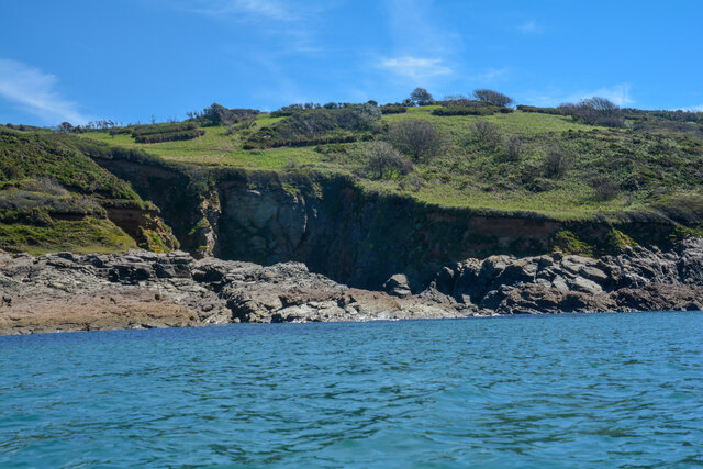
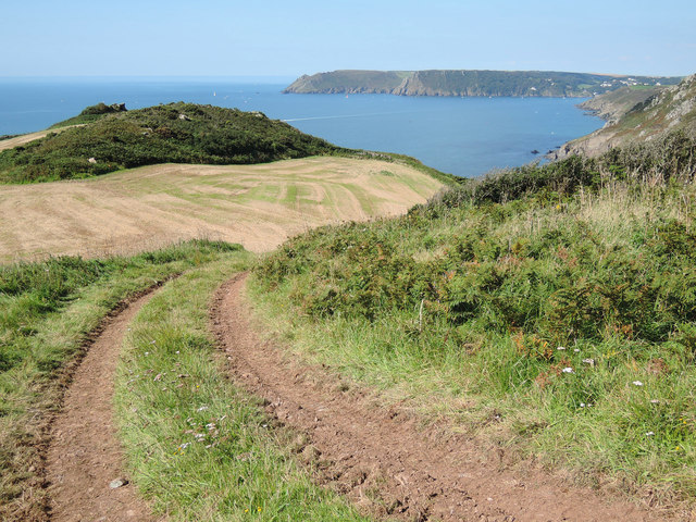
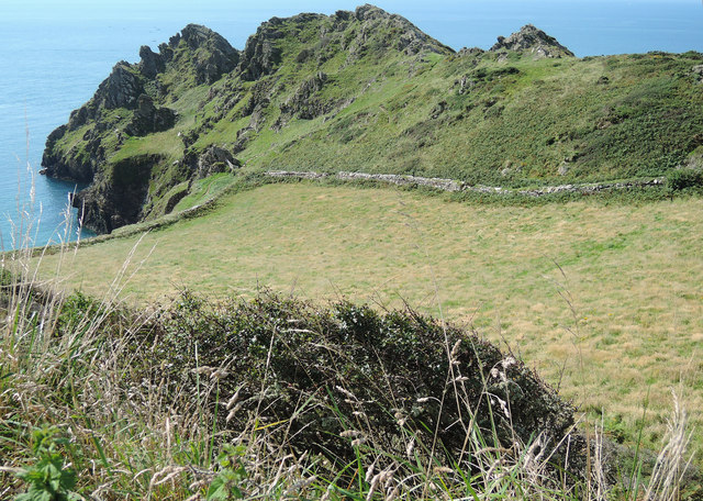
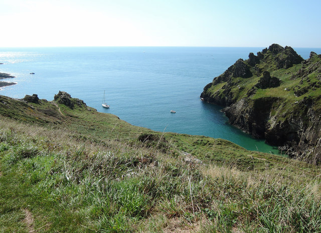
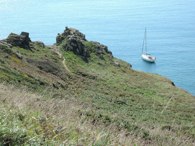
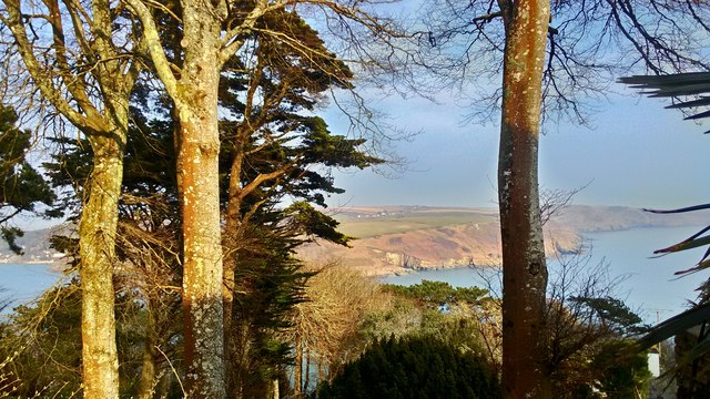
Deckler's Island, located off the coast of Devon, is a picturesque and secluded island that stretches across approximately 5 square kilometers. Accessible only by boat, this island is a hidden gem for nature enthusiasts and those seeking tranquility away from the bustling mainland. Deckler's Island is known for its unspoiled natural beauty, featuring rugged cliffs, sandy beaches, and lush greenery.
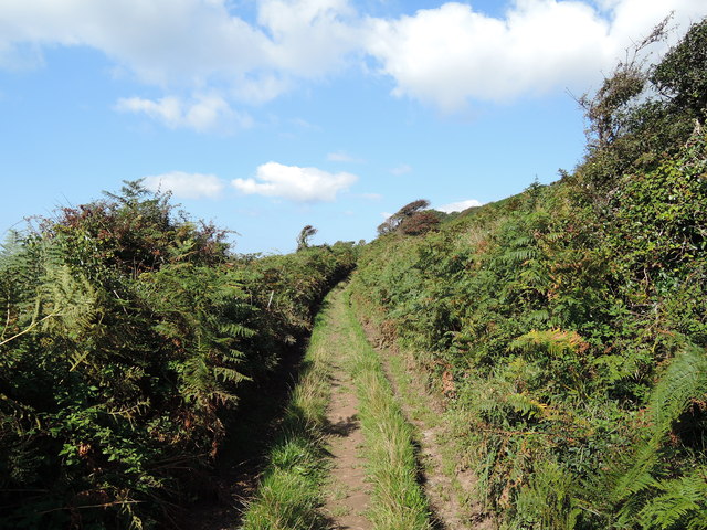
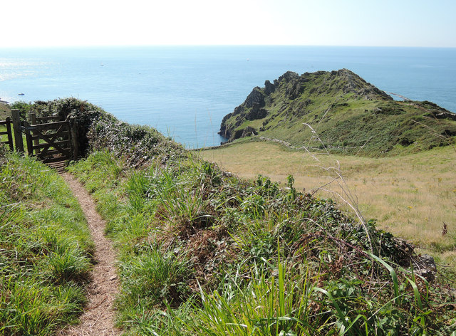
The island boasts a diverse ecosystem, with a variety of plant and animal species inhabiting its shores. Visitors can expect to encounter numerous seabirds, including puffins and gulls, as well as occasional sightings of seals and dolphins playing in the surrounding waters. The island's unique topography provides ample opportunities for hiking and exploration, with well-marked trails leading to breathtaking viewpoints and hidden coves.
Deckler's Island also holds historical significance, with remnants of ancient settlements and structures scattered throughout its landscape. Archaeological findings suggest that the island was once inhabited by early humans, leaving behind traces of their existence in the form of stone tools and pottery fragments.
While there are no permanent residents on the island, it offers a few basic amenities for day-trippers and campers, including picnic areas, public toilets, and designated camping spots. Visitors are urged to respect the island's fragile ecosystem and adhere to strict guidelines to preserve its natural beauty.
Deckler's Island is a true haven for those seeking solace in nature's embrace, offering a unique and unforgettable experience for anyone fortunate enough to explore its enchanting shores.
If you have any feedback on the listing, please let us know in the comments section below.
Deckler's Island Images
Images are sourced within 2km of 50.216421/-3.7469373 or Grid Reference SX7536. Thanks to Geograph Open Source API. All images are credited.


Deckler's Island is located at Grid Ref: SX7536 (Lat: 50.216421, Lng: -3.7469373)
Administrative County: Devon
Police Authority: Devon and Cornwall
What 3 Words
///suitably.chap.shepherdess. Near Salcombe, Devon
Nearby Locations
Related Wikis

Salcombe Cannon Wreck
The Salcombe Cannon wrecksite is close to two other designated wrecksites in the Erme Estuary which the South West Maritime Archaeological Group (SWMAG...
Moor Sand site
The remains of a wreck carrying cargo of Middle Bronze Age weapons was found in 1977 off Moor Sand, Gammon Head, South Hams, Devon, England. The site was...

East Portlemouth
East Portlemouth is a small Devon village situated at the southern end of the Kingsbridge Estuary, on the south Devon Coast. The population of this parish...

RNAS Prawle Point
The RNAS Naval Air Station Prawle Point was a British First World War airfield outside the village of East Prawle in Devon, England and 2.6 miles (4.2...

Prawle Point
Prawle Point (Old English: Prǣwhyll, "lookout hill") is a coastal headland in south Devon, England. It is the southernmost point of Devon. Just to the...

Salcombe Castle
Salcombe Castle or Fort Charles is a ruined fortification just off the beach of North Sands in Salcombe, Devon, England, within the South Devon Area of...

East Prawle
East Prawle is a village in Chivelstone parish in the South Hams district of Devon, England. It is situated on the coast south east of Salcombe, near the...

Hallowe'en (clipper)
Hallowe’en was a 920-ton iron clipper ship. She was built in 1870 by Maudslay, Son & Field at Greenwich, England, for Jock Willis & Sons (commissioned...
Nearby Amenities
Located within 500m of 50.216421,-3.7469373Have you been to Deckler's Island?
Leave your review of Deckler's Island below (or comments, questions and feedback).