Bullock Cove

Bay in Devon

England

Bullock Cove

Towards a rock outcrop Seen from a public footpath near East Prawle
Towards a rock outcrop Credit: Martin Bodman

Bullock Cove, Devon, also known as Bullock Cove Bay, is a scenic coastal area located in the southwestern part of England. Situated in the county of Devon, this picturesque cove offers visitors a tranquil and idyllic setting.

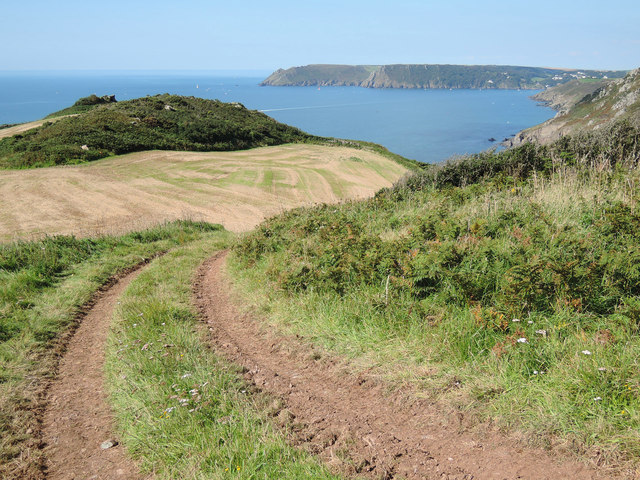
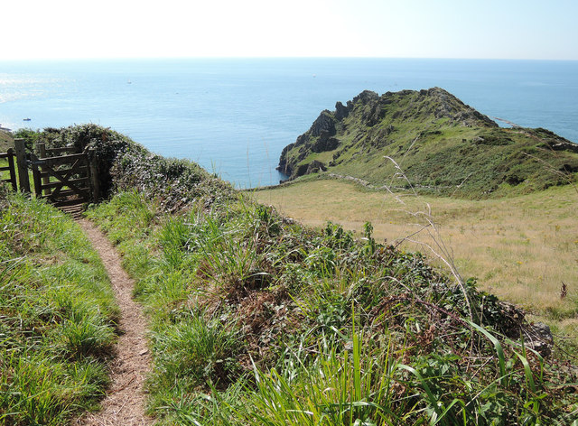
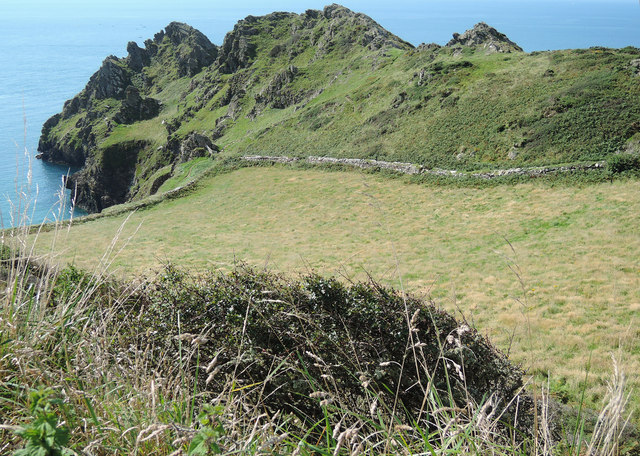
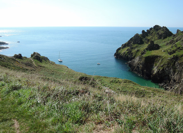
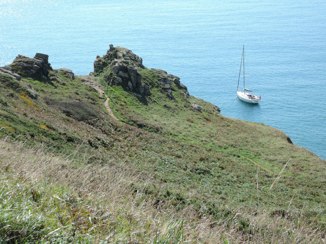
The cove is nested between towering cliffs, providing a natural shield against strong winds and creating a calmer atmosphere. The sandy beach stretches for approximately 200 meters and is adorned with pebbles and seashells, making it a popular spot for beachcombing and leisurely walks. The clear turquoise waters of the bay are ideal for swimming and other water activities during the warmer months.

One of the key features of Bullock Cove is its rich marine life. The bay is home to a diverse array of aquatic species, including colorful fish, crabs, and various species of seaweed. This makes it an excellent location for snorkeling and scuba diving, as visitors can explore the vibrant underwater ecosystem.

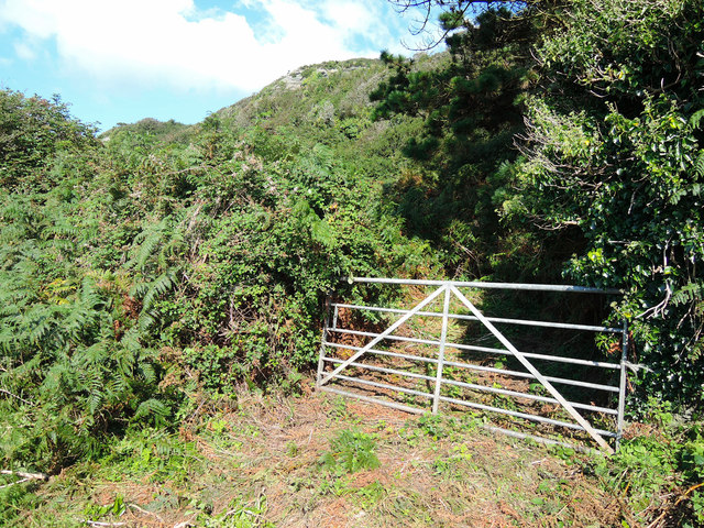
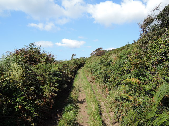
Surrounding the cove are lush green cliffs covered in wildflowers, offering breathtaking views of the bay and the English Channel beyond. The area is also known for its coastal path, which attracts hikers and nature enthusiasts who wish to explore the stunning landscapes and enjoy the fresh sea air.

Although relatively secluded, Bullock Cove is within close proximity to nearby amenities. There are several small villages and towns in the vicinity, offering accommodation, cafes, and restaurants for visitors to enjoy.

If you have any feedback on the listing, please let us know in the comments section below.

Bullock Cove Images

Images are sourced within 2km of 50.214982/-3.7415303 or Grid Reference SX7536. Thanks to Geograph Open Source API. All images are credited.

Towards a rock outcrop Seen from a public footpath near East Prawle
Towards a rock outcrop
Seen from a public footpath near East Prawle
Public footpath from East Prawle The path looking westwards. To the south, way out of shot, is Prawle Point
Public footpath from East Prawle
The path looking westwards. To the south, way out of shot, is Prawle Point
A field of Oats Looking towards Prawle Point from a public footpath from East Prawle
A field of Oats
Looking towards Prawle Point from a public footpath from East Prawle
Farmland above the Pig's Nose Looking towards Bolt Head and the entrance to Salcombe Harbour in the distance
Farmland above the Pig's Nose
Looking towards Bolt Head and the entrance to Salcombe Harbour in the distance
Towards Gammon Head On a footpath leading to the South West Coast Path above Elender Cove
Towards Gammon Head
On a footpath leading to the South West Coast Path above Elender Cove
Gammon Head
Gammon Head
By Gammon Head
By Gammon Head
Towards the South West Coast Path Just east from Elender Cove, with moored yacht
Towards the South West Coast Path
Just east from Elender Cove, with moored yacht
Rocky coast below Deckler's Cliff Rocky coast below Deckler's Cliff with Bolt Head the headland across the bay in the background.
Rocky coast below Deckler's Cliff
Rocky coast below Deckler's Cliff with Bolt Head the headland across the bay in the background.
Sandy beach at Seacombe A sandy beach named Seacombe on the OS map, viewed here from the coast path.  Bolt Head can be seen in the distance across the bay.
Sandy beach at Seacombe
A sandy beach named Seacombe on the OS map, viewed here from the coast path. Bolt Head can be seen in the distance across the bay.
Gammon Head Gammon Head and Maceley Cove viewed from the South West Coast Path.
Gammon Head
Gammon Head and Maceley Cove viewed from the South West Coast Path.
Maceley Cove Maceley Cove has a small beach sheltered by Gammon Head.
Maceley Cove
Maceley Cove has a small beach sheltered by Gammon Head.
Seacombe View across the beach at Seacombe to Gara Rock.
Seacombe
View across the beach at Seacombe to Gara Rock.
Venerick's Cove View over Venerick's Cove with Deckler's Cliff in the background.
Venerick's Cove
View over Venerick's Cove with Deckler's Cliff in the background.
View west from Gammon Head View to the west from the South West Coast Path on Gammon Head.  The headland in the distance is Bolt Head which is on the other side of the entrance to Salcombe Harbour.
View west from Gammon Head
View to the west from the South West Coast Path on Gammon Head. The headland in the distance is Bolt Head which is on the other side of the entrance to Salcombe Harbour.
View towards Prawle Point View towards Prawle Point from the South West Coast Path where it crosses Gammon Head.
View towards Prawle Point
View towards Prawle Point from the South West Coast Path where it crosses Gammon Head.
Gammon Head Gammon Head viewed from the east over Elender Cove.
Gammon Head
Gammon Head viewed from the east over Elender Cove.
View to Gammon Head View to Gammon Head from above Black Cove.  The beach in Maceley Cove is just visible in the centre to the right of the headland.
View to Gammon Head
View to Gammon Head from above Black Cove. The beach in Maceley Cove is just visible in the centre to the right of the headland.
Show me another place!

Bullock Cove is located at Grid Ref: SX7536 (Lat: 50.214982, Lng: -3.7415303)

Administrative County: Devon

Police Authority: Devon and Cornwall

What 3 Words

///overdrive.rocker.sulky. Near Salcombe, Devon

Related Wikis

Salcombe Cannon Wreck

The Salcombe Cannon wrecksite is close to two other designated wrecksites in the Erme Estuary which the South West Maritime Archaeological Group (SWMAG...

Moor Sand site

The remains of a wreck carrying cargo of Middle Bronze Age weapons was found in 1977 off Moor Sand, Gammon Head, South Hams, Devon, England. The site was...

RNAS Prawle Point

The RNAS Naval Air Station Prawle Point was a British First World War airfield outside the village of East Prawle in Devon, England and 2.6 miles (4.2...

Prawle Point

Prawle Point (Old English: Prǣwhyll, "lookout hill") is a coastal headland in south Devon, England. It is the southernmost point of Devon. Just to the...

East Portlemouth

East Portlemouth is a small Devon village situated at the southern end of the Kingsbridge Estuary, on the south Devon Coast. The population of this parish...

East Prawle

East Prawle is a village in Chivelstone parish in the South Hams district of Devon, England. It is situated on the coast south east of Salcombe, near the...

Salcombe Castle

Salcombe Castle or Fort Charles is a ruined fortification just off the beach of North Sands in Salcombe, Devon, England, within the South Devon Area of...

Hallowe'en (clipper)

Hallowe’en was a 920-ton iron clipper ship. She was built in 1870 by Maudslay, Son & Field at Greenwich, England, for Jock Willis & Sons (commissioned...

Nearby Amenities

Located within 500m of 50.214982,-3.7415303
Source: PGS
Lat/Long: 50.2165424/-3.7453054
Shag Rock
Place: locality
Source: NPE
Lat/Long: 50.2149651/-3.7449209
Bronze Age Field System
Historic: archaeological_site
Source: South Devon AONB
Lat/Long: 50.2173548/-3.7429953
Source: PGS
Lat/Long: 50.2164051/-3.7454303
Ford: yes
Lat/Long: 50.2181473/-3.7465243
The data included in this document is from www.openstreetmap.org. The data is made available under ODbL.

Have you been to Bullock Cove?

Leave your review of Bullock Cove below (or comments, questions and feedback).