Western Beach

Beach in Devon North Devon

England

Western Beach

South West Coast Path The South West Coast Path National Trail - 630 miles of superb coastal walking. From Minehead on the edge of the Exmoor National Park to the shores of Poole Harbour in Dorset. It is the longest of all Britain's National Trails.
Website: <span class="nowrap"><a title="http://www.southwestcoastpath.com/" rel="nofollow ugc noopener" href="http://www.southwestcoastpath.com/">Link</a><img style="margin-left:2px;" alt="External link" title="External link - shift click to open in new window" src="https://s1.geograph.org.uk/img/external.png" width="10" height="10"/></span>
South West Coast Path Credit: Lauren

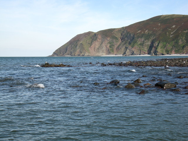
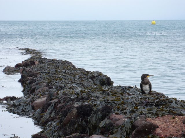
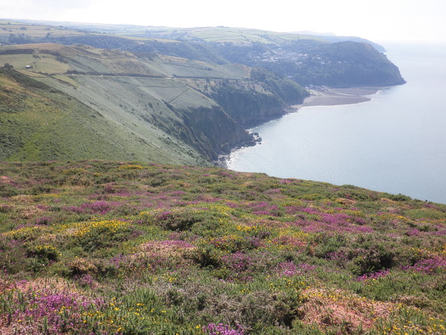
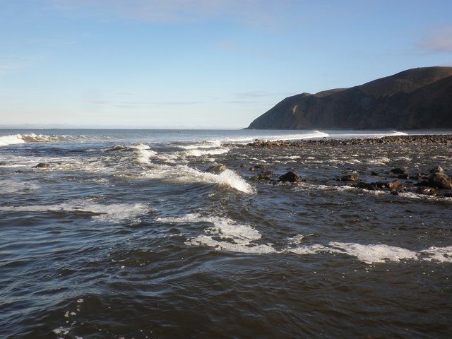
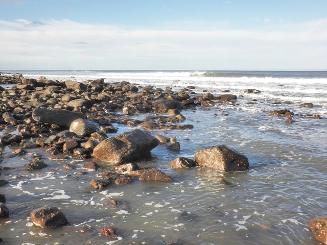
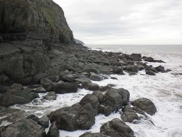
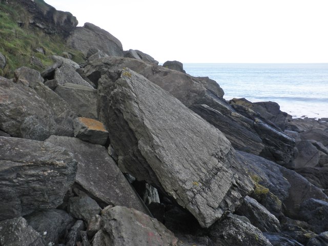
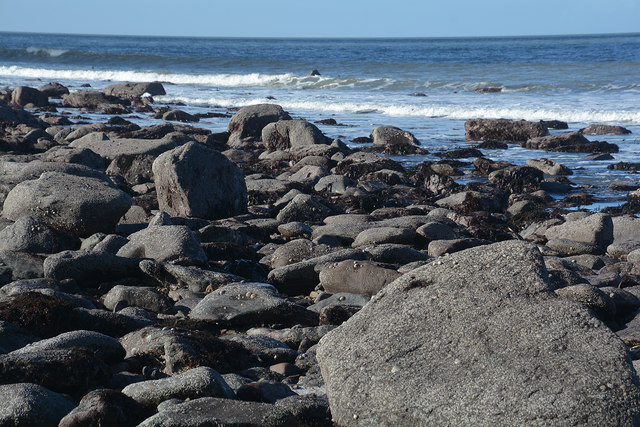
Western Beach is a picturesque coastal area located in the county of Devon, England. Situated on the southern coast, it forms part of the popular seaside resort town of Exmouth. With its stunning sandy stretches, clear blue waters, and breathtaking views, Western Beach is a beloved destination for both locals and tourists alike.

The beach offers a range of amenities and activities to cater to all visitors. Its vast expanse of golden sand provides ample space for sunbathing, picnicking, or simply taking a leisurely stroll along the shore. The calm waters make it an ideal spot for swimming, and lifeguards are on duty during peak seasons to ensure the safety of beachgoers.

For those seeking a more adventurous experience, Western Beach is a hub for various water sports such as kayaking, paddleboarding, and sailing. Equipment rentals and lessons are available for those looking to try their hand at these activities. Additionally, the beach is renowned for its excellent conditions for windsurfing and kitesurfing.

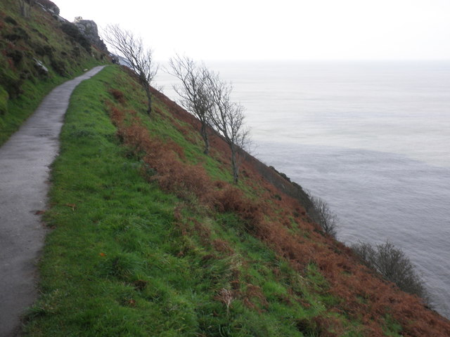
The surrounding area offers a range of amenities to enhance visitors' experience. There are several cafes, restaurants, and ice cream parlors nearby, perfect for indulging in a delicious treat or refreshing drink. The beach is easily accessible, with ample parking available and good public transport links.

Overall, Western Beach in Devon provides a stunning coastal escape with its beautiful scenery, tranquil waters, and a range of activities for all ages. Whether one is seeking relaxation or adventure, this beach is an excellent choice for a day out by the sea.

If you have any feedback on the listing, please let us know in the comments section below.

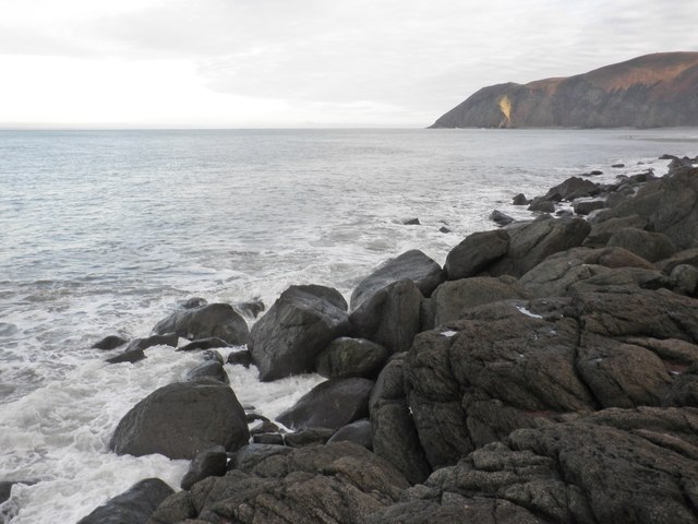
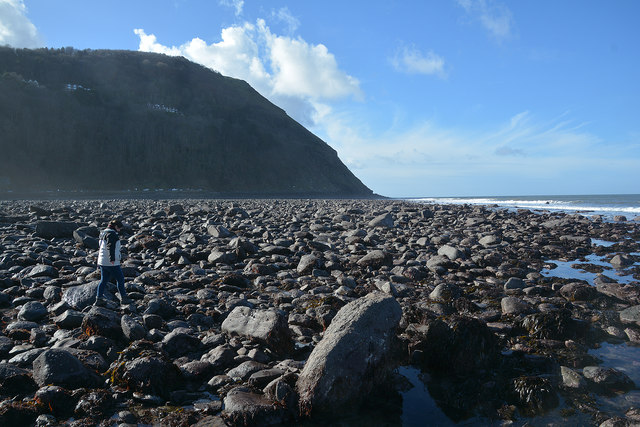
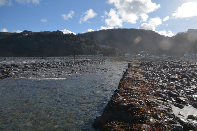
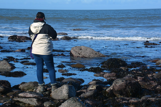
Western Beach Images

Images are sourced within 2km of 51.233745/-3.83287 or Grid Reference SS7249. Thanks to Geograph Open Source API. All images are credited.

South West Coast Path The South West Coast Path National Trail - 630 miles of superb coastal walking. From Minehead on the edge of the Exmoor National Park to the shores of Poole Harbour in Dorset. It is the longest of all Britain's National Trails.
Website: <span class="nowrap"><a title="http://www.southwestcoastpath.com/" rel="nofollow ugc noopener" href="http://www.southwestcoastpath.com/">Link</a><img style="margin-left:2px;" alt="External link" title="External link - shift click to open in new window" src="https://s1.geograph.org.uk/img/external.png" width="10" height="10"/></span>
South West Coast Path
The South West Coast Path National Trail - 630 miles of superb coastal walking. From Minehead on the edge of the Exmoor National Park to the shores of Poole Harbour in Dorset. It is the longest of all Britain's National Trails. Website: LinkExternal link
Lyn Mouth rocks These rocks are only visible when there is a very low tide. The photo was taken at 16:03 BST during a low autumn tide. Foreland Point is clearly visible in the distance with the gully known as Great Red showing between the cliffs in the centre.
Lyn Mouth rocks
These rocks are only visible when there is a very low tide. The photo was taken at 16:03 BST during a low autumn tide. Foreland Point is clearly visible in the distance with the gully known as Great Red showing between the cliffs in the centre.
Ruddy Ball Ruddy Ball is part of the cliff face in Lynton North Devon. The photograph was taken close to the foot of the cliff at low tide.
Ruddy Ball
Ruddy Ball is part of the cliff face in Lynton North Devon. The photograph was taken close to the foot of the cliff at low tide.
Cormorant at Lynmouth These rocks are just exposed at low tide at the very southern edge of the grid square.
Cormorant at Lynmouth
These rocks are just exposed at low tide at the very southern edge of the grid square.
Cliff path, above Ruddy Ball
View towards the Lyn Mouth
Lyn Mouth and the Bristol Channel Looking north east from Lynton, near the upper cliff railway station.
Lyn Mouth and the Bristol Channel
Looking north east from Lynton, near the upper cliff railway station.
Breaking waves at the harbour entrance, Lynmouth
Water's edge, Lynmouth
View west, from Ruddy Ball
Rock slabs, Ruddy Ball
Rising tide, Ruddy Ball
Lynmouth : Lyn Mouth At the mouth of the Lyn and you're pretty much in the sea.
Lynmouth : Lyn Mouth
At the mouth of the Lyn and you're pretty much in the sea.
Lynmouth : Western Beach Looking out across the pebble beach.
Lynmouth : Western Beach
Looking out across the pebble beach.
Lynmouth : Western Beach Looking back along the River Lyn and Lynmouth.
Lynmouth : Western Beach
Looking back along the River Lyn and Lynmouth.
Lynmouth : Marker A marker out in the sea.
Lynmouth : Marker
A marker out in the sea.
Lynmouth : Coastal Scenery Looking out to sea from Western Beach.
Lynmouth : Coastal Scenery
Looking out to sea from Western Beach.
Lynmouth : Coastal Scenery Looking out across the coastline from Western Beach.
Lynmouth : Coastal Scenery
Looking out across the coastline from Western Beach.
Show me another place!

Western Beach is located at Grid Ref: SS7249 (Lat: 51.233745, Lng: -3.83287)

Administrative County: Devon

District: North Devon

Police Authority: Devon and Cornwall

What 3 Words

///careful.combines.sonic. Near Lynton, Devon

Related Wikis

Lynmouth Bay railway station

Lynmouth Bay railway station is a station in Lynmouth, Devon, England, served by the Lynton and Lynmouth Cliff Railway, a water-powered funicular railway...

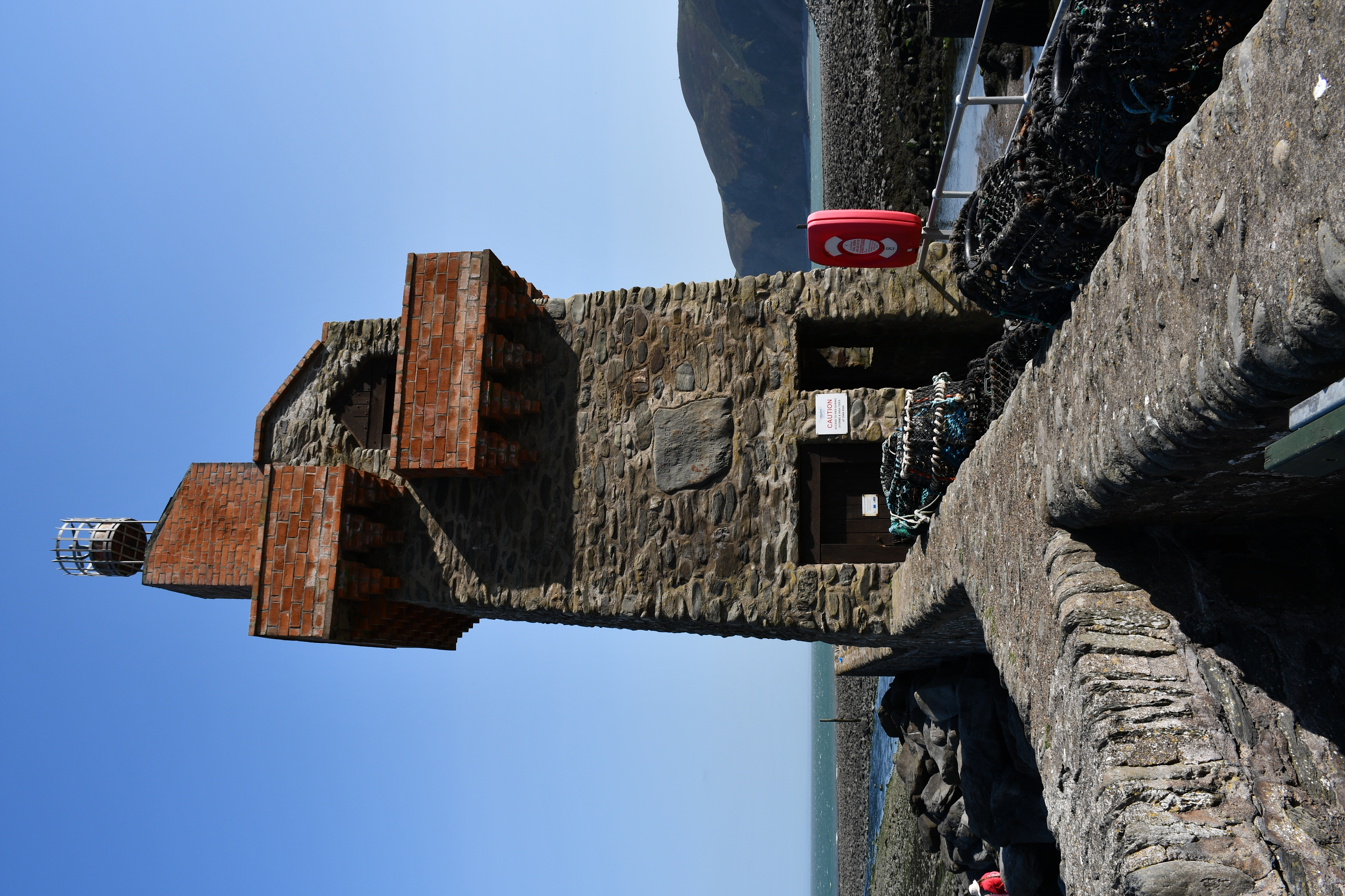
Rhenish Tower, Lynmouth

The Rhenish Tower is a building on the pier of Lynmouth, in Devon, England, originally built in the 19th century. It is Grade II listed. The tower has...

Lynton and Lynmouth Cliff Railway

The Lynton and Lynmouth Cliff Railway is a water-powered funicular joining the twin towns of Lynton and Lynmouth on the rugged coast of North Devon in...

East Lyn River

The East Lyn is a river which rises high in Exmoor, in the English county of Somerset. It flows through the East Lyn Valley in Devon. == Watercourse... ==

Nearby Amenities

Located within 500m of 51.233745,-3.83287
Source: PGS
Lat/Long: 51.23491/-3.8264476
Source: PGS
Lat/Long: 51.2349795/-3.8267004
Source: PGS
Lat/Long: 51.2350271/-3.8271889
Source: PGS
Lat/Long: 51.235036/-3.8276463
Source: PGS
Lat/Long: 51.235097/-3.8280043
Source: PGS
Lat/Long: 51.2353579/-3.8286433
Source: PGS
Lat/Long: 51.2353147/-3.829402
Source: PGS
Lat/Long: 51.2350447/-3.8307933
Source: PGS
Lat/Long: 51.2351138/-3.8312622
Source: PGS
Lat/Long: 51.2351646/-3.8317623
Source: PGS
Lat/Long: 51.2352937/-3.8331511
Source: PGS
Lat/Long: 51.2353618/-3.8342141
Source: PGS
Lat/Long: 51.2353869/-3.83521
Source: PGS
Lat/Long: 51.2353708/-3.835756
Source: PGS
Lat/Long: 51.23533/-3.8359802
Source: PGS
Lat/Long: 51.2351645/-3.8373431
Source: PGS
Lat/Long: 51.2352222/-3.837713
Source: PGS
Lat/Long: 51.2353479/-3.8387742
Lynmouth Bay Railway Station
Addr Country: GB
Public Transport: station
Railway: station
Usage: tourism
Wheelchair: yes
Wikidata: Q18619254
Wikipedia: en:Lynmouth Bay railway station
Lat/Long: 51.2316264/-3.8323694
Toilets
Lat/Long: 51.2303934/-3.8365165
Tourism: hotel
Lat/Long: 51.2302987/-3.8308607
Cafe
Note: part of Riverside Cottage hotel
Lat/Long: 51.230132/-3.8303465
Maurice Bishop's Studio
Level: 0
Phone: +44 1598 752444
Postal Code: EX35 6EH
Tourism: gallery
Website: https://www.mauricebishop.co.uk/
Lat/Long: 51.2303471/-3.8303641
Barrier: bollard
Lat/Long: 51.2296935/-3.8345538
Barrier: bollard
Lat/Long: 51.229925/-3.8344557
Lynmouth Flood Memorial Hall
Fee: no
Opening Hours: 10:00-18:00
Tourism: museum
Wheelchair: no
Wikidata: Q6708877
Wikipedia: en:Lynmouth Lifeboat Station
Lat/Long: 51.230901/-3.8312251
Post Box
Brand: Royal Mail
Brand Wikidata: Q638098
Brand Wikipedia: en:Royal Mail
Collection Times: Mo-Fr 09:00; Sa 07:00
Operator: Royal Mail
Operator Wikidata: Q638098
Post Box Design: type_b
Post Box Type: pillar
Ref: EX35 35D
Royal Cypher: GR
Royal Cypher Wikidata: Q33102273
Lat/Long: 51.2302885/-3.8353758
Post Box
Brand: Royal Mail
Collection Times: Mo-Fr 09:00; Sa 07:00
Operator: Royal Mail
Operator Wikidata: Q638098
Post Box Type: pillar
Ref: EX35 122D
Royal Cypher: GVIR
Royal Cypher Wikidata: Q33102169
Lat/Long: 51.230109/-3.829997
Lynton Village Railway Station
Addr City: Lynton
Addr Postcode: EX35 6EQ
Addr Suburb: Lynmouth
Public Transport: station
Railway: station
Usage: tourism
Website: https://www.cliffrailwaylynton.co.uk
Wheelchair: yes
Wikidata: Q18619256
Wikipedia: en:Lynton Village railway station
Lat/Long: 51.2313042/-3.8354722
Fast Food
Esplanade Fish Bar
Addr Housenumber: 2
Addr Street: The Esplanade
Cuisine: fish_and_chips
Phone: +44 1598 753798
Takeaway: yes
Lat/Long: 51.2316708/-3.83162
Cafe
Cliff Top Cafe
Lat/Long: 51.2312302/-3.8353529
Image: https://archive.org/details/lynmouth-2021-09-07/DSCN4731.JPG
Seamark Light Category: vertical
Seamark Light Character: F
Seamark Light Colour: green
Seamark Light Height: 6
Seamark Light Multiple: 2
Seamark Light Range: 5
Seamark Light Reference: A 5593
Seamark Type: light_minor
Source: US NGA Pub. 114. 2011-05-26.
Lat/Long: 51.2320248/-3.8307108
Image: https://archive.org/details/lynmouth-2021-09-07/DSCN4736.JPG
Seamark Light Category: vertical
Seamark Light Character: F
Seamark Light Colour: red
Seamark Light Height: 6
Seamark Light Multiple: 2
Seamark Light Range: 5
Seamark Light Reference: A 5592
Seamark Type: light_minor
Source: US NGA Pub. 114. 2011-05-26.
Lat/Long: 51.2318267/-3.8305745
Cafe
Laceys
Lat/Long: 51.2301442/-3.8356626
Bus Stop
Bus: yes
Naptan AtcoCode: 1100DEA10882
Naptan NaptanCode: dvnawdma
Public Transport: platform
Lat/Long: 51.2302156/-3.8355657
Bus Stop
Bus: yes
Public Transport: platform
Lat/Long: 51.2302152/-3.8360982
Barrier: bollard
Bicycle: no
Foot: yes
Lat/Long: 51.230336/-3.8306646
Turning Circle
Lat/Long: 51.2329122/-3.8353099
Pub
The Queens
Wikidata: Q79837573
Lat/Long: 51.2294865/-3.8344535
Information: office
Tourism: information
Lat/Long: 51.2303317/-3.8363381
Restaurant
Coffee Mill
Addr Housenumber: 7
Addr Street: Riverside Road
Cuisine: coffee_shop
Phone: +44 1598 752772
Lat/Long: 51.2304528/-3.8306995
Bench
Lat/Long: 51.2316298/-3.8283174
Bench
Backrest: yes
Lat/Long: 51.2315677/-3.8286078
Bench
Lat/Long: 51.231697/-3.8280465
Toilets
Fee: no
Female: yes
Male: no
Lat/Long: 51.2308794/-3.831209
Castle Hill Guest House
Addr City: Lynton
Addr Postcode: EX35 6JA
Addr Street: Church Hill
Internet Access: wlan
Tourism: hotel
Wikidata: Q111369227
Lat/Long: 51.229466/-3.833836
Give Way
Lat/Long: 51.2298991/-3.8342654
Give Way
Lat/Long: 51.230128/-3.8362865
Give Way
Lat/Long: 51.2307714/-3.8309927
Cafe
Lynmouth bay café
Name En: Lynmouth bay café
Lat/Long: 51.230193/-3.8301062
Bar
The Ancient Mariner
Wheelchair: yes
Lat/Long: 51.2305959/-3.8311189
Cafe
The Pavilion
Level: 1
Lat/Long: 51.2316727/-3.8318744
Exmoor National Park Visitors Centre
Information: office
Level: 0
Tourism: information
Lat/Long: 51.2316748/-3.8317971
Historic: memorial
Memorial: war_memorial
Lat/Long: 51.2302301/-3.8362358
Bath Hotel
Tourism: hotel
Lat/Long: 51.2305272/-3.8310629
Restaurant
Lat/Long: 51.2295317/-3.8344592
Public Bookcase
Lynmouth Library
Booth: K6
Disused Amenity: telephone
Listed Status: Grade II
Man Made: telephone_box
Public Bookcase Type: phone_box
Lat/Long: 51.2310142/-3.8312479
Bench
Backrest: no
Lat/Long: 51.2307914/-3.8311319
Bench
Backrest: no
Lat/Long: 51.2308197/-3.831146
Toilets
Fee: no
Female: no
Male: yes
Lat/Long: 51.2309781/-3.8312527
Drinking Water
Lat/Long: 51.2308/-3.83114
Cafe
The Bake House Café & Takeaway
Cuisine: cake;cornish_pasty;ice_cream
Image: https://archive.org/details/lynmouth-2021-09-07/DSCN4651.JPG
Level: 0
Lat/Long: 51.231118/-3.831305
Cafe
Villa Spaldi
Lat/Long: 51.2329273/-3.8378145
Generator Method: photovoltaic
Generator Output Electricity: yes
Generator Source: solar
Generator Type: solar_photovoltaic_panel
Location: roof
Power: generator
Lat/Long: 51.2296258/-3.8349791
Generator Method: photovoltaic
Generator Output Electricity: yes
Generator Source: solar
Generator Type: solar_photovoltaic_panel
Location: roof
Power: generator
Lat/Long: 51.2296174/-3.8348772
Defibrillator
Defibrillator Location: On exterior wall of Lynmouth Flood Memorial Hall, to the right of the shelter.
Emergency: defibrillator
Indoor: no
Lat/Long: 51.230936/-3.8312129
Defibrillator
Defibrillator Location: On exterior wall of Cliff Railway Ticket Office, by the entrance at the bottom.
Emergency: defibrillator
Lat/Long: 51.2317573/-3.832284
Barrier: bollard
Foot: yes
Lat/Long: 51.2303286/-3.8352211
Post House Interiors
Shop: gift
Lat/Long: 51.2300543/-3.8299937
Hardings
Addr City: Lynton
Addr Housenumber: 17
Addr Postcode: EX35 6EH
Addr Street: Lynmouth Street
Addr Village: Lynmouth
Shop: clothes
Website: https://www.exmoorsheepskin.co.uk/
Lat/Long: 51.2300891/-3.8301698
The Victorian Portrait Co.
Addr City: Lynton
Addr Housenumber: 15
Addr Postcode: EX35 6EH
Addr Street: Lynmouth Street
Addr Village: Lynmouth
Craft: photographer
Website: https://www.victorianportraitcompany.co.uk/
Lat/Long: 51.2301135/-3.8302616
Fast Food
The Pie Shack
Addr City: Lynton
Addr Postcode: EX35 6AA
Addr Street: Queen Street
Cuisine: regional;pies;wraps
Drive Through: no
Phone: +44 7866 321246
Lat/Long: 51.2295437/-3.8343339
Bench
Backrest: yes
Colour: green
Covered: yes
Lat/Long: 51.2317225/-3.8321105
Turning Circle
Lat/Long: 51.2318409/-3.8328169
Access: yes
Drinking Water: yes
Drinking Water Legal: yes
Man Made: water_tap
Lat/Long: 51.2308597/-3.8312379
Leisure: picnic_table
Lat/Long: 51.2298814/-3.8337054
Tourism: viewpoint
Lat/Long: 51.2299576/-3.8336806
Entrance: yes
Lat/Long: 51.2298287/-3.8338308
Tourism: viewpoint
Lat/Long: 51.2310977/-3.8351939
The Walker
Artist Name: Richard Graham
Artwork Type: statue
Material: metal
Tourism: artwork
Lat/Long: 51.2318302/-3.8318141
Vending Machine
Image: https://archive.org/details/lynmouth-2021-09-07/DSCN4616.JPG
Operator: North Devon District Council
Vending: parking_tickets
Lat/Long: 51.2328732/-3.8352424
Man Made: flagpole
Lat/Long: 51.2306944/-3.8311306
Addr Housename: The Manor Cottage
Lat/Long: 51.2311844/-3.8313337
Life Ring
Emergency: life_ring
Lat/Long: 51.2318068/-3.8310418
Street Lamp
Lamp Mount: straight_mast
Lat/Long: 51.2311529/-3.8313981
Addr Housename: Seabreeze Cottage
Lat/Long: 51.2315577/-3.8314658
Street Lamp
Lamp Mount: straight_mast
Lat/Long: 51.2317273/-3.8317274
Street Lamp
Lat/Long: 51.2317462/-3.832076
Bench
Backrest: yes
Colour: green
Covered: yes
Lat/Long: 51.2317328/-3.8320425
Street Lamp
Lat/Long: 51.2317706/-3.8324016
Image: https://archive.org/details/lynmouth-2021-09-07/DSCN4621.JPG
Information: map
Map Size: city
Map Source: OpenStreetMap
Map Type: street
Tourism: information
Lat/Long: 51.2319228/-3.8330111
Give Way
Lat/Long: 51.2319147/-3.8328723
Barrier: height_restrictor
Lat/Long: 51.2319167/-3.8328747
Barrier: height_restrictor
Lat/Long: 51.2318965/-3.8329055
Vending Machine
Operator: North Devon District Council
Payment Contactless: yes
Payment Credit Cards: yes
Payment Debit Cards: yes
Vending: parking_tickets
Lat/Long: 51.2319106/-3.832989
Ice Cream
Caravel Fudge & Toy Shop
Confectionery: fudge
Shop: confectionery
Shop 1: toys
Lat/Long: 51.2302867/-3.8302481
Spinning Wheel Quality Gifts
Level: 0
Shop: gift
Lat/Long: 51.2304362/-3.83057
Street Lamp
Lat/Long: 51.2317135/-3.831264
Donation Box
Historic: sea_mine
Operator: Shipwrecked Mariners' Society
Lat/Long: 51.2317569/-3.8312355
Rhenish Tower
Board Type: history
Image: https://archive.org/details/lynmouth-2021-09-07/DSCN4718.JPG
Information: board
Network: Lynmouth Heritage Trail
Operator: Lynton and Lynmouth Town Council
Ref: 2
Tourism: information
Lat/Long: 51.2317265/-3.8312677
Bench
Backrest: yes
Lat/Long: 51.231772/-3.8311929
Bench
Backrest: yes
Lat/Long: 51.2317689/-3.831156
Historic: memorial
Image: https://archive.org/details/lynmouth-2021-09-07/DSCN4684.JPG
Memorial: plaque
Lat/Long: 51.2303131/-3.8288862
Street Lamp
Lamp Mount: straight_mast
Lat/Long: 51.230314/-3.8289047
Street Lamp
Lamp Mount: straight_mast
Lat/Long: 51.2315598/-3.8286368
Waste Basket
Waste: trash
Lat/Long: 51.230664/-3.8289328
Bench
Backrest: yes
Material: wood
Lat/Long: 51.2304698/-3.8285382
Bench
Backrest: yes
Material: wood
Lat/Long: 51.23072/-3.8284819
Bench
Backrest: yes
Material: wood
Lat/Long: 51.2306976/-3.8288742
Playground: structure
Lat/Long: 51.2305118/-3.8286965
Baby: yes
Playground: swing
Lat/Long: 51.2306533/-3.8288493
Playground: swing
Lat/Long: 51.2305924/-3.8288111
Gunns Gallery
Shop: art
Website: http://www.gunnsgallery.co.uk
Lat/Long: 51.2301595/-3.8358841
Street Lamp
Lamp Mount: straight_mast
Lat/Long: 51.2302704/-3.8360367
Street Lamp
Lamp Mount: straight_mast
Lat/Long: 51.2302951/-3.8355166
Atm
Lat/Long: 51.2301501/-3.8350093
Street Lamp
Lamp Mount: straight_mast
Ref: 17
Lat/Long: 51.2299193/-3.8341594
Location: roof
Man Made: flagpole
Lat/Long: 51.2297123/-3.8339891
Clock
Display: analog
Lat/Long: 51.2297145/-3.8340032
Bench
Backrest: yes
Survey Date: 2023-05-13
Lat/Long: 51.2301295/-3.829958
Life Ring
Emergency: life_ring
Survey Date: 2023-05-13
Lat/Long: 51.2307538/-3.8307422
Bench
Backrest: yes
Survey Date: 2023-05-13
Lat/Long: 51.2306634/-3.829707
Bench
Backrest: yes
Survey Date: 2023-05-13
Lat/Long: 51.2318613/-3.8322344
Bench
Backrest: yes
Survey Date: 2023-05-13
Lat/Long: 51.2302146/-3.8303458
Waste Basket
Survey Date: 2023-05-13
Lat/Long: 51.2308619/-3.8311277
Bench
Survey Date: 2023-05-13
Lat/Long: 51.2306834/-3.8297662
Binoculars
Survey Date: 2023-05-13
Lat/Long: 51.2318404/-3.8324016
Waste Basket
Survey Date: 2023-05-13
Lat/Long: 51.230693/-3.8307605
Bench
Backrest: yes
Survey Date: 2023-05-13
Lat/Long: 51.2306356/-3.8296424
Restaurant
The Old Bank
Email: info@theoldbanklynton.co.uk
Opening Hours: We-Su 12:00-14:30,18:00-21:00
Phone: +441598751487
Reservation: recommended
Website: https://www.theoldbanklynton.co.uk/
Lat/Long: 51.2295464/-3.8341299
The data included in this document is from www.openstreetmap.org. The data is made available under ODbL.

Have you been to Western Beach?

Leave your review of Western Beach below (or comments, questions and feedback).