Mouthmill Beach
Beach in Devon Torridge
England
Mouthmill Beach
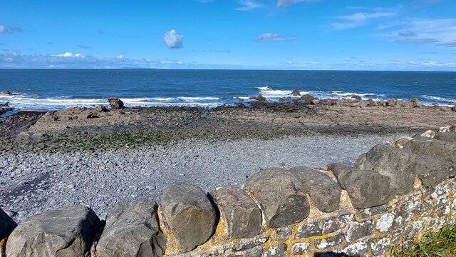
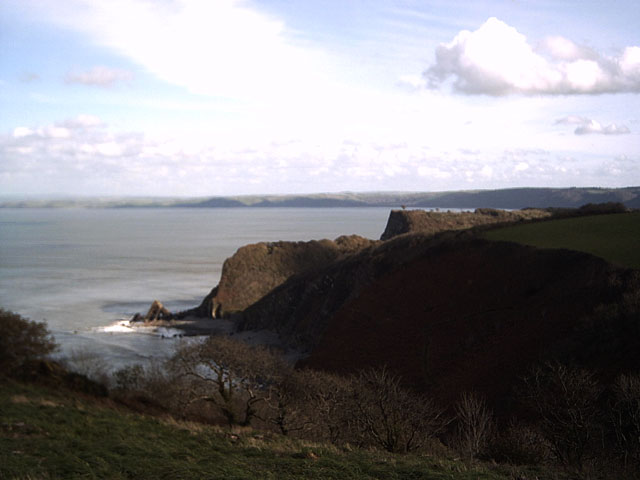
Mouthmill Beach is a picturesque coastal gem located in Devon, England. Nestled along the rugged North Devon coastline, this secluded beach offers a serene and tranquil retreat for visitors seeking a peaceful getaway from the bustling city life.
With its soft golden sand and clear turquoise waters, Mouthmill Beach presents a stunning natural beauty that is a sight to behold. The beach is surrounded by towering cliffs and lush greenery, creating a breathtaking backdrop that adds to its allure. Due to its remote location and lack of commercial development, it remains relatively untouched and retains its unspoiled charm.
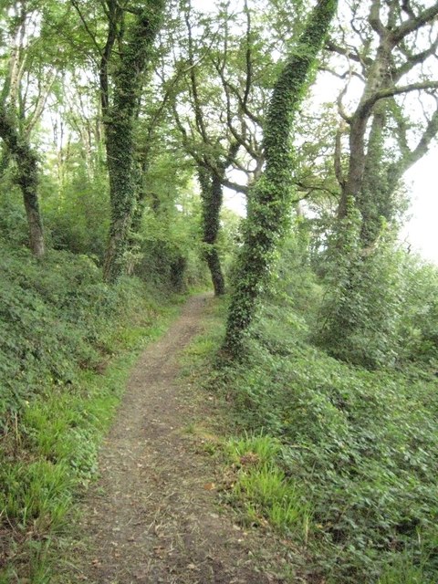
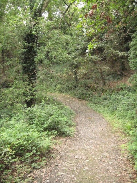
The beach is accessible via a narrow and winding path, which adds to the sense of adventure for those willing to make the journey. This secluded location also means that the beach is often uncrowded, providing visitors with ample space to relax and unwind.
Mouthmill Beach is a popular spot for nature lovers and outdoor enthusiasts. The surrounding cliffs offer excellent opportunities for hiking and exploring, with stunning coastal views awaiting at every turn. The clear waters are also ideal for swimming, snorkeling, and even kayaking, allowing visitors to fully immerse themselves in the coastal beauty.
Facilities at Mouthmill Beach are limited, with no on-site amenities or lifeguards, so visitors are advised to come prepared with any necessary supplies. However, a small parking area is available nearby for those arriving by car.
Overall, Mouthmill Beach is a hidden gem that offers a tranquil escape and a chance to connect with nature, making it a must-visit destination for beach lovers and outdoor enthusiasts in Devon.
If you have any feedback on the listing, please let us know in the comments section below.
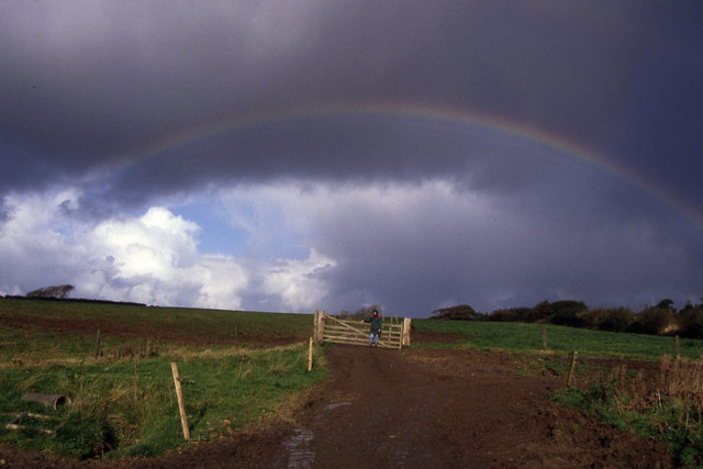
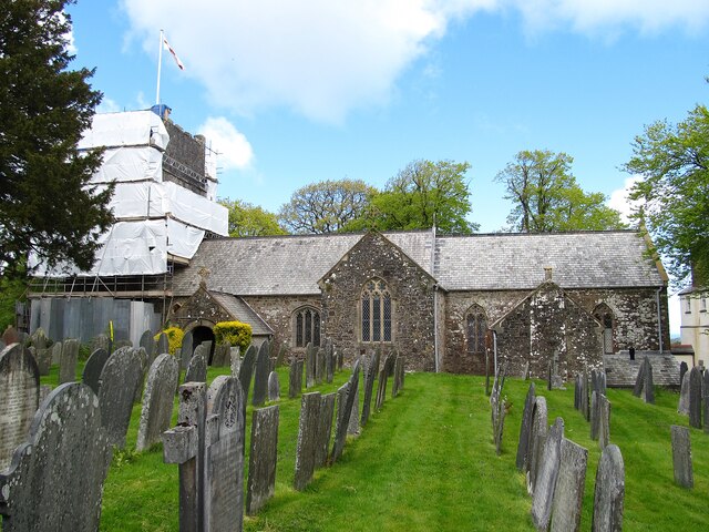
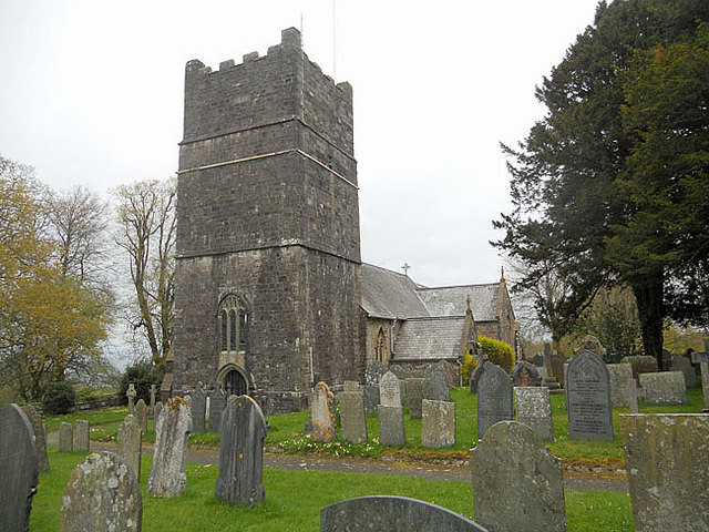
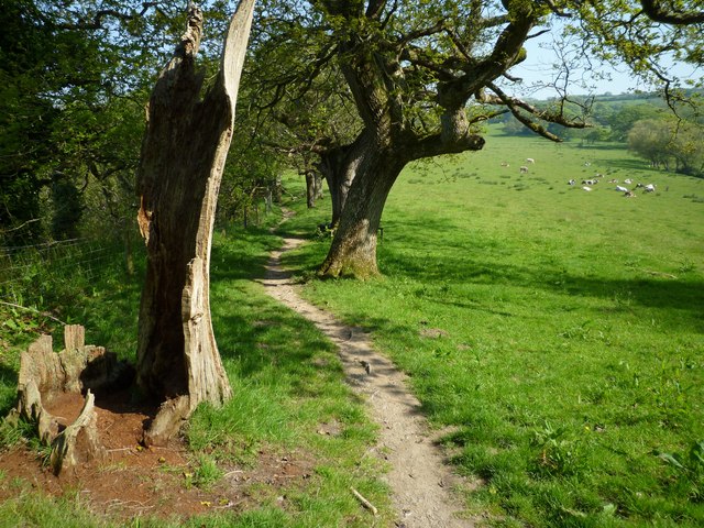
Mouthmill Beach Images
Images are sourced within 2km of 51.013618/-4.4298696 or Grid Reference SS2926. Thanks to Geograph Open Source API. All images are credited.


Mouthmill Beach is located at Grid Ref: SS2926 (Lat: 51.013618, Lng: -4.4298696)
Administrative County: Devon
District: Torridge
Police Authority: Devon and Cornwall
What 3 Words
///crackles.explores.tomb. Near Northam, Devon
Nearby Locations
Related Wikis
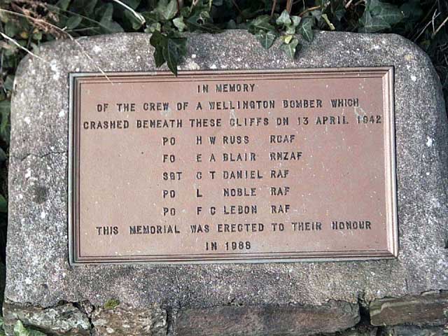
Windbury Head
Windbury Head is the site of an Iron Age hill fort on the Hartland Peninsula, just north of Clovelly in North Devon, England. Most of the fort has been...
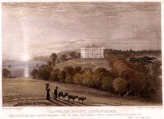
Clovelly Court
Clovelly Court is a privately owned country house in Clovelly, Devon. The house and adjacent stable block are Grade II listed buildings. The gardens and...

Atlantic Academy
Atlantic Academy is a secondary free school situated in Bucks Cross in Bideford, Devon, England. It has 131 pupils as of June 2017, and its current principal...
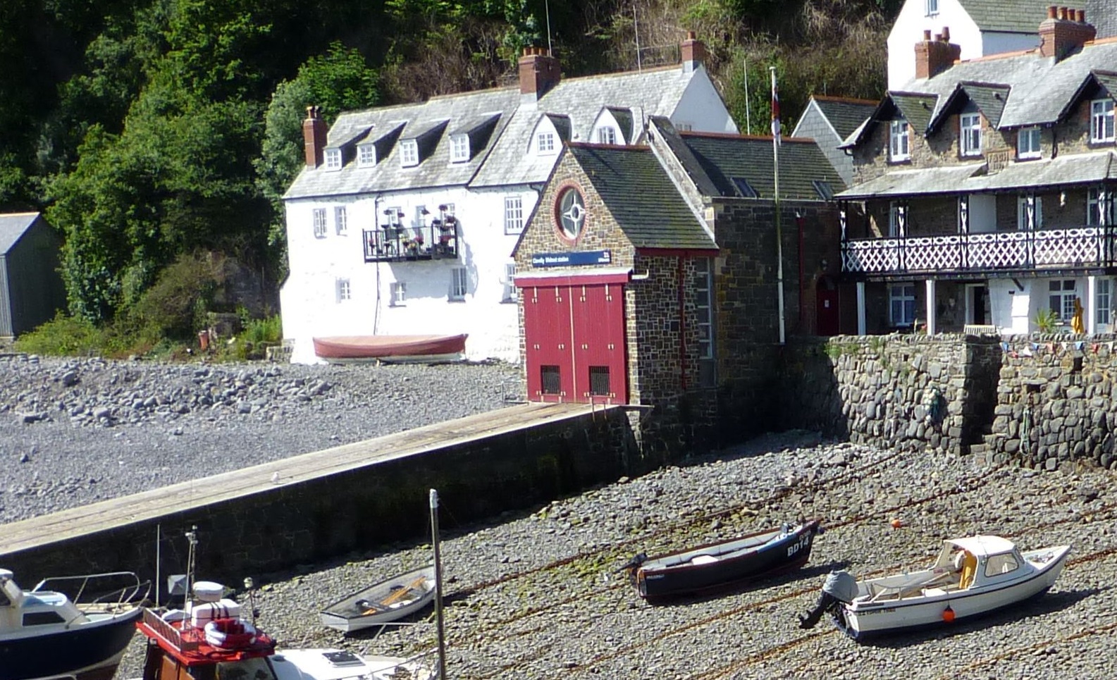
Clovelly Lifeboat Station
Clovelly Lifeboat Station, serving the North Devon village of Clovelly and surrounding coastal waters, is run by the Royal National Lifeboat Institution...

Burscott
Burscott is a village in Devon, England. == External links == Media related to Burscott at Wikimedia Commons

Clovelly
Clovelly () is a privately owned harbour village in the Torridge district of Devon, England. The settlement and surrounding land belongs to John Rous who...
Clovelly Dykes
Clovelly Dykes is an Iron Age hill fort or earthwork near Clovelly, Devon, England. Situated on the high plateau behind the coast at approx 210 metres...
The Small School
The Small School was a coeducational private school for children ages 11–16, located in Hartland, Devon, England, that closed in 2016. == History == Satish...
Nearby Amenities
Located within 500m of 51.013618,-4.4298696Have you been to Mouthmill Beach?
Leave your review of Mouthmill Beach below (or comments, questions and feedback).