Dumpton Bay
Bay in Kent Thanet
England
Dumpton Bay

Dumpton Bay is a picturesque coastal area located in the county of Kent, England. It is situated about one mile south of the popular seaside town of Broadstairs. This bay is characterized by its stunning sandy beach, towering white cliffs, and crystal-clear waters, making it a beloved destination for both locals and tourists alike.
The bay itself stretches for approximately half a mile, offering visitors ample space to relax, sunbathe, and enjoy various water activities. The sandy beach gently slopes into the sea, making it ideal for families with children who can safely swim and play in the shallow waters. The beach also provides stunning views, with the iconic chalk cliffs on either side creating a dramatic backdrop.
Dumpton Bay is rich in biodiversity, attracting nature enthusiasts and birdwatchers. The area is home to various species of seabirds, including gulls, cormorants, and sandpipers. During low tide, it is also possible to explore the rock pools that teem with marine life, providing an educational experience for visitors of all ages.
Facilities at Dumpton Bay are limited, with no promenade or shops directly on the beach. However, there is a small café nearby, offering refreshments and snacks. The bay is easily accessible, with a car park located close by, and public transportation links available.
Overall, Dumpton Bay is a hidden gem on the Kent coastline, offering a tranquil and picturesque setting for visitors seeking relaxation, natural beauty, and a chance to connect with the marine environment.
If you have any feedback on the listing, please let us know in the comments section below.
Dumpton Bay Images
Images are sourced within 2km of 51.347488/1.4411493 or Grid Reference TR3966. Thanks to Geograph Open Source API. All images are credited.


Dumpton Bay is located at Grid Ref: TR3966 (Lat: 51.347488, Lng: 1.4411493)
Administrative County: Kent
District: Thanet
Police Authority: Kent
What 3 Words
///trips.trials.bricks. Near Broadstairs, Kent
Nearby Locations
Related Wikis

Holy Cross R.C. Secondary School
Holy Cross R.C. Secondary School (1962–1998) was a former Roman Catholic Secondary modern school and sixth form college located in Broadstairs, Kent, it...

East Kent College
Broadstairs East Kent College is a further education college (although also provides higher education courses) located in Broadstairs, Kent on the southeast...
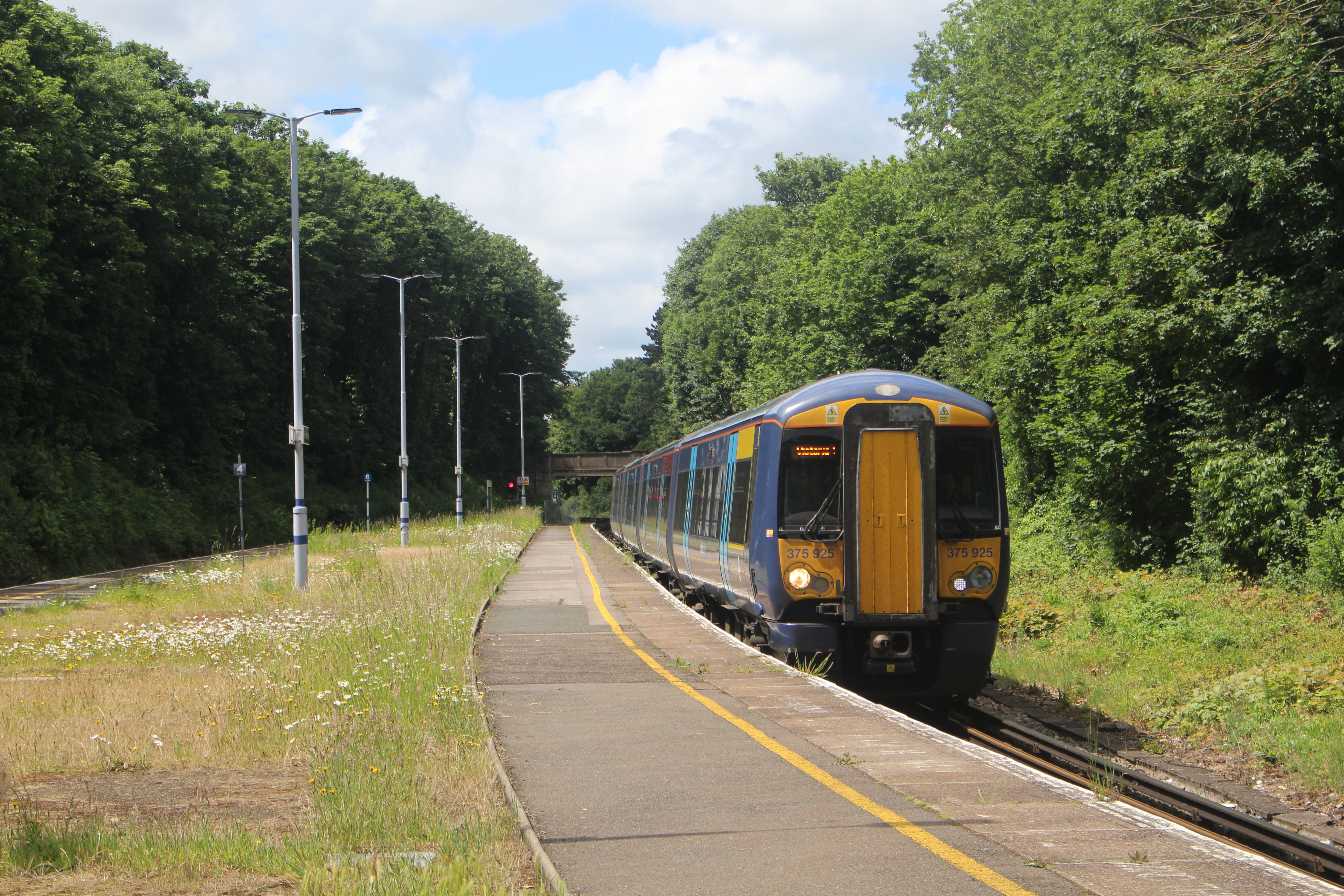
Dumpton Park railway station
Dumpton Park railway station is on the Chatham Main Line in England, serving the district of Dumpton between the towns of Broadstairs and Ramsgate, Kent...
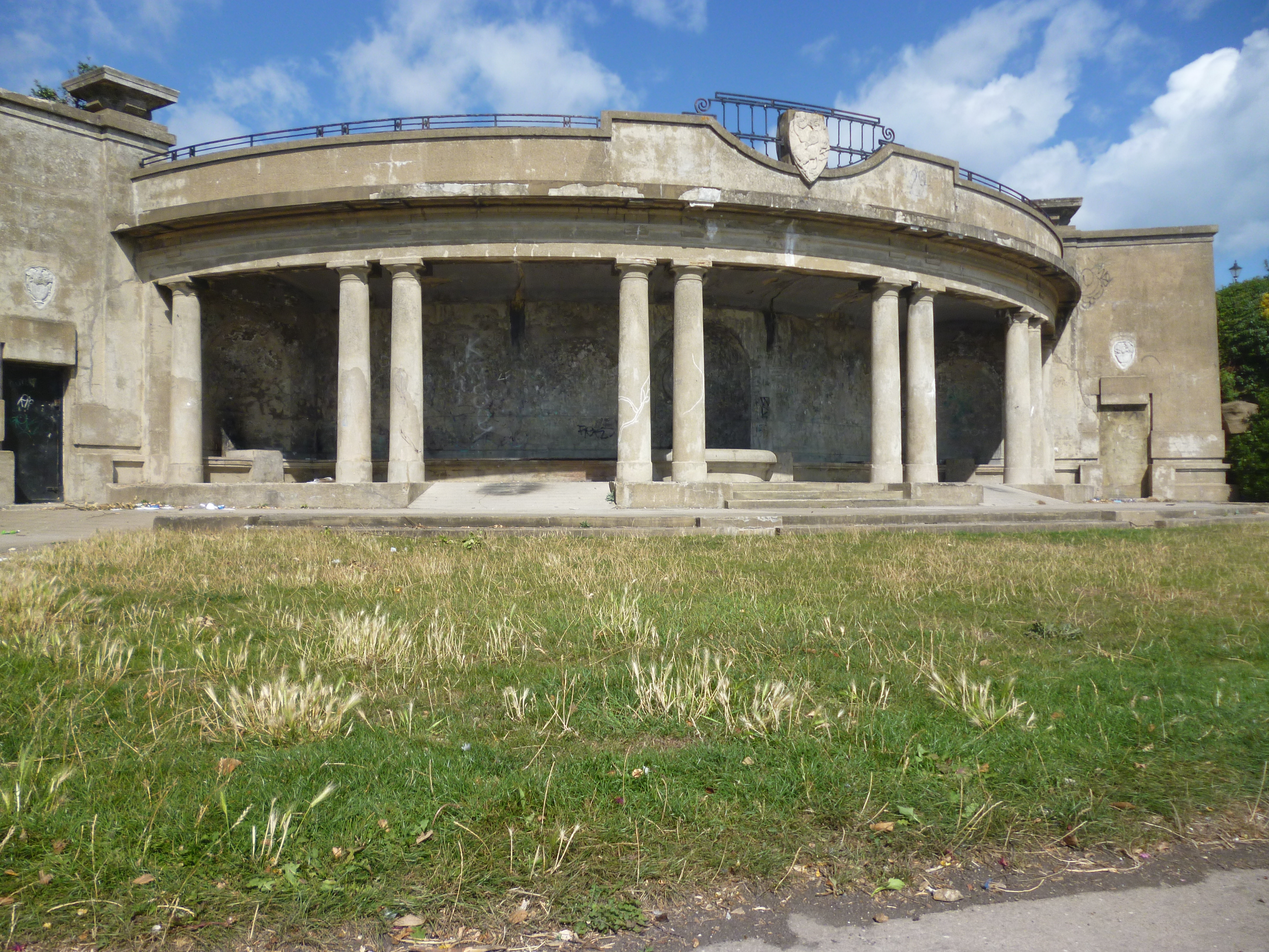
Winterstoke sun shelter and rock gardens
The Winterstoke sun shelter and rock gardens are located on Victoria Parade, Ramsgate, Kent, United Kingdom. Overlooking the sea, the ornamental gardens...
Nearby Amenities
Located within 500m of 51.347488,1.4411493Have you been to Dumpton Bay?
Leave your review of Dumpton Bay below (or comments, questions and feedback).