Louisa Bay

Bay in Kent Thanet

England

Louisa Bay

Below East Cliff, Broadstairs This whole bay and the wave-cut platform are all submerged at high tide.
Below East Cliff, Broadstairs Credit: Trevor Harris

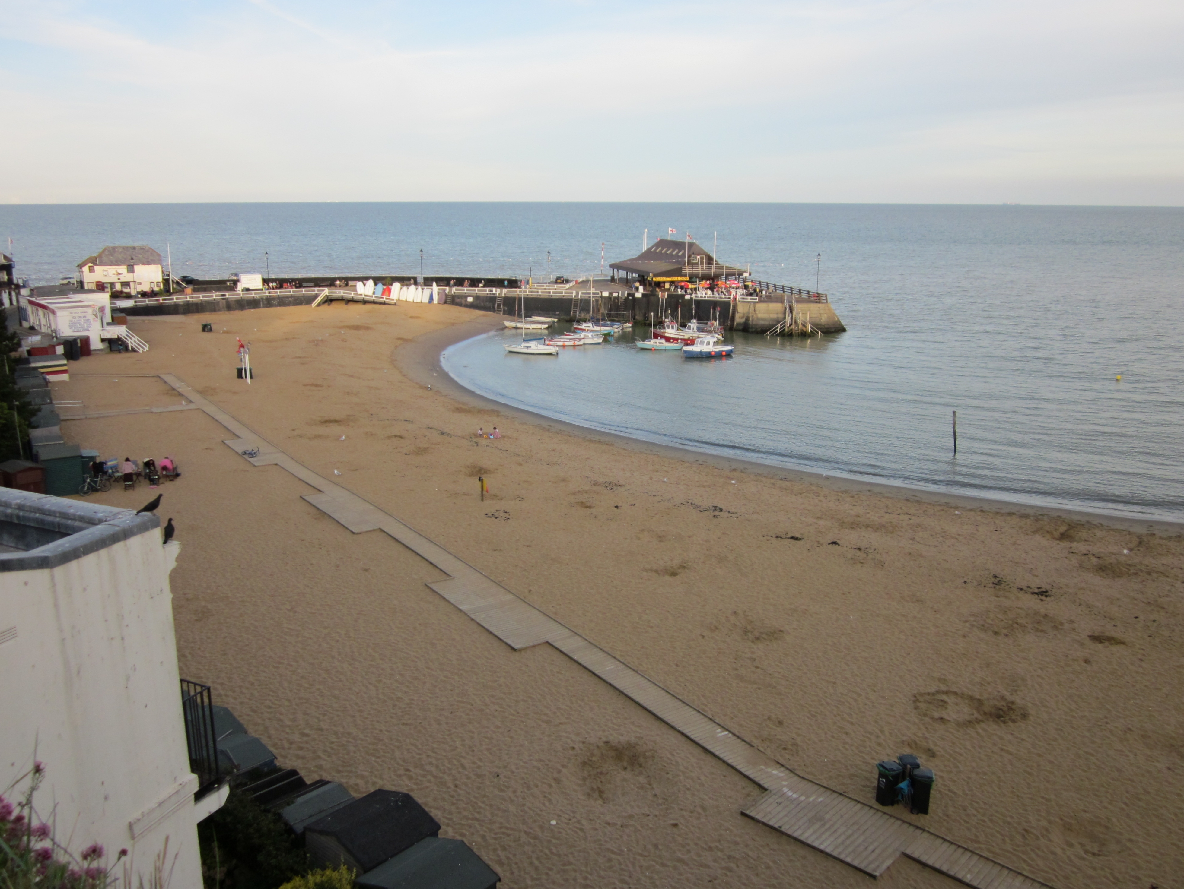
Louisa Bay, also known as Bay, is a picturesque coastal area located in the county of Kent, England. Situated on the southeastern coast, it forms part of the larger seaside town of Broadstairs. Louisa Bay is named after Princess Louisa of Belgium, who visited the area in the late 19th century and was captivated by its beauty.

The bay features a stunning sandy beach with clear blue waters, making it a popular destination for locals and tourists alike. Its pristine shoreline stretches for approximately 200 meters, providing ample space for sunbathing, picnicking, and beach activities. The beach is also flanked by towering chalk cliffs, adding to its charm and providing a scenic backdrop.

The bay is well-equipped with facilities such as public toilets, a café, and ample parking space, making it easily accessible to visitors. There are also lifeguards on duty during the summer months, ensuring the safety of swimmers and beachgoers.

In addition to its natural beauty, Louisa Bay boasts a rich history. The area was once a favorite haunt of smugglers and was known for its clandestine activities during the 18th century. Today, remnants of this past can still be seen in the form of hidden caves and tunnels along the cliffs.

Louisa Bay offers a tranquil escape from the hustle and bustle of city life, providing visitors with an idyllic coastal experience. Whether one seeks relaxation on the beach or wishes to explore the area's historical significance, Louisa Bay is a must-visit destination in Kent.

If you have any feedback on the listing, please let us know in the comments section below.

Louisa Bay Images

Images are sourced within 2km of 51.355316/1.4441499 or Grid Reference TR3967. Thanks to Geograph Open Source API. All images are credited.

Below East Cliff, Broadstairs This whole bay and the wave-cut platform are all submerged at high tide.
Below East Cliff, Broadstairs
This whole bay and the wave-cut platform are all submerged at high tide.
Foreshore at Stone Bay The sandy beach transforms into a rock platform at low tide.
Foreshore at Stone Bay
The sandy beach transforms into a rock platform at low tide.
Stone Bay, Broadstairs Looking along the full length from the harbour jetty with Hope Point and North Foreland in the distance. Note the sewage discharge pipe at the beginning of the rocks, hopefully no longer in use!
Stone Bay, Broadstairs
Looking along the full length from the harbour jetty with Hope Point and North Foreland in the distance. Note the sewage discharge pipe at the beginning of the rocks, hopefully no longer in use!
Turnstone on the landing slip, Broadstairs Taking refuge after being chased along the beach by a dog.
Turnstone on the landing slip, Broadstairs
Taking refuge after being chased along the beach by a dog.
Broadstairs Sailing Club A decent wind without too much sea running. Mainly Laser class one-man dinghies with a Contender far right.
Broadstairs Sailing Club
A decent wind without too much sea running. Mainly Laser class one-man dinghies with a Contender far right.
Rocks at Low Tide This square just avoids being in the All At Sea category with a small area of weed covered rock getting exposed at low tide. At high tide it's only the beacon at the end of the nearby slipway that isn't under water.
Rocks at Low Tide
This square just avoids being in the All At Sea category with a small area of weed covered rock getting exposed at low tide. At high tide it's only the beacon at the end of the nearby slipway that isn't under water.
White Rocks, Green Weed These strange rounded chalk boulders topped with soft green seaweed emerge at low tide. Some of them definitely resemble dummy heads wearing green wigs.
White Rocks, Green Weed
These strange rounded chalk boulders topped with soft green seaweed emerge at low tide. Some of them definitely resemble dummy heads wearing green wigs.
Beach Cricket at Low Tide An evening game on a rather soggy pitch down by the pier.
Beach Cricket at Low Tide
An evening game on a rather soggy pitch down by the pier.
Dog walker on Stone Bay
Rocks at Stone Bay, Broadstairs
East Cliff, Broadstairs
Stone Bay, Broadstairs
Coastal View at Broadstairs View north towards East Cliff.
Coastal View at Broadstairs
View north towards East Cliff.
Breakwater at Broadstairs This beacon warns shipping from coming to close to the land and Broadstairs Pier. This breakwater is only seen at low tide.

Also seen in <a href="https://www.geograph.org.uk/photo/1931281">TR4067 : Walking on the Breakwater</a>
Breakwater at Broadstairs
This beacon warns shipping from coming to close to the land and Broadstairs Pier. This breakwater is only seen at low tide. Also seen in TR4067 : Walking on the Breakwater
Broadstairs Pier As seen from the breakwater.
Broadstairs Pier
As seen from the breakwater.
Show me another place!

Louisa Bay is located at Grid Ref: TR3967 (Lat: 51.355316, Lng: 1.4441499)

Administrative County: Kent

District: Thanet

Police Authority: Kent

What 3 Words

///tone.eaten.prefer. Near Broadstairs, Kent

Related Wikis

Culmer White

The Culmer White was a 19th-century lifeboat of the Isle of Thanet, Kent, England. With its sister boat, the Mary White, it took part in the rescue of...

Mary White (lifeboat)

The Mary White was a lifeboat based in Broadstairs, Kent, England, named in 1851 after the completion of an heroic rescue of a brig, the Mary White. The...

Palace Cinema, Broadstairs

The Palace Cinema is an independent single-screen cinema in Broadstairs, Kent, England. Housed in a converted commercial building, it opened in 1965 as...

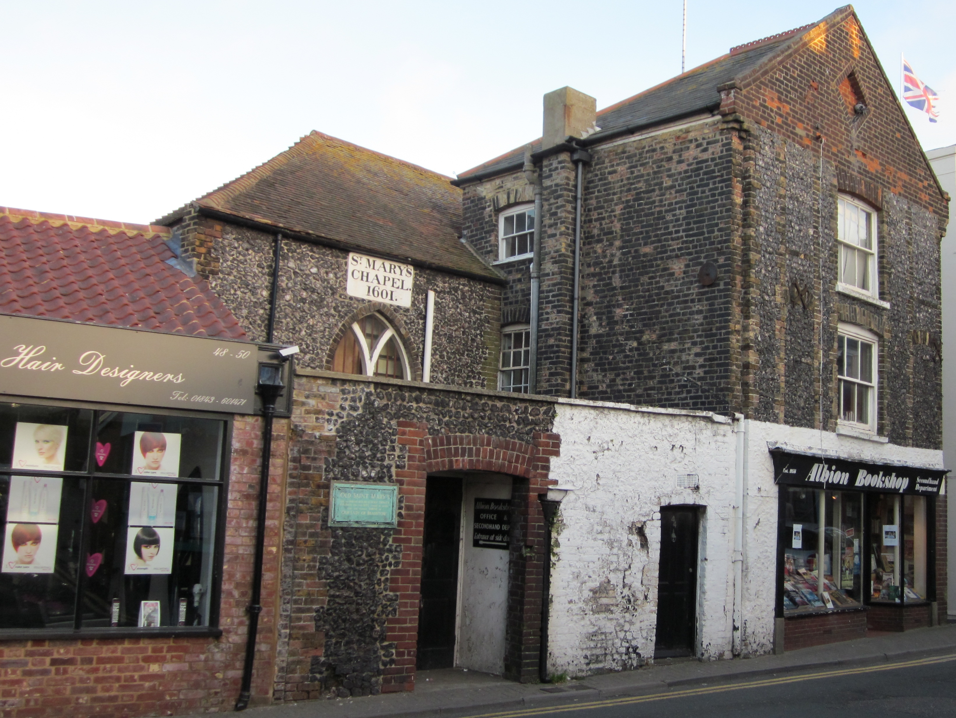
Shrine of Our Lady, Bradstowe

The Shrine of Our Ladye Star of the Sea was an old chapel on the cliffs at Broadstairs (which was formerly known as Bradstowe). Dating back at least to...

Nearby Amenities

Located within 500m of 51.355316,1.4441499
Check Date: 2021-06-06
Traffic Calming: table
Lat/Long: 51.3588124/1.4402029
Broadstairs
Place: town
Population: 24903
Postal Code: CT10
Source Population: 2011 census
Wikidata: Q922739
Wikipedia: en:Broadstairs
Lat/Long: 51.3586758/1.4407855
Post Box
Check Date: 2022-06-13
Collection Times: Mo-Fr 09:00, Sa 07:00
Drive Through: no
Operator: Royal Mail
Operator Wikidata: Q638098
Post Box Type: pillar
Ref: CT10 94D
Royal Cypher: VR
Royal Cypher Wikidata: Q33102356
Lat/Long: 51.3558602/1.4380217
Post Box
Collection Times: Mo-Fr 09:00; Sa 07:00
Drive Through: no
Operator: Royal Mail
Operator Wikidata: Q638098
Post Box Design: reproduction_penfold
Post Box Type: pillar
Postal Code: CT10
Ref: CT10 157D
Royal Cypher: VR
Royal Cypher Wikidata: Q33102356
Lat/Long: 51.3569765/1.4418035
Post Box
Collection Times: Mo-Fr 17:15; Sa 12:00
Postal Code: CT10
Ref: CT10 92
Royal Cypher: GR
Royal Cypher Wikidata: Q33102273
Lat/Long: 51.3578507/1.4414512
Barrier: lift_gate
Lat/Long: 51.3548782/1.4389497
Bicycle Parking
Bicycle Parking: stands
Capacity: 4
Covered: no
Cyclestreets Id: 26969
Lat/Long: 51.3554396/1.4417629
Viking Guest House
Addr City: Broadstairs
Addr County: Kent
Addr Postcode: CT10 1QA
Addr Street: West Cliff Avenue
Fhrs Id: 658456
Phone: +44 1843 862375
Source Addr: http://www.viking-guesthouse.co.uk/
Tourism: guest_house
Website: http://www.viking-guesthouse.co.uk/
Lat/Long: 51.3551124/1.4410607
Barrier: bollard
Bollard: removable
Lat/Long: 51.3592037/1.4452581
Barrier: bollard
Lat/Long: 51.3591303/1.4433877
Post Box
Collection Times: Mo-Fr 09:00; Sa 07:00
Post Box Type: wall
Postal Code: CT10
Ref: CT10 88D
Royal Cypher: GR
Royal Cypher Wikidata: Q33102273
Lat/Long: 51.3592545/1.4429789
Bicycle Parking
Bicycle Parking: stands
Capacity: 8
Covered: no
Cyclestreets Id: 22892
Lat/Long: 51.3589945/1.4432992
Man Made: surveillance
Lat/Long: 51.3584527/1.4426446
Visitor Information
Information: map
Map Size: site
Map Type: street
Tourism: information
Lat/Long: 51.3582243/1.4425943
Dickens House Museum
Addr City: Broadstairs
Addr Housenumber: 2
Addr Postcode: CT10 1QS
Addr Street: Victoria Parade
Fee: yes
Museum: history
Opening Hours Url: https://www.thanet.gov.uk/info-pages/dickens-house-museum/
Phone: +44 01843 577577
Tourism: museum
Website: https://www.thanet.gov.uk/info-pages/dickens-house-museum/
Wheelchair: limited
Wikidata: Q26557860
Lat/Long: 51.358288/1.4422251
Defibrillator
Booth: K6
Covered: booth
Defibrillator Location: inside former red telephone box next to harbour office
Disused Amenity: telephone
Emergency: defibrillator
Listed Status: Grade II
Man Made: telephone_box
Wikidata: Q26557739
Lat/Long: 51.3591956/1.4452807
Addr City: Broadstairs
Addr Housenumber: 68
Addr Street: West Cliff Road
Name Signed: no
Phone Signed: no
Tourism: guest_house
Lat/Long: 51.3546783/1.4413869
Bus Stop
Chandos Road
Bench: no
Flag: yes
Naptan AtcoCode: 2400100324
Naptan Bearing: E
Naptan CommonName: Chandos Road
Naptan Indicator: adj
Naptan Landmark: Chandos Road
Naptan Street: Oscar Road
Naptan Verified: no
Public Transport: platform
Ref: kntjgmgw
Shelter: no
Source: naptan_import
Source Date: 2018-02-02T12:11:00
Tactile Paving: no
Lat/Long: 51.3567009/1.4405255
Bus Stop
Chandos Road
Bench: no
Flag: no
Local Ref: opp
Naptan AtcoCode: 2400100326
Naptan Bearing: W
Naptan BusStopType: CUS
Naptan CommonName: Chandos Road
Naptan Indicator: opp
Naptan Landmark: Chandos Road
Naptan NaptanCode: kntgwjaw
Naptan PlusbusZoneRef: THANET
Naptan RevisionNumber: 1
Naptan Status: act
Naptan Street: Oscar Road
Naptan Verified: no
Public Transport: platform
Ref: kntgwjaw
Shelter: no
Source: naptan_import
Source Date: 2018-02-02
Tactile Paving: no
Lat/Long: 51.3566218/1.4405329
Bus Stop
The Royal Albion Hotel
Bench: no
Bin: no
Flag: yes
Lit: yes
Naptan AtcoCode: 2400A046900A
Naptan Bearing: SW
Naptan CommonName: The Royal Albion Hotel
Naptan Indicator: adj
Naptan Landmark: The Royal Albion Hotel
Naptan NaptanCode: kntdwpjp
Naptan PlusbusZoneRef: THANET
Naptan Street: Albion Street
Naptan Verified: yes
Public Transport: platform
Ref: kntdwpjp
Shelter: no
Source: naptan_import
Source Date: 2018-02-12T16:37:00
Tactile Paving: no
Lat/Long: 51.3585619/1.4422203
Bus Stop
The Royal Albion Hotel
Bench: no
Bin: no
Flag: yes
Lit: no
Naptan AtcoCode: 2400A047050A
Naptan Bearing: NE
Naptan CommonName: The Royal Albion Hotel
Naptan Indicator: opp
Naptan Landmark: The Royal Albion Hotel
Naptan NaptanCode: kntdwptp
Naptan PlusbusZoneRef: THANET
Naptan Street: Albion Street
Naptan Verified: no
Public Transport: platform
Ref: kntdwptp
Shelter: no
Source: naptan_import
Source Date: 2018-02-12T16:35:00
Tactile Paving: no
Lat/Long: 51.3586389/1.4421512
Bus Stop
Baptist Church
Bench: yes
Bin: yes
Flag: yes
Lit: yes
Naptan AtcoCode: 2400A047060A
Naptan Bearing: S
Naptan CommonName: Baptist Church
Naptan Crossing: High Street
Naptan Indicator: adj
Naptan Landmark: Baptist Church
Naptan NaptanCode: kntdwptw
Naptan PlusbusZoneRef: THANET
Naptan Street: Queens Road
Naptan Verified: yes
Public Transport: platform
Ref: kntdwptw
Shelter: yes
Source: naptan_import
Source Date: 2018-02-02T12:02:00
Tactile Paving: no
Lat/Long: 51.3584932/1.4392143
Bus Stop
King Edward Avenue
Bench: yes
Bin: yes
Flag: yes
Lit: no
Naptan AtcoCode: 2400A047070A
Naptan Bearing: S
Naptan CommonName: King Edward Avenue
Naptan Indicator: opp
Naptan Landmark: King Edward Avenue
Naptan NaptanCode: kntdwpwa
Naptan PlusbusZoneRef: THANET
Naptan Street: Queens Road
Naptan Verified: yes
Public Transport: platform
Ref: kntdwpwa
Shelter: no
Source: naptan_import
Source Date: 2018-02-02T12:54:00
Tactile Paving: no
Lat/Long: 51.3564579/1.4387045
Bus Stop
King Edward Avenue
Bench: no
Bin: no
Flag: yes
Lit: yes
Local Ref: adj
Naptan AtcoCode: 2400A047290A
Naptan Bearing: N
Naptan BusStopType: MKD
Naptan CommonName: King Edward Avenue
Naptan Indicator: adj
Naptan Landmark: King Edward Avenue
Naptan NaptanCode: kntdwtgd
Naptan PlusbusZoneRef: THANET
Naptan RevisionNumber: 6
Naptan Status: act
Naptan Street: Queens Road
Naptan Verified: yes
Public Transport: platform
Ref: kntdwtgd
Shelter: no
Source: naptan_import
Source Date: 2018-02-02
Tactile Paving: no
Lat/Long: 51.356672/1.4386246
Bus Stop
Victoria Parade
Bench: yes
Check Date Departures Board: 2021-06-06
Check Date Passenger Information Display: 2021-06-06
Departures Board: timetable
Flag: yes
Local Ref: S-bound
Naptan AtcoCode: 2400A047360A
Naptan Bearing: S
Naptan BusStopType: MKD
Naptan CommonName: Victoria Parade
Naptan Indicator: S-bound
Naptan Landmark: Victoria Gardens
Naptan NaptanCode: kntdwtjd
Naptan PlusbusZoneRef: THANET
Naptan RevisionNumber: 3
Naptan Status: act
Naptan Street: Victoria Parade
Naptan Verified: yes
Passenger Information Display: no
Public Transport: platform
Ref: kntdwtjd
Shelter: yes
Source: naptan_import
Source Date: 2018-02-12
Tactile Paving: no
Lat/Long: 51.3561087/1.4417097
Bus Stop
Victoria Parade
Bench: yes
Departures Board: timetable
Flag: yes
Local Ref: N-bound
Naptan AtcoCode: 2400A047370A
Naptan Bearing: N
Naptan BusStopType: MKD
Naptan CommonName: Victoria Parade
Naptan Indicator: N-bound
Naptan Landmark: Victoria Gardens
Naptan NaptanCode: kntdwtjg
Naptan PlusbusZoneRef: THANET
Naptan RevisionNumber: 3
Naptan Status: act
Naptan Street: Victoria Parade
Naptan Verified: no
Passenger Information Display: no
Public Transport: platform
Ref: kntdwtjg
Shelter: no
Source: naptan_import
Source Date: 2009-06-02
Tactile Paving: no
Lat/Long: 51.3558629/1.441418
Bus Stop
Palmerston Avenue
Bench: no
Bin: no
Flag: yes
Local Ref: adj
Naptan AtcoCode: 2400A047380A
Naptan Bearing: SW
Naptan BusStopType: MKD
Naptan CommonName: Palmerston Avenue
Naptan Indicator: adj
Naptan Landmark: Palmerston Avenue
Naptan NaptanCode: kntdwtjm
Naptan PlusbusZoneRef: THANET
Naptan RevisionNumber: 3
Naptan Status: act
Naptan Street: Dumpton Park Drive
Naptan Verified: no
Public Transport: platform
Ref: kntdwtjm
Shelter: no
Source: naptan_import
Source Date: 2018-02-12
Tactile Paving: no
Lat/Long: 51.3536573/1.4404948
Bus Stop
Palmerston Avenue
Bench: no
Bin: no
Flag: yes
Local Ref: opp
Naptan AtcoCode: 2400A047390A
Naptan Bearing: NE
Naptan BusStopType: MKD
Naptan CommonName: Palmerston Avenue
Naptan Indicator: opp
Naptan Landmark: Palmerston Avenue
Naptan NaptanCode: kntdwtjp
Naptan PlusbusZoneRef: THANET
Naptan RevisionNumber: 3
Naptan Status: act
Naptan Street: Dumpton Park Drive
Naptan Verified: no
Public Transport: platform
Ref: kntdwtjp
Shelter: no
Source: naptan_import
Source Date: 2018-02-12
Tactile Paving: no
Lat/Long: 51.3536024/1.4400991
Post Box
Drive Through: no
Operator: Royal Mail
Operator Wikidata: Q638098
Post Box Type: pillar
Postal Code: CT10
Ref: CT10 111
Royal Cypher: GR
Royal Cypher Wikidata: Q33102273
Source: survey
Lat/Long: 51.3525645/1.4397847
Post Box
Post Box Type: pillar
Ref: CT10 83
Royal Cypher: VR
Royal Cypher Wikidata: Q33102356
Lat/Long: 51.3556052/1.4415419
Turning Circle
Lat/Long: 51.3583464/1.4423719
Cafe
Louisa Bay Cafe
Addr City: Broadstairs
Addr Country: GB
Addr County: Kent
Addr Postcode: CT10 1QE
Addr Street: Queens Gardens
Fhrs Id: 448892
Source Addr: FHRS Open Data
Lat/Long: 51.3556287/1.4426369
Source: inspection
Tourism: viewpoint
Lat/Long: 51.3547914/1.4430249
Barrier: bollard
Bicycle: yes
Foot: yes
Source: survey
Lat/Long: 51.3546346/1.4429185
Barrier: bollard
Bicycle: yes
Foot: yes
Source: survey
Lat/Long: 51.3546312/1.4429588
Shelter
Source: survey
Lat/Long: 51.3512298/1.4419926
Barrier: bollard
Bicycle: yes
Foot: yes
Lat/Long: 51.3595721/1.4457643
Barrier: bollard
Bicycle: yes
Foot: yes
Lat/Long: 51.3595807/1.4457174
Barrier: bollard
Bicycle: yes
Foot: yes
Lat/Long: 51.3595883/1.4456349
Preacher's Knoll
Seamark Type: beacon_isolated_danger
Lat/Long: 51.3565688/1.4454362
Crossing
Check Date Crossing: 2021-05-31
Crossing: uncontrolled
Crossing Island: no
Crossing Ref: zebra
Tactile Paving: yes
Lat/Long: 51.3564426/1.4417141
Toilets
Access: yes
Changing Table: no
Fee: no
Female: yes
Operator: TDC
Toilets Disposal: flush
Wheelchair: no
Lat/Long: 51.3562072/1.4428126
Toilets
Access: yes
Changing Table: no
Fee: no
Male: yes
Operator: TDC
Toilets Disposal: flush
Wheelchair: no
Lat/Long: 51.3563716/1.4427976
Seamark Light Category: vertical
Seamark Light Character: F
Seamark Light Colour: red
Seamark Light Height: 7
Seamark Light Multiple: 2
Seamark Light Range: 4
Seamark Light Reference: A 0964
Seamark Type: light_minor
Source: US NGA Pub. 114. 2011-04-02
Lat/Long: 51.3583333/1.4456167
Leisure: slipway
Lat/Long: 51.3587537/1.4452895
Seamark Type: beacon_isolated_danger
Lat/Long: 51.3584041/1.4466086
Bicycle Parking
Bicycle Parking: stands
Capacity: 2
Covered: no
Lat/Long: 51.3585329/1.441329
Bicycle Parking
Bicycle Parking: stands
Capacity: 6
Covered: no
Lat/Long: 51.3586199/1.4402416
Bicycle Parking
Bicycle Parking: stands
Capacity: 2
Covered: no
Lat/Long: 51.3586502/1.4408981
Crossing
Button Operated: yes
Check Date Crossing: 2020-12-24
Crossing: traffic_signals
Crossing Island: no
Crossing Ref: pelican
Tactile Paving: yes
Traffic Signals Sound: yes
Traffic Signals Vibration: yes
Lat/Long: 51.3588953/1.4398452
Traffic Calming: hump
Lat/Long: 51.3593481/1.4411919
Check Date: 2021-05-28
Traffic Calming: hump
Lat/Long: 51.356724/1.4418141
Traffic Calming: hump
Lat/Long: 51.3572586/1.4419551
Entrance: yes
Lat/Long: 51.3595282/1.4431651
Restaurant
Seafarer
Addr City: Broadstairs
Addr Country: GB
Addr County: Kent
Addr Housenumber: 51
Addr Postcode: CT10 1NE
Addr Street: Albion Street
Cuisine: fish_and_chips;diner;hot_dog
Fhrs Id: 455637
Fhrs Local Authority Id: PI/000042099
Level: 0
Source Addr: FHRS Open Data
Lat/Long: 51.3597138/1.4431841
New Kent art gallery & studio
Tourism: artwork
Lat/Long: 51.359705/1.443071
Restaurant
Raindell's American Grill
Addr City: Broadstairs
Addr Country: GB
Addr County: Kent
Addr Housenumber: 19-21
Addr Postcode: CT10 1LU
Addr Street: Albion Street
Cuisine: steak_house;burger;grill
Fhrs Id: 608384
Fhrs Local Authority Id: PI/000100426
Opening Hours Signed: no
Phone: +44 1843 603949
Source Addr: FHRS Open Data
Lat/Long: 51.3589497/1.4424499
Defibrillator
Access: yes
Booth: K6
Covered: booth
Defibrillator Location: In old red telephone box, Chandos Square, Broadstairs
Disused Amenity: telephone
Emergency: defibrillator
Man Made: telephone_box
Opening Hours: 24/7
Lat/Long: 51.3570065/1.4418052
Broadstairs Surf Life Saving Club
Lat/Long: 51.3577947/1.4426777
Bench
Backrest: yes
Lat/Long: 51.3558604/1.4379502
Elevator
Lat/Long: 51.3569235/1.4424119
Barrier: bollard
Motor Vehicle: no
Lat/Long: 51.3564119/1.4390179
Entrance: yes
Lat/Long: 51.354134/1.4374821
Entrance: yes
Lat/Long: 51.3541824/1.4375043
Broadstairs, Viking Bay
Description: Bathing water quality monitoring point at Broadstairs, Viking Bay
Man Made: monitoring_station
Monitoring Bathing Water: yes
Operator: Environment Agency
Ref: 12800
Ref EU Bwid: ukj4210-12800
Source: Environment Agency Open Data
Website: http://environment.data.gov.uk/bwq/profiles/profile.html?site=ukj4210-12800
Lat/Long: 51.3577366/1.4429398
Entrance: main
Lat/Long: 51.359571/1.4432044
Restaurant
Samworth & Mee
Addr City: Broadstairs
Addr Housenumber: 9-11
Addr Postcode: CT10 1LU
Addr Street: Albion Street
Check Date Opening Hours: 2022-06-11
Fhrs Id: 637792
Fhrs Local Authority Id: PI/000100166
Level: 0
Opening Hours: Tu-Su 17:00-21:00+; Mo off
Phone: +44 1843 867792
Source Addr: FHRS Open Data
Lat/Long: 51.3586256/1.4421286
Fire Hydrant
Emergency: fire_hydrant
Fire Hydrant Type: underground
Survey Date: 2019-07-24
Lat/Long: 51.3556429/1.4403677
Fire Hydrant
Emergency: fire_hydrant
Fire Hydrant Position: green
Fire Hydrant Type: underground
Survey Date: 2019-07-24
Water Source: main
Lat/Long: 51.3575725/1.4420307
Fire Hydrant
Emergency: fire_hydrant
Fire Hydrant Type: underground
Survey Date: 2019-07-24
Lat/Long: 51.3558004/1.4391661
Fire Hydrant
Emergency: fire_hydrant
Fire Hydrant Position: sidewalk
Fire Hydrant Type: underground
Survey Date: 2019-07-24
Water Source: main
Lat/Long: 51.3585037/1.4413708
Generator Method: photovoltaic
Generator Output Electricity: yes
Generator Source: solar
Generator Type: solar_photovoltaic_panel
Location: roof
Power: generator
Lat/Long: 51.3534503/1.4380932
Suzannes
Shop: gift
Lat/Long: 51.3583582/1.442108
The Little Art Gallery
Shop: art
Lat/Long: 51.3595033/1.4439558
Card Shack
Shop: gift
Lat/Long: 51.3594846/1.4439232
Peter’s Shoe Repairs
Shop: shoe_repair
Lat/Long: 51.3580411/1.4416613
Fast Food
Le Brunch
Addr City: Broadstairs
Addr Postcode: CT10 1NA
Addr Street: Eldon Place
Addr Unit: 4
Fhrs Id: 858183
Opening Hours: Mo-We 11:30-15:00; Fr 18:00-24:00; Sa-Su 11:30-17:00
Source Addr: FHRS Open Data
Lat/Long: 51.3594484/1.4438779
Ice Cream
Chiappini’s
Addr City: Broadstairs
Addr Housename: The Prospect
Addr Postcode: CT10 1NB
Addr Street: The Parade
Fhrs Id: 409743
Source Addr: FHRS Open Data
Lat/Long: 51.3592042/1.4434833
Kit Beach
Shop: clothes
Lat/Long: 51.3594676/1.4438999
Coral
Brand: Coral
Brand Wikidata: Q54621344
Brand Wikipedia: en:Coral (bookmaker)
Opening Hours: Mo-Sa 08:30-20:00; Su 09:00-18:30
Phone Signed: no
Shop: bookmaker
Lat/Long: 51.3588741/1.4403064
Matt’s Headroom
Addr City: Broadstairs
Addr Housenumber: 40a
Addr Street: High Street
Check Date Opening Hours: 2022-06-11
Opening Hours: Mo-Fr 08:00-17:00; Sa 08:00-16:00
Phone: +44 751 3177024
Shop: hairdresser
Lat/Long: 51.3588883/1.4402489
Cafe
Boswell’s
Contact Phone: +44 1843 861289
Outdoor Seating: yes
Lat/Long: 51.3577755/1.4419642
Post Office
High Street Post Office
Addr City: Broadstairs
Addr Country: GB
Addr County: Kent
Addr Housenumber: 5
Addr Postcode: CT10 1LP
Addr Street: High Street
Brand: Post Office
Brand Wikidata: Q1783168
Brand Wikipedia: en:Post Office Ltd
Contact Website: https://www.postoffice.co.uk/branch-finder/2789094/high-street-(5)
Opening Hours: Mo-Sa 07:00-21:00; Su 07:00-17:00
Operator: Londis
Phone Signed: no
Ref Pol Id: 147555
Lat/Long: 51.3583894/1.441448
Generator Method: photovoltaic
Generator Output Electricity: yes
Generator Source: solar
Generator Type: solar_photovoltaic_panel
Location: roof
Power: generator
Lat/Long: 51.3538657/1.4410168
Generator Method: photovoltaic
Generator Output Electricity: yes
Generator Source: solar
Generator Type: solar_photovoltaic_panel
Location: roof
Power: generator
Lat/Long: 51.3540081/1.4410356
Generator Method: photovoltaic
Generator Output Electricity: yes
Generator Source: solar
Generator Type: solar_photovoltaic_panel
Location: roof
Power: generator
Lat/Long: 51.3539026/1.441521
Generator Method: photovoltaic
Generator Output Electricity: yes
Generator Source: solar
Generator Type: solar_photovoltaic_panel
Location: roof
Power: generator
Lat/Long: 51.3545006/1.440534
Stop
Direction: backward
Lat/Long: 51.3557799/1.4379315
Rooms at Number One
Addr City: Broadstairs
Addr Country: GB
Addr County: Kent
Addr District: Thanet
Addr Housenumber: 1
Addr Postcode: CT10 1PE
Addr Street: Dundonald Road
Fhrs Authority: Thanet
Fhrs Id: 909643
Fhrs Local Authority Id: PI/000042299
Guest House: bed_and_breakfast
Source: FHRS Open Data
Tourism: guest_house
Lat/Long: 51.3579066/1.4408666
Restaurant
The Table
Addr City: Broadstairs
Addr Country: GB
Addr County: Kent
Addr District: Thanet
Addr Housenumber: 9
Addr Postcode: CT10 1PD
Addr Street: York Street
Fhrs Authority: Thanet
Fhrs Id: 1212495
Fhrs Local Authority Id: PI/000017380
Source: FHRS Open Data
Lat/Long: 51.3577542/1.441163
The Thirty-Nine Steps Delicatessen
Addr City: Broadstairs
Addr Country: GB
Addr County: Kent
Addr District: Thanet
Addr Housenumber: 5
Addr Postcode: CT10 1LR
Addr Street: Charlotte Street
Fhrs Authority: Thanet
Fhrs Id: 1063263
Fhrs Local Authority Id: PI/000106623
Shop: deli
Source: FHRS Open Data
Lat/Long: 51.3582366/1.4418476
Cafe
Be Me Tea
Addr City: Broadstairs
Addr Country: GB
Addr County: Kent
Addr District: Thanet
Addr Housenumber: 5
Addr Postcode: CT10 1LR
Addr Street: Charlotte Street
Fhrs Authority: Thanet
Fhrs Id: 1283652
Fhrs Local Authority Id: PI/000109046
Source: FHRS Open Data
Lat/Long: 51.358224/1.4418463
Barrier: entrance
Lat/Long: 51.3564455/1.4427859
The Bank Job
Addr City: Broadstairs
Addr Country: GB
Addr County: Kent
Addr District: Thanet
Addr Housenumber: 42
Addr Postcode: CT10 1JT
Addr Street: High Street
Contact Facebook: https://www.facebook.com/thebankjobbroadstairs
Contact Instagram: https://www.instagram.com/thebankjobbroadstairs/
Email: thebankjobbroadstairs@gmail.com
Leisure: escape_game
Opening Hours Covid19: closed
Phone: +44 1843 860818
Website: https://www.thebankjobbroadstairs.co.uk/
Lat/Long: 51.3589137/1.4400904
Disused Amenity: vending_machine
Was Operator: Royal Mail
Lat/Long: 51.3578437/1.4414054
Bus Stop
Leybourn Road
Bench: no
Flag: yes
Naptan AtcoCode: 2400107923
Naptan Bearing: S
Naptan CommonName: Leybourn Road
Naptan Indicator: opp
Naptan Landmark: Leybourn Road
Naptan NaptanCode: kntjwmpa
Naptan Street: Western Esplanade
Naptan Verified: no
Public Transport: platform
Ref: kntjwmpa
Shelter: no
Source: NAPTAN
Source Date: 2018-02-02T13:49:00
Tactile Paving: no
Lat/Long: 51.3512856/1.4417645
Bus Stop
Buckmaster House
Bench: no
Departures Board: timetable
Flag: yes
Naptan AtcoCode: 2400107921
Naptan Bearing: N
Naptan CommonName: Buckmaster House
Naptan Indicator: adj
Naptan Landmark: Buckmaster House
Naptan NaptanCode: kntjwmjw
Naptan Street: Western Esplanade
Passenger Information Display: no
Public Transport: platform
Ref: kntjwmjw
Shelter: no
Source: NAPTAN
Source Date: 2017-05-23T15:39:00
Tactile Paving: no
Lat/Long: 51.35269/1.4417262
Bus Stop
Seapoint Road
Bench: no
Departures Board: timetable
Flag: yes
Local Ref: adj
Naptan AtcoCode: 2400107925
Naptan Bearing: N
Naptan BusStopType: MKD
Naptan CommonName: Seapoint Road
Naptan Indicator: adj
Naptan Landmark: Seapoint Road
Naptan NaptanCode: kntjwmpd
Naptan RevisionNumber: 3
Naptan Status: act
Naptan Street: Western Esplanade
Naptan Verified: no
Passenger Information Display: no
Public Transport: platform
Ref: kntjwmpd
Shelter: no
Source: naptan_import
Source Date: 2017-05-23
Tactile Paving: no
Lat/Long: 51.3541563/1.4426407
Bus Stop
Seapoint Road
Bench: yes
Flag: yes
Local Ref: opp
Naptan AtcoCode: 2400107927
Naptan Bearing: S
Naptan CommonName: Seapoint Road
Naptan Indicator: opp
Naptan Landmark: Seapoint Road
Naptan NaptanCode: kntjwmpg
Naptan RevisionNumber: 3
Naptan Status: act
Naptan Street: Western Esplanade
Naptan Verified: no
Public Transport: platform
Ref: kntjwmpg
Shelter: no
Source: naptan_import
Source Date: 2017-05-23
Tactile Paving: no
Lat/Long: 51.3543466/1.4428992
Entrance: emergency
Lat/Long: 51.3587544/1.4414601
Entrance: main
Lat/Long: 51.3585975/1.4413775
Bench
Backrest: yes
Colour: brown
Material: wood
Lat/Long: 51.3586734/1.4402616
Bench
Backrest: yes
Colour: black and brown
Material: steel and wood
Lat/Long: 51.3545874/1.4430474
Bench
Backrest: yes
Colour: brown
Material: wood
Lat/Long: 51.3545556/1.4430635
Bicycle Parking
Capacity: 3
Lat/Long: 51.3546176/1.443034
Barrier: chain
Lat/Long: 51.3592074/1.4450616
Crossing
Crossing: unmarked
Crossing Markings: no
Lat/Long: 51.3522328/1.4397909
Crossing
Crossing: unmarked
Crossing Markings: no
Lat/Long: 51.3543167/1.4408666
Crossing
Crossing: unmarked
Crossing Markings: no
Lat/Long: 51.3547352/1.4409504
The data included in this document is from www.openstreetmap.org. The data is made available under ODbL.

Have you been to Louisa Bay?

Leave your review of Louisa Bay below (or comments, questions and feedback).