Rotton Helliers

Bay in Shetland

Scotland

Rotton Helliers

Waves in Bluemull Sound from Westing
Waves in Bluemull Sound from Westing Credit: Mike Pennington

Rotton Helliers, also known as Rotten Helliar Bay, is a picturesque coastal area located in the Shetland Islands, an archipelago in Scotland. This bay is situated on the east coast of the main island, known as Mainland, in close proximity to the village of Lerwick.

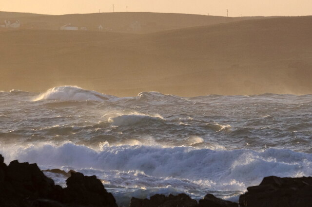
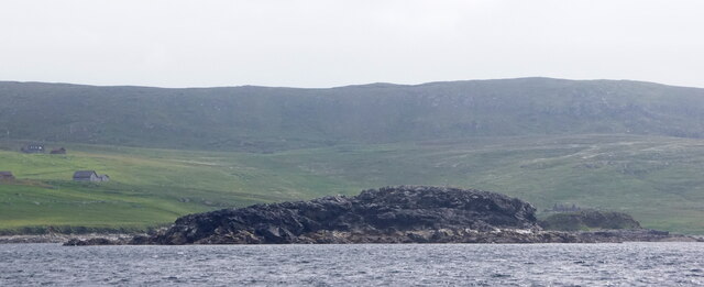
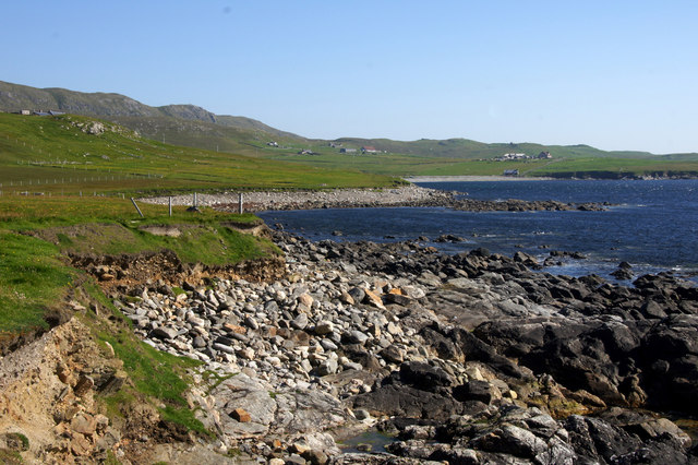
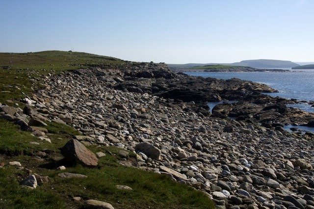
Rotton Helliers is renowned for its stunning natural beauty and tranquil atmosphere. The bay features a crescent-shaped sandy beach that stretches for approximately 200 meters. The sand is golden and soft, making it an ideal spot for sunbathing, picnicking, and leisurely walks along the shore. The crystal-clear waters of the North Sea gently lap against the beach, providing a refreshing swimming experience for visitors.

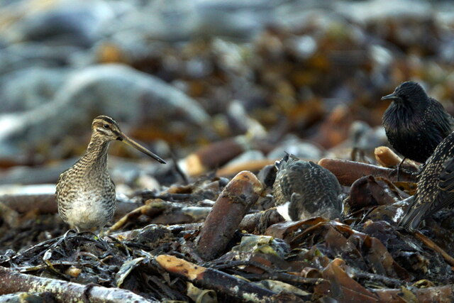
Surrounded by rugged cliffs and rolling hills, Rotton Helliers offers breathtaking panoramic views of the surrounding landscape. The bay is also home to a diverse range of flora and fauna, including various seabirds, seals, and even occasional sightings of otters.

Due to its remote location, Rotton Helliers remains relatively undiscovered by tourists, making it a hidden gem for those seeking a peaceful getaway. The bay provides a sense of seclusion and tranquility, allowing visitors to unwind and connect with nature.

Overall, Rotton Helliers in Shetland is a must-visit destination for nature lovers and those seeking a serene beach experience in a stunning coastal setting.

If you have any feedback on the listing, please let us know in the comments section below.

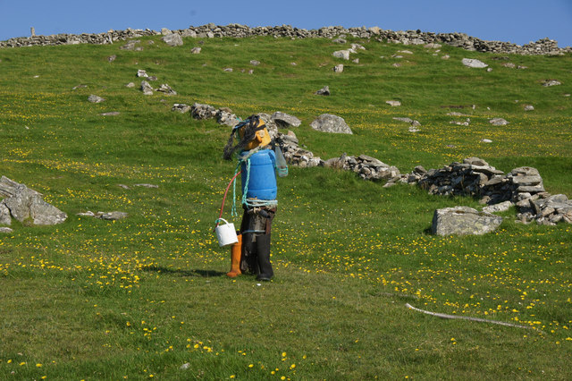
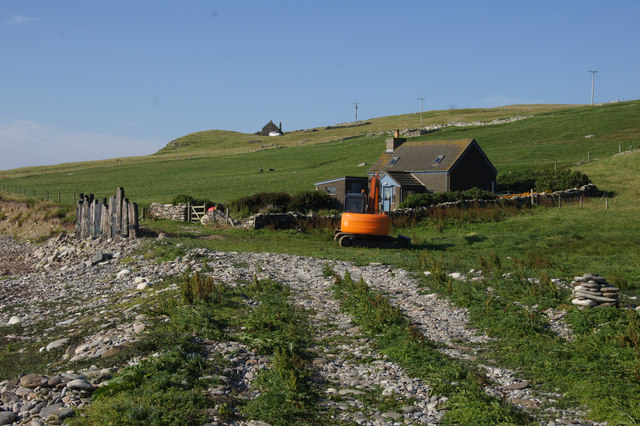
Rotton Helliers Images

Images are sourced within 2km of 60.72458/-0.95589687 or Grid Reference HP5705. Thanks to Geograph Open Source API. All images are credited.

Waves in Bluemull Sound from Westing
Lamba Stack, Blue Mull, from the sea
The Vere from the sea
Angling boat beside the Vere
Round Holm, Westing, from the sea
Blue Mull from the sea
Geo south of Lamba Stack, Blue Mull
Angling boat and the Vere
St Olaf's Kirk, Lund I am standing beside the ruins of St Olaf's Kirk at Lund, Unst, Shetland, and looking across Lunda Wick towards the site of Norse ruins (a farmstead and a broch) at Underhoull.
St Olaf's Kirk, Lund
I am standing beside the ruins of St Olaf's Kirk at Lund, Unst, Shetland, and looking across Lunda Wick towards the site of Norse ruins (a farmstead and a broch) at Underhoull.
St Olaf's Kirk, Lund (interior) The ruins of St Olaf's Kirk, Lund, Unst, Shetland, built in the Celtic style and dating back to the C12th.
St Olaf's Kirk, Lund (interior)
The ruins of St Olaf's Kirk, Lund, Unst, Shetland, built in the Celtic style and dating back to the C12th.
Common Snipe, Westing beach
Lang Holm from south of Kirkaby, Westing
Kirkaby, Westing There was an old church on the headland, hence its name.
Kirkaby, Westing
There was an old church on the headland, hence its name.
Coast south of Kirkaby, Westing Looking towards the Ayre of Newgarth ('Westing beach').
Coast south of Kirkaby, Westing
Looking towards the Ayre of Newgarth ('Westing beach').
Beach bruck person, Westing A human shape made from bruck (rubbish) washed on to the shore. It was surprising how realistic the figure looked from a distance.
Beach bruck person, Westing
A human shape made from bruck (rubbish) washed on to the shore. It was surprising how realistic the figure looked from a distance.
Eevers Geo, Spoo Ness, Westing
Holiday cottage at Ayre of Newgarth, Westing High seas washed away the wall and took waves into the front garden last winter, so a breakwater has been constructed this summer, made from sections of old salmon cages.
Holiday cottage at Ayre of Newgarth, Westing
High seas washed away the wall and took waves into the front garden last winter, so a breakwater has been constructed this summer, made from sections of old salmon cages.
Show me another place!

Rotton Helliers is located at Grid Ref: HP5705 (Lat: 60.72458, Lng: -0.95589687)

Unitary Authority: Shetland Islands

Police Authority: Highlands and Islands

What 3 Words

///start.grins.confined. Near Uyeasound, Shetland Islands

Related Wikis

Brough Holm

Brough Holm is a small island off Unst, in the North Isles of Shetland. It is off Westing, which as the name implies is on the west coast of Unst. The...

Society of Our Lady of the Isles

The Society of Our Lady of the Isles (SOLI) is a small Anglican religious order for women, founded in the late 20th century. It is located in Shetland...

St Olaf's Church, Unst

St Olaf's Church, Unst is a ruined medieval church located on the island of Unst, in Shetland, Scotland, UK. The church was built in the Celtic style,...

Cullivoe

Cullivoe (Old Norse: Kollavágr - Bay of Kolli), is a village on Yell in the Shetland Islands. It is in the north east of the island, near Bluemull Sound...

Belmont House, Shetland

Belmont House is a neo classical Georgian Country House Estate on the island of Unst, the most northerly of the Shetland Islands, [United Kingdom] and...

Uyeasound

Uyeasound is a village on the Isle of Unst, the northernmost island of the Shetland Islands, Scotland. It takes its name from the neighbouring strait of...

Belmont, Shetland

Belmont is a settlement and ferry terminal in southern Unst in the Shetland Islands. The ferry crosses from here to Gutcher in Yell and to Hamars Ness...

Unst

Unst (; Scots: Unst; Norn: Ønst) is one of the North Isles of the Shetland Islands, Scotland. It is the northernmost of the inhabited British Isles and...

Nearby Amenities

Located within 500m of 60.72458,-0.95589687
Passing Place
Lat/Long: 60.7209404/-0.9509137
Passing Place
Lat/Long: 60.7221771/-0.9524628
Passing Place
Lat/Long: 60.7240795/-0.9538702
Passing Place
Lat/Long: 60.7252872/-0.9545035
Passing Place
Lat/Long: 60.7286337/-0.9570554
Barrier: cattle_grid
Lat/Long: 60.7274292/-0.9539049
Power: pole
Lat/Long: 60.7218744/-0.9487498
Power: pole
Lat/Long: 60.7223965/-0.9488169
Power: pole
Lat/Long: 60.7281545/-0.9529748
Power: pole
Lat/Long: 60.7282214/-0.9522426
Power: pole
Lat/Long: 60.7282909/-0.9514567
Power: pole
Lat/Long: 60.7280903/-0.9537393
Power: pole
Lat/Long: 60.7281309/-0.9544206
Power: pole
Lat/Long: 60.7281624/-0.9551045
Power: pole
Lat/Long: 60.7250376/-0.9490768
Power: pole
Lat/Long: 60.7239856/-0.9489829
Power: pole
Lat/Long: 60.7232708/-0.9489158
Power: pole
Lat/Long: 60.7257301/-0.9491411
Power: pole
Lat/Long: 60.7263373/-0.9492162
Power: pole
Lat/Long: 60.7265918/-0.9492189
Power: pole
Lat/Long: 60.7269131/-0.9489346
Power: pole
Lat/Long: 60.7271413/-0.949286
Power: pole
Lat/Long: 60.727206/-0.9488003
Rotton Helliers
Natural: bay
Source: OS Open Names
Lat/Long: 60.724599/-0.9559117
Power: pole
Lat/Long: 60.728223/-0.9561722
The data included in this document is from www.openstreetmap.org. The data is made available under ODbL.

Have you been to Rotton Helliers?

Leave your review of Rotton Helliers below (or comments, questions and feedback).