Littledean

Settlement in Gloucestershire Forest of Dean

England

Littledean

Old Boundary Stone, Littledean "Royal Forest of Dean boundary". In the parish of East Dean, at the slip road leading to Camp Farm, between Littledean and Elton. In a retaining wall. Interestingly, 12.5 metres due South of this stone, in 1877, a hemispherical parcel of land was an exclave of Westbury on Severn, bisecting a farm building.

Inscription: D.F / 1832 / Nᴼ. 202

Milestone Society National ID: GL_DFLITT202em
Old Boundary Stone, Littledean Credit: Mr Red

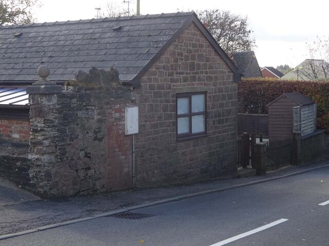
Littledean is a small village located in the Forest of Dean district of Gloucestershire, England. Situated near the River Severn, it lies approximately 4 miles southwest of the town of Cinderford. The village is surrounded by lush green countryside, offering picturesque views and a tranquil atmosphere.

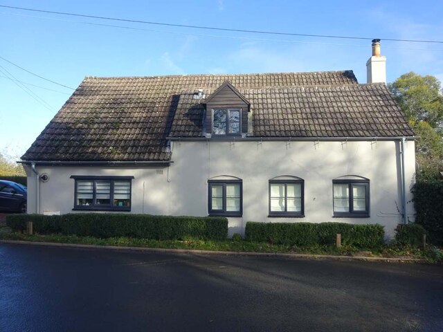
Littledean has a rich history that dates back to Roman times, as evidenced by the discovery of a Roman villa in the area. The village itself is known for its traditional stone cottages, some of which date back several centuries, giving it a charming and historic feel.

One notable landmark in Littledean is the Littledean Jail Museum. Housed in a former Victorian prison, this unique museum showcases the history of crime and punishment in the region. Visitors can explore the cells, see various exhibits, and learn about infamous criminals who were once incarcerated there.

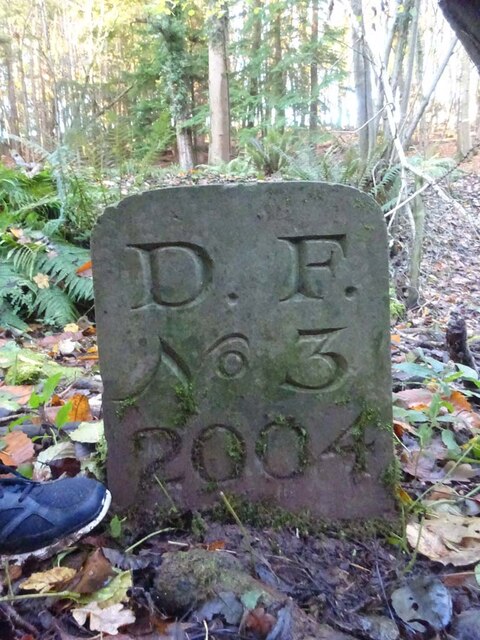
The village also boasts a few amenities, including a local pub, a primary school, and a village hall that hosts community events. Additionally, there are several walking trails in the surrounding countryside, providing opportunities for outdoor enthusiasts to explore the beautiful natural surroundings.

Littledean is well-connected to neighboring towns and cities via road networks, with the A48 passing nearby. This makes it easily accessible for both residents and visitors alike.

Overall, Littledean offers a peaceful and idyllic setting, steeped in history and surrounded by stunning landscapes, making it an attractive destination for those seeking a rural retreat or a glimpse into the past.

If you have any feedback on the listing, please let us know in the comments section below.
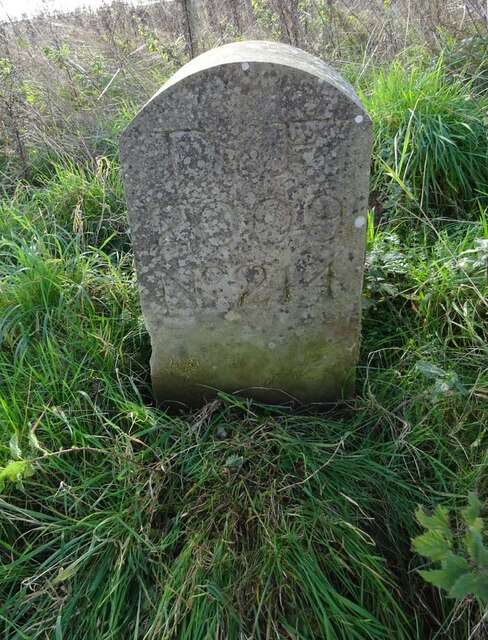
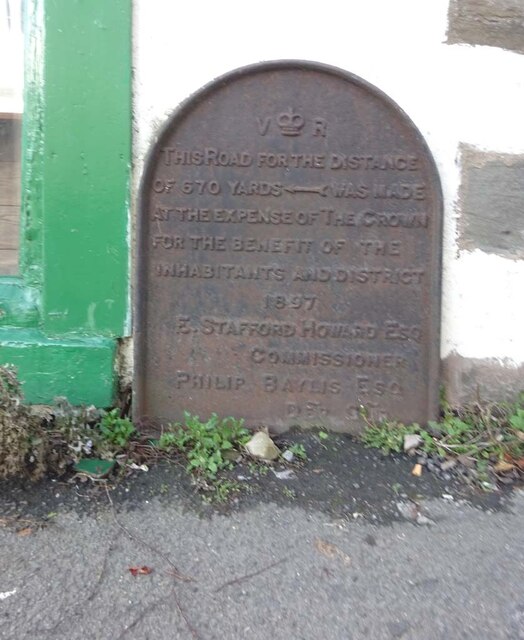
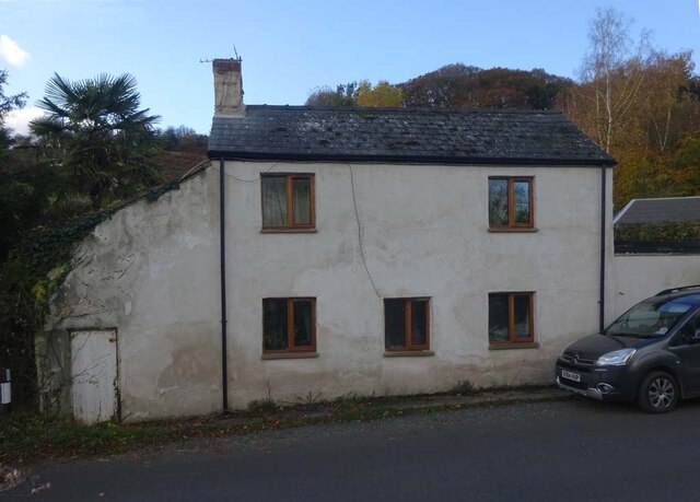
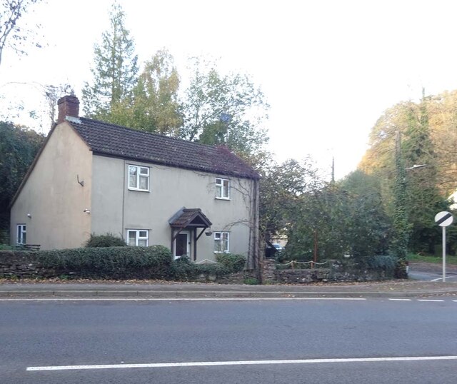
Littledean Images

Images are sourced within 2km of 51.819063/-2.480822 or Grid Reference SO6613. Thanks to Geograph Open Source API. All images are credited.

Old Boundary Stone, Littledean "Royal Forest of Dean boundary". In the parish of East Dean, at the slip road leading to Camp Farm, between Littledean and Elton. In a retaining wall. Interestingly, 12.5 metres due South of this stone, in 1877, a hemispherical parcel of land was an exclave of Westbury on Severn, bisecting a farm building.

Inscription: D.F / 1832 / Nᴼ. 202

Milestone Society National ID: GL_DFLITT202em
Old Boundary Stone, Littledean
"Royal Forest of Dean boundary". In the parish of East Dean, at the slip road leading to Camp Farm, between Littledean and Elton. In a retaining wall. Interestingly, 12.5 metres due South of this stone, in 1877, a hemispherical parcel of land was an exclave of Westbury on Severn, bisecting a farm building. Inscription: D.F / 1832 / Nᴼ. 202 Milestone Society National ID: GL_DFLITT202em
Commemorative Plate, Cinderford On the wall of a house where Market and Victoria Streets concatenate.

Grade II Listed, details <span class="nowrap"><a title="https://historicengland.org.uk/listing/the-list/list-entry/1186466" rel="nofollow ugc noopener" href="https://historicengland.org.uk/listing/the-list/list-entry/1186466">Link</a><img style="margin-left:2px;" alt="External link" title="External link - shift click to open in new window" src="https://s1.geograph.org.uk/img/external.png" width="10" height="10"/></span>.

Inscription:
V (crown) R
This road for the distance
of 1100 ↢ yards was made
at the expense of the crown
for the benefit of the
inhabitants and district
1897 - 8
E.Stafford Howard Esq
Commissioner
Philip Baylis Esq
Dep Surveyor

Milestone Society National ID: GL_CIND05cm
Commemorative Plate, Cinderford
On the wall of a house where Market and Victoria Streets concatenate. Grade II Listed, details LinkExternal link. Inscription: V (crown) R This road for the distance of 1100 ↢ yards was made at the expense of the crown for the benefit of the inhabitants and district 1897 - 8 E.Stafford Howard Esq Commissioner Philip Baylis Esq Dep Surveyor Milestone Society National ID: GL_CIND05cm
Old Boundary Stone, Littledean Hill In the private garden of "Oak Ridge" in the Ruffitt. An original 1832 Forest of Dean boundary marker. 

Inscription: D.F / 1832 / Nᴼ. 209

Milestone Society National ID: GL_DFCINLIT209em
Old Boundary Stone, Littledean Hill
In the private garden of "Oak Ridge" in the Ruffitt. An original 1832 Forest of Dean boundary marker. Inscription: D.F / 1832 / Nᴼ. 209 Milestone Society National ID: GL_DFCINLIT209em
Boundary Stone, Cinderford On the corner of Littledean Hill Road, and the chamfered corner of the former Royal Forrester pub. Technically on private land but effectively just off the road.
The context view of the ex pub is <a href="https://www.geograph.org.uk/photo/4430088">SO6614 : Former Royal Forester, Cinderford</a>

Inscription: D.F / 2008 / Nᴼ. 211

Milestone Society National ID: GL_DFCINLIT211em
Boundary Stone, Cinderford
On the corner of Littledean Hill Road, and the chamfered corner of the former Royal Forrester pub. Technically on private land but effectively just off the road. The context view of the ex pub is SO6614 : Former Royal Forester, Cinderford Inscription: D.F / 2008 / Nᴼ. 211 Milestone Society National ID: GL_DFCINLIT211em
Boundary Stone, Cinderford In the High Street where the line of the row of shops kinks, near the pedestrian crossing.

Inscription: D.F / 2010 / Nᴼ. 213

Milestone Society National ID: GL_DFCIND213em
Boundary Stone, Cinderford
In the High Street where the line of the row of shops kinks, near the pedestrian crossing. Inscription: D.F / 2010 / Nᴼ. 213 Milestone Society National ID: GL_DFCIND213em
Boundary Stone, Littledean Hill On the Southern side of the road (the Ruffitt) in the driveway of "Stone Cottage".

Inscription: D.F / 2015 / Nᴼ. 210

Milestone Society National ID: GL_DFCINLIT210em
Boundary Stone, Littledean Hill
On the Southern side of the road (the Ruffitt) in the driveway of "Stone Cottage". Inscription: D.F / 2015 / Nᴼ. 210 Milestone Society National ID: GL_DFCINLIT210em
Boundary Stone, Denton's Corner In the junction of the A4151 Elton Road with the Slad and Greenway. In the parish of Littledean near Littledean Jail.

Inscription: D.F / 2011 / Nᴼ. 204

Milestone Society National ID: GL_DFLITT204em
Boundary Stone, Denton's Corner
In the junction of the A4151 Elton Road with the Slad and Greenway. In the parish of Littledean near Littledean Jail. Inscription: D.F / 2011 / Nᴼ. 204 Milestone Society National ID: GL_DFLITT204em
Boundary Stone, Cinderford On the corner of Edge Hills Road and Causeway Road. Just to confuse, the houses above are addressed as being in Wedgewood Crescent. Including 9 and 10, clearly in Edge Hills Road.

Inscription: D.F. / 2011 / Nᴼ. 212

Milestone Society National ID: GL_DFCIND212em
Boundary Stone, Cinderford
On the corner of Edge Hills Road and Causeway Road. Just to confuse, the houses above are addressed as being in Wedgewood Crescent. Including 9 and 10, clearly in Edge Hills Road. Inscription: D.F. / 2011 / Nᴼ. 212 Milestone Society National ID: GL_DFCIND212em
Boundary Stone, Cinderford Technically in the modern parish of Ruspidge and Soudley. Cinderford is the Northern side of the road.

Inscription: D.F / 2015 / Nᴼ. 214

Milestone Society National ID: GL_DFRUSU214em
Boundary Stone, Cinderford
Technically in the modern parish of Ruspidge and Soudley. Cinderford is the Northern side of the road. Inscription: D.F / 2015 / Nᴼ. 214 Milestone Society National ID: GL_DFRUSU214em
Commemorative Plate, Cinderford On the wall of an empty shop at the junction of High Street and Wesley Road. An older image showing the plaque when the shop was a greengocer's is <a href="https://www.geograph.org.uk/photo/728722">SO6514 : Traditional greengrocer, High Street, Cinderford</a>.
E.Stafford Howard was MP for Thornbury 1885/6. Served as Under-Secretary of State for India under William Ewart Gladstone. Later Senior Commissioner of HM's Woods and Forests.

Inscription:
V (crown) R
This road for the distance
of 670 ↢ yards was made
at the expense of the crown
for the benefit of the
inhabitants and district
1897 - 8
E.Stafford Howard Esq
Commissioner
Philip Baylis Esq
Dep Surveyor

Milestone Society National ID: GL_CIND06cm
Commemorative Plate, Cinderford
On the wall of an empty shop at the junction of High Street and Wesley Road. An older image showing the plaque when the shop was a greengocer's is SO6514 : Traditional greengrocer, High Street, Cinderford. E.Stafford Howard was MP for Thornbury 1885/6. Served as Under-Secretary of State for India under William Ewart Gladstone. Later Senior Commissioner of HM's Woods and Forests. Inscription: V (crown) R This road for the distance of 670 ↢ yards was made at the expense of the crown for the benefit of the inhabitants and district 1897 - 8 E.Stafford Howard Esq Commissioner Philip Baylis Esq Dep Surveyor Milestone Society National ID: GL_CIND06cm
Pike House, George Road, Littledean Former Toll House opposite Greenway. Used by the Forest of Dean Turnpike Trust in the 19th Century. See on the map of GB (UK) Toll houses <span class="nowrap"><a title="http://gbth.mister.red/#13/51.828/-2.47859" rel="nofollow ugc noopener" href="http://gbth.mister.red/#13/51.828/-2.47859">Link</a><img style="margin-left:2px;" alt="External link" title="External link - shift click to open in new window" src="https://s1.geograph.org.uk/img/external.png" width="10" height="10"/></span>

Milestone Society National ID: GL.LIT01
Pike House, George Road, Littledean
Former Toll House opposite Greenway. Used by the Forest of Dean Turnpike Trust in the 19th Century. See on the map of GB (UK) Toll houses LinkExternal link Milestone Society National ID: GL.LIT01
Denton's Corner, Littledean A4151 Former Toll House at Denton's Corner where Greenway and the Slad meet the A4151 Gloucester Road. This building served the Elton Turnpike Trust in the 19ᵗʰ Century.

Milestone Society National ID: GL.LIT03
Denton's Corner, Littledean A4151
Former Toll House at Denton's Corner where Greenway and the Slad meet the A4151 Gloucester Road. This building served the Elton Turnpike Trust in the 19ᵗʰ Century. Milestone Society National ID: GL.LIT03
Old Tollhouse, 26 St White's Road In the modern parish of Ruspidge and Soudley. Within the boundaries of the "Forest of Dean", and still showing a "TP" on the 1873 map. This building served the Forest of Dean Turnpike Trust.

Milestone Society National ID: GL.CIN01
Old Tollhouse, 26 St White's Road
In the modern parish of Ruspidge and Soudley. Within the boundaries of the "Forest of Dean", and still showing a "TP" on the 1873 map. This building served the Forest of Dean Turnpike Trust. Milestone Society National ID: GL.CIN01
Old Boundary Stone, Blaise Bailey Marking the boundary of the "Forest of Dean" seen from Forestry Commission land but actually just in the private field beyond. One of the few originals.

Inscription: D. F. / Nᴼ. 218 / 1832

Milestone Society National ID: GL_DFRUSU218em
Old Boundary Stone, Blaise Bailey
Marking the boundary of the "Forest of Dean" seen from Forestry Commission land but actually just in the private field beyond. One of the few originals. Inscription: D. F. / Nᴼ. 218 / 1832 Milestone Society National ID: GL_DFRUSU218em
Boundary Stone, Grange At the end of Gloucestershire bridleway ENE4, near Grange Village. Signposted to "Precious Pets" boarding kennels.

Inscription: D.F / Nᴼ. 2 / 2007

Milestone Society National ID: GL_DFNEWN2em
Boundary Stone, Grange
At the end of Gloucestershire bridleway ENE4, near Grange Village. Signposted to "Precious Pets" boarding kennels. Inscription: D.F / Nᴼ. 2 / 2007 Milestone Society National ID: GL_DFNEWN2em
Old Boundary Stone, Grange Just after the end of Gloucestershire footpath ENE34 marking the boundary of the "Forest of Dean". A modern companion stone, Nᴼ.3, can be seen 50m North at <a href="https://www.geograph.org.uk/photo/7352881">SO6711 : Boundary Stone, Blaise Bailey</a>.

Inscription: D. F. / 1832 / Nᴼ. 4

Milestone Society National ID: GL_DFNEWN4em
Old Boundary Stone, Grange
Just after the end of Gloucestershire footpath ENE34 marking the boundary of the "Forest of Dean". A modern companion stone, Nᴼ.3, can be seen 50m North at SO6711 : Boundary Stone, Blaise Bailey. Inscription: D. F. / 1832 / Nᴼ. 4 Milestone Society National ID: GL_DFNEWN4em
Boundary Stone, Blaise Bailey In the wood just past Gloucestershire footpath ENE34. A companion stone Nᴼ.4, an 1832 stone, can be seen 50m South, at <a href="https://www.geograph.org.uk/photo/7352856">SO6711 : Old Boundary Stone, Grange</a>.

Inscription: D. F. / Nᴼ. 3 / 2004

Milestone Society National ID: GL_DFNEWN3em
Boundary Stone, Blaise Bailey
In the wood just past Gloucestershire footpath ENE34. A companion stone Nᴼ.4, an 1832 stone, can be seen 50m South, at SO6711 : Old Boundary Stone, Grange. Inscription: D. F. / Nᴼ. 3 / 2004 Milestone Society National ID: GL_DFNEWN3em
Old Pike Cottage, Pleasant Stile On the road between Littldean and Newnham on Severn pleasantly known as Pleasant Stile becoming Dean Road to the SE and starting as Silver Street to the NW. Erected by the Forest of Dean Turnpike Trust.

Milestone Society National ID: GL.LIT02
Old Pike Cottage, Pleasant Stile
On the road between Littldean and Newnham on Severn pleasantly known as Pleasant Stile becoming Dean Road to the SE and starting as Silver Street to the NW. Erected by the Forest of Dean Turnpike Trust. Milestone Society National ID: GL.LIT02
Show me another place!

Littledean is located at Grid Ref: SO6613 (Lat: 51.819063, Lng: -2.480822)

Administrative County: Gloucestershire

District: Forest of Dean

Police Authority: Gloucestershire

What 3 Words

///collect.instructs.gear. Near Cinderford, Gloucestershire

Nearby Locations

Littledean Double View

Related Wikis

Littledean Hall

Littledean Hall (grid reference SO672130) is a country house in the village of Littledean, Gloucestershire, England. It has been described as one of the...

Littledean

Littledean is a village in the Forest of Dean, west Gloucestershire, England. The village has a long history and formerly had the status of a town. Littledean...

Littledean Camp

Littledean Camp is in fact a castle overlooking the village of Littledean in Gloucestershire, England, notable for its unique early Norman design. Originally...

Cinderford Town A.F.C.

Cinderford Town Association Football Club is a football club based in Cinderford in Gloucestershire, England. Affiliated to the Gloucestershire County...

Cinderford

Cinderford is a town and civil parish on the eastern fringe of the Forest of Dean in Gloucestershire, England. The population was 8,777 at the 2021 Census...

The Forest High School, Cinderford

Forest High School is a coeducational secondary school with academy status, located in Cinderford in the English county of Gloucestershire.The school was...

Blaize Bailey

Blaize Bailey is a small hamlet and viewpoint on the eastern edge of the Forest of Dean, in Gloucestershire, England. The viewpoint was constructed using...

Pope's Hill

Pope's Hill is a hill and a small village situated in the east of the Forest of Dean, Gloucestershire within the parish of Littledean. The hill is 12 miles...

Related Videos

Royal Forest of Dean | Walking the Soudley Ponds trail

One of the best places to walk in England is the Forest of Dean. In this video we discover the Soudley Ponds trail. In the heart of ...

Womens refuge walking challenge. 56 Miles in Feb day 1

Soudley ponds 4 miles. day 1 52 miles to go.

A summer walk in Soudley Ponds- Forest of Dean!

A Summer walk typically means raincoats, wellies and whole lot of enthusiasm. It also means climbing, squelching and 'wow'ing a ...

Winter Wonderland 15th December 2022

Local walk in the forest of Dean.

Nearby Amenities

Located within 500m of 51.819063,-2.480822
Mini Roundabout
Direction: clockwise
Lat/Long: 51.8180792/-2.4785355
Bus Stop
King's Head
Naptan AtcoCode: 1600GL2953
Naptan Bearing: NW
Naptan CommonName: King's Head
Naptan Indicator: Opp
Naptan NaptanCode: gloajtjp
Naptan Street: Broad St
Naptan Verified: no
Source: naptan_import
Lat/Long: 51.8180481/-2.4786821
Bus Stop
King's Head
Naptan AtcoCode: 1600GL2954
Naptan Bearing: E
Naptan CommonName: King's Head
Naptan NaptanCode: gloajtjt
Naptan Street: Broad St
Naptan Verified: no
Source: naptan_import
Lat/Long: 51.8181364/-2.4787477
Bus Stop
Primary School
Bus: yes
Naptan AtcoCode: 1600GL2955
Naptan Bearing: SW
Naptan CommonName: Oakway
Naptan Indicator: Opp
Naptan NaptanCode: gloajtpg
Naptan Street: Church Street
Naptan Verified: no
Public Transport: platform
Source: naptan_import
Lat/Long: 51.8202852/-2.4764018
Bus Stop
Primary School
Bus: yes
Naptan AtcoCode: 1600GL2956
Naptan Bearing: NE
Naptan CommonName: Oakway
Naptan NaptanCode: gloajtmw
Naptan Street: Church Street
Naptan Verified: no
Public Transport: platform
Source: naptan_import
Lat/Long: 51.8202385/-2.4768366
Bus Stop
The Belfry
Naptan AtcoCode: 1600GL2957
Naptan Bearing: NW
Naptan CommonName: The Belfry
Naptan Indicator: Opp
Naptan NaptanCode: gloajtgt
Naptan Street: Broad St
Naptan Verified: no
Source: naptan_import
Lat/Long: 51.8196508/-2.4820534
Bus Stop
The Belfry
Naptan AtcoCode: 1600GL2958
Naptan Bearing: SE
Naptan CommonName: The Belfry
Naptan NaptanCode: gloajtgw
Naptan Street: Broad St
Naptan Verified: no
Source: naptan_import
Lat/Long: 51.8195358/-2.4815734
Bus Stop
Beech Way
Naptan AtcoCode: 1600GLA06374
Naptan Bearing: N
Naptan CommonName: Beech Way
Naptan NaptanCode: glogpmga
Naptan Street: George Lane
Naptan Verified: no
Source: naptan_import
Lat/Long: 51.8201645/-2.4817542
Bus Stop
Littledean House Hotel
Bus: yes
Naptan AtcoCode: 1600GLA26345
Naptan Bearing: NE
Naptan CommonName: Court Farm
Naptan Crossing: High Street
Naptan Indicator: Opp
Naptan NaptanCode: glogpjpt
Naptan Street: A4151
Naptan Verified: no
Public Transport: platform
Source: naptan_import
Lat/Long: 51.8201538/-2.4848066
Bus Stop
Oakway
Naptan AtcoCode: 1600GLF858
Naptan Bearing: E
Naptan CommonName: Oakway
Naptan NaptanCode: gloajtmd
Naptan Street: Beech Way
Naptan Verified: no
Source: naptan_import
Lat/Long: 51.82069/-2.4785679
Post Box
Brand: Royal Mail
Brand Wikidata: Q638098
Mapillary: 819781851961800
Operator: Royal Mail
Operator Wikidata: Q638098
Post Box Mounting: pier
Post Box Type: lamp
Ref: GL14 128
Source: survey
Survey Date: 2020-07-11
Lat/Long: 51.820805/-2.4759628
Recycling
Lat/Long: 51.8200429/-2.4811918
The Folders
Waterway: pumping_station
Lat/Long: 51.8208639/-2.480968
Barrier: cattle_grid
Lat/Long: 51.8210673/-2.4754387
Littledean
Is In: Gloucestershire, England, UK
Place: village
Lat/Long: 51.8179394/-2.4786515
Littledean Stores
Addr City: Littledean
Addr Housename: Littledean Stores
Addr Postcode: GL14 3NQ
Addr Street: Broad Street
Air Conditioning: yes
Brand: Premier - Convenience Store
Opening Hours: Mo-Sa 07:00-20:00; Su 08:00-19:00
Operator: Premier - Covenience Store
Payment Cash: yes
Payment Credit Cards: yes
Phone: +44 1594 822059
Shop: convenience
Wheelchair: yes
Lat/Long: 51.8190934/-2.4806292
Pub
The Belfry
Addr Place: Littledean
Addr Postcode: GL14 3JS
Addr Street: Broad Street
Fhrs Id: 10448
Lat/Long: 51.8197674/-2.4815545
Place Of Worship
Littledean United Reformed Church
Denomination: united_reformed
Religion: christian
Lat/Long: 51.8186634/-2.4804643
Parking
Lat/Long: 51.8175612/-2.4810707
Littledean War Memorial
Historic: memorial
Lat/Long: 51.8182862/-2.4796493
Littledean House Hotel
Addr Place: Littledean
Addr Postcode: GL14 3JZ
Addr Street: Broad Street
Fhrs Id: 34600
Tourism: hotel
Lat/Long: 51.8205145/-2.4830608
Telephone
Booth: KX100
Fee: yes
Operator: BT
Payment Coins: yes
Lat/Long: 51.819146/-2.480729
Fast Food
Fryday's
Cuisine: fish_and_chips
Lat/Long: 51.8190723/-2.4809877
Court Farm Garage
Shop: car_repair
Lat/Long: 51.8199887/-2.4827454
Miners' Memorial
Historic: memorial
Lat/Long: 51.8201867/-2.482982
Kindergarten
Little Acorns
Lat/Long: 51.8199767/-2.477598
Barrier: cycle_barrier
Lat/Long: 51.8183025/-2.4795531
Post Box
Collection Times: Mo-Fr 16:45; Sa 10:00
Drive Through: no
Operator: Royal Mail
Post Box Type: wall
Ref: GL14 122
Royal Cypher: EIIR
Royal Cypher Wikidata: Q33102113
Lat/Long: 51.8191994/-2.4808643
Crossing
Crossing: uncontrolled
Crossing Ref: zebra
Lat/Long: 51.8192578/-2.4810682
The data included in this document is from www.openstreetmap.org. The data is made available under ODbL.

Have you been to Littledean?

Leave your review of Littledean below (or comments, questions and feedback).