Littledean Hill

Settlement in Gloucestershire Forest of Dean

England

Littledean Hill

St Anthony's Well Image of the historic well in woodland North-west of Flaxley.
St Anthony's Well Credit: Clint Mann

Littledean Hill is a small village located in the Forest of Dean district in Gloucestershire, England. Situated on the western edge of the Forest of Dean, it is nestled amidst picturesque countryside and is surrounded by dense woodlands, rolling hills, and meandering streams. The village is part of an area renowned for its natural beauty and is a popular destination for outdoor enthusiasts and nature lovers.

The village itself is quaint and charming, with a population of around 500 residents. It has a rich history dating back to the medieval period and is mentioned in the Domesday Book of 1086. Many of the buildings in Littledean Hill exhibit traditional architectural styles, including timber-framed cottages and stone houses, giving the village an old-world charm.

Despite its small size, Littledean Hill offers a range of amenities for its residents and visitors. There is a local pub, a village hall, and a primary school, providing a sense of community and meeting places for social gatherings. The village is also well-connected, with good transport links to nearby towns and cities, making it an attractive place for those seeking a peaceful rural lifestyle with access to urban amenities.

Surrounding Littledean Hill are numerous walking trails and cycling routes, allowing visitors to explore the stunning natural landscapes of the Forest of Dean. Popular attractions in the vicinity include the Dean Heritage Centre and the Clearwell Caves, which offer insights into the area's rich industrial heritage and geological formations.

Overall, Littledean Hill is a picturesque village that offers a peaceful and idyllic setting for residents and visitors alike, with its natural beauty, historical charm, and access to outdoor activities.

If you have any feedback on the listing, please let us know in the comments section below.

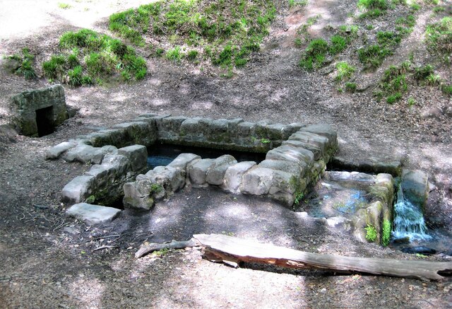
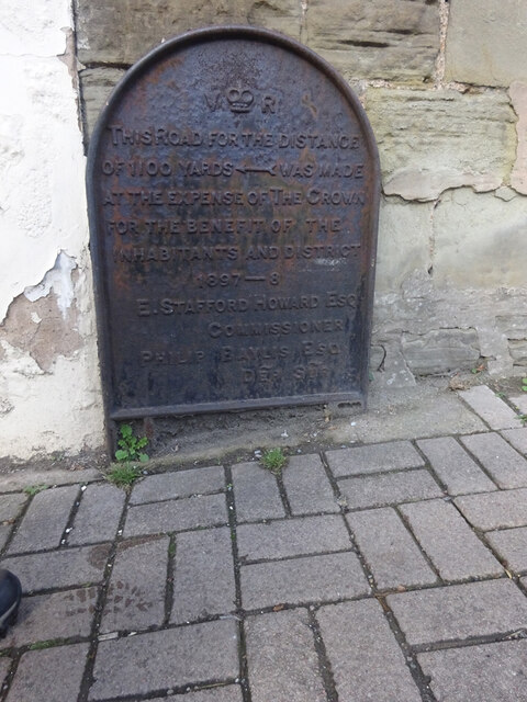
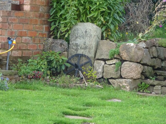
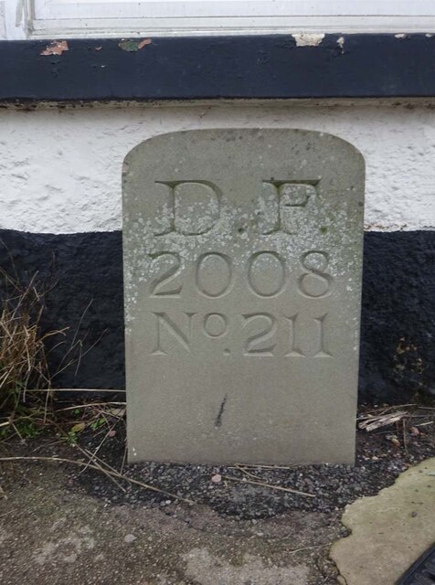
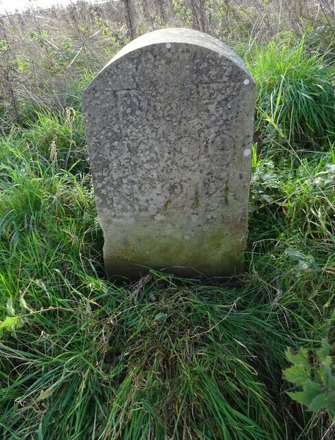
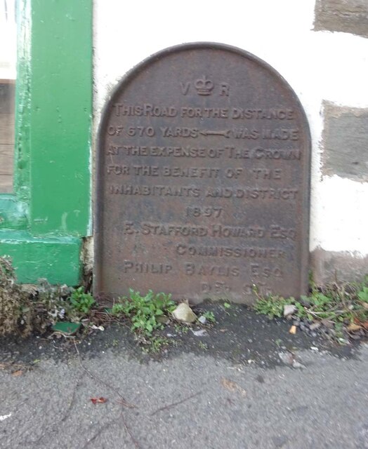
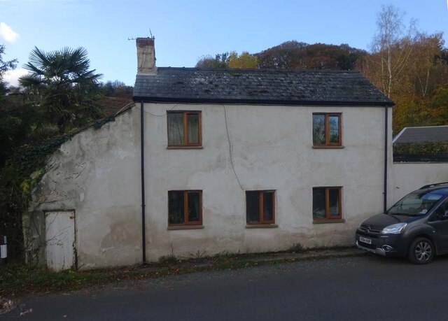
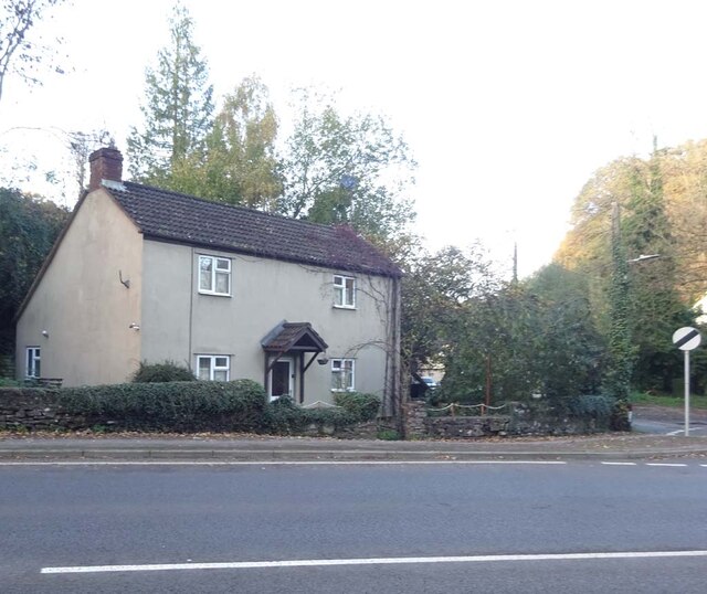
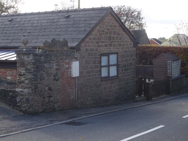
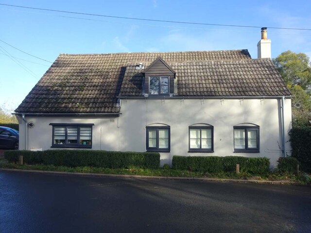
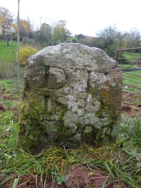
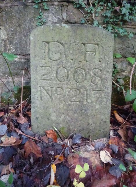
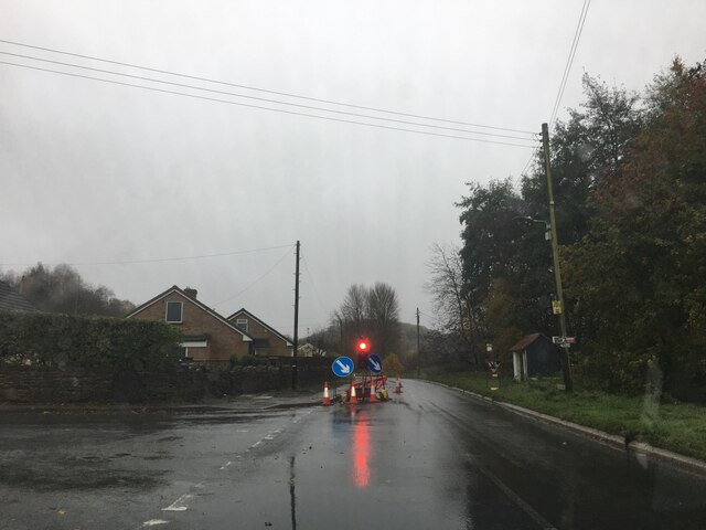
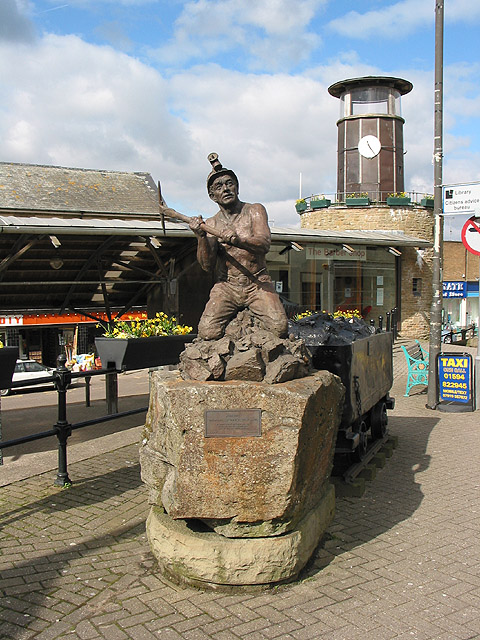
Littledean Hill Images

Images are sourced within 2km of 51.825809/-2.488962 or Grid Reference SO6614. Thanks to Geograph Open Source API. All images are credited.

St Anthony's Well Image of the historic well in woodland North-west of Flaxley.
St Anthony's Well
Image of the historic well in woodland North-west of Flaxley.
Machinery in the woods Various pieces of equipment litter the woodland at the end of Jubilee Lane.
Machinery in the woods
Various pieces of equipment litter the woodland at the end of Jubilee Lane.
Commemorative Plate, Cinderford On the wall of a house where Market and Victoria Streets concatenate.

Grade II Listed, details <span class="nowrap"><a title="https://historicengland.org.uk/listing/the-list/list-entry/1186466" rel="nofollow ugc noopener" href="https://historicengland.org.uk/listing/the-list/list-entry/1186466">Link</a><img style="margin-left:2px;" alt="External link" title="External link - shift click to open in new window" src="https://s1.geograph.org.uk/img/external.png" width="10" height="10"/></span>.

Inscription:
V (crown) R
This road for the distance
of 1100 ↢ yards was made
at the expense of the crown
for the benefit of the
inhabitants and district
1897 - 8
E.Stafford Howard Esq
Commissioner
Philip Baylis Esq
Dep Surveyor

Milestone Society National ID: GL_CIND05cm
Commemorative Plate, Cinderford
On the wall of a house where Market and Victoria Streets concatenate. Grade II Listed, details LinkExternal link. Inscription: V (crown) R This road for the distance of 1100 ↢ yards was made at the expense of the crown for the benefit of the inhabitants and district 1897 - 8 E.Stafford Howard Esq Commissioner Philip Baylis Esq Dep Surveyor Milestone Society National ID: GL_CIND05cm
Old Boundary Stone, Littledean Hill In the private garden of "Oak Ridge" in the Ruffitt. An original 1832 Forest of Dean boundary marker. 

Inscription: D.F / 1832 / Nᴼ. 209

Milestone Society National ID: GL_DFCINLIT209em
Old Boundary Stone, Littledean Hill
In the private garden of "Oak Ridge" in the Ruffitt. An original 1832 Forest of Dean boundary marker. Inscription: D.F / 1832 / Nᴼ. 209 Milestone Society National ID: GL_DFCINLIT209em
Boundary Stone, Cinderford On the corner of Littledean Hill Road, and the chamfered corner of the former Royal Forrester pub. Technically on private land but effectively just off the road.
The context view of the ex pub is <a href="https://www.geograph.org.uk/photo/4430088">SO6614 : Former Royal Forester, Cinderford</a>

Inscription: D.F / 2008 / Nᴼ. 211

Milestone Society National ID: GL_DFCINLIT211em
Boundary Stone, Cinderford
On the corner of Littledean Hill Road, and the chamfered corner of the former Royal Forrester pub. Technically on private land but effectively just off the road. The context view of the ex pub is SO6614 : Former Royal Forester, Cinderford Inscription: D.F / 2008 / Nᴼ. 211 Milestone Society National ID: GL_DFCINLIT211em
Boundary Stone, Cinderford In the High Street where the line of the row of shops kinks, near the pedestrian crossing.

Inscription: D.F / 2010 / Nᴼ. 213

Milestone Society National ID: GL_DFCIND213em
Boundary Stone, Cinderford
In the High Street where the line of the row of shops kinks, near the pedestrian crossing. Inscription: D.F / 2010 / Nᴼ. 213 Milestone Society National ID: GL_DFCIND213em
Boundary Stone, Littledean Hill On the Southern side of the road (the Ruffitt) in the driveway of "Stone Cottage".

Inscription: D.F / 2015 / Nᴼ. 210

Milestone Society National ID: GL_DFCINLIT210em
Boundary Stone, Littledean Hill
On the Southern side of the road (the Ruffitt) in the driveway of "Stone Cottage". Inscription: D.F / 2015 / Nᴼ. 210 Milestone Society National ID: GL_DFCINLIT210em
Boundary Stone, Denton's Corner In the junction of the A4151 Elton Road with the Slad and Greenway. In the parish of Littledean near Littledean Jail.

Inscription: D.F / 2011 / Nᴼ. 204

Milestone Society National ID: GL_DFLITT204em
Boundary Stone, Denton's Corner
In the junction of the A4151 Elton Road with the Slad and Greenway. In the parish of Littledean near Littledean Jail. Inscription: D.F / 2011 / Nᴼ. 204 Milestone Society National ID: GL_DFLITT204em
Boundary Stone, Cinderford On the corner of Edge Hills Road and Causeway Road. Just to confuse, the houses above are addressed as being in Wedgewood Crescent. Including 9 and 10, clearly in Edge Hills Road.

Inscription: D.F. / 2011 / Nᴼ. 212

Milestone Society National ID: GL_DFCIND212em
Boundary Stone, Cinderford
On the corner of Edge Hills Road and Causeway Road. Just to confuse, the houses above are addressed as being in Wedgewood Crescent. Including 9 and 10, clearly in Edge Hills Road. Inscription: D.F. / 2011 / Nᴼ. 212 Milestone Society National ID: GL_DFCIND212em
Boundary Stone, Cinderford Technically in the modern parish of Ruspidge and Soudley. Cinderford is the Northern side of the road.

Inscription: D.F / 2015 / Nᴼ. 214

Milestone Society National ID: GL_DFRUSU214em
Boundary Stone, Cinderford
Technically in the modern parish of Ruspidge and Soudley. Cinderford is the Northern side of the road. Inscription: D.F / 2015 / Nᴼ. 214 Milestone Society National ID: GL_DFRUSU214em
Commemorative Plate, Cinderford On the wall of an empty shop at the junction of High Street and Wesley Road. An older image showing the plaque when the shop was a greengocer's is <a href="https://www.geograph.org.uk/photo/728722">SO6514 : Traditional greengrocer, High Street, Cinderford</a>.
E.Stafford Howard was MP for Thornbury 1885/6. Served as Under-Secretary of State for India under William Ewart Gladstone. Later Senior Commissioner of HM's Woods and Forests.

Inscription:
V (crown) R
This road for the distance
of 670 ↢ yards was made
at the expense of the crown
for the benefit of the
inhabitants and district
1897 - 8
E.Stafford Howard Esq
Commissioner
Philip Baylis Esq
Dep Surveyor

Milestone Society National ID: GL_CIND06cm
Commemorative Plate, Cinderford
On the wall of an empty shop at the junction of High Street and Wesley Road. An older image showing the plaque when the shop was a greengocer's is SO6514 : Traditional greengrocer, High Street, Cinderford. E.Stafford Howard was MP for Thornbury 1885/6. Served as Under-Secretary of State for India under William Ewart Gladstone. Later Senior Commissioner of HM's Woods and Forests. Inscription: V (crown) R This road for the distance of 670 ↢ yards was made at the expense of the crown for the benefit of the inhabitants and district 1897 - 8 E.Stafford Howard Esq Commissioner Philip Baylis Esq Dep Surveyor Milestone Society National ID: GL_CIND06cm
Pike House, George Road, Littledean Former Toll House opposite Greenway. Used by the Forest of Dean Turnpike Trust in the 19th Century. See on the map of GB (UK) Toll houses <span class="nowrap"><a title="http://gbth.mister.red/#13/51.828/-2.47859" rel="nofollow ugc noopener" href="http://gbth.mister.red/#13/51.828/-2.47859">Link</a><img style="margin-left:2px;" alt="External link" title="External link - shift click to open in new window" src="https://s1.geograph.org.uk/img/external.png" width="10" height="10"/></span>

Milestone Society National ID: GL.LIT01
Pike House, George Road, Littledean
Former Toll House opposite Greenway. Used by the Forest of Dean Turnpike Trust in the 19th Century. See on the map of GB (UK) Toll houses LinkExternal link Milestone Society National ID: GL.LIT01
Denton's Corner, Littledean A4151 Former Toll House at Denton's Corner where Greenway and the Slad meet the A4151 Gloucester Road. This building served the Elton Turnpike Trust in the 19ᵗʰ Century.

Milestone Society National ID: GL.LIT03
Denton's Corner, Littledean A4151
Former Toll House at Denton's Corner where Greenway and the Slad meet the A4151 Gloucester Road. This building served the Elton Turnpike Trust in the 19ᵗʰ Century. Milestone Society National ID: GL.LIT03
Old Tollhouse, 26 St White's Road In the modern parish of Ruspidge and Soudley. Within the boundaries of the "Forest of Dean", and still showing a "TP" on the 1873 map. This building served the Forest of Dean Turnpike Trust.

Milestone Society National ID: GL.CIN01
Old Tollhouse, 26 St White's Road
In the modern parish of Ruspidge and Soudley. Within the boundaries of the "Forest of Dean", and still showing a "TP" on the 1873 map. This building served the Forest of Dean Turnpike Trust. Milestone Society National ID: GL.CIN01
Old Pike Cottage, Pleasant Stile On the road between Littldean and Newnham on Severn pleasantly known as Pleasant Stile becoming Dean Road to the SE and starting as Silver Street to the NW. Erected by the Forest of Dean Turnpike Trust.

Milestone Society National ID: GL.LIT02
Old Pike Cottage, Pleasant Stile
On the road between Littldean and Newnham on Severn pleasantly known as Pleasant Stile becoming Dean Road to the SE and starting as Silver Street to the NW. Erected by the Forest of Dean Turnpike Trust. Milestone Society National ID: GL.LIT02
Old Boundary Stone, In a field North of the A4151, just beyond the dead end of a Public Right of Way.
It marks the boundary of the "Forest of Dean", and is on the boundary of East Dean and Littledean (1950 parishes).

Inscription: D. F / 1832 / Nᴼ. 203

Milestone Society National ID: GL_DFLITT203em
Old Boundary Stone,
In a field North of the A4151, just beyond the dead end of a Public Right of Way. It marks the boundary of the "Forest of Dean", and is on the boundary of East Dean and Littledean (1950 parishes). Inscription: D. F / 1832 / Nᴼ. 203 Milestone Society National ID: GL_DFLITT203em
Modern Boundary Stone, Buckshaft Road On the verge/berm against a wall, adjacent to 2 telephone poles, opposite house 1a.
It marks the boundary of the "Forest of Dean", in the parish of Ruspidge and Soudley.

Inscription: D. F. / 2008 / Nᴼ. 217

Milestone Society National ID: GL_DFRUSU217em
Modern Boundary Stone, Buckshaft Road
On the verge/berm against a wall, adjacent to 2 telephone poles, opposite house 1a. It marks the boundary of the "Forest of Dean", in the parish of Ruspidge and Soudley. Inscription: D. F. / 2008 / Nᴼ. 217 Milestone Society National ID: GL_DFRUSU217em
B4227 near Cinderford
Show me another place!

Littledean Hill is located at Grid Ref: SO6614 (Lat: 51.825809, Lng: -2.488962)

Administrative County: Gloucestershire

District: Forest of Dean

Police Authority: Gloucestershire

What 3 Words

///fires.regrowth.spine. Near Cinderford, Gloucestershire

Related Wikis

Cinderford Town A.F.C.

Cinderford Town Association Football Club is a football club based in Cinderford in Gloucestershire, England. Affiliated to the Gloucestershire County...

The Forest High School, Cinderford

Forest High School is a coeducational secondary school with academy status, located in Cinderford in the English county of Gloucestershire.The school was...

Cinderford

Cinderford is a town and civil parish on the eastern fringe of the Forest of Dean in Gloucestershire, England. The population was 8,777 at the 2021 Census...

Cinderford New railway station

Cinderford New railway station was a disused railway station that was opened by the former Severn and Wye Railway to serve the mining town of Cinderford...

Edgehills Bog

Edgehills Bog (grid reference SO660154) is a 0.66-hectare (1.6-acre) nature reserve in Gloucestershire in the Forest of Dean.The site is managed by the...

Cinderford Canal

The Cinderford Canal was a private canal, opened in about 1797, in Gloucestershire, England, which was used to provide coke and water to Cinderford Ironworks...

Littledean Hall

Littledean Hall (grid reference SO672130) is a country house in the village of Littledean, Gloucestershire, England. It has been described as one of the...

Littledean

Littledean is a village in the Forest of Dean, west Gloucestershire, England. The village has a long history and formerly had the status of a town. Littledean...

Nearby Amenities

Located within 500m of 51.825809,-2.488962
Bus Stop
Heywood School
Naptan AtcoCode: 1600GL1224
Naptan Bearing: E
Naptan CommonName: Heywood School
Naptan NaptanCode: gloajpdp
Naptan Street: Causeway Rd
Naptan Verified: no
Source: naptan_import
Lat/Long: 51.828192/-2.4930134
Bus Stop
Severn View
Naptan AtcoCode: 1600GL1229
Naptan Bearing: SE
Naptan BusStopType: CUS
Naptan CommonName: Severn View
Naptan Indicator: Opp
Naptan NaptanCode: gloajpjt
Naptan Street: Latimer Rd
Naptan Verified: no
Source: naptan_import
Lat/Long: 51.8252571/-2.489615
Bus Stop
Severn View
Naptan AtcoCode: 1600GL1230
Naptan Bearing: NW
Naptan CommonName: Severn View
Naptan NaptanCode: gloajpmw
Naptan Street: Latimer Rd
Naptan Verified: no
Source: naptan_import
Lat/Long: 51.8250429/-2.4892209
Bus Stop
Dockham Rd
Naptan AtcoCode: 1600GL1235
Naptan Bearing: NE
Naptan CommonName: Dockham Rd
Naptan NaptanCode: gloajpag
Naptan Street: Meadow Rd
Naptan Verified: no
Source: naptan_import
Lat/Long: 51.8239272/-2.4937214
Bus Stop
Dockham Rd
Naptan AtcoCode: 1600GL1236
Naptan Bearing: SW
Naptan CommonName: Dockham Rd
Naptan NaptanCode: gloajpaj
Naptan Street: Meadow Rd
Naptan Verified: no
Source: naptan_import
Lat/Long: 51.8231732/-2.494491
Forest View School stop
Naptan AtcoCode: 1600GLA06382
Naptan Bearing: S
Naptan BusStopType: CUS
Naptan CommonName: Forest View School stop
Naptan Crossing: Causeway Road
Naptan NaptanCode: glogpmjd
Naptan Street: Forest Rise
Naptan Verified: no
Source: naptan_import
Lat/Long: 51.8262575/-2.4890454
Bus Stop
Dockham Rd
Naptan AtcoCode: 1600GLF279
Naptan Bearing: SW
Naptan CommonName: Dockham Rd
Naptan Indicator: Opp
Naptan NaptanCode: gloajpgm
Naptan Street: Littledean Hill Rd
Naptan Verified: no
Source: naptan_import
Lat/Long: 51.8218542/-2.4906083
Bus Stop
Dockham Rd
Naptan AtcoCode: 1600GLF280
Naptan Bearing: NE
Naptan CommonName: Dockham Rd
Naptan NaptanCode: gloajpgp
Naptan Street: Littledean Hill Rd
Naptan Verified: no
Source: naptan_import
Lat/Long: 51.8221242/-2.4905532
Bus Stop
The Oak Field
Naptan AtcoCode: 1600GLF281
Naptan Bearing: S
Naptan CommonName: The Oak Field
Naptan Indicator: Opp
Naptan NaptanCode: gloajpmd
Naptan Street: Littledean Hill Rd
Naptan Verified: no
Source: naptan_import
Lat/Long: 51.8238459/-2.4894981
Bus Stop
The Oak Field
Naptan AtcoCode: 1600GLF282
Naptan Bearing: N
Naptan CommonName: The Oak Field
Naptan NaptanCode: gloajpma
Naptan Street: Littledean Hill Rd
Naptan Verified: no
Source: naptan_import
Lat/Long: 51.824512/-2.4893167
Bus Stop
Electric Sub Station
Naptan AtcoCode: 1600GLF283
Naptan Bearing: NE
Naptan BusStopType: CUS
Naptan CommonName: Electric Sub Station
Naptan NaptanCode: gloajpga
Naptan Street: York Rd
Naptan Verified: no
Source: naptan_import
Lat/Long: 51.8243247/-2.4911139
Bus Stop
Electric Sub Station
Naptan AtcoCode: 1600GLF284
Naptan Bearing: SW
Naptan CommonName: Electric Sub Station
Naptan Indicator: Opp
Naptan NaptanCode: gloajpgd
Naptan Street: York Rd
Naptan Verified: no
Source: naptan_import
Lat/Long: 51.8242983/-2.4909685
Bus Stop
The Royal Foresters
Naptan AtcoCode: 1600GLF389
Naptan Bearing: SE
Naptan CommonName: The Royal Foresters
Naptan Indicator: Opp
Naptan NaptanCode: gloajptm
Naptan Street: Causeway Rd
Naptan Verified: no
Source: naptan_import
Lat/Long: 51.8264319/-2.4881767
Bus Stop
The Royal Foresters
Naptan AtcoCode: 1600GLF390
Naptan Bearing: NW
Naptan CommonName: The Royal Foresters
Naptan NaptanCode: gloajptj
Naptan Street: Causeway Rd
Naptan Verified: no
Source: naptan_import
Lat/Long: 51.8264311/-2.4883653
Littledean Hill
Natural: peak
Source: NPE
Lat/Long: 51.8246088/-2.4857218
Pub
The Royal Foresters
Lat/Long: 51.826242/-2.4883942
Barrier: cattle_grid
Bicycle: yes
Foot: yes
Lat/Long: 51.829355/-2.486615
Man Made: tower
Tower Type: communication
Lat/Long: 51.8286803/-2.4876216
Post Box
Drive Through: no
Lat/Long: 51.8240059/-2.4935865
Barrier: stile
Lat/Long: 51.8218504/-2.4905414
Power: pole
Source: Bing
Lat/Long: 51.8283568/-2.4830576
Power: pole
Source: Bing
Lat/Long: 51.8291082/-2.484238
Freedom Leisure
Leisure: sports_centre
Lat/Long: 51.8288395/-2.4927917
Generator Method: photovoltaic
Generator Output Electricity: yes
Generator Source: solar
Generator Type: solar_photovoltaic_panel
Location: roof
Power: generator
Lat/Long: 51.8250281/-2.4940977
Generator Method: photovoltaic
Generator Output Electricity: yes
Generator Source: solar
Generator Type: solar_photovoltaic_panel
Location: roof
Power: generator
Lat/Long: 51.8260128/-2.4927378
Generator Method: photovoltaic
Generator Output Electricity: yes
Generator Source: solar
Generator Type: solar_photovoltaic_panel
Location: roof
Power: generator
Lat/Long: 51.826046/-2.4925366
Generator Method: photovoltaic
Generator Output Electricity: yes
Generator Source: solar
Generator Type: solar_photovoltaic_panel
Location: roof
Power: generator
Lat/Long: 51.8280684/-2.4943712
Defibrillator
Access: yes
Booth: K6
Covered: booth
Defibrillator Location: inside old red phone box at junction of Edge Hills Road and Westfield Road, Cinderford
Disused Amenity: telephone
Emergency: defibrillator
Man Made: telephone_box
Lat/Long: 51.8261382/-2.4960721
The data included in this document is from www.openstreetmap.org. The data is made available under ODbL.

Have you been to Littledean Hill?

Leave your review of Littledean Hill below (or comments, questions and feedback).