Bay of Carrick

Bay in Orkney

Scotland

Bay of Carrick

Fog in Calf Sound from Carrick House garden
Fog in Calf Sound from Carrick House garden Credit: Neil-K

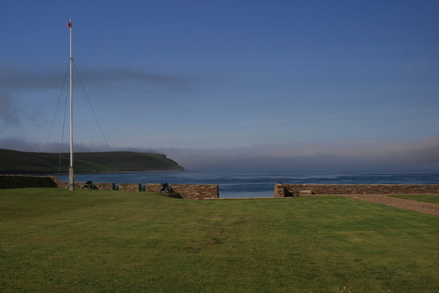
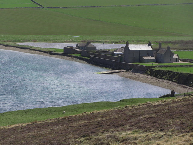
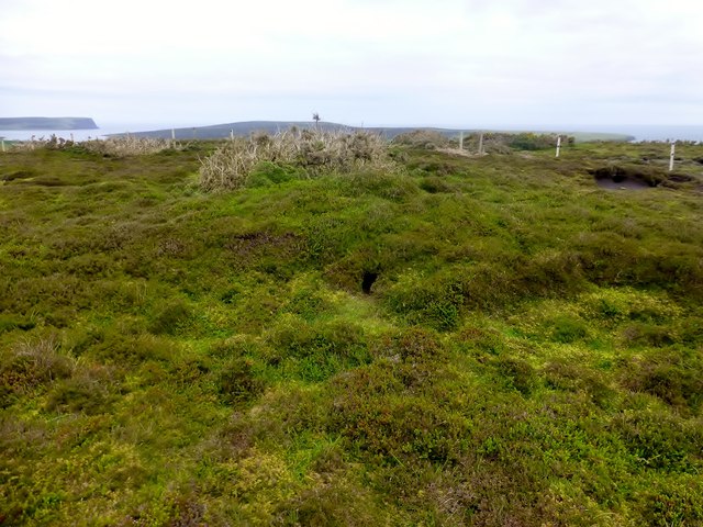
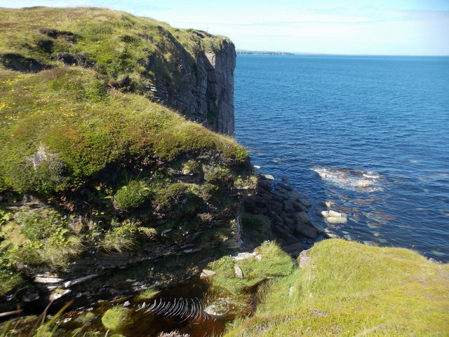
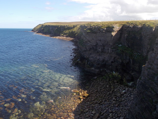
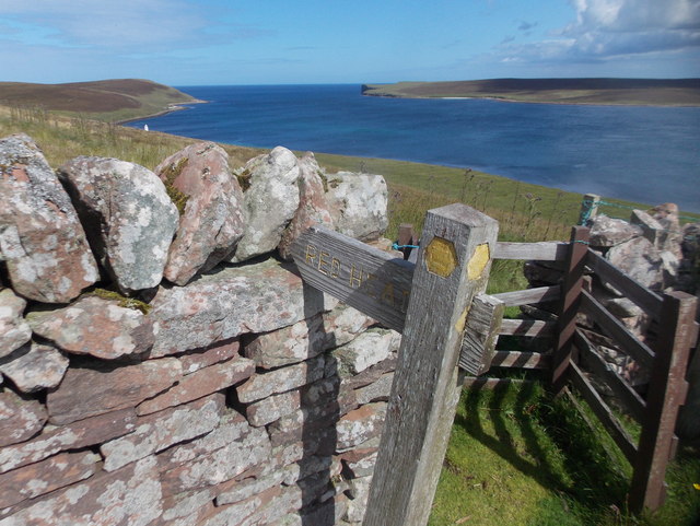
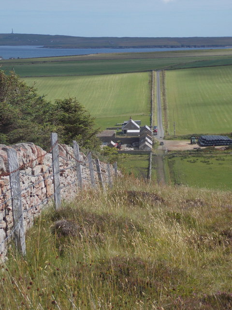
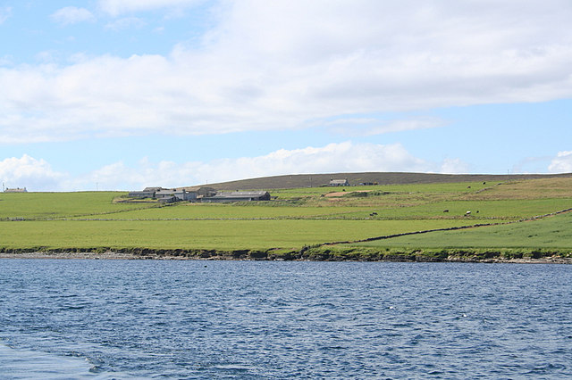
The Bay of Carrick is a picturesque inlet located on the east coast of the Orkney Mainland, in Scotland. Nestled between the villages of St. Mary's and Holm, this bay offers stunning views of the North Sea and is a popular destination for locals and tourists alike.

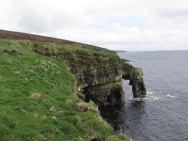
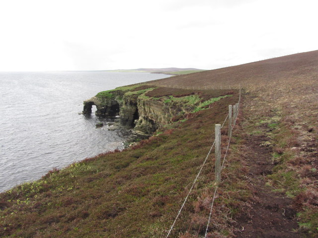
The bay is characterized by its rocky shoreline, which is dotted with small pebble beaches and tide pools. At low tide, visitors can explore the exposed sea bed, revealing an array of fascinating marine life, including crabs, starfish, and various species of seaweed. The water is crystal clear and often attracts kayakers and snorkelers looking to discover the underwater wonders.

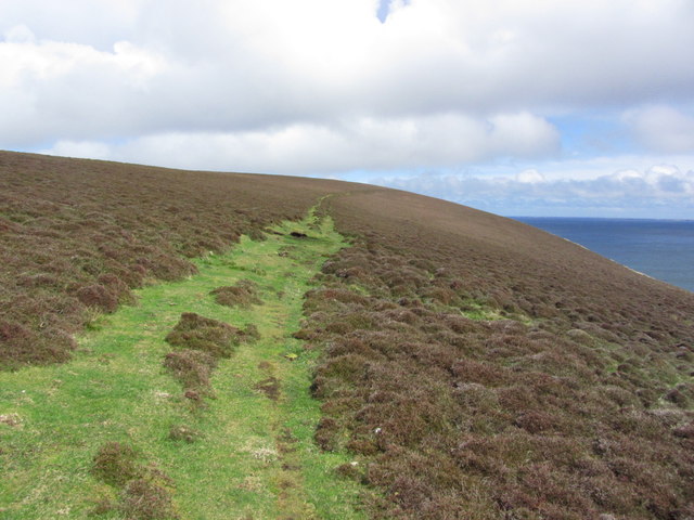
Surrounding the bay are rolling green hills, providing a striking contrast against the deep blue sea. These hills are home to a diverse range of wildlife, including seabirds such as puffins, guillemots, and razorbills. Birdwatchers will particularly enjoy visiting during the nesting season to observe these magnificent creatures in their natural habitat.

For those looking to immerse themselves in the bay's rich history, the nearby Holm Farm Heritage Centre offers an insight into the area's agricultural past. The center showcases traditional farming techniques and displays artifacts from the local farming community.

Visitors to the Bay of Carrick can also enjoy leisurely walks along the coastal path, taking in the breathtaking scenery and enjoying the peaceful atmosphere. The bay is easily accessible by car or public transportation, and there are parking facilities available for convenience.

Overall, the Bay of Carrick is a hidden gem in Orkney, offering a tranquil retreat with its natural beauty, abundant wildlife, and rich history.

If you have any feedback on the listing, please let us know in the comments section below.

Bay of Carrick Images

Images are sourced within 2km of 59.230935/-2.751276 or Grid Reference HY5738. Thanks to Geograph Open Source API. All images are credited.

Fog in Calf Sound from Carrick House garden
Eday; Stephen's Gate, Natural Arch (View N)
Eday; Stephen's Gate, Natural Arch (View S)
Eday - Heading towards Calf of Eday Lighthouse
Eday; Calf of Eday Lighthouse
Eday; Path leading up to Red Head
Eday - On Vinquoy Hill with view to Carrick House
Eday; Vinquoy Hill Chambered Cairn
Eday; Stone of Setter The tallest standing stone on the Orkney Islands
Eday; Stone of Setter
The tallest standing stone on the Orkney Islands
Calf of Eday Lighthouse Eday is an island southwest of Sanday, and 15 miles north of the main island of Orkney mainland. It is the 9th largest island of the Orkney's.
The lighthouse is located on Eday about half a mile north of Blett (not the Calf of Eday which is a smaller island to the northeast, separated from Eday by Calf Sound). There should be good view from a walking trail north from Blett.
There were protests when the Lighthouse Board announced plans for the replacement of the original lighthouse in 2000, as a result, it was replaced with an aluminium replica of the original.
Calf of Eday Lighthouse
Eday is an island southwest of Sanday, and 15 miles north of the main island of Orkney mainland. It is the 9th largest island of the Orkney's. The lighthouse is located on Eday about half a mile north of Blett (not the Calf of Eday which is a smaller island to the northeast, separated from Eday by Calf Sound). There should be good view from a walking trail north from Blett. There were protests when the Lighthouse Board announced plans for the replacement of the original lighthouse in 2000, as a result, it was replaced with an aluminium replica of the original.
Vinquoy Hill Second TuMP of the day with Jim Bloomer, Richard and Tricky Speirs on a sunny morning on Eday.  
Name: Vinquoy Hill
Hill number:12227
Height: 76m / 249ft
Parent (Ma/M):none
Area:23: Orkney Islands
Class:0
Grid ref: HY561385 (est)
Drop: 69m
Col: 7m  HY556340
Vinquoy Hill
Second TuMP of the day with Jim Bloomer, Richard and Tricky Speirs on a sunny morning on Eday. Name: Vinquoy Hill Hill number:12227 Height: 76m / 249ft Parent (Ma/M):none Area:23: Orkney Islands Class:0 Grid ref: HY561385 (est) Drop: 69m Col: 7m HY556340
Greenybrae Hill Parked at Orkney Water shed and used gateways to access the moorland summit with Jim Blooker, Richard Tibbetts and Tricky Speirs.
Name: Greenybrae Hill
Hill number:12241
Height: 56m / 184ft
Parent (Ma/M):none
Area:23: Orkney Islands
Class:0
Grid ref: HY578370 (est)
Drop: 32m
Col: 24m  HY563372
Greenybrae Hill
Parked at Orkney Water shed and used gateways to access the moorland summit with Jim Blooker, Richard Tibbetts and Tricky Speirs. Name: Greenybrae Hill Hill number:12241 Height: 56m / 184ft Parent (Ma/M):none Area:23: Orkney Islands Class:0 Grid ref: HY578370 (est) Drop: 32m Col: 24m HY563372
Eday: postbox № KW17 89 and phone This postbox is of a modern design, constructed of pressed steel and designed to be more robust, rustproof and theft-proof than the traditional cast iron box that it will have replaced in the last couple of years.

The postbox, along with traditional red phone box, stands outside the community shop and post office. While in the midst of redevelopment, the shop currently occupies a large outbuilding at the back, and the post office counter is within a large empty building.
Eday: postbox № KW17 89 and phone
This postbox is of a modern design, constructed of pressed steel and designed to be more robust, rustproof and theft-proof than the traditional cast iron box that it will have replaced in the last couple of years. The postbox, along with traditional red phone box, stands outside the community shop and post office. While in the midst of redevelopment, the shop currently occupies a large outbuilding at the back, and the post office counter is within a large empty building.
Eday: postbox № KW17 101 This postbox is of a modern design, constructed of pressed steel and designed to be more robust, rustproof and theft-proof than the traditional cast iron box that it will have replaced in the last couple of years.

It is the most northerly of the four boxes on the island, all of the same design.
Eday: postbox № KW17 101
This postbox is of a modern design, constructed of pressed steel and designed to be more robust, rustproof and theft-proof than the traditional cast iron box that it will have replaced in the last couple of years. It is the most northerly of the four boxes on the island, all of the same design.
Eday: Black Grip reaches the sea This small and unusually named stream reaches the cliff top and forms a small stagnant pool before plunging over the edge.
Eday: Black Grip reaches the sea
This small and unusually named stream reaches the cliff top and forms a small stagnant pool before plunging over the edge.
Eday: cliffs at the north of the island Looking north from towards Red Head.
Eday: cliffs at the north of the island
Looking north from towards Red Head.
Eday: path to Red Head A kissing gate and a fingerpost indicate the way to Red Head, passing the Calf Sound lighthouse.
Eday: path to Red Head
A kissing gate and a fingerpost indicate the way to Red Head, passing the Calf Sound lighthouse.
Eday: a straight wall leads to a straight road Looking along a wall as it descends quite steeply to Carrick Farm. Beyond it, and in the next square east, is the lane leading to the island's main road.

The island of Sanday is in the background.
Eday: a straight wall leads to a straight road
Looking along a wall as it descends quite steeply to Carrick Farm. Beyond it, and in the next square east, is the lane leading to the island's main road. The island of Sanday is in the background.
Show me another place!

Bay of Carrick is located at Grid Ref: HY5738 (Lat: 59.230935, Lng: -2.751276)

Unitary Authority: Orkney Islands

Police Authority: Highlands and Islands

What 3 Words

///emptied.shin.shred. Near Backaland, Orkney Islands

Related Wikis

Related Videos

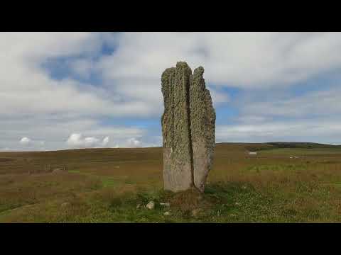
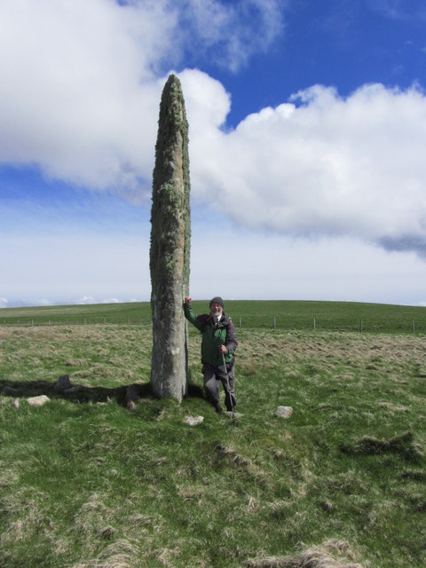
The monolith of Stone of Setter, Neolithic standing stone in Eday Island Orkney

The Stone of Setter is a Neolithic standing stone located on the island of Eday, in Orkney, Scotland. It dates to the Late Neolithic or ...

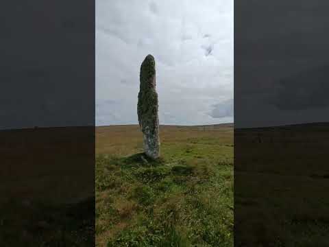
Stone of Setter, Neolithic standing stone in Eday island, Orkney islands

The Stone of Setter is a Neolithic standing stone located on the island of Eday, in Orkney, Scotland. It dates to the Late Neolithic or ...

Your questions answered, from stuck ferments to salad growing!

You asked, and I answered! Here I delve into 10 of your questions! Booze for Free - https://amzn.to/3POdAql Drink Your Garden ...

Sticky Toffee Pudding Wine: Does It Taste Like Christmas?

Sticky Toffee Pudding Wine Review and Taste Test ↓↓↓↓↓ “SHOW MORE” ↓↓↓↓↓ You can find lots of our homebrew ...

Nearby Amenities

Located within 500m of 59.230935,-2.751276
Power: pole
Lat/Long: 59.228131/-2.7460429
Generator Method: wind_turbine
Generator Source: wind
Generator Type: horizontal_axis
Power: generator
Lat/Long: 59.2282724/-2.7458122
Power: pole
Lat/Long: 59.2300028/-2.7523488
Power: pole
Lat/Long: 59.2294402/-2.7506724
Power: pole
Lat/Long: 59.2289791/-2.7493715
Power: pole
Lat/Long: 59.2283808/-2.7476925
Power: pole
Lat/Long: 59.2274051/-2.7484891
Power: pole
Lat/Long: 59.2266833/-2.7487654
Power: pole
Lat/Long: 59.23027/-2.7594459
Power: pole
Lat/Long: 59.2279926/-2.7569266
Power: pole
Lat/Long: 59.2277671/-2.7551951
Power: pole
Lat/Long: 59.2275537/-2.7534794
Power: pole
Lat/Long: 59.2270109/-2.7521729
Power: pole
Lat/Long: 59.2264572/-2.7508294
The data included in this document is from www.openstreetmap.org. The data is made available under ODbL.

Have you been to Bay of Carrick?

Leave your review of Bay of Carrick below (or comments, questions and feedback).