Mill Bay

Bay in Orkney

Scotland

Mill Bay

Eday Youth Hostel 1992
Eday Youth Hostel 1992 Credit: fabio sassi

Mill Bay is a picturesque bay located on the western coast of Orkney, an archipelago situated off the northeastern coast of Scotland. Nestled between the small village of Finstown and the larger town of Stromness, Mill Bay offers visitors a tranquil and scenic retreat.

The bay itself is characterized by its sweeping sandy beach, which stretches for approximately half a mile. The soft golden sand is perfect for long walks, sunbathing, or building sandcastles with the family. At low tide, the beach expands even further, revealing fascinating rock formations and pools teeming with marine life.

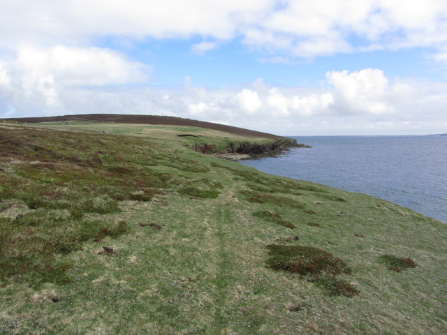
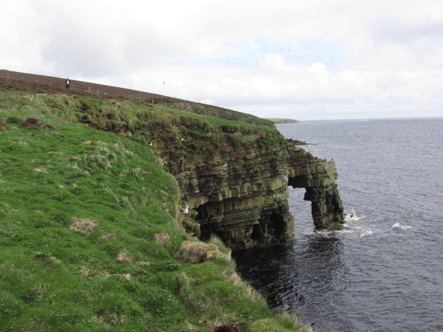
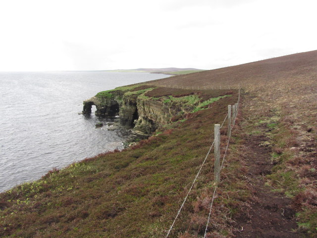
Surrounded by rolling green hills and rugged cliffs, Mill Bay provides breathtaking views of the surrounding landscape. On a clear day, visitors can enjoy panoramic vistas of the neighboring islands and the sparkling waters of the Atlantic Ocean.

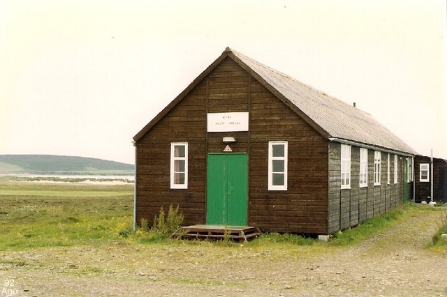
The bay is also home to a historic mill, which dates back to the 19th century. This well-preserved structure once played a crucial role in the local community, grinding grain for the surrounding farms. Today, the mill stands as a charming reminder of Orkney's industrial past and is open to the public for guided tours.

Nature enthusiasts will appreciate the rich biodiversity found in Mill Bay. The area is a haven for birdwatchers, with numerous species of seabirds inhabiting the cliffs and nearby islets. Common sightings include fulmars, guillemots, and puffins, making it a popular spot for birdwatching enthusiasts.

With its serene ambiance, stunning scenery, and historical charm, Mill Bay is a must-visit destination for those seeking a peaceful retreat amidst the natural beauty of Orkney.

If you have any feedback on the listing, please let us know in the comments section below.

Mill Bay Images

Images are sourced within 2km of 59.208312/-2.7467336 or Grid Reference HY5735. Thanks to Geograph Open Source API. All images are credited.
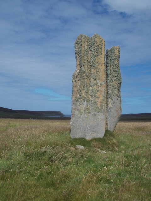
Eday Youth Hostel 1992
Eday; Walking N along coast E of Hammerhill
Eday; Stephen's Gate, Natural Arch (View N)
Eday; Stephen's Gate, Natural Arch (View S)
Eday; Stone of Setter The tallest standing stone on the Orkney Islands
Eday; Stone of Setter
The tallest standing stone on the Orkney Islands
Eday; Trig point on Stennie Hill
Greenybrae Hill Parked at Orkney Water shed and used gateways to access the moorland summit with Jim Blooker, Richard Tibbetts and Tricky Speirs.
Name: Greenybrae Hill
Hill number:12241
Height: 56m / 184ft
Parent (Ma/M):none
Area:23: Orkney Islands
Class:0
Grid ref: HY578370 (est)
Drop: 32m
Col: 24m  HY563372
Greenybrae Hill
Parked at Orkney Water shed and used gateways to access the moorland summit with Jim Blooker, Richard Tibbetts and Tricky Speirs. Name: Greenybrae Hill Hill number:12241 Height: 56m / 184ft Parent (Ma/M):none Area:23: Orkney Islands Class:0 Grid ref: HY578370 (est) Drop: 32m Col: 24m HY563372
Stennie Hill Short walk on occasionally deep heather with Jim Bloomer, Richard Tibbetts and Tricky Speirs on a sunny afternoon.
Name: Stennie Hill
Hill number:12233
Height: 66m / 217ft
Parent (Ma/M):none
Area:23: Orkney Islands
Class:0
Grid ref: HY563355 (est)
Drop: 34m
Col: 32m  HY561362
Stennie Hill
Short walk on occasionally deep heather with Jim Bloomer, Richard Tibbetts and Tricky Speirs on a sunny afternoon. Name: Stennie Hill Hill number:12233 Height: 66m / 217ft Parent (Ma/M):none Area:23: Orkney Islands Class:0 Grid ref: HY563355 (est) Drop: 34m Col: 32m HY561362
Eday: the old Faray postbox This stone-built structure looks rather like it once contained a postbox, and indeed it did: and a postbox which had a specific function.

A lady has contacted me with the following information: The pillar contained a postbox until 1947, and it was used for post for the island of Faray, off the west of Eday. A Faray islander would come across each week and collect their mail from here. [Faray has been uninhabited since 1947, so this story fits perfectly.]
Eday: the old Faray postbox
This stone-built structure looks rather like it once contained a postbox, and indeed it did: and a postbox which had a specific function. A lady has contacted me with the following information: The pillar contained a postbox until 1947, and it was used for post for the island of Faray, off the west of Eday. A Faray islander would come across each week and collect their mail from here. [Faray has been uninhabited since 1947, so this story fits perfectly.]
Eday: postbox № KW17 89 and phone This postbox is of a modern design, constructed of pressed steel and designed to be more robust, rustproof and theft-proof than the traditional cast iron box that it will have replaced in the last couple of years.

The postbox, along with traditional red phone box, stands outside the community shop and post office. While in the midst of redevelopment, the shop currently occupies a large outbuilding at the back, and the post office counter is within a large empty building.
Eday: postbox № KW17 89 and phone
This postbox is of a modern design, constructed of pressed steel and designed to be more robust, rustproof and theft-proof than the traditional cast iron box that it will have replaced in the last couple of years. The postbox, along with traditional red phone box, stands outside the community shop and post office. While in the midst of redevelopment, the shop currently occupies a large outbuilding at the back, and the post office counter is within a large empty building.
Eday: the Stone of Setter An ancient standing stone, standing 15 feet in height, as is perhaps not evident from the photo.
Eday: the Stone of Setter
An ancient standing stone, standing 15 feet in height, as is perhaps not evident from the photo.
Eday: Mill Bay A long, narrowish inlet seen at low tide. The island of Sanday can be seen in the distance.
Eday: Mill Bay
A long, narrowish inlet seen at low tide. The island of Sanday can be seen in the distance.
Old Milestone by the B9063, Millbounds, Eday parish Milestone by the B9063, in parish of Eday (District), at passing place opposite a white house, by wall.

Inscription reads:-
: G / 4½ : : C / 2 :
(To Greentoft and Carrick)

Surveyed

Milestone Society National ID: OR_EDAY04
Old Milestone by the B9063, Millbounds, Eday parish
Milestone by the B9063, in parish of Eday (District), at passing place opposite a white house, by wall. Inscription reads:- : G / 4½ : : C / 2 : (To Greentoft and Carrick) Surveyed Milestone Society National ID: OR_EDAY04
Old Milestone by the B9063, Eday parish Milestone by the B9063, in parish of Eday (District), near electricity pole 53, in front of wire fence, East side of road.

Inscription reads:-
: G / 5½ : : C / 1 :
(To Greentoft and Carrick)

Surveyed

Milestone Society National ID: OR_EDAY05
Old Milestone by the B9063, Eday parish
Milestone by the B9063, in parish of Eday (District), near electricity pole 53, in front of wire fence, East side of road. Inscription reads:- : G / 5½ : : C / 1 : (To Greentoft and Carrick) Surveyed Milestone Society National ID: OR_EDAY05
Island milestone One of 3 milestones on the 6 mile long island of Eday. G is Greentoft, the old ferry landing in the south; C is Carrick, north end of island
Island milestone
One of 3 milestones on the 6 mile long island of Eday. G is Greentoft, the old ferry landing in the south; C is Carrick, north end of island
Calfsound from Eday Calf Island across the Sound and Sanday in the distance across Lashy Sound
Calfsound from Eday
Calf Island across the Sound and Sanday in the distance across Lashy Sound
Eday, Bay of London Very early May morning heading for the north of this 6 mile long island.
Eday, Bay of London
Very early May morning heading for the north of this 6 mile long island.
Mu Geos and Castle Rock from the Sea Mill Bay on the left, with the cliffs of the East coast of Eday and Shamrock Lea on the head of the hill
Mu Geos and Castle Rock from the Sea
Mill Bay on the left, with the cliffs of the East coast of Eday and Shamrock Lea on the head of the hill
Show me another place!

Mill Bay is located at Grid Ref: HY5735 (Lat: 59.208312, Lng: -2.7467336)

Unitary Authority: Orkney Islands

Police Authority: Highlands and Islands

What 3 Words

///full.empire.alienated. Near Backaland, Orkney Islands

Related Wikis

Eday Airport

Eday London Airport (IATA: EOI, ICAO: EGED) is located on Eday in Orkney, Scotland. As it is close to the Bay of London it is known locally as just London...

Vinquoy chambered cairn

Vinquoy chambered cairn (grid reference HY56013809) is a Neolithic chambered cairn located on the island of Eday, in Orkney, Scotland. The tomb probably...

Calf of Eday

The Calf of Eday (Scots: Cauf o Aidee; Old Norse: Kalfr) is an uninhabited island in Orkney, Scotland, lying north east of Eday. It is known for its wildlife...

Sanday Light Railway

The Sanday Light Railway was a privately owned ridable miniature railway situated in Braeswick, on the island of Sanday, Orkney, Scotland. The railway...

Eday

Eday (, Scots: Aidee) is one of the islands of Orkney, which are located to the north of the Scottish mainland. One of the North Isles, Eday is about 24...

Braeswick

Braeswick is a settlement on the island of Sanday, in Orkney, Scotland. The settlement is within the parish of Cross and Burness, and is situated on the...

Faray

Faray (Old Norse: Færey) is a small island in Orkney, Scotland, lying between Eday and Westray. Previously inhabited, the low-lying island is now a successful...

Holm of Faray

The Holm of Faray is a small island in Orkney, Scotland, near Faray and Westray, which it lies between. Together with its neighbour Faray, it is designated...

Related Videos

Orkney Tour 2022-08-19 Eday

Best day so far, bright and clear with beautiful views over the archipelago. A little chilly in the shade and a bit breezy, but not that ...

Crabbing at The Bay of London

A partially successful trip trying out creels! Not enough for dinner but proof they work! Hopefully the fishing rods will arrive soon ...

The Old Kirk, Eday, Orkney

Time for sight seeing around Eday, Orkney. Come with me and visit the Old Kirk in Eday. ↓↓↓↓↓ “SHOW MORE” ...

Growing Up In Orkney - An island upbringing

What's a typical day like on a remote island in Orkney for a child? Come and find out! ↓↓↓↓↓ “SHOW MORE” ↓↓↓↓↓ Read ...

Nearby Amenities

Located within 500m of 59.208312,-2.7467336
Power: pole
Lat/Long: 59.2098722/-2.7535611
Power: pole
Lat/Long: 59.2097198/-2.7521154
Power: pole
Lat/Long: 59.2102113/-2.7513751
Power: pole
Lat/Long: 59.2107934/-2.7505034
Power: pole
Lat/Long: 59.2113207/-2.749688
Power: pole
Lat/Long: 59.2070903/-2.7543792
The data included in this document is from www.openstreetmap.org. The data is made available under ODbL.

Have you been to Mill Bay?

Leave your review of Mill Bay below (or comments, questions and feedback).