Caithness Geos

Coastal Feature, Headland, Point in Orkney

Scotland

Caithness Geos

Fog in Calf Sound from Carrick House garden
Fog in Calf Sound from Carrick House garden Credit: Neil-K

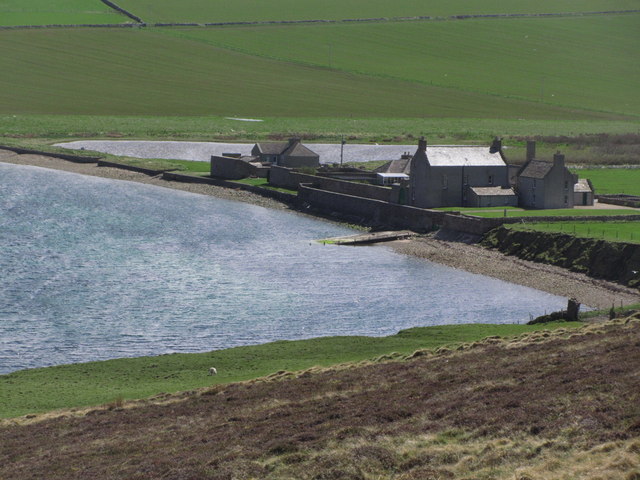
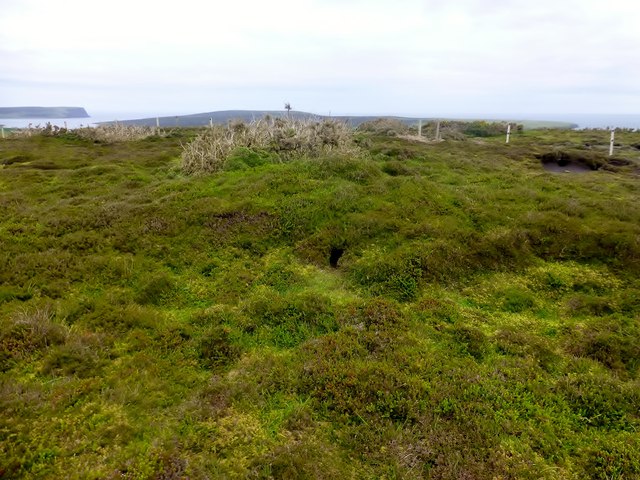
Caithness Geos, located in Orkney, Scotland, is a prominent coastal feature known for its unique geological formations and breathtaking views. A geo is a term used in the Orkney dialect to describe a narrow, steep-sided inlet or cleft in the coastline, often formed by erosion of the cliffs.

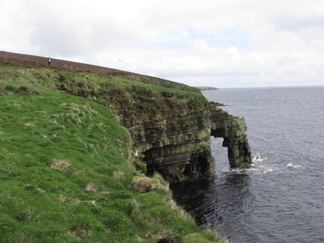
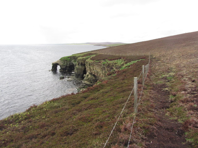
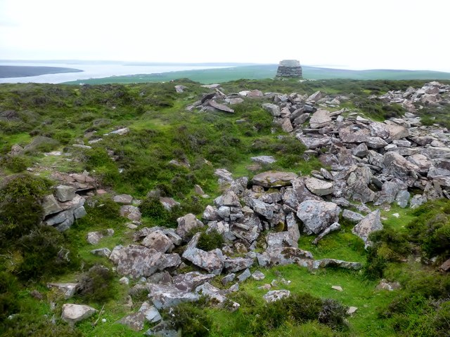
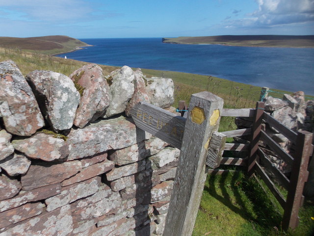
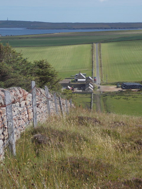
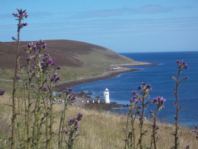
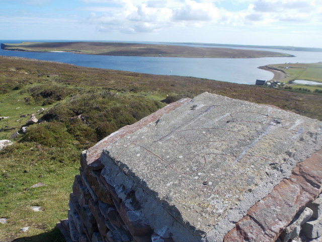
This headland, also referred to as a point, juts out into the North Sea and is characterized by its rugged cliffs, which can tower up to 100 feet in height. The cliffs are composed of sandstone, which has been shaped and sculpted by the relentless forces of wind and waves over millions of years.

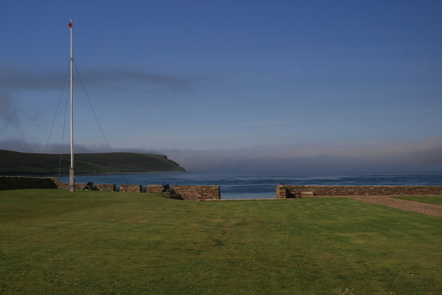
Caithness Geos offers visitors a stunning panoramic view of the surrounding area, with its dramatic cliffs plunging into the sea below. The coastline is dotted with sea stacks, natural arches, and caves, further adding to the beauty and intrigue of this coastal feature.

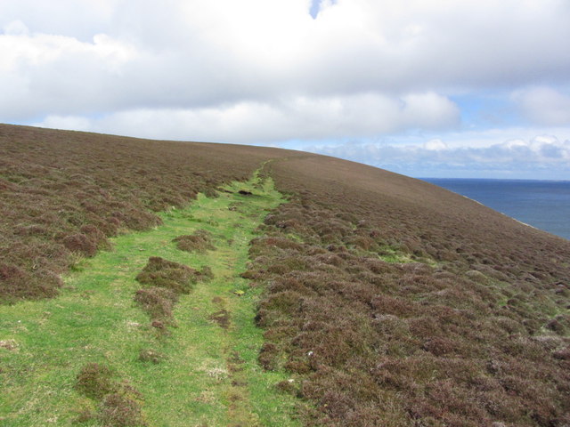
Due to its remote location and challenging terrain, Caithness Geos remains relatively untouched by human activity. This has allowed a diverse range of flora and fauna to thrive in the area, including seabirds such as gannets, puffins, and guillemots. The surrounding waters are also home to a variety of marine life, making it a popular spot for birdwatching and wildlife enthusiasts.

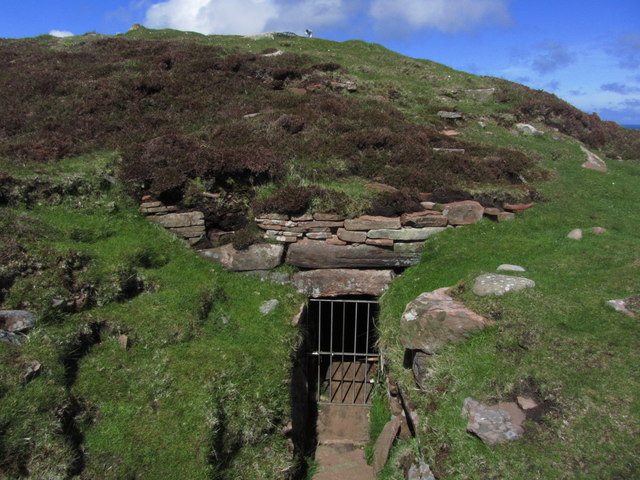
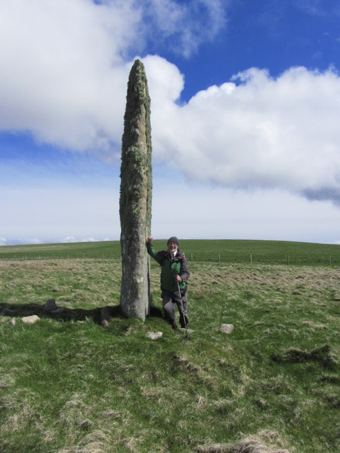
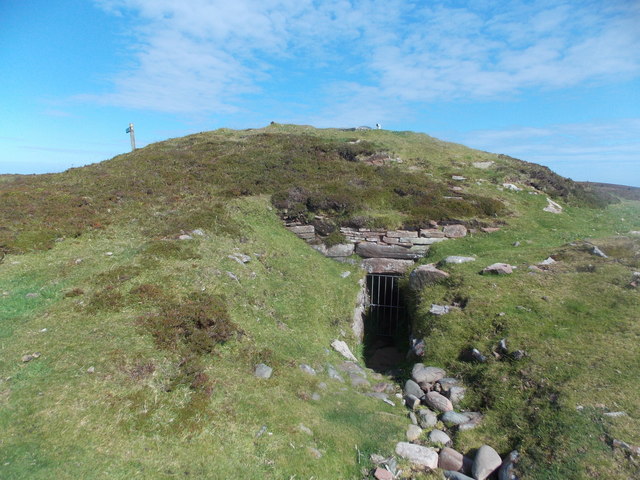
Caithness Geos is not only a natural wonder but also holds historical significance. The area is known to have archaeological remains dating back thousands of years, including ancient settlements and burial sites. Exploring the headland can provide a glimpse into the rich history and cultural heritage of the Orkney Islands.

In conclusion, Caithness Geos in Orkney is a captivating coastal feature that offers a combination of stunning geological formations, abundant wildlife, and historical intrigue, making it a must-visit destination for nature lovers and history enthusiasts alike.

If you have any feedback on the listing, please let us know in the comments section below.

Caithness Geos Images

Images are sourced within 2km of 59.231196/-2.741784 or Grid Reference HY5738. Thanks to Geograph Open Source API. All images are credited.

Fog in Calf Sound from Carrick House garden
Eday; Stephen's Gate, Natural Arch (View N)
Eday; Stephen's Gate, Natural Arch (View S)
Eday - Heading towards Calf of Eday Lighthouse
Eday; Calf of Eday Lighthouse
Eday; Path leading up to Red Head
Eday - On Vinquoy Hill with view to Carrick House
Eday; Vinquoy Hill Chambered Cairn
Eday; Stone of Setter The tallest standing stone on the Orkney Islands
Eday; Stone of Setter
The tallest standing stone on the Orkney Islands
Calf of Eday Lighthouse Eday is an island southwest of Sanday, and 15 miles north of the main island of Orkney mainland. It is the 9th largest island of the Orkney's.
The lighthouse is located on Eday about half a mile north of Blett (not the Calf of Eday which is a smaller island to the northeast, separated from Eday by Calf Sound). There should be good view from a walking trail north from Blett.
There were protests when the Lighthouse Board announced plans for the replacement of the original lighthouse in 2000, as a result, it was replaced with an aluminium replica of the original.
Calf of Eday Lighthouse
Eday is an island southwest of Sanday, and 15 miles north of the main island of Orkney mainland. It is the 9th largest island of the Orkney's. The lighthouse is located on Eday about half a mile north of Blett (not the Calf of Eday which is a smaller island to the northeast, separated from Eday by Calf Sound). There should be good view from a walking trail north from Blett. There were protests when the Lighthouse Board announced plans for the replacement of the original lighthouse in 2000, as a result, it was replaced with an aluminium replica of the original.
Vinquoy Hill Second TuMP of the day with Jim Bloomer, Richard and Tricky Speirs on a sunny morning on Eday.  
Name: Vinquoy Hill
Hill number:12227
Height: 76m / 249ft
Parent (Ma/M):none
Area:23: Orkney Islands
Class:0
Grid ref: HY561385 (est)
Drop: 69m
Col: 7m  HY556340
Vinquoy Hill
Second TuMP of the day with Jim Bloomer, Richard and Tricky Speirs on a sunny morning on Eday. Name: Vinquoy Hill Hill number:12227 Height: 76m / 249ft Parent (Ma/M):none Area:23: Orkney Islands Class:0 Grid ref: HY561385 (est) Drop: 69m Col: 7m HY556340
Greenybrae Hill Parked at Orkney Water shed and used gateways to access the moorland summit with Jim Blooker, Richard Tibbetts and Tricky Speirs.
Name: Greenybrae Hill
Hill number:12241
Height: 56m / 184ft
Parent (Ma/M):none
Area:23: Orkney Islands
Class:0
Grid ref: HY578370 (est)
Drop: 32m
Col: 24m  HY563372
Greenybrae Hill
Parked at Orkney Water shed and used gateways to access the moorland summit with Jim Blooker, Richard Tibbetts and Tricky Speirs. Name: Greenybrae Hill Hill number:12241 Height: 56m / 184ft Parent (Ma/M):none Area:23: Orkney Islands Class:0 Grid ref: HY578370 (est) Drop: 32m Col: 24m HY563372
Eday: postbox № KW17 101 This postbox is of a modern design, constructed of pressed steel and designed to be more robust, rustproof and theft-proof than the traditional cast iron box that it will have replaced in the last couple of years.

It is the most northerly of the four boxes on the island, all of the same design.
Eday: postbox № KW17 101
This postbox is of a modern design, constructed of pressed steel and designed to be more robust, rustproof and theft-proof than the traditional cast iron box that it will have replaced in the last couple of years. It is the most northerly of the four boxes on the island, all of the same design.
Eday: path to Red Head A kissing gate and a fingerpost indicate the way to Red Head, passing the Calf Sound lighthouse.
Eday: path to Red Head
A kissing gate and a fingerpost indicate the way to Red Head, passing the Calf Sound lighthouse.
Eday: a straight wall leads to a straight road Looking along a wall as it descends quite steeply to Carrick Farm. Beyond it, and in the next square east, is the lane leading to the island's main road.

The island of Sanday is in the background.
Eday: a straight wall leads to a straight road
Looking along a wall as it descends quite steeply to Carrick Farm. Beyond it, and in the next square east, is the lane leading to the island's main road. The island of Sanday is in the background.
Eday: towards Calf Sound lighthouse Looking along the northern end of the island, beyond some tall thistles towards the lighthouse on Calf Sound.
Eday: towards Calf Sound lighthouse
Looking along the northern end of the island, beyond some tall thistles towards the lighthouse on Calf Sound.
Eday: concrete viewfinder on Vinquoy Hill Looking across Calf Sound from the top of Vinquoy Hill. The diagram, rather crudely drawn, confirms that the island fully in view is the Calf of Eday, and the distant land to the right is Sanday.
Eday: concrete viewfinder on Vinquoy Hill
Looking across Calf Sound from the top of Vinquoy Hill. The diagram, rather crudely drawn, confirms that the island fully in view is the Calf of Eday, and the distant land to the right is Sanday.
Eday: chambered cairn on Vinquoy Hill This ancient burial place is situated just south of the very summit of Vinquoy Hill.
Eday: chambered cairn on Vinquoy Hill
This ancient burial place is situated just south of the very summit of Vinquoy Hill.
Show me another place!

Caithness Geos is located at Grid Ref: HY5738 (Lat: 59.231196, Lng: -2.741784)

Unitary Authority: Orkney Islands

Police Authority: Highlands and Islands

What 3 Words

///sprouted.length.double. Near Kettletoft, Orkney Islands

Related Wikis

Calf of Eday

The Calf of Eday (Scots: Cauf o Aidee; Old Norse: Kalfr) is an uninhabited island in Orkney, Scotland, lying north east of Eday. It is known for its wildlife...

Vinquoy chambered cairn

Vinquoy chambered cairn (grid reference HY56013809) is a Neolithic chambered cairn located on the island of Eday, in Orkney, Scotland. The tomb probably...

Sanday Light Railway

The Sanday Light Railway was a privately owned ridable miniature railway situated in Braeswick, on the island of Sanday, Orkney, Scotland. The railway...

Braeswick

Braeswick is a settlement on the island of Sanday, in Orkney, Scotland. The settlement is within the parish of Cross and Burness, and is situated on the...

Nearby Amenities

Located within 500m of 59.231196,-2.741784
Power: pole
Lat/Long: 59.228131/-2.7460429
Power: pole
Lat/Long: 59.2272994/-2.7448064
Power: pole
Lat/Long: 59.2268178/-2.7435511
Generator Method: wind_turbine
Generator Source: wind
Generator Type: horizontal_axis
Power: generator
Lat/Long: 59.2282724/-2.7458122
Power: pole
Lat/Long: 59.2289791/-2.7493715
Power: pole
Lat/Long: 59.2283808/-2.7476925
The data included in this document is from www.openstreetmap.org. The data is made available under ODbL.

Have you been to Caithness Geos?

Leave your review of Caithness Geos below (or comments, questions and feedback).